Wednesday, 28 April 2021

Malverleys


A new experience today: a visit to a private garden near Newbury which is open as part of the National Gardens Scheme. We arrived in light rain and, along with 20 or 30 others, started by hearing about the garden from the Head Gardener/Horticulturist, Mat Reese. He is highly regarded in the horticultural profession and has been at Malverleys for 10 years, working with the owner to create an ambitious garden, arranged in a series of separate 'rooms' and areas. He is not finished yet apparently, with further projects in mind.

After the introductory talk we were free to explore the garden (there was no guided tour because of Covid). We started in the impressively large walled garden (above) where the plantings were almost entirely white. In the centre were two  cherry trees housed in purpose-built open pagodas. We had never seen anything like this before - very striking!

We went next to a smaller, but exquisite, walled Italian garden where a cherry tree avenue  bordered a rill with a neoclassical statue at the end. This was a real delight and very popular with the other visitors. I had to sneak back when they had all gone to get a decent photograph

At right angles to this room was another which offered a beautiful view towards the statue.

Next, the cool garden, was another real show-stopper, this beautifully proportioned circular pool with an exquisite metal bowl in the centre aligned with a Greek urn on a pedestal.

We next discovered a classic long border. This was the hot garden (for obvious reasons).  Apparently, the owner prefers the hot garden and his wife the cool garden.

We ended our exploration near the main house - we were told not to publish any pictures of the house, a request which I naturally complied with. I thought a snapshot of the newish family chapel would be OK though.


Conditions: wet.

Rating: 5 stars. A marvellous way to spend a couple of hours. I would love to come back again in the summer to see the gardens in a different season.

Thursday, 22 April 2021

Sir Harold Hillier Gardens

                                                                                 Jermyn's House

We are on our way home from Poole and decided to break our journey to see the Sir Harold Hillier Gardens. The Garden, originally known as the Hillier Arboretum, was founded in June 1953 when Harold Hillier acquired Jermyn's House (dating from the 18th century, but later extended) and its grounds. The arboretum was given to Hampshire County Council in 1977 to be managed as a charitable trust. Sir Harold Hillier was knighted in 1983 and died aged 80 in 1985. 

We started our exploration with the Winter Garden, which was opened in 1998. We were warned at reception that it was past its peak. This was indeed the case, but it still made for a pleasant stroll. We did enjoy seeing a good number of Orange Tip butterflies however. And we were quite taken by this sculpture in the shape of a pine cone as we neared the main entrance again.

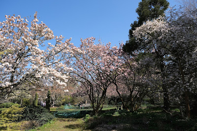
We then ambled towards towards the eastern side of the garden, mainly through woodland, to reach the area in front of Jermyns House. Here we saw some beautiful Cherry blossom.


And this spectacular Acer.

The whole area was very colourful, but the prize must go to this astonishingly dense display of tulips. It seemed to us that the colours ought not to work together, but actually they were a triumph.

We walked along the Centenary Border, a long grassy path with flower beds on either side. It didn't lend itself to photography however as workmen were busy installing underground water pipes along its length. At the end we did enjoy this display of mixed tulips in various varieties and colours.


Visiting the garden was a rather off-the-cuff decision, but it was a delightful experience. We also took advantage of the neighbouring Garden Centre to stock up with plants for our garden.

Wednesday, 21 April 2021

Kimmeridge and Swyre Head

We started this lovely walk from the old quarry car park just above Kimmeridge.  We headed eastwards along a road and quickly turned right along a farm track which led all the way to Swyre Head. It was very hazy to seaward and it was some while before I could take any sort of reasonable photo. The picture below (best expanded by clicking on it) extends from the Clavell Tower on the extreme left to Warbarrow on the right. In the middle ground is the village of Kimmeridge.


After a while we could see Smedmore House in the valley between the ridge and the Coast Path.

Quite soon after this Swyre Head loomed ahead. It is the highest point in the Purbeck Hills at 98 metres.

When we reached Swyre Head we were pleased to discover that since our last visit many years ago a Permissive Path had been mapped out. Previously it had been a contentious issue and we had ended up on one occasion having to walk back along the farm tracks.

From the top of Swyre Head there was a fine view to the east as far as St Aldhelm's Head.

We descended and reached the coast at Rope Lake Head, turning right along the Coast Path. It occupies a fairly narrow strip of long between the fences which demarcate the fields and the cliff edge. We were struck by the amount of evidence of erosion, including one point where it seemed that part of the path had fallen away quite recently. In other places the fence line had been moved inland by several feet - and it seemed that more of this was becoming necessary.

We were particularly struck by the way the cliffs were eroding at an angle from the top.

As we neared Kimmeridge Bay, we encountered again the delightful folly known as the Clavell Tower. It was built in about 1820 and was spectacularly dismantled in 2005 and moved 80 ft away from the cliff edge because erosion of the cliff was threatening its survival. It is now owned by the Landmark Trust and available as a two-bedroomed holiday let.

We continued past the Tower and headed into Kimmeridge Bay. The rock ledges which it is famous for were below water.

We then walked inland and through the pretty village of thatched houses, pausing to enjoy some ice cream at the village restaurant.

We had hoped to visit the The Etches Collection, Museum of Jurassic Marine Life - especially fossils - but unfortunately it was closed. The planned reopening is May 17 2021. It remained only to climb a steep path passing between the church and rectory and then uphill across a grassy field to return to the Quarry.

Map: Purbeck and South Dorset.

Distance: about 5 miles. 

Conditions: hazy.

Rating: four stars.

Tuesday, 20 April 2021

Acton, Seacombe and Dancing Ledge

We are in Poole for a few days, starting with this interesting walk from the hamlet of Acton, between Langton Matravers and Worth Matravers.

We parked just off the main road and walked down through the village to reach the Priest's Way. This turns out to be one of the shortest signposted paths we have ever encountered: it starts in Swanage and finishes on the edge of Worth Matravers just three miles later. 

We headed west between drystone walls, passing through a quarry and then detouring via a signposted gate to visit the site of the Dinosaurs' footprints. Quarrying on this area revealed several depressions in the rock which have been identified as those of Brachiosaurus, a member of the Sauropod family of dinosaurs. I took some photos of the footprints, but somehow managed to delete them! Here at least is an impression of what a Brachiosaurus would have looked like.

We continued along the Priest's Way to reach Worth Matravers which gave us our first view of the sea between the twin hills of East Man and West Man.

We continued past the pub (the white building on the right in the picture below) and looped round through the village to double back across the valley.

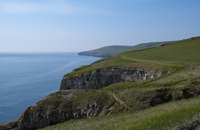
Reaching East Man we made our way downhill to reach the South West Coast Path. Here is the splendid view with Seacombe in the foreground.


We followed the path above the cliffs noting how much this section of coast has been influenced by quarrying. Apparently it goes back as far as the Roman occupation. So far as I can can discover, quarrying at Winspit (below West Man) ended in 1952 and this was the last of the Isle of Purbeck cliff quarries. Quarrying on Portland continued for at least another 30 years.

 This is the fine view looking back as we neared the wonderfully named Dancing Ledge.

And here is Dancing Ledge. 


When we first came this way in 2011, we did actually pause on the ledge to do a few jive moves. It felt wonderful! According to Wikipedia: "Dancing Ledge is so called because at certain stages of the tide when the waves wash over the horizontal surface, the surface undulations cause the water to bob about making the ledge appear to dance". It sounds like a just-so story to me.

We now headed inland, climbing quite steeply and having a bit of difficulty finding the right track. We observed the direction a few other walkers were coming from and followed their line in reverse, soon reaching Spyway Barn and not long after that , the Priest's Way.

On the way we spotted these Cowslips, the first of the year.

We continued a short way along the Priest's Way and then turned right to retrace our steps through Acton to reach the car.

Conditions: sunny and reasonably warm.

Distance: 5-6 miles.

Map: Explorer OL 15 Purbeck and South Dorset.

Rating: four stars. Wonderful to be on the Purbeck Coast again.

Sunday, 18 April 2021

Pewsey Wharf and the Giant's Grave


We started this walk from Pewsey Wharf on the Kennet and Avon Canal and walked east along the tow path, to soon pass under Pains Bridge. The still water provided a nice reflection.

Just beyond the bridge was a World War II pill box. They are scattered all along the canal and I recently discovered that their specific function was to provide a second line of defence in the event of a German invasion. It is just as well they didn't invade as it seems unlikely that a line of pill boxes, tank traps and blown up bridges would have provided much of a barrier.

In the background can be spotted the long ridge which ends in the Giant's Grave.


At first we didn't spot the Heron standing quietly on the opposite bank.


We left the canal at the next bridge - below is the next stretch of canal ...


... and headed north along a lane passing a few houses and walking along a delightful avenue of trees leading to West Wick. A little further on there was a glimpse of the House, with the Farm behind it.

We continued on the same line and began a steep climb which brought us to a ridge, where we admired the view of the ridge that lay ahead.. 


and shortly afterwards the view back ...


We continued along the ridge, part of the Mid Wilts Way (a new discovery, which we hope to do in its entirety). Walking along the ridge was exhilarating and soon we reached the top of the fancifully named Giant's Grave, more prosaically an Iron Age promontory fort, according to Pevsner.

We looked across towards the village of Oare and spotted to the left what had to be Oare House. Pevsner describes it as "an impressive townish house built in 1740 by Henry Deacon a London wine merchant".


As we descended we spotting this intriguing building over to the right ...

... and soon afterwards we had a great view back to the Giant's Grave

A series of field paths led us back to Pains Bridge where we turned right along the tow path to return to Pewsey Wharf.

Conditions: bright and windy.

Distance: 5.5 miles.

Map: Explorer157 (Marlborough and Savernake Forest).

Rating: Four stars. An excellent and varied walk.