Showing posts with label Warwickshire. Show all posts

Monday, 3 October 2016

Warwick Castle

The oldest part of the castle

We are in Warwick to meet old friends Roger and Deborah: it's basically halfway (and more inviting that the exact half point as defined by the excellent What's Halfway website which was Bedford). None of us had been round the castle so we decided to make that the focus, although we were slightly concerned that it might too much like a theme park.

The castle was originally founded, as so many were, by William the Conqueror, in 1068 as a simple motte-and-bailey. Stone buildings were added from the 13th century.

We enter through the electronic turnstiles and immediately have a great view of the imposing oldest parts of the castle. Unfortunately, we are looking directly into the sun and so the best I could manage as a photo is just one corner: the magnificent Guy's Tower. It is the tallest of the three main towers at 128 ft and has twelve sides. It was completed in 1394.


We head round to the splendid gatehouse, which is revealed as two towers, one behind the other. There is a great view looking up into the Clock Tower.


Once we are inside the castle, its scale becomes apparent, as do some small theme-park features (music, tents and huts serving food and drink, the dungeons). The picture at the head of this post shows the wonderful view looking back towards the Gatehouse across the large grassy area in the middle of the castle. The third old tower, Caesar's Tower, is on the right. It is irregularly shaped and awkwardly located, so hard to photograph.

We are delighted to find that there is a partial wall around the walls and head off to the right to climb some steps onto a walkway which leads to Guy's Tower. The views from the top are wonderful. Looking down into the castle you can see the mainly Victorian buildings on the left and the original motte ahead and to the right - it was later landscaped and made picturesque.

Looking out from Guy's Tower there is a great view of the town and especially the great church of St Mary. It was originally completed in 1394, like much of the castle, but was almost completely destroyed by the Fire of Warwick in 1694. Rebuilding was complete by 1704.


We descended back to the walkway and enjoyed a nice juxtaposition of Guy's Tower and the tower of St Mary's.


Climbing the Gatehouse Tower brought us fine views over open country as far as Kenilworth, another fine Warwickshire castle. More immediately, we looked down on the delightful Mill Street.


Just off to the right was the Old Bridge over the River Avon. It dates from 1374-83.


We continued through Caesar's Tower and down to explore the rest of the castle and the motte. The views over the countryside were pleasant enough. Outside the walls we watched the popular Birds of Prey show for a short while and were impressed to see just how big a Lammergeyer actually is. After that it remained only to head into town to find the Market Place and enjoy an excellent lunch at the Rose and Crown, sitting outside in the surprisingly warm sun.

Distance: very little.

Conditions: bright and sunny. Warm.

Rating: Four and half stars. A great day out. Our theme park fears were largely unfounded.

Friday, 12 June 2015

Kenilworth

Kenilworth Castle

We met our friends Sally and Malcolm for this walk which I found on the AA website, usually a reliable resource. It starts outside the castle and heads off to the west. The views of the castle were the main attraction.

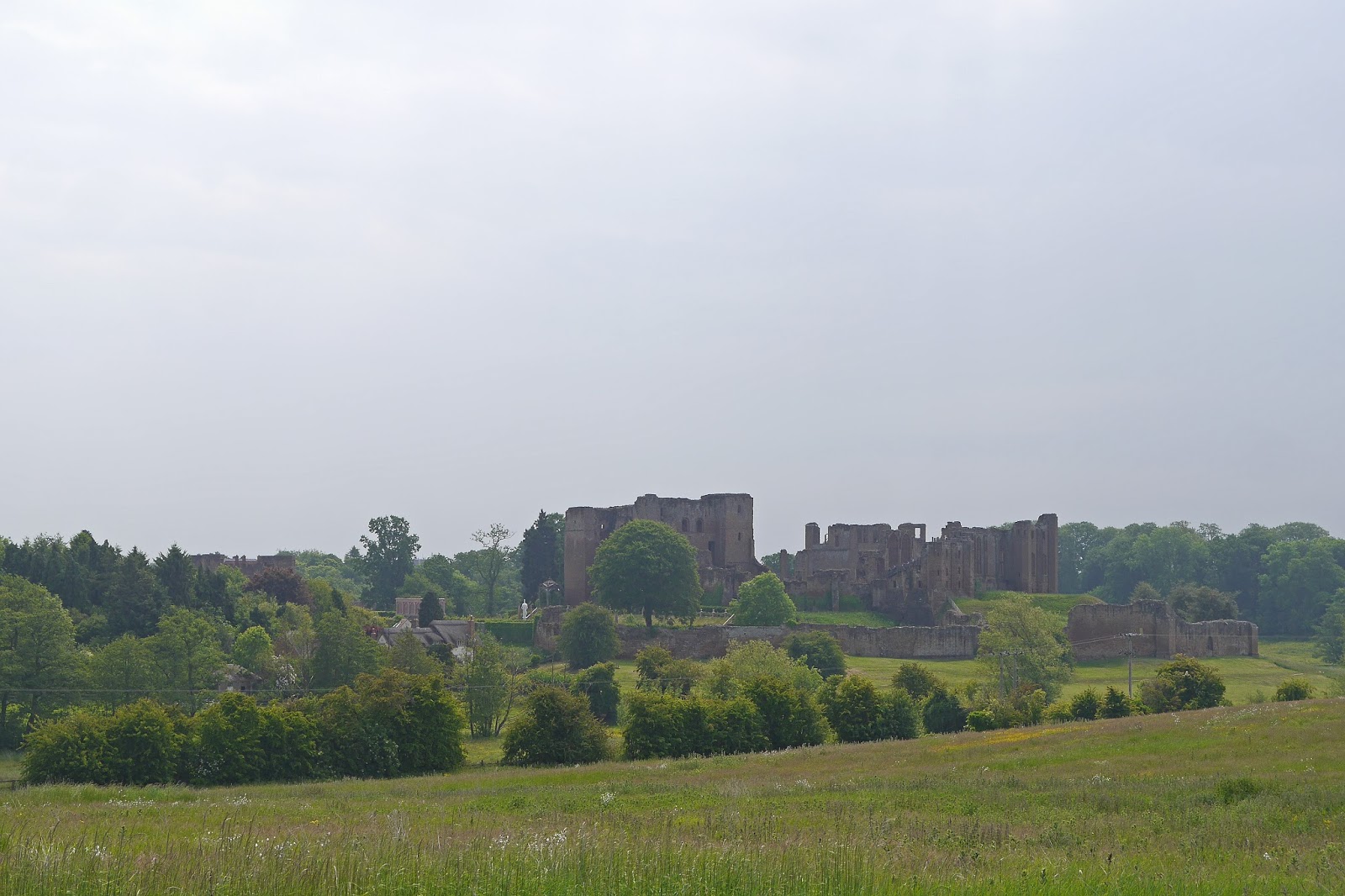
The castle, described by Pevsner as "undoubtedly one of the grandest" ruinous castles in England, was founded in 1120 and the Norman keep (on the right above) was built about 50 years later. It was later owned by John of Gaunt who built the Great Hall (on the left) in the 14th century. Further extensions were made by Elizabeth I's favourite, Robert Dudley and the fortifications were dismantled after the Civil War.

The start of the walk is Castle Green and the initial instruction is to go through the handgate to the left of the castle; there is no map. It took us a while to work out that in fact you should follow the path round to the right! We went left, which brought us round to the visitor entrance (the view above) and continued on a circumnavigation of the castle which brought us to the "beautiful, pink thatched cottage" which was the first key landmark.


We headed northwest and enjoyed this impressive view of the castle. Unfortunately, it was into the sun and beginning to become hazy.


We followed Chase Lane westwards for a mile and half, harassed several times by a mail delivery van, and turned left at the end of Chase Wood. As we walked along the next track we could just see the steeple of Honiley church. According to Pevsner, the tower is "exceptionally bold and exceptionally Baroque", dating from 1723. So it was probably as well we did not make the detour to see it (Baroque is one of my least favourite architectural styles).


After a stretch of field-edge path, we emerged into a marshy area within which there was a rectangular mound surrounded by a ditch. A bit like an iron age hill fort, but without the usual hill. The map described it as Pleasance Mound and we speculated for some while about what it might be.


A helpful sign board explained that the ditch contained a moat and this surrounded a stone wall with four round corner towers which enclosed a pleasure garden, banqueting hall and chapel. This "Pleasance" was built by Henry IV around 1414 and was connected to the castle by a canal. It was dismantled by Henry VIII.

As we got closer to the castle there was an even better view, although it was even duller than before.


On our return to Castle Green we climbed a grassy mound and could see something of the recently re-created garden which Robert Dudley had built for Queen Elizabeth.


We were all moved to criticism: we felt that the sculpture, bowers and obelisques were out of scale and that the pink orangery and posts were in the wrong shade to tone with the red sandstone of the castle buildings.

Conditions: mild, becoming cloudier and duller as time passed.

Distance: 4.5 miles.

Map: Explorer 221 (Coventry and Warwick).

Rating: three and a half stars. The views were great (better on a nice day), but the walk itself was pretty ordinary.

Thursday, 14 March 2013

Royal Leamington Spa


All Saints church

We joined our friends Sally and Malcolm for this walk around Leamington which I found on the Discovering Britain website. The description makes it clear that Leamington was a small village until the water from its well was recognised as having medicinal qualities at the end of the 18th century. Its dominant character is Regency and Victorian and it owes it all to the spa.

The walk begins at the church of All Saints. The architect was officially a local man, J C Jackson, but the driving force was the long-serving vicar, John Craig, who is said to have been his own architect. It was begun in 1843 and the grand tower was added in 1898-1902 by Sir Arthur Blomfield. Pevsner describes it,  justly, as "in a Continental Gothic style, not correct in the details". It is very big. The stained glass in the apse is lovely.

You go round the back to seek, in Church Rd, the two oldest houses in Leamington, which date from the late sixteenth or early 17th century. They are timber-framed, but have been re-fronted at a later date.

Now you return to the front of the church and turn right to cross the river and reach the Pump Rooms, with its impressive Tuscan colonade of 1813-14. Everything behind it dates from the 1920s.


The walk now takes us onto the grassy area that was once the Pump Rom Gardens. The walk guide does not comment on this handsome Italianate church on the far side.


It is St Peter's RC church, by Henry Clutton (1861-5). We cross the river again and head towards the station where our commentary focuses on the station garden. We are more taken with the stripped down classical front of the station building, with its minimalist pilasters. We enjoyed the art deco style lettering of the station name


We now walked along a short, undistinguished, section of the Grand Union Canal and emerged near the Apollo Rooms, once one of seven competing pump rooms. It operated under the wonderful name of Smart’s Imperial Sulphurous Medicinal Fount and Ladies Marble Baths. There was too much traffic unfortunately to permit a photo.


Not much further on, we reached the Leamington Spa Mission in George St. This was built in 1828 as a Roman Catholic chapel, the first in the town. It eventually fell into disuse, but was taken over by the Seventh Day Adventists in the 1990s and restored.


We crossed the river for the third time by the blue suspension bridge to enter Jephson Gardens, named for the town's most famous doctor and an advocate of taking the waters. Our walk guide had explained that the delightful prevalence of public open space by the river was the result of it being on the flood plain. It does give this part of the town a pleasant spacious character.

In the gardens there is a tiny, rather  unconvincing Clock Tower, a nice little tempietto providing a monument to Jephson and a fine new hothouse.


After a break for lunch, we walked up Regent Grove, a wide spacious road with a grassy central area and a path up the middle. We were now entering the "new town" of Leamington, developed after the Spa boom started to take off - the original village was to the south of the river. The new town was planned mainly on a grid pattern, but with some curves to give it a more rural feel.

On the right, Hamilton Terrace, was lovely brick chapel of a rather unusual design. It is now offices. It is not mentioned in Pevsner, but some Googling reveals it was the Congregational Church and dates from 1849.


At the top we found our way to Lansdowne Circus, a group of semi-detached villas laid around a circular communal garden. It lacks the sheer grandeur of the Circus in Bath, but the houses with their balconies and wrought ironwork make a lovely group. Pevsner describes them as "sweet cottages". It is interesting that they are actually built of brick and faced with stucco. The Circus was the work of W Thomas. It is apparently one of the best addresses in Leamington.


Round the corner is Lansdowne Crescent, a classic terraced Crescent, again with fine ironwork.


We now passed the lowest point of the walk: the Chandos St car park. This was an unlovely parking lot which forms one block of the grid system, and might be redeveloped. This just crystallised our feeling that the author of the walk description was slightly too fascinated with every detail of his home town.

We had now sadly run out of time (our Italian evening class beckoned) and we forwent a visit to Clarendon Square, built on three sides with substantial houses of 1825. Instead we walked down The Parade, a wide impressive thoroughfare of about the same age.


At the bottom, after the Regent Hotel, once one of the largest in Europe and now a Travel Lodge, you come to the Town Hall, which marks the end of the walk. It dates from 1884-5 and is by J Cundall. It is an impressive building, but as Pevsner says "quite out of keeping with Leamington".


Conditions: bright, but quite cold.

Distance: about 3 miles.

Rating: three and half stars.

Monday, 3 December 2012

Upton House and Ratley

 View towards Radway and the Edge Hill battlefield

We met up with our friend Sally for this walk which comes from the Great British walks booklet given away by the Guardian earlier this year and is also available on their website, but we cut off a bit to save time. We left Upton House car park and followed the road to join the Centenary Way at Edgehill Farm. (The Centenary Way is 100 miles long and was created to celebrate Warwickshire's 100th anniversary. The Council's website says where it starts and explains that it can be found on OS maps - a bit pathetic as information goes.)

The path follows the edge of an escarpment with fine views over the plain below, initially obscured by trees, but eventually more open. The dominant element in the foreground (see above) is Radway Grange. The house was originally Elizabethan, but was substantially altered by an 18th century owner, Sanderson Miller.

Behind and to the left of the house is the site of the Civil War battle of Edge Hill (1642). It was the first pitched battle of the war but did produce a conclusive result.

Opposite the village of Edgehill, we paused to enjoy further views of the plain and look back along the edge of the scarp towards the distant hills beyond.


We climbed some steps, grandly marked on the map as Jacob's Ladder, and were rather staggered to see a large crenelated tower above us. This turned out to be the Castle Inn and we were sufficiently impressed to stop for lunch. The castle dates from 1746-7 and is, in Pevsner's view, "really very picturesque". It is impossible to disagree. Interestingly, it was the work of the same Sanderson Miller who altered Radway Grange, and was presumably a classic folly on a hill, designed to improve the view from the house.


We carried on along the scarp path and soon turned right, now along the Macmillan Way, into Ratley.  This long distance path was developed to support the Macmillan cancer charity and runs 290 miles from Boston in Lincolnshire to Abbotsbury in Dorset.

We only skirted the village however, so missing its gothic church, and climbed across some very indented country ...


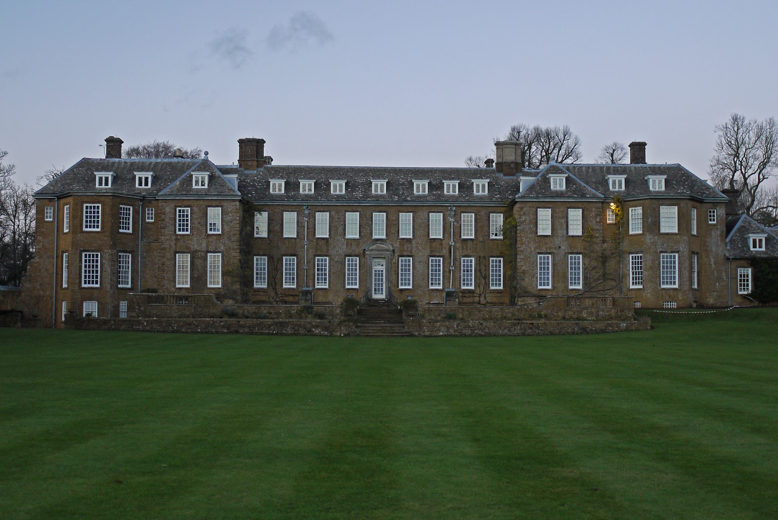
 ....to reach Uplands Farm and follow a track and then roads back to Upton House. It dates from 1695, but was altered in the 19th century and during the early 20th. It came into the hands of Lord Bearsted, the wealthy owner of Shell Petroleum, in 1927 and still houses his superb collection of pictures, including works by Breughel, Durer, Rogier van der Weyden, El Greco, Constable ....

 Our first proper look at the house was from the end of the long drive ...


 ... but we thought the south front was more impressive.


 As you walk down the long lawn away from the house, you can a grassy ridge in the near distance, but all of a sudden the lawn ends and a sunken garden is revealed in a dip between the lawn and the high ground. It is quite theatrical and rather wonderful.


Distance: about 5 miles.

Map: Explorer 206 (Edge Hill and Fenny Compton).

Weather: bright but cold.

Rating: four stars.


Friday, 24 February 2012

Warwick

The Westgate

We met up with our friends Sally and Malcolm for this city walk at a point equidistant between our respective homes. We started the walk - in less than ideal conditions, with cloud and rain - outside the imposing Westgate. This already existed in 1129 (Pevsner) and already had a chapel over it at this point. What you see today seems to be 14th century.

We went through the gate and doubled back to visit the wonderful Lord Leycester Hospital, which surely must be one the finest almshouses in the country.


It was founded in 1571 by Robert Dudley, Earl of Leicester, using premises of two Guilds of the town. The little chapel of St James over the Westgate (rebuilt1383) has a small but delightful stained glass window by William Morris.

You go through into a lovely courtyard. I was staggered to discover from Pevsner that the building on the left, the Master's Lodge, dates only from about 1850. Pevsner laments the "overdone" details, but we all found them rather charming.


The Hospital also includes two fine halls, one with the very interesting Museum of the Queen's Own Hussars, and a small millenium garden and the celebrated Master's Garden - closed of course until April.

The Hospital now houses seven ex-Servicemen, known as Brothers, and we rather had the impression that they ran the place as a sort of family business.  One handled reception duties in an exceptionally friendly way, one was in the museum. OK, one was practising the trumpet in the hall, so perhaps this theory doesn't quite hold up.

Across the street, you can see one of the boundaries of the great fire of 1694: the half-timbered houses on the right pre-date it, but the brick one on the left and the rest of the street were the result of subsequent rebuilding. We recently saw an even more comprehensive rebuilding after a fire of a similar period in Blandford Forum.


We now walked along High St and Jury St, mainly Georgian in character. So to the East Gate, which Pevsner tells us was built before 1426. The chapel was rebuilt in 1726 and is now part of the Girls' High School.


We carried on eastwards into Smith St. At the end of this street, which is notable now for some truly niche shops (vacuum cleaner spares, unpackaged tea), is St John's House, which dates from about 1626. It is now a museum.

At this point, we turned round and retraced our steps up Smith St. There is a nice group near the top of the street, with the Landor House of 1692 dominating.


Back into Jury St and left into Castle St for a quick peek at Warwick Castle.


Then back again and into Church St, where the massive tower of St Mary's stands proudly at the end, 174 ft high to the finials.


Inside the church is extraordinary. The tower, nave and aisles were destroyed in the great fire and were rebuilt to the designs of Sir William Wilson - completed in 1704. The windows are massive and the aisles are the same height as the nave, so the effect on entering is of a vast airy space.

The east end of the church survived the fire and at the end of the nave you immediately see the chancel, finished in 1392, with its unusual flying ribs in the roof.


Immediately to the right is the tiny Dean's chapel, with an extraordinary plaster ceiling.


And further to the right is the fabulous and celebrated Beauchamp Chapel: the chantry chapel of Richard Beauchamp, Earl of Warwick. It was begun in 1443. Fantastic tombs, decoration, stained glass.

Now, finally, to the Market Place, a large rather characterless space, dominated by the former Town Hall of 1670, now a museum (another museum!).


We repaired to the excellent Rose and Crown, more a restaurant than a pub, for an excellent and by now much-needed hot lunch.

Conditions: wet, cool.

Distance: about 2.5 miles.

Rating: four stars. Full of character and charm. Many interesting things to see, without even getting a proper look at the castle.

Tuesday, 11 May 2010

Stratford upon Avon

Shakespeare's birthplace

About the walk

My birthday. This walk around Stratford, courtesy of the Stratford upon Avon website, was the culmination of an excellent day out which had already included a trip to the wonderful Stratford Butterfly Farm and lunch at the fantastic Bernadettes restaurant.

The walk begins at the statue of the Jester at the top of Henley Street. You walk down the street and soon come to William Shakespeare's birthplace. The part on the left was the family home, while the part on the right was his father John's workshop and shop (he made and sold gloves).

At the bottom of Henley St you turn right into High St, with the handsome half-timbered Marlowe's restaurant building down on the left. Opposite, on the right, is the ornately carved Harvard House dating from 1596. It was the birthplace of John Harvard who founded the university of the same name.


Diagonally opposite is the magnificent Victorian gothic Old Bank, with a wonderful terracotta frieze of scenes from Shakespeare and a byzantine-style mosaic of the great man over the door.


You carry on down Chapel St past another fine half-timbered building - the Shakespeare Hotel.


Then you come to Nash's House (home of Thomas Nash, who married Shakespeare's granddaughter), with the site of New Place, the house where Shakespeare died, next to it.

On the opposite corner is the Guild Chapel. It dates from the 13th century and was build by the fraternity or Guild of the Holy Cross. There was also a hospital for poor priests. The nave and tower were added in the 15th century. Inside there are the remains of frescoes and fine (modern) stained glass depicting famous citizens of the town.


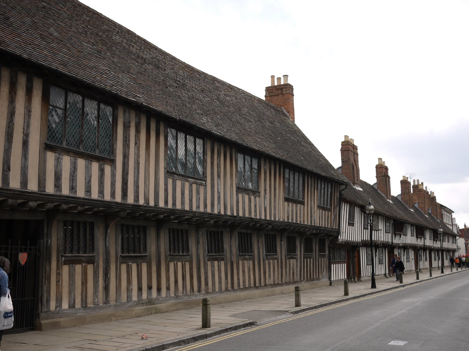
Continuing along Church St, the left-hand side has the former Guildhall, King Edward VI Grammar School and almshouses (of 1427) erected by the Guild. The Guild was a powerful force in the town, but was suppressed along with the monasteries in the Reformation and its property given to the town council.


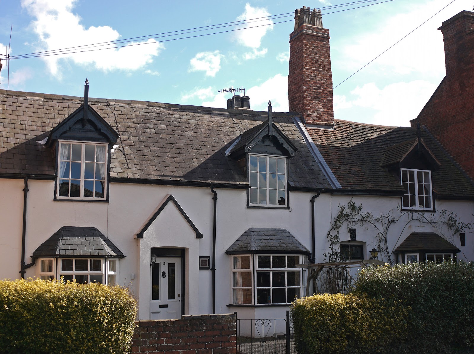
At the end of Church St you turn left into the Georgian New Town, with this lovely group of presumably Victorian houses on the left hand corner.


Further along, you pass Hall's Croft another fine house with Shakespearian associations: here lived Shakespeare's daughter with her husband, Dr John Hall.


At the end you reach Holy Trinity church, which contains Shakespeare's tomb. The building itself was begin in 1230 and extended at the end of the 13th century. The crossing, under the tower, is the oldest part of the building and beyond it the "weeping" chancel can be seen.


It is described as weeping because it is at a slight angle to the line of the nave. It dates from a further rebuilding in the late 15th century.

You now follow the line of the river to pass the Royal Shakespeare Theatre. An artistic power house, but architecturally very dull.

After a glance at the one-time canal basin (Stratford was an inland port) and the bridge over the Avon, you head up Bridge St into Wood St and into the Rother Market to admire the elaborate Victorian clock tower.


From here it is a few steps back to the Jester.

Rating: four stars. Much to see.