Thursday 25 June 2020

Tidcombe and Hippenscombe Bottom


St Michael's church, Tidcombe

For today's walk we drove to Tidcombe in Wiltshire, a village located a few miles off the A338. The village has the rare distinction of being a dead end.

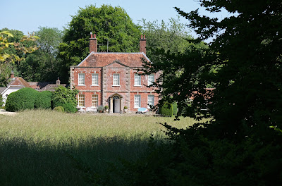
We started from the church (14th century with Victorian restorations). From the churchyard there was a fine view of the mid-18th century Manor House.


We turned right down the road and left to descend across fields and then climb to a wonderful view point looking towards the north west.


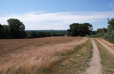
We continued ahead to cross the Chute Causeway, which we have encountered on other recent walks: Chute Causeway and Coldridge Wood and The Chutes. We continued along a track which offered lovely views initially to the left (see below) and later to the right.


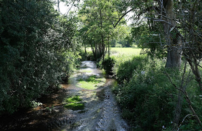
At the junction between our path and a crossing track we turned right and headed downhill to reach Hippenscombe Farm. We now followed the wonderful winding valley known as Hippenscombe Bottom, which we had noticed on our walk along part of the Chute Causeway.  This is the view from near the start ...


... and here is the situation about 2km on.


We did hit a problem at around this point. The walk book described reaching a gate after 2.7 km. We found two gates in quick succession, but neither seemed to totally match the instructions (we later realised we hadn't gone quite far enough). We left the track however and headed through a bit of woodland to reach Chute Causeway - but not quite where we were supposed to be. At least we were now sure of exactly where we were!

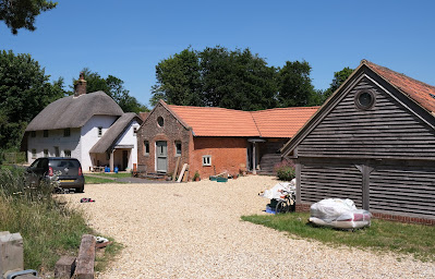
We decided to return to the start along the Causeway (rather than crossing fields), passing a thatched cottage and sundry other buildings at Scots Poor.


We reached the point above Tidcombe where we had crossed the Causeway on the way out and turned left retracing our initial steps. I took another picture of the view, this time a little more to the west, which made the Wilton Windmill visible (it is the white X just below the horizon), the Crofton Pumping Station off to the left.


Conditions: hot and sunny.

From: Walking in the North Wessex Downs (Cicerone).

Map: Explorer 131 (Romsey, Andover & Test Valley).

Distance: 6 miles.

Rating: four stars.

Tuesday 23 June 2020

Ashmansworth and Faccombe

The village green

We set off from the village green in Ashmansworth, admiring the pretty thatched cottage (Mere Cottage) which faces the green and especially the wonderful topiary.


We walked down the road towards Faccombe and turned off into a track between fields. A lovely open vista lay before us.


After passing through a small wood we followed  field edge path, admiring the wide set-aside with loads of Oxeye daisies and butterflies. Hats off to the farmer!


Continuing towards Faccombe we found two isolated buildings, described as barns, but clearly renovated or rebuilt. There was no sign of life.


Entering Faccombe we were drawn to the pretty village pond. I was delighted to see a baby cootbriefly emerge from the vegetation at the edge of the pond. The village pub lies beyond.


We passed the the 18th century Faccombe Manor ...


... and the church of St Barnabas (1865-66).


Leaving the village, we followed a path downhill which then led gradually up Pilot Hill, the highest point in Hampshire at 286m.


On the way up we were pleased to see these pale pink orchids.


We crossed a large field and joined the Wayfarer's Way mainly through light woodland to return to Ashmansworth, passing these attractive cottages on the way back to the start.


Conditions: hot and sunny.

From: Walking in the North Wessex Downs (Cicerone).

Map: Explorer 131 (Romsey, Andover & Test Valley).

Distance: 6 miles.

Rating: four stars.
Sunday 21 June 2020

Collingbourne Wood

The Shears pub

We have generally avoided walking at the weekend in recent months, but after a wet week we felt we just had to get out. This walk starts at the 16th century Shears pub, not far from the wonderfully named Collingbourne Ducis, once held by the Duchy of Lancaster.

We walked along a lane and forked right to follow a climbing path which soon led us along the edge of Collingbourne Wood. Once we entered the wood proper we were delighted to be walking along an avenue of Copper Beeches.


We then turned left to walk along the main path thorough the wood, Water Lane. We were delighted with the detailed directions and had no trouble navigating our way through the wood (unlike our recent walk in the nearby Coldridge Wood).

As the path left the wood we turned left downhill to a point where there was a small valley to the left ...


.. and a bigger one to the right.


We turned left walking along a wide path hedged on both sides but with a section on the right left as a set aside. This was something of a haven for butterflies and we saw Meadow Brown, Small Heath, Small Tortoiseshell, Small White, Green-veined White, Marbled White, Large Skipper along the way. Well done to the land owner!  At the end we rejoined the road back to the pub.

New wildflower of the day

Common Toadflax


Conditions: mild, mostly grey.

From: Wiltshire: from Salisbury to the Kennet (Jarrold).

Map: Explorer 131 (Romsey, Andover & Test Valley).

Distance: 4.5 miles.

Rating: three stars.

Monday 15 June 2020

Crookham and the River Enborne


We started this walk at the Travellers' Friend pub in Crookham and headed south past some houses to suddenly emerge into farmland. A little further on, a meadow on the right was covered in Oxeye daisies. We immediately saw our first Marbled Whites of the year, a few Skippers and legions of Meadow Browns.


We passed through a bit of woodland to soon reach the River Enborne, here a narrow, shallow and winding stream. The river rises between West Woodhay and Inkpen, to the west of Newbury and meanders eastwards to join the Kennet near Aldermaston.


We followed the line of the river and enjoyed spotting this damselfly, which seems to be a Beautiful Demoiselle. We were a bit surprised that the fields here seemed to be hardly cultivated.


We reached a road and turned left towards Folly Farm which we skirted, spotting this toad on the path as we passed by.


We crossed a road and walked through a series of fields, passing this substantial cattle trough - rather like our own bath we thought.


We headed then through woodland climbing towards the top of Huntsmoor Hill. Just as we approached the top we passed this curious construction. We could come up with no plausible idea of what it could be.


At the top is Hill House, an intriguing construction, which seemed to us to be reminiscent of a Mexican hacienda.


Now down a narrow lane to reach the hamlet of Goose Hill and along a path, identified as Park Lane, through woods and then across fields - we were disappointed that the next path wasn't called Mayfair - to reach the Brimpton to Crookham road.

Conditions: warm and sunny.

From: Rambling for pleasure. Kennet Valley and Watership Down.

Map: Explorer 158 (Newbury & Hungerford)

Distance: 6.25 miles

Rating: four stars, mainly for the first half.

Monday 1 June 2020

Chute Causeway and Coldridge Wood

St Nicholas church, Upper Chute

A second visit to the land of the Chutes (here is a link to the previous one). We parked near the bus stop in Upper Chute and walked past the19th century church of St Nicholas. It is a picturesque building by John Loughborough Pearson and dates from 1872. Unlike the previous walk we ignored a green lane to the right and followed the road up the hill. We left the road where it turned right and continued along a path which led us to the wonderful Causeway, a one-time Roman road.

The Causeway is on a ridge with lovely views of the valley below to the right ...


... and directly opposite.


We turned left along the Causeway - this is the view looking back as we neared some trees.


This one was dead, but it still made a fine sight (I have become much more conscious of the shapes and dramatic valley of trees in the last year or so).


A little further along the Causeway, we turned left and followed a track heading south past New Zealand Farm and then on the edge of woodland to reach Rutherfords Stud. Here we turned right along a track and then left with another lovely valley on our left.


The directions now required us to walk to the right of a large earthwork and then go through two gates to enter Coldridge Wood.


Unfortunately, either we entered the wood at the wrong place or we didn't correctly follow the simple-sounding instructions about navigating the wood. That is to say we were soon lost. And in dense woodland, our phones were of little use in pinpointing our position.

It is now clear that we penetrated way too far into the wood. However, we did spot a field through the trees and we realised that that this must be just beyond the right hand edge of the woods. We took the next path on our right and followed a track just on the edge of the wood. We weren't in the right place, but at least we knew here we were and how to get back to Upper Chute. Reaching an isolated house we followed a track away from the woods and back to Upper Chute.

Conditions: a lovely sunny day.

Distance: 4.5 miles officially, but perhaps a mile longer.

From: 100 walks in Wiltshire. This is the second time we have gone astray with a walk from this book. We are beginning to think that the instructions and sketch maps are insufficiently detailed.

Map: Explorer 131 (Romsey & Andover)

Rating: four stars.  An enjoyable walk notwithstanding our struggles.