Showing posts with label Rw. Show all posts
Showing posts with label Rw. Show all posts
Saturday, 7 November 2015
The Ridgeway
1 Ivinghoe Beacon to Wigginton
2 Wigginton to Wendover
3 Wendover to Princes Risborough
4 Princes Risborough to Kingston Blount
5 Kingston Blount to Swyncombe
6 Swyncome to Mongewell Park
7 Mongewell Park to Streatley
8 Streatley to Bury Down
9 Bury Down to Gramps Hill
10 Gramps Hill to Ashbury Folly
11 Ashbury Folly to Round Hill Downs
12 Round Hill Downs to Barbury Castle

Thursday, 16 July 2015
Barbury Castle to Overton Hill (The Ridgeway 13)

View from the Ridgeway towards Avebury
Today we completed the 86.8 mile Ridgeway. We started this great walk with our friends Merv and Pud in October 2013, but made little progress in 2014. Seven sessions this year however have finished it off. A proper review will follow in a future post, for the moment I will limit myself to the final leg.
We set off from the car park at Barbury Castle in a grey mist, apparently a sea mist that had penetrated far inland. As we approached the Iran Age hill fort, we saw a couple of examples of this pretyy flower which none of us could identify.

The hill fort itself was of the familiar shape with two circular ditches and earthwork ramparts and was surprisingly large. It dates back to about 500BC. It was much too murky to take a picture. We did see a few butterflies however including some pristine Marbled Whites.
We followed the clear path, first south west and then due south. There were soon some reasonable views through the mist. At Berwick Basset Downs we came on this Dewpond. A helpful sign board explained that, despite the name, Dewponds were carefully situated and designed to be fed by rainwater with a view to providing a source of fresh water for grazing sheep. Most date from the 19th century.

Soon after this, I was very pleased to see my first Gatekeeper of the year, joining the innumerable Ringlets and Meadow Browns that we had already seen

Now we also began to see lots of Sarsen stones by the wayside and in the fields. These stones are post glacial deposits and some larger ones were used at Stonehenge and nearby Avebury. The origin of the name is a corruption of Saracen, a medieval term for a Muslim which came to mean anything non-Christian.

Then there was another good butterfly moment. I thought this was a Small Skipper, but closer inspection revealed the dark tips to the antennae which indicate an Essex Skipper (Small Skippers have orange tips). This was the first time I have definitively seen one. It was soon joined by a Large Skipper.

Shortly after this we reached a point north east of Avebury and the weather seemed to have relented enough for me to take the picture at the head of this post. Soon after this we crossed the Wessex Ridgeway - our next project - and the view south towards some rolling hills offered a delightful palate of colours.

Not long after this we reached the end of the Ridgeway at Overton Hill. It was, it must be said, underwhelming. Just a nondescript car car, no band, no finishing post, no sign even. Fortunately Merv and Pud had brought champagne, so all was well.
Conditions: Misty then cloudy, but quite warm.
Distance: 6 miles. Distance now covered 86.8 miles.
Map: Explorer 157 (Marlborough & Savernake Forest).
Rating: four stars. A lovely walk, just not an ideal day. Surprisingly good for butterflies though.
Monday, 15 June 2015
Round Hill Downs to Barbury Castle (The Ridgeway 12)

View over Round Hill Downs towards the Marlborough Downs
Our most recent walk along The Ridgeway have been in dull, cloudy weather but today, happily, there is some blue sky and sunshine. We resume the route near Chase Wood Farm and head south with lovely wide open views to the west.
There is an even better view a little further on, with some cows to provide foreground interest.

We enter a more enclosed path and head downhill, swinging round to the west, to cross the A346 Swindon to Marlborough Road. On the other side there is a very nice small group of thatched cottages in a hamlet called Hallam.
The path now swings round to the north as we bypass Ogbourne St George and there is a great back across to the east showing the route we have previously travelled.

The rest of the walk follows a fantastic grassy ridge ...

... and we begin to see butterflies (Small Heath, Common Blue, Brown Argus).
We follow Smeathe's Ridge towards Barbury Castle, along a grassy trail with longer grass areas sporting many flowers on either side.

Before long there is great excitement as we spot our first Painted Lady of the year, a pristine and very amenable specimen which posed repeatedly for a photograph.

Butterfly Conservation think that this may be going to be a "Painted Lady Year" when theses beautiful butterflies migrate here in great numbers from southern Europe - the last one was in 2009. Fingers crossed! I did dutifully log my sighting.
Soon after this we arrived rather suddenly at Barbury Castle where we had left the car. It is of course an Iron Age hill fort rather than an actual castle, but we didn't get any sense of it as the path entered the parking area. Hopefully it will be clearer next month when we will complete this walk.
Conditions: Bright and sunny, quite warm.
Distance: 5 miles. Distance now covered 78.8 out of 86.8 miles.
Map: Explorer 157 (Marlborough & Savernake Forest.
Rating: four stars. One of the best sections of the whole Ridgeway.
Friday, 15 May 2015
Ashbury Folly to Round Hill Downs (The Ridgeway 11)

The Ridgeway path
Our recent efforts on The Ridgeway with Merv and Pud have been plagued by rather grey weather and today's stretch was no exception. The wide, straightish path was at least easy walking and pleasantly bordered by dense Cow Parsley.
Russley Downs away to the south east offered a point of view across the high (180m or so) plain

As we passed south of Bishopstone we saw some walkers emerging out of a wonderful curving valley, with what Merv identified as interlocking spurs. It transpired they were testing a walk they planned to do with their walking group the following week.

From here there was a long steady climb to Fox Hill. This was followed by about a mile along a road, which allowed a safe crossing above the M4. We were surprised by how little traffic noise there was and how close to the motorway we were before we really heard it.
On the other side, after a bit more road, we climbed Liddington Hill, but resisted the diversion to see the Iron AGe hill fort at the summit (277m). Instead we headed due south on the high ridge, especially enjoying the view back to north west. We thought we could just make out Lord Wantage's monument which we passed two legs ago in March.

A little further on there was more pleasing countryside.

And just beyond that, more unfolding valleys with some horses or ponies in the foreground.

This beautiful open country gave way to a more typical enclosed path which crossed the road from Ogbourne St George to Aldbourne. The final section was a lane leading to a farm. It was remarkable for the beautiful displays of Bluebells and Stitchwort among the trees to either side.

Conditions: Grey at first, brightening and warming up later, but never really clearing. Not a single butterfly.
Distance: 7.4 miles. Distance now covered 73.8 out of 86.8 miles.
Map: Explorer 170 (Abingdon, Wantage and Vale of White Horse) and 157 (Marlborough & Savernake Forest.
Rating: four stars. Wonderful views of wide-open country.
Monday, 13 April 2015
Gramps Hill to Ashbury Folly (The Ridgeway 10)

Uffington Castle
We have planned a once-a-month programme to finish the Ridgeway. Today's walk starts under rather dull, grey skies. We start with a brief look at St Michael's church in Letcombe Bassett, where Gramps Lane, our point of resumption, begins. The chancel is Norman and we wondered about the unusual external rendering. The churchyard had a wonderful display of primroses and other flowers.

At the point where Gramps Lane intersects the Ridgeway, the countryside stretches away to the west. You couldn't really see it when we started, so I have used this picture, taken when we returned to collect out car after the end of the walk

The path is chalky - thank goodness it was not wet or it would have been very slippery - and the fields to the north are a mass of chalk as well. By the side of the path we saw a couple of isolated Cowslips, just beginning to come into bloom.

At one point further on, I was admiring further scattered yellow blooms in the adjacent fields and thinking how pretty they looked. Of course it was only early-ripening Rape, but the effect was charming and much more gentle than the almost fluorescent yellow we will see next month.

Eventually we reached the back of Whitehorse Hill, which peaks at 261m. We headed across the grass away from the track to investigate Uffington Castle. The first impression is of the substantial ramparts and, once you clear them, of the great scale of the iron age (300 BC to 43 AD) hill fort they enclose. We were amused to see a sign that revealed that the fort was in the care of the Ministry of Works (it must have been there since before 1962 when that body was renamed).

We have seen quite a lot of these in southern England and Uffington must be one of the largest. A different view of its scale comes from the view at the head of this post, taken from the road immediately below the hill after the end of the walk.
We walked to the edge of the plateau and gained a great view of the country below towards Uffington village. In the foreground, a lovely combe known as the Manger.

This is what it looks like from nearer ground level.

To the right of the Manger is the rather artificial-looking Dragon Hill. We speculated that maybe it was formed by scourings from the nearby White Horse, but I learn from Wikipedia that it is a natural chalk hill. It has a legend attached to it that it was where St George slew the Dragon (hence the name!) and the bare patch of chalk visible in the photo, where apparently nothing will grow, is supposedly where the Dragon died.

On the way back I climbed Dragon Hill expecting to get a good view of the famous White Horse, which was apparently dug in the first century AD, but unfortunately the view point, although interesting, was too low.

Continuing now along a rolled path we soon reached Wayland's Smithy, a Neolithic Long Barrow, dating from the 4th century BC. But what has that got to do with Wayland? According to English Heritage, "it was once believed to have been the habitation of the Saxon smith-god Wayland". Wikipedia adds that this usage dates from 955 AD.

Another mile brought us to the car park at th einterestingly names Ashbury Folly, just up the road from the village of Ashbury where had lunch in the excellent Rose and Crown. I can't find any trace of an Ashbury Folly, but googling has revealed that there is a Folly Tower at Faringdon, about seven miles away, which looks worth a visit.
Conditions: Grey at first, brightening later.
Distance: 6.8 miles. Distance now covered 66.4 out of 86.8 miles.
Map: Explorer 170 (Abingdon, Wantage and Vale of White Horse).
Rating: four stars. Uffington Castle and White Horse were just wonderful.
Monday, 16 March 2015
Bury Down to Gramps Hill (The Ridgeway 9)

Scutchamer Knob
Our second leg this year of The Ridgeway: we started last year and then had to have a long lay-off. We set out from Bury Down on very grey morning and after a mile or so reached the strangely named Scutchamer Knob. It is an early iron age round barrow. Wikepedia says that it was originally called Cwichelmeshlaew or Cwichelm's Barrow and offers the fairly pointless opinion that the current name may be a corruption of Cwichelmeshlaew. It appears that the barrow was a high mound until the 19th century, when over-enthusiastic excavations reduced it to its present sorry state.
We made quite rapid progress along the broad path, unable to see too much in the murk to either side. A nice view offered itself just before we reached Lord Wantage's monument: the second stand of trees made a nice contrast with the grass and other trees.

The path passes close by the monument which dates from 1902. It was erected by his wife to commemorate the life of General Robert James Loyd-Lindsay, VC, 1st Baron Wantage. He was a philanthropist, one of the founders of the British Red Cross, an MP for a while and Lord Lieutenant of Berkshire.

Soon after the monument there was a pleasing combe to the right (north).

But as we drew south of Wantage, it started to rain, drizzle at first, then continuous and quite heavy rain. This wasn't what we expected! So the last part of the walk was a bit of a slog on a slippery chalky path. No further pictures were possible. We ended the walk at Gramps Hill, just south of the pretty village of Letcombe Bassett.
Conditions: cold, grey then wet.
Distance: 7.3 miles. Distance now covered 59.6 out of 86.8 miles.
Map: Explorer 170 (Abingdon, Wantage and Vale of White Horse).
Rating: three stars. More on a nice day. Lovely open country and little sign of habitation.
Monday, 2 March 2015
Streatley to Bury Down (The Ridgeway 8)

A dovecote in Streatley
It's a remarkably lovely day to resume The Ridgeway. We start by walking up the hill away from Streatley, where we see this fine dovecote over to the left.
Near the top of the hill we turn left onto a minor road and are soon presented with this lovely stand of trees viewed against the hills behind.

A little further on we pass Thurle Grange, fully in view through a gap torn in the hedge. We last came this way, walking in the reverse direction, in August 2008, when only the gate pillars could be seen. It is apparently a livery yard. We thought the house might be from the 1920s.

Further along the road we began to see catkins and there was much enthusiasm about teh advent of spring.

After some houses, the road gave way to a track, which is how it will continue across the North Wessex Downs.

Off to the left (south) there were grassy fields and rollings hills.

Passing to the north of the downland villages of Aldworth and Compton, we crossed a former railway line and wondered why it had not been restored as a path or cycling trail. Soon afterwards we stopped for a picnic lunch, crouching behind some bushes to get out of the headwind we had been walking into for some while.
The path now descended, with a ridge ahead which carries the busy - and noisy - A34.

After a steady climb, there was a great view back, in which The Ridgeway can be seen snaking diagonally across the landscape.

Conditions: bright, very windy, cold.
Distance: 8.2 miles. Distance now covered 52.3 out of 86.8 miles.
Map: Explorer 170 (Abingdon, Wantage and Vale of White Horse).
Rating: four stars. Wonderful wide open country, with great views in all directions (ignoring the Didcot power station of course) and scarcely a sign of habitation.
Sunday, 25 January 2015
Mongewell Park to Streatley (The Ridgeway 7)

The Thames at Goring
After a very long break, principally the result of injuries to key participants, we resume the Ridgeway, pricking up the route at Mongewell Park near Wallingford. We walk along the parallel to the Thames to soon reach the pretty village of North Stoke. On the right we notice the Arts and Crafts style Village Hall, with delightful lettering over the door.

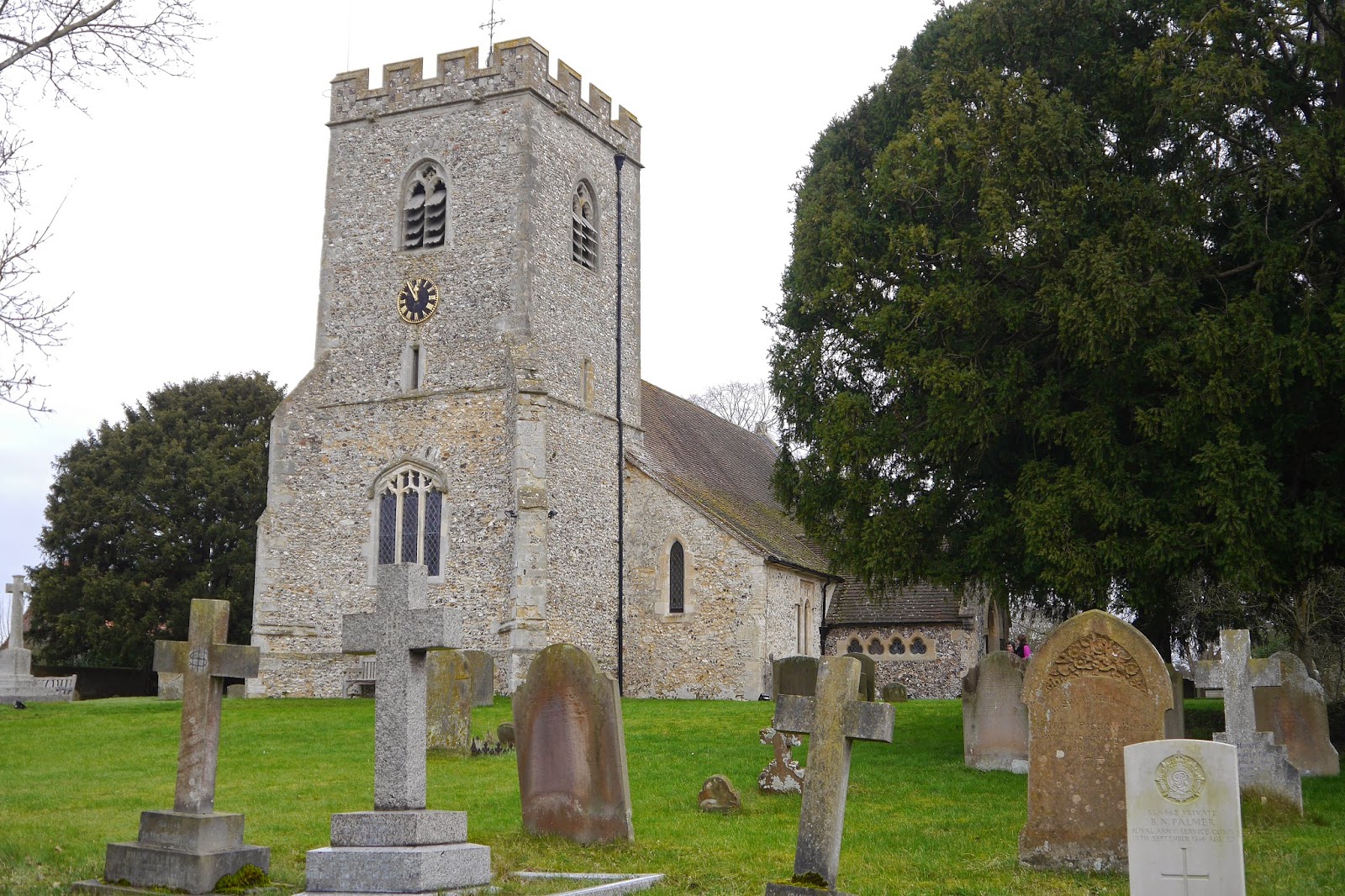
A little further we bear right past the church of St Mary, whose chancel dates from the 13th century and nave and tower from the early 14th.

We continued along the same line and then turned right to bring us to the river, wide and fairly featureless at this point. In the trees to the left there was a well preserved concrete pill box from the second world war. We are used to seeing these further south - e.g. on the Kennet and Avon Canal, but I don't recall seeing one in this area before.

Now we followed the tow path beside the river, under a brick railway bridge by Brunel, until we we had to turn inland to pass through the impressive village of South Stoke. The first main sight being this enormous barn under restoration.

On the right was the well-named Corner House. Pevsner confirms our assessment of a Georgian House being added on to a much earlier one.

On the left is the 13th century church of St Andrew, much restored in the mid 19th century.
Gradually the path draws closer to the river until eventually you are walking quite close beside it. A flock of Brent Geese could be seen, curiously static in the water, with the North Berkshire Downs behind.

Soon we were in Goring, where Ange lived as a child, ...

... where we noted a surprising advert for Tango lessons and admired the 12th century tower of St Thomas of Canterbury church.

It remained only to cross the river (see photo at the head of this post) and adjourn to the Bull pub for lunch. It was that very day under new management and all was chaos in the kitchen.
Conditions: grey, cool.
Distance: 5.8 miles. Distance now covered 44.1 out of 86.8 miles, so we are over half-way. We have vowed to increase our pace and get it finished with dispatch.
Map: Explorer 170 (Abingdon, Wantage and Vale of White Horse)
Rating: three and a half stars. Varied and enjoyable.
Subscribe to:
Posts (Atom)