Showing posts with label long distance paths. Show all posts

Monday, 5 October 2015

The South West Coast Path - West Cornwall: A review


Falmouth: Custom House Dock

Introduction

Cornwall as a whole accounts for 287 of the 630 miles of the South West Coast Path. The  South West Coast Path Association sensibly divides the county into three sections, South, West and North, and I have followed their lead. We finished West Cornwall some months ago, but I have only just found time to complete this review.

The West Cornwall section of the SWCP covers 120 miles between Falmouth and Portreath, and includes major milestones such as the Lizard Point and Land's End. I will highlight a few key impressions of this rich and rewarding part of the Coast Path. The individual stages we walked are listed below, with links to the original blog posts.

Milestones and impressions

After starting from the delightful town of Falmouth, Porthallow was our first major milestone, as it marked the halfway point of the whole SWCP. There is a substantial marker, but Porthallow itself is entirely unremarkable.


Soon afterwards we came to Lowland Point. It is a pretty spot, covered in wild flowers, notably thrift and bluebells, and just a few metres above sea level. We have passed many Points and Heads on the coast so far and this is definitely the lowest.


The next major milestone was the Lizard Point, which was a bit disappointing: a collection of shacks on a small rocky headland. We enjoyed the view across Housel Bay to the Lizard lighthouse which preceded it however.


We also enjoyed the west side of the Lizard with Kynance and Mullion Coves and then Portleven. Soon after this the coast began to change with the advent of remains of the Cornish tin mines and also larger sandy beaches such as Praa (pronounced "pray') Sands.

The wonderful St Michael's mount was almost hidden under grey cloud when we passed and it was frustrating to not even get a decent photo, let alone visit. There is not too much to say about Penzance, but we did love picturesque Mousehole, with its strange sandy beach within the confines of the small harbour.

Soon afterwards was one of our most favourite beaches - and we have seen a lot now - Porthcurno. viewed from near the wonderful Minack Theatre in the picture below.


Next up of was Land's End, but the less said the better about the monstrous shopping village which hides the actual end of the land from view. Cape Cornwall just along the coast was much more special.

And immediately beyond it is the main area for mining heritage at Botallack and Levant (below)


After Zennor the coast becomes more challenging and the section from there to St Ives was one of the hardest we have done. The view of St Ives and that lovely town itself made it well worthwhile however.


By contrast, the remaining sections, especially around Hayle were not so exciting, but did end with a wonderful view of a beach full of seals near Godrevy Point.


Stages

51 Falmouth to Helford Passage

52 Helford to Porthallow

53 Porthallow to Coverack

54 Coverack to Kennack Sands

55 Kennack Sands to Lizard Point

56 Lizard Point to Mullion Cove

57 Mullion Cove to Porthleven

58 Porthleven to Praa Sands

59 Praa Sands to Penzance

60 Penzance to Lamorna Cove

61 Lamorna Cove to Porthcurno

62 Porthcurno to Sennen Cove

63 Sennen Cove to Cape Cornwall


64 Cape Cornwall to Trevean Cliff

65 Trevean Cliff to Zennor

66 Zennor to St Ives

67 St Ives to Hayle

68 Hayle to Godrevy Point

69 Godrevy Point to Portreath

Tuesday, 18 November 2014

The Stour Valley Path: A review

Stourhead

The Stour Valley Path runs from Hengistbury Head at the mouth of Christchurch Harbour to Stourhead just over the border in Wiltshire, a distance of 60 miles. We did it in eight legs spread out over fourteen months.

Some things about this Path are a bit confusing. It is in fact generally know as the Stour Valley Way, to distinguish from another Stour Valley Path in Suffolk, but the only guide book is The new Stour Valley Path by Edward R Griffiths, Greenfield Books, 1998. It is marked on the OS Explorer maps, but sometimes there are alternative routes and the book doesn't always match the map. It seems that the local authority is not fully behind it either because signposting and waymarking are a bit haphazard to say the least.

Is it worth doing then? Definitely. It offers a way to see and get to know Dorset from south to north through many interesting places and much beautiful country. We had already walked the Coast Path in Dorset, but this direction was substantially unknown to us.

So what were the best bits? We had already encountered the Lady Wimborne houses in the Poole-Wimborne area, but it was fascinating to go past was is now Cranford School, where she once lived and to see the extraordinary railway bridge on the outskirts of Wimborne which also bears her name.


Crawford Bridge on the outskirts of Spetisbury was a beautiful structure and the weather conditions facilitated this pleasing photo on the day we reached it.


Just along the road on the other side of Spetisbury, the handsome church of St Mary was rebuilt, apart from the base of the tower, in 1713 by Thomas Bastard, father of the celebrated Bastard Brothers who rebuilt Blandford after the great fire of 1731.We had driven past it before (it is on the Poole-Blandford road) and would do so several times again in the course of this and other walks. It was good to know its story.


The two great surprises were the adjacent chalk hills: Hod and Hambledon. They offered excellent walking, with some decent climbs and fantastic views, especially from Hambledon Hill (193m), where the panorama was almost 360 degrees.


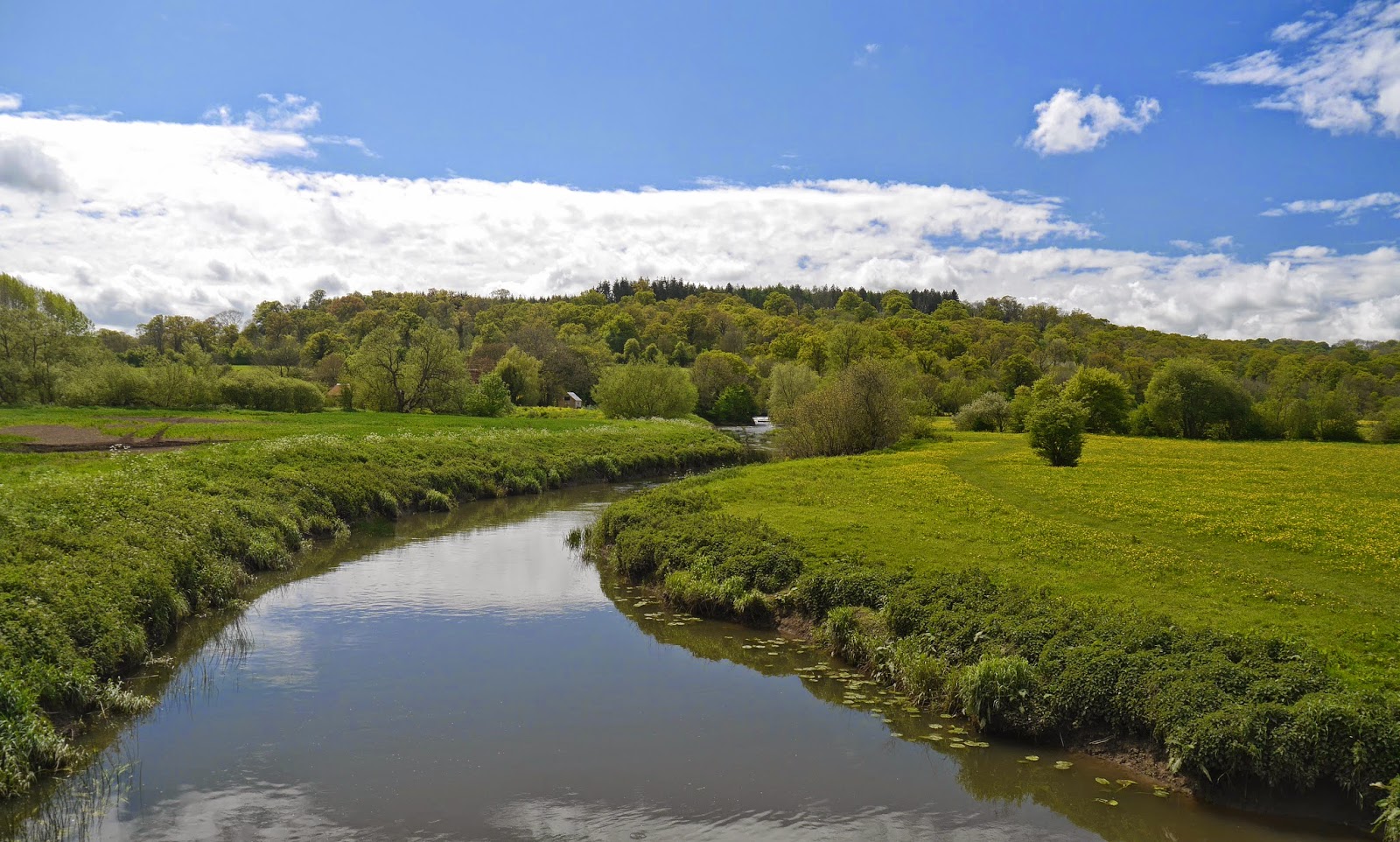
What of the river? Well the Path follows the river valley more than the river itself and indeed one of the disappointing things was that unlike, say, the Thames Path very little of the walking was along the river bank. The longest section was around Wimborne. The Stour is generally a narrow, winding river, pretty enough but never really dramatic.


And the best bit? Undoubtedly the gardens of Stourhead, arranged around the exquisitely beautiful lake. Here, to finish on, is another view.


Stages

1 Hengistbury Head to West Parley

2 West Parley to Wimborne

3 Wimborne to Crawford Bridge

4 Crawford Bridge to Bryanston

5 Bryanston to Hammoon

6 Hammoon to Fifehead Magdalen

7 Fifehead Magdalen to Silton

8 Silton to Stourton and Stourhead

Sunday, 1 September 2013

The South West Coast Path - South Devon: A review

Lyme Bay

Background

It has taken us almost exactly a year to compete the South Devon section of the South West Coast: we started in August 2012 and finished in August 2013. From Lyme Regis to the River Tamar in Plymouth is, it turns out, 133 miles. We are now 219 miles in all along the Coast Path. Only 411 to go!

Because we were now farther from home we adopted a new model of making three and four day trips, in place of the previous single day outings, and this sense of increased momentum was also reflected in our efforts to walk a bit further each day, several times over 10 miles.

Impressions

Perhaps the biggest difference we noticed between Devon and Dorset is the number of river estuaries: notably the Sid, the Exe, the Teign, the Dart, the Avon, the Erme, the Yealm - and the Kingsbridge estuary (although this is strictly a ria - a drowned river valley that remains open to the sea). The Dorset section effectively has none. Planning the logistics of ferry crossings was a new challenge. Many of the estuaries were very pretty. The Erme is often especially praised, but my personal favourite was the Avon.


Secondly, although there is much isolated and unspoilt coast in Devon, there seemed to be many more towns actually on the coast than there were in Dorset - and, linked to this, a much more evident holiday industry. So there was more urbanised walking, for example around Torbay and in Plymouth. We thought Brixham (below) and Dartmouth were perhaps the prettiest. However, Torquay had some surprises: Torre Abbey and the fantastic 1912 Pavilion; while the Hoe in Plymouth is a fantastic urban open space.


But there were of course some spectacular sections of coastline. We very much liked the red sandstone cliffs around Buddleigh Salterton and Sidmouth. This is the view from Littleham Cove.


And, further west, dramatic rocky areas like Soar Mill Cove ...


... and Aymer Cove


Lyme Bay is a dominant feature of much Dorset walking and in Devon Tor Bay, Start Bay and Bigbury Bay (with Burgh Island) all loomed large. One of the great things about bays is that as you approach the final headland, you can look back at a wide sweep of coast and say that you have walked along all of it.  

One last impression is of the amount of relics of past wars, even more so than in Dorset. There are castles dating back to the fear of a Spanish invasion in the 1540s, towers built against the threat of the Dutch a century later, massive 19th century defences against the French around Plymouth and lots of traces of the Second World War, gun emplacements and the like, and also memorials like the Sherman Tank at the end of Slapton Sands at Torcross.

All in all, a wonderful section of coast!


Stages

21 Lyme Regis to Seaton

22 Seaton to Branscombe

23 Branscombe to Sidmouth

24 Sidmouth to Buddleigh Salterton

25 Buddleigh Salterton to Exmouth

26 Starcross to Teignmouth

27 Shaldon to Babbacombe

28 Babbacombe to Paignton

29 Paignton to Brixham

30 Brixham to Coleton Fishacre

31 Coleton Fishacre to Dartmouth

32 Dartmouth to Torcross

33 Torcross to East Prawle

34 East Prawle to Salcombe

35 Salcombe to Hope Cove

36 Hope Cove to River Erme

37 River Erme to Noss Mayo

38 Warren Point to Mount Batten

39 Mount Batten to Cremyll Ferry

Wednesday, 3 July 2013

The Oxfordshire Way: A review


Background

The Oxfordshire Way runs for 68.25 miles from Bourton-on-the-Water to Henley-on-Thames, from the Cotswolds to the Chilterns. The Path was developed by the Oxfordshire Branch of the Council for the Protection of Rural England (CPRE) as far back as 1978 and later adopted by the County Council. We used The Oxfordshire Way. A walker's guide published by the County Council in 1993 as a resource and found it to be very useful and informative and still largely accurate. There was just one map where the route was wrongly marked, but we soon figured it out. The signposting was pretty good too.

We did the Oxfordshire Way with our friends Merv and Pud and we started by doing the short Windrush Way in two sections from Winchcombe to Hawling and from Hawling to Bourton as a sort of warm-up and to link it to our previous venture, the Cotswold Way. We started on 1 April 2012 and have only just finished. Some personal factors resulted in the odd cancellation of a planned leg, but the weather played a big part - there is just no fun in setting out on a walk when you know it is already pouring down with rain.

Impressions

The walk has three distinct components: the section up to about Charlbury (our third stage) still feels like the Cotswolds, then there is the main body of the path which arcs across Oxfordshire, north of Oxford, which we found surprisingly flat. After that the final two stages through the Chilterns came as a bit of a relief. Overall, then it was an easier walk that the Cotswold Way, but less dramatic and with less stunning scenery.

It was striking how many country house parks we walked through. Blenheim was by the far the greatest of them, but there were several other pleasant, mainly Georgian, houses at places like Kirtlington, Rycote and Waterperry.

Otmoor is an unusual area and important type of habitat. Our guide described the low lying flat moorland as "often boggy". This turned out to be something of an understatement - totally saturated would have been more accurate and just after Waterperry there was a section which could only be described as flooded, which gave us some concern about whether we would be able to get through at all.

We found a good number of excellent pubs to have lunch on afterwards, notably the Kings Head at Bledington, the Crown at Pishill and the Angel on the Bridge at Henley

And finally every walk had its share of Kites, many swooping low to show off their fine colours. At one point we saw five in the air at once. To think that this species was once endangered and had to be re-introduced. "As common as sparrows", somebody said - but of course sparrows are becoming much rarer in this part of the country, so this is a rather two-edge comment.

All in all a most enjoyable walk that did not quite reach the heights of the Cotswold Way, both literally and metaphorically. Would we recommend it? It is an excellent means to get an overall feel for what Oxfordshire is like. The only problem is that it turns out that some parts are perhaps a bit dull.

We now plan to start the Ridgeway this autumn.

Stages

1 Bourton-on-the-Water to Foxholes

2 Foxholes to Grove Lane

3 Grove Lane to Littleworth Farm

4 Littleworth Farm to Kirtlington

5 Kirtlington to Islip

6 Islip to Menmarch Guide Post

7 Menmarch Guide Post to Albury

8 Albury to Wheatfield

 9 Wheatfield to Pishill

10 Pishill to Henley

Saturday, 13 April 2013

The Wayfarer's Walk: A review

I started the Wayfarer's Walk on impulse one afternoon in November 2011: I felt like a walk and I wanted to do something different. I had already touched on one or two parts of it in circular walks in North Hampshire. The only practical approach seemed to be a series of there-and-back walks and that was the main way I tackled it, with a few linear sections. I suppose that explains why it took so long and required so many separate "goes".

It is effectively north-south walk across Hampshire - a sort of Hampshire Way. It can be compared to our first experience of long distance paths - the BBC's informal Berkshire Way - and the Oxfordshire Way, which we are currently walking in occasional stages with friends. There is something tremendously satisfying in walking across a whole county

A plaque on a signpost that I noticed at Brown Candover explained that it was initiated in 1981 by Bill Bide who was then the Principal Officer for Footpaths. I have since read, on the Traildino site, that it follows the route of an ancient drove road, but I am not totally convinced by this. Some sections, notably the initial ones along the North Hampshire Downs feel like old trails, but much of the rest seems to be local footpaths stitched together to make a long distance route.

An alternative, detailed description of the route can be found on the British Walks site.


Impressions

The initial stages are noticeably rural, with great views from the ridge of North Hampshire Downs, and the whole route gives a strong reminder of what a rural country Hampshire is outside of its main population centres. I have been thinking about cities lately and I was surprised to realise that Hampshire, with three cities (Winchester, Portsmouth and Southampton) has the most of any English county apart from East and West Midlands. That said, big fields and field edge paths are probably the abiding images.

I don't think it is too harsh to say that there are no major places or sites of great grandeur or impact on the route. I think Alresford was probably my favourite town and I enjoyed the views from Ports Down over Portsmouth and the coast to the east of there. Cheriton, Droxford and Hambledon are pretty villages. I think I probably enjoyed the last leg most: an interesting mixture of Victorian history and birdwatching.

I think the there-and-back model was quite effective. It gives a high level of control over what you do: you can do more or less than you planned, according to how you feel or what the weather is like. And the experience is different on the way back. The main price is it all takes so long and gradually as you get further away from home you become conscious of how far you have driven relative to how much forward progress you have made.

So overall, pleasant but not great. I am glad to have done it though.


My stages

1 Walbury Hill to Bunkhanger Copse

2 Bunkhanger Copse to Upper Woodcott Down

3 Upper Woodcott Down to Nuthanger Down

4 Nuthanger Down to North Oakley

5 North Oakley to Deane Down Farm

6 Deane Down Farm to Bull's Bushes Farm

7 Bull's Bushes Farm to Breach Farm Cottages

8 Breach Farm Cottages to Brown Candover

9 Brown Candover (I strayed off the track!)

10 Brown Candover to Abbotsford

11 Abbotsford to Alresford

12 Alresford to Hinton Ampner 

13 Hinton Ampner to Wind Farm

14 Wind Farm to Corhampton Down

15 Corhampton Down to Hambledon

16 Hambledon to Portsdown

17 Ports Down to Emsworth

Wednesday, 31 October 2012

National Trails


There are 15 National Trails (13 in England and 2 in Wales). They include such celebrated routes as the South West Coast Path, the Cotswold Way, the Ridgeway, the Pennine Way and Offa's Dyke Path. Together they account for 2,500 miles of long distance path. There are some notable exclusions too, e.g. Alfred Wainwright's Coast to Coast path.

They are currently mainly funded by central government and administered by Natural England, which has a National Trail Officer responsible for each one.

Driven by funding pressures and by central government's desire to "see more devolved and locally responsive solutions to public service provision", Natural England has reviewed the National Trails and gone out to consultation with proposals to devolve management of the trails to a number of local Trail Partnerships. The consultation closed in July, but the document is still available here.

The Ramblers and others feel that there is great danger in this devolution. There are three obvious risks:
  • There would be no national champion to advocate and plan for the future of the National Trails - how would new ones be introduced?
  • The responsibility for managing and maintaining National Trails would fall on already-stretched Local Authorities and stakeholders, without these bodies having any additional support.
  • There is no safety net in the case of a Local Trail Partnership failure.
The Ramblers' have produced their vision for the National Trails.   It centres on the creation of a new national charity, the National Trails Trust, which would oversee the whole network of trails and so address the risks described above. It would also seek to expand and develop the network of trails.

It seems eminently sensible, but to bolster the rational argument, the Ramblers is asking people to sign a petition urging the government to rethink the proposals.

Sign the petition here.

And when you've signed, get your friends to do so as well by clicking here.

Monday, 3 September 2012

The Bournemouth Coast Path: A review

We found about the existence of the Bournemouth Coast Path quite by accident: we noticed a guide book in the Poole branch of Waterstone's. Exploring the Bournemouth Coast Path by Leigh Harris is published by Countryside Books (more information can be found here.) It describes a route from Swanage to Lymington, but we felt that the core route was from Sandbanks to New Milton - the Swanage to Sandbanks section is part of the South West Coast Path, which we had already done, while New Milton to Lymington marks the beginning of the Solent Way, a possible future project.

The Bournemouth Coast Path dates from 1985 and seems to have been the invention of the author: well done to him! He is clearly pleased that it has been designated as part  of the E9 European Coast Path, which will run 3,125 miles from Capo de Sao Vincente in Portugal to Narva-Joesuu in Estonia. This (the E9) is obviously a wonderful concept, but seems to consist at present of not much more than a line drawn on the map. I have it on my to-do list to see what stretches of coast path are extant in Portugal, Spain and France.

We really enjoyed walking the BCP, which we did in four legs (listed below), a distance of 27 miles including the retunr trip along Hurst Spit. We were surprised by how varied it was and this reflects the route which takes you up and down the various chines that surround Bournemouth rather than simply following the promenade at the back of the beach. Also of course the route encompasses two harbours (Poole and Christchurch) and it was interesting to see how they were both similar and different. There are also two castles, at least on our route - Highcliffe and Hurst. We loved Highcliffe, but were a bit disappointed by the appearance of Hurst (we arrived too late in the day to go in).

We also learned a lot about the history, geography and geology of the area and, not least, were shocked to see how far Poole extended. We hadn't really clocked where the boundary with Bournemouth was, but now we know.

But perhaps the greatest satisfaction is that, as we have already walked the SW Coast Path to the western edge of Dorset at Lyme Regis, we can now say that we have walked every inch of the coast of this lovely county. And finally doing the Bournemouth Coast Path inspired me to devise a short town walk around Bournemouth.


Stages

1 Sandbanks to Bournemouth Pier

2 Bournemouth Pier to Mudeford Spit

3 Mudeford Quay to Barton-on-Sea

4 Barton-on-Sea to Hurst Castle

We had previously waked from Poole Quay to Sandbanks.

Tuesday, 10 April 2012

The South West Coast Path - Dorset: A review

Background

We started the 630 mile South West Coast Path in January 2011, having recently bought a holiday flat in Poole. We decided we would approach it as a series of circular walks, so as to also get to know the interior. At the start we thought we might eventually reach Weymouth or perhaps even Lyme Regis.


What happened is that we have gathered momentum as time has gone on, and we have finished 2011 having already reached Weymouth and then gone on to complete the circuit of the Isle of Portland and push on to Lyme Regis. As we approached Weymouth, we decided to shift to doing linear walks and used a combination of train and taxi to do so - which of course greatly accelerated our progress along the coast. We are now thinking that perhaps we can do the whole thing over the next several years. In a nutshell, we have been hooked! 

The total distance we have walked so far - which is of course also the official length of the coast path in Dorset - is 86 miles.


Reflections

We had previously done next to no walking along the coast, just one memorable walk in Crosby and others on holiday in Cap Ferrat and the Costa Brava (Llafranc to Cap Roig and to Golfet). At first there was the novelty of a few miles along the beach to Studland and then the already-familiar area around Old Harry Rocks and Ballard Down. After the interesting town of Swanage comes Durleston and what feels like the beginning of the Coast Path proper. Certainly one of the striking things is that there is very little development actually on the coast - Weymouth and Lyme are the only major settlements. So one of our abiding impressions is how quiet and rural it is.

From about Dancing Ledge onwards the coast becomes much more dramatic with the spectacular chalk cliffs that extend as far as White Nothe - where there is a dramatic change to red sandstone to Weymouth and then Portland Stone around the gigantic quarry that is Portland.  Towards the end you climb Golden Cap, the highest point on the south coast, although not by much. The climbs and descents of the chalk cliffs will live in the memory. And there is no doubt that we are fitter as a result and more confident of our ability to tackle anything else that the Coast Path may have in store.

We were pleasantly surprised that for the most part the Coast Path is not crowded. The section between the car park at Lulworth Cove and Durdle Door is the only real exception, but even here as soon as you pass Durdle Door things quieten down straight away.

Wildlife sightings were relatively limited, but quite interesting. Fulmars, a Short Toed lark, a Serrin, a Clouded Yellow butterfly and a common seal were the highlights.

There was a noticeable theme of war: from the castles built by Henry VIII when he feared attack by the Spanish, to the pillboxes, radar research and preparations for D-Day 500 hundred years later.

There was also constant evidence of erosion of the coastline and several places where the path had been temporarily or permanently moved inland. The most dramatic example was the Clavell Tower which had been moved 80ft inland in 2005. I suppose walking the Coast Path must increase the rate of erosion, but as both erosion and walking are fundamentally natural processes, I think this is acceptable.

The stages in which we did the walk are listed below. Flowers Barrow to Lulworth Cove was the most demanding and Lulworth Cove to White Nothe probably the most pleasing.


Stages

1 South Haven Point to Studland Bay

2 Studland Bay to New Swanage

3 Swanage to Anvil Point

4 Anvil Point to Dancing Ledge

5 Dancing Ledge to Winspit

6 Winspit to Chapman's Pool

7 Chapman's Pool to Rope Lake Head

8 Rope Lake Head to Kimmeridge Bay

9 Kimmeridge Bay to Flower's Barrow

10 Flower's Barrow to Lulworth Cove

11 Lulworth Cove to White Nothe

12 White Nothe to Osmington Mills

13 Osmington Mills to Ferry Bridge

14 Ferry Bridge to Portland Bill

15 Portland Bill to Ferry Bridge

16 Ferry Bridge to Langton Herring

17 Langton Herring to West Bexington

18 West Bexington to Eype Mouth

19 Eype Mouth - Golden Cap - Charmouth

20 Charmouth to Lyme Regis

Tuesday, 4 October 2011

The Cotswold Way: A review

The Cotswold Way

The Cotswold Way runs for 102 miles from Chipping Camden to Bath. It was originally developed as a long-distance footpath in 1970, and was formally launched as a National Trail in 2007, with some changes to the route.

I have described our experiences of walking the Cotswold Way in a number of postings (listed below). It now seems time to stand back and offer some reflections. I will divide them into two broad categories: our experience of walking the Way and the route itself. Reviewing the route also identifies a number of places we would like to go back to and investigate further.


Our experience

We agreed that it had been a good idea! The things that the four of us liked were many and varied: wonderful views, friendly people (especially the guy who brought us tea near Birdlip), appreciating how the geography fits together, hospitable pubs, deepening our friendship, little villages, discovering new places on our own doorstep, not too many golf courses, good signposting, great fun, variety, catching up with each other's news, working out the ramifications of the two-car model, learning about butterflies, learning about geology, the miraculous weather, finding that we were all up to it, taking photos, the way it managed to be in country right to the end, how we got fitter and increased our expectations of what we could do.

It was a good move to go from Chipping Camden to Bath. It felt a better place to end up.

We all felt our guide book had been a great help. It took some getting used to, but once mastered was invaluable. The Cotswold Way by Tricia and Bob Hayne (Trailblazer Publications, 2009).


The route

The route follows the edge of the Cotswold escarpment virtually all the way, so there was a long series of fantastic views off to our right. Some personal highlights were views from Wistley Hill, Crickley Hill, Ring Hill / Haresfield Hill and Cam Long Down. (These and other places mentioned can all be located using the search facility above.)

We also passed through many lovely towns and villages, notably Broadway, Painswick, Winchcombe, Wotton-under-Edge and Stanton.

We saw some lovely churches, of which All Saints at Selsley was perhaps our favourite for its Morris and Co stained glass. Hailes Abbey and its nearby church were also very special.

Other especially interesting buildings and structures were: Broadway Tower, the Tyndale Monument and the Market House at Dursley.

Throughout there was a great sense of history: from stone age barrows, to iron age hill forts and civil war and later battles.

And finally, there were many nice pubs, of which the Mount at Stanton was a particular favourite.


Places to go back to and explore properly

Snowshill Manor
Stanway House
Sudeley Castle
Painswick Rococo Garden
Dyrham Park
Beckford's Tower


 Stages

1 Chipping Camden to Broadway Tower

2 Broadway Tower to Stanton

3 Stanford to Hailes Abbey

4 Hailes Abbey to Cleeve Hill

5 Cleeve Hill to Seven Springs

6 Seven Springs to Birdlip

7 Birdlip to Painswick

8 Painswick to Randwick 

9 Randwick to Coaley Peak

10 Coaley Peak to Wotton-under-Edge

11 Wotton-under-Edge to Hawkesbury Upton

12 Hawkesbury Upton to Tormarton

13 Tormarton to Cold Ashton

14 Cold Ashton to Bath

Friday, 4 June 2010

The Blackwater Valley Path: A review

Review

The route covers the 23 miles from the source of the Blackwater in Rowhill Nature Reserve at Weybourne near Aldershot to where it merges with the Whitewater and then the Loddon near Swallowfield.

We walked it in the reverse direction, thinking that following a river to its source was a more classic undertaking. It also meant we started nearer home.

The first few sections were all fairly familiar from other local walks: pleasant riverside paths with extensive sections of former gravel pits now turned into boating lakes or wildlife sanctuaries. There was a substantial Western extension of the gravel works which did not improve the walk.

The second half of the walk was severely marred by traffic noise resulting from proximity to the busy A331 road.

Overall, therefore rather disappointing. There were some nice sections but much was fairly dreary.

The guide book was very good, although stronger on the natural environment than the buildings that were en route. There is also a nice book of circular walks along the route and useful little books about the butterflies and especially dragonflies which may be seen.


Stages

12-11 Swallowfield to Eversley Bridge

10-8 Eversley Bridge to Sandhurst

7-5 Sandhurst to Farnborough

4-1 Farnborough to Weybourne

Friday, 19 June 2009

The Three Castles Path: A review

Introduction

We have described our experiences of walking the Three Castles Path in a number of postings (listed below). The route links Windsor and Winchester, via the third castle, Odiham.


Review

The Three Castles Path was "inspired by the well-documented 13th century journeys of King John via the castle he built near Odiham" and the guide to it was first published in 1992. The initial stages are in semi-suburban east Berkshire, where as I noted in one post, "you are never far away from a housing estate".

However, once you get into Hampshire things become much more interesting as you walk along the delightful and little-known Basingstoke Canal, through a whole series of pretty villages with half-timbered thatched cottages and Norman churches. The fields in Hampshire are bigger too and the paths very often have a copse on one side and a field edge on the other, with views over gently rolling hills.

As you approach Winchester you follow the fast-flowing Itchen and then reach that fascinating city with its magnificent cathedral and all sorts of historical sites.

Although the route is perhaps a little contrived, there are several sections of sustained track and overall it feels reasonably like a single path.

The walk book (The Three Castles Path by David Bounds for the East Berkshire Ramblers’ Association Group) is excellent with very clear maps and very precise directions, as well as helpful comments on points of interest along the way - the hallmark of the East Berkshire Ramblers series of walk book books. The only flaws are that there are no suggestions for parking places at the start of each stage and because the maps overlap at the starts and finishes it is sometimes difficult to calculate the distance accurately.

One thing puzzled me. The route of the Three Castles Path is clearly marked on the OS Explorer maps, but is nowhere acknowledged on the ground by named way marks or footpath signs. No doubt there is a story behind this.

The best bits? The Odiham to Tunworth stage had great variety: the canal, Odiham Castle, the pretty village of Greywell, the river Whitewater and the wonderful Five Lanes End junction. Winchester was wonderful and well worth allowing a separate day for.

So, a good easy Long Distance Path which has helped to cement our desire to do more. Next up, the Ridgeway?


Stages

1 Broadmoor to Moulsham Green (Stages 4-5)

2 Moulsham Green to Hazeley Heath (Stage 6)

3 Hazeley Heath to Odiham (Stages 7-8)

4 Odiham to Tunworth (Stages 8-9)

5 Tunworth to Ellisfield (Stage 10)

6 Ellisfield to Upper Wield (stages 11-12)

7 Upper Wield to Abbotstone (Stages 12-13)

8 Abbotstone to the edge of Winchester (Stages 14-15)

9 Winchester (Stage 15)

Monday, 16 February 2009

The BBC's Berkshire Way: A review

Introduction

We have described our experiences of walking the BBC's Berkshire Way in a number of postings (listed below). The route links Lambourn in the west with Windsor in the east and traces a meandering path across the whole county. Now that we have finished the whole walk it is time to offer some reflections on it.


Review

Overall, it's a fantastic idea - well done to the BBC! We have very much enjoyed the individual walks and felt a great sense of achievement when we finally got to Windsor, even though it was months after we started the walk.

The 14 stages comprise a cleverly chosen route which links the best bits of Berkshire countryside and provides great variety. The route covers a number of different types of walking: downlands (the Berkshire Downs and North Hampshire Downs), rivers (the Thames, the Kennet, the Loddon), the Kennet and Avon Canal, gravel pits, fields (of course), woodland (especially Swinley Forest), even a racecourse (Ascot) and the park of a royal palace (Windsor).

You also see something of some of the county's nicer towns: Hungerford, Newbury, Wokingham and Windsor.

We wondered if there were any significant omissions. There is some nice country west of Reading in the Bucklebury-Hampstead Norreys area and the Thames in the east of the county is also very attractive. But, obviously a route like this can't cover everywhere, and one has to conclude that the compilers of the walk have done an excellent job.

Conversely, the route managed to avoid most of the areas of the county that you wouldn't want to spend much time walking in: there were very few areas of suburban sprawl to plod through.

Beyond the specific locations, the Berkshire Way provides a nice introduction to the joys of linear rather than circular walking and of long distance paths.

At a more practical level, the walk descriptions and maps are good, and there was seldom any real ambiguity about where to go. There was some variability in the precision and clarity of directions. Leg 3 for example a bit vague in places (you are told to take a turning but not given a sense of how far along the path it will be). We just got lost once - in Purley - but that is easily done. However, these are only very minor gripes.

Some of the descriptions are also a bit out of date – there are quite a lot of references to “when we walked this in 2002”. However, we did not encounter any significant problems with changes since then. And in fact West Berkshire Council at least have improved signing and way-marking since 2002.

The stages are listed below. Our favourite was probably Bury Down to Lardon Chase, along the Ridgeway.


Stages of the Berkshire Way

1 Lambourn to Hungerford (7.5 miles)

2 Hungerford to Combe Gibbet (6 miles)


3 Combe Gibbet to Hamstead Marshall (4.75 miles)

4 Hamstead Marshall to Newbury (4.75 miles)

5 Newbury to Chieveley (6.75 miles)

6 Chieveley to Bury Down (6.75 miles)

7 Bury Down to Lardon Chase (7.5 miles)

8 Lardon Chase to Pangbourne (7.5 miles)

9 Pangbourne to Reading Bridge (7 miles)

10 Reading Bridge to Ashenbury Park, Woodley (5 miles)

11 Ashenbury Park, Woodley, to Wokingham (8 miles)


12 Wokingham to the Lookout, Bracknell (7.25 miles)


13 The Lookout, Bracknell, to Ascot (4.5 miles)


14 Ascot to Windsor (7 miles)