Showing posts with label stately. Show all posts

Wednesday, 8 February 2023

Axford and Ramsbury Manor


The first walk of the year with my walking partner, Mervyn. He had kindly developed a circular walk starting to the west of the delightful Wiltshire town of Ramsbury at the rather prosiaic Axbury Pumping Station (marked as S).

We start along the narrow road which followed Sound Bottom and was soon delighted to see my first Snowdrops of the year.

After a while we took a path on the left which led south to reveal a fine vista across the fields and then passed a pleasing red brick house ...

... and along a lane to skirt a rather imposing Georgian (or more probably Georgian-style) house.

We followed the path down to Stichcombe and after crossing the Kennet we had an informative chat with a couple who were clearly very familiar with the area, pointing out to us Little Egrets and other wildlife. 

We passed Cowleaze Cottage and followed the border of Ramsbury Manor Park. According to Wikipedia it belongs to the Capricorn Foundation, a trust which has the task of maintaining the house as a museum and cultural resource for the nation. It dates from the 1680s.

The best views were of the beautiful lake with the House beyond it ...


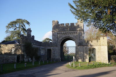
... and then the gates on the other side of the grounds.


The final section was rather arduous as we had to follow White's Hill for a mile or so. This is the main road from Ramsbury and has no footpath. Fortunately, we made it OK.

Overall, a delightful walk of about 8 miles.

Thursday, 10 February 2022

Horton Cross, New Town & Chalbury

 
We are on a visit to Poole and found this interesting walk north of Wimborne Minster in one of our numerous walk books. We parked opposite the pub and headed along the away from the Horton Inn to the north west.  We turned left after crossing a bridge ...

... and followed a farm track which led us to the delightful Crichel Mill.

We continued south along a field edge with a narrow waterway on our right.

 At the end of the field edge we crossed a couple of bridges, bearing right and entering some woodland. We admired a fine display of Snowdrops.

We passed through a white kissing gate and could soon make out Crichel House through the trees and across Crichel Lake.  

The handsome House is largely 18th century in appearance, the original Tudor house having been largely burned down in the 17th century. Various additions have been made since. 

We reached the drive of Crichel House and turned left along the road to reach the rather fine Gatehouse.

 We now turned sharp left and walked past the houses of this small village. I liked the delicate date stone on the gable end of one the houses.

We then skirted a newish housing development (foreshadowed in our walk book) on either side of a watercourse.

We followed a track to reach the B3078 road. At this point we were feeling a bit weary (we had gone off the planned route a few times - a consequence of the very sketchy sketch map). We decided to walk along the road back to Horton Cross. Before long we realised that this road was rather busy and dangerous, so we turned right off it and headed up a lane towards Chalbury. At the top we turned left (by chance rejoining the walk route) heading towards Chalbury Farm.

Quite soon we spotted, on the right, the wonderful Horton Tower which we had last encountered in 2011. Here is a link.

After passing the farmhouse we walked across two massive fields - mercifully with marked-out paths. This brought us back to the Horton Inn.

Source: Pub Walks in Dorset by Mike Power, 1997 (!), but not much seems to have changed.

Map: Shaftesbury & Cranborne Chase, Explorer 118.

Conditions: bright and sunny, though rather cool.

Distance: about 5 miles.

Thursday, 8 July 2021

Blenheim Palace

                                                          The approach to the Palace

We first visited Blenheim (and Woodstock) last November and thoroughly enjoyed it, even though the interior was closed at the time and the weather was quite grey. The visit of a friend from the US gave us an opportunity for another look. We walked up from the car park to the imposing main entrance gate, the East Gate.


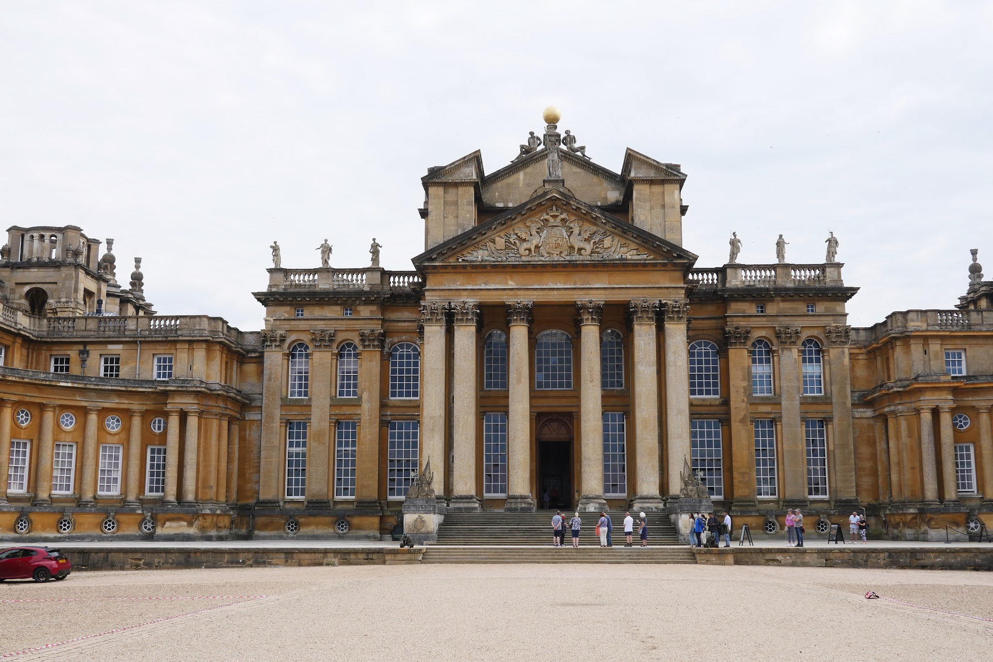
This leads into a large courtyard which in turn give way to the Great Court, in front of the Great Hall.

After a short wait we went through the main door to discover just how high the Hall is. Looking through the doorway, you can see the Column of Victory (1727-30) in the distance.

We followed the interior route which featured a number of clothing designs by Osbert Sitwell - not really my thing. But near the end of the route we emerged into the astonishingly vast Library, now sometimes available for social events.

Leaving the Hall we came upon the Chapel, a small rather awkwardly shaped building designed by Sir John Vanbrugh as a memorial of the First Duke of Blenheim, commissioned by his wife. The chapel was not finished when the duke died in 1722, so he was buried in Westminster Abbey, but was reinterred in the crypt underneath the chapel alongside his wife after her death in 1744.

We now went round the side of the Palace buildings to visit the formal gardens. If you are alert you can spot a couple having a photo shoot.

There was no way of exiting the Palace other than retracing our steps, but this did give us a fine view of the buildings to the left of the Hall in beautiful sunshine.

We exited via the East Gate and walked around the side to at last see the range of buildings in their full splendour.

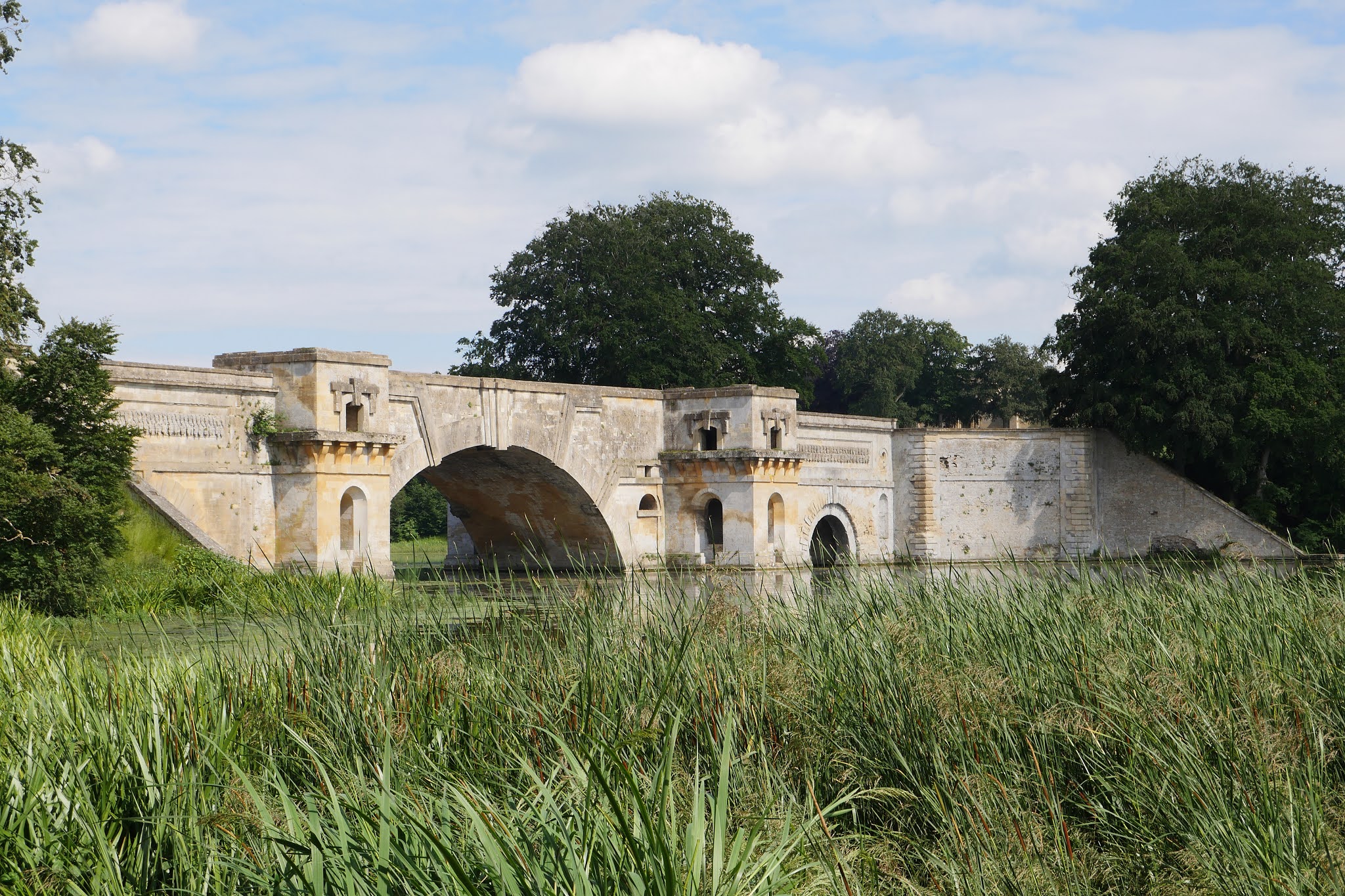
We walked away from the Palace down to the see Vanbrugh's magnificent Palladian style bridge, which separate the two parts of the lake.

It was interesting to find an area left aside for butterflies and we were delighted to spot a few we hadn't seen so far this year (Marbled White, Ringlet, Meadow Brown, Gatekeeper). Finally, there was a lovely view including both the bridge and the Palace.

Another discovery, when writing this, was that Blenheim is a World Heritage Site.


Wednesday, 10 February 2021

Shaw


Shaw House

A nice walk from home to Shaw House and back. We walked into Newbury and along the Kennet and Avon canal to reach Victoria Park.

Walking across the Park we came to the Victoria memorial. I discovered on a previous walk around the town that the statue and lions were originally were originally located in the Market Place but removed in 1933 and put into storage. It was installed in its present site in 1966. I noticed today that the lions consist of two parts - you can see a line across their backs. Presumably they were cut down for storage.

Emerging along a passageway to reach London Road, we looked left towards the interesting Roman Catholic church of St Joseph. It dates only from 1927-8. Pevsner describes it as being "Early Christian or Byzantine or Italian Romanesque" with a high campanile in a Free Renaissance design.

Crossing the busy road junction by an underpass we continued along Shaw Road with the rather pleasing Smith's Crescent of 1823 on the right.


The terrace is punctuated by a single archway with, to the right, the only house in the terrace which has bay windows.

At the end we passed a former mill, which we had never previously noticed.

We turned left into Church Road and soon, on the right, we reached Shaw House. It was built in 1579-81 for Thomas Dolman and remained in his family until the early 18th century. It changed hands several times after that, becoming a school in 1943 and was renovated in 2005-8 to take on its current role as a Register Office, meeting place and visitor attraction.

Continuing along Church Lane we came to St Mary's church, rebuilt in 1841-2 in a neo-Norman style, which jars with the Romanesque tower. The chancel, by William Butterfield, with 13th century style tracery offers another discordant element.

At the end of the lane we turned right effectively doubling back alongside a stream. There was a pleasant view back from a bridge and the surprising sight of a lone angler landing what looked like a trout of 2 or 3 pounds.

We headed along a footpath towards Smith's Terrace and enjoyed a sight of the first snow drops of the year.

We now retraced our steps across Victoria Park to reach Newbury Bridge (1769-1772).

Finally, in Enborne Road we noticed this memorial to Protestant Martyrs.


Conditions: pleasant with some sun.

Distance:  Perhaps four miles in all.

Rating: four stars. A very interesting and varied walk.

Tuesday, 29 September 2020

The Hardy Monument and Littlebredy


                                                                                                                The Hardy Monument 

Today we finally got round to visiting the Hardy Monument and doing a circular walk inland from it. The Hardy Monument is a twenty-two metre (70 feet) single column built of local Portland stone and perched on the summit of Blackdown Hill, above the village of Portesham. Although the Monument looks like a chimney, it is in fact intended to represent a spyglass. The Monument was restored in 1900 by Hardy's descendants and given to the National Trust in 1938.

 The Monument commemorates Thomas Masterman Hardy who was born in nearby Portesham in 1769 and died in 1839. He was the Captain of Nelson's flagships, especially the Victory, and was later an Admiral himself. He was principally famous for being the recipient of Nelson's dying words - "kiss me Hardy".

The view above conceals a doorway in the rear of the monument. There are 122 steps inside the monument and a small viewing platform on top. It is of course currently closed.

Before we set off we noted the splendid views down towards Portland.

We headed downhill passing a tree with a series of carved rocks bearing the message: Be still, Close your eyes, Be still, Listen. Obviously we were in too much of hurry to get into our walk to pay any attention.

The path continued through woodland and then a field-edge path to reach a view point looking down to near to Abbotsbury. You can see the Fleet along with the Chapel of St Catherine on its hill.

 We continued along this path to enjoy further wonderful views ...

... and then reach a road junction.We now headed inland along a field edge path to reach the KIngston Russell Stone Circle, a rather minimal circle if truth be told. We wondered if the two people sitting there had just had a domestic.

We headed across the large field and passed some ancient grassy mounds. The next section was quite stressful in that the directions suddenly became sparse and approximate. We struggled our way across fields and streams to eventually reach Littlebredy. This is an estate village which was once the property of Cerne Abbey. We passed the Village Hall and another building ...

... to reach the attractive church of St Michael and All Angels. It is a medieval church largely rebuilt in the mid 19th century.

This was quickly followed by the Bridehead Estate Estate Yard with its Blacksmiths Cottage and Old Forge. We then followed an estate road, catching a glimpse of Bridehead through the trees. The house dates from 1630, but was was rebuilt and extended in the mid 19th century. 

We climbed a steep hill to reach a road, which we soon left to follow a woodland path for a mile of so back to the Monument. We missed a turning towards the end and overshot the Monument, but fortunately a dog walker pointed us towards a path which led upwards to it. 

Conditions: bright and sunny.

Distance: 7 miles.

From: 50 walks in Dorset.

Map:  Explorer OL15 (Purbeck & South Dorset).

Rating: four stars.

Tuesday, 22 September 2020

Ashdown House and the Ridgeway


                                                                        Ashdown House

Today's goal was to do a circular walk involving a length of the Ridgeway and other tracks and hopefully to get close enough to Ashdown House to take some photos of it (we knew it was closed). We (Merv and I) started just south east of Ashbury, where the Ridgeway crosses the B4000. The spot is known as Ashbury Folly for some reason - no folly could be spotted. We headed west and after half a mile turned left down a track heading towards Ashdown. There was a lovely view over the downs to our right.


A left turn across fields led us to the rear of Ashdown House and our first view (see the head of this post). The house was built in 1662 by William, Lord Craven, for Elizabeth, the daughter of James I of England and VI of Scotland. Her husband, Frederick, the Elector Palatine, was defeated at the battle of White Mountain and Elizabeth was thereafter known as the Winter Queen (echoes of Game of Thrones!) After Frederick's death Craven looked after Elizabeth and it is said that they married in secret, although there is no evidence for this. Sadly, Elizabeth died before the building of the Dutch-style house was complete.

A little further along there was a more square-on view of the back of the house which made the two pavilions visible.


We headed anti-clockwise passing Ashdown Farm this disused, but rather imposing, stable block.


We passed the main entrance to the House and were lucky to get this shot up the drive as a car drove in. 

We crossed the B4000 and began a steady climb up the grassy hillside, with this initial view back ...

... soon followed by this view which highlights the downs at the rear of the House.
 

 We continued north east and reached this enticing track, still heading north east.

We could see a series of parallel tracks to the left all of which would head towards the Ridgeway. We so enjoyed the track we were on that we ended up taking the last of the tracks and making our walk longer that we had planned.

Soon we were rewarded by  quite a large herd of deer charging across the track and then regrouping in the middle of a large field.

Eventually we rejoined the Ridgeway and turned left along the track.

Some distance later we came to Weyland's Smithy, an imaginative name for a long barrow. We passed by here in April 2015 when we were doing the Gramps Hill to Ashbury Folly stretch of the Ridgeway. It looked rather different with the trees still in leaf.

Soon afterwards we reached Ashbury Folly.

Conditions: warm and sunny.

Distance: 8 miles.

Map: Explorer 170 (Abingdon, Wantage and Vale of White Horse)

Rating: 4 stars