Sunday 24 October 2010

Studland and Old Harry rocks

Old Harry rocks

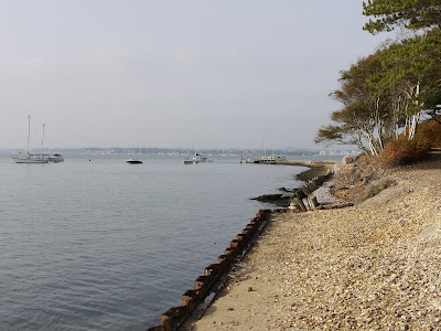
We can see Old Harry rocks in the distance from our base in Poole and this walk gave us the opportunity to see them close up. We drove to Sandbanks and took the chain ferry across to Studland bay and went on to Studland itself where we parked near the South Beach.

The route took us past the Norman church of St Nicholas.


Pevsner describes it as “one of the dozen or so so most complete Norman village churches”. He adds that the nave, tower and chancel are probably pre-Conquest, but rebuilt soon after.

From here you leave the village and walk along a sequence of tracks until you emerge on Godlingston Heath, part of the largest surviving area of heathland in Dorset. You climb up to Agglestone Rock, 17ft high and weighing over 400 tons.


There are fine views over the heath towards the Isle of Wight, Bournemouth ...


... and Poole.

You carry on over the heath and past a golf club to approach Ballard Down.
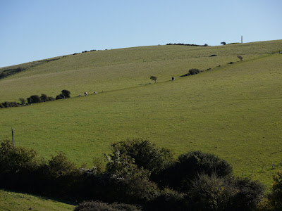

At the top the climb you swing left and there are fine views to the right towards Swanage.


You soon reach this rocket-shaped obelisk.


A helpful plaque explains that it was taken down during the war, for fear that it might provide a useful landmark for German planes, and rebuilt later, but its original purpose was not specified. It evidently serves as a comfortable place to settle down and read your book.

Going straight ahead from here you come onto the long ridge of Ballard Down, with fabulous views on all sides. The white chalk cliffs of the Isle of Wight are directly ahead as you approach Ballard Point.


Here the path swings a north east and as you approach Handfast Point, the first sea stacks appear in the chalk cliffs.


A little further on Old Harry rocks can be seen clearly for the first time. There is no consensus about why the rocks are so called: they may simply be named for the devil or more prosaically for Harry Paye, a celebrated Poole pirate. You continue along the South West Coastal path to return to Studland.

From: Dorset Walks (Pathfinder Guides).

Map: Explorer OL15 (Purbeck and South Dorset).

Conditions: sunny, about 12 degrees.

Distance: allegedly 6 miles, but nearer 7 according to my pedometer.

Rating: four and half stars. Great variety and fantastic views.

Sunday 17 October 2010

Cleeve Hill to Seven Springs (Cotswold Way 5)

View from Cleeve Hill towards Cheltenham Race Course

Time to continue our assault on the Cotswold Way with Merv and Pud. We picked up the route at Cleeve Hill near the golf club and walked south along the edge of the escarpment. The morning was still misty down in the valley, but from up here the views were magnificent towards Cheltenham Race Course.
Further on, there were also fine views back towards Bishop's Cleeve, with the Malvern Hills in the background.


Carrying on we came to the site of an iron age fort.


We were rather surprised to find one of the golf course greens was actually within the confines of the fort. It looked like quite a difficult hole to play and provoked a few puns about the meaning of the iron age (successor to the wood age, ha ha).

Soon we left the grassy plateau to follow a series of tracks (still at around 310m above sea level) past Bill Smyllie's Nature Reserve to begin the long descent towards Dowdeswell Reservoir at 106m. We were now in pleasant woodland, with Lineover Wood in view ahead.


We crossed the A40 near the Reservoir pub and entered Lineover Wood, immediately beginning a steep climb, with fine views to the east through the odd gap in the trees.


You emerge into a grassy open area near the top where a bench offers a fine spot to enjoy the view toward Cheltenham. The hideous 1968 Eagle Star building is all too visible to the left of the bench.


Some of us were showing signs of tiring by now, and Merv's repeated reassurances that we were "nearly at the top" fell on increasingly deaf ears. It was the opposite of crying wolf - crying lamb maybe - and had the same effect on his credibility.

After a short level section it became apparent that one further - really quite stiff - climb diagonally across the side of a hill awaited. But again at the top - of Wistley Hill - there was a magnificent view northwards. The dip on the horizon at the left indicates the Cleeve Hill plateau where we started walking.


From, here the route left the edge of the escarpment and went across fields and then beside the A436 to the lay by at Seven Springs where today's stage ended.

Conditions: bright and sunny, about 12 degrees, but feeling cold in the shade.

Map: Explorer 179 (Gloucester, Cheltenham and Stroud).

Distance: about 9 miles.

Rating: four stars.

Sunday 10 October 2010

Poole Old Town

The Guildhall

Not everybody knows that Poole has a wonderful Old Town, but this walk, which can be downloaded from the Poole Tourism site, shows that it does. Alternatively, you can pick up a nice leaflet from the Welcome Centre on Poole Quay.

The walk starts rather prosaically by the bus shelter on the site of the old Fish Shambles (fish market) on Poole Quay. This is opposite the point where the Brownsea Island ferries depart - the location for yesterday's walk.

You walk along the quay past the 19th century Henning's Wharf (the big white building in the photo below), past the green tiled Poole Arms, parts of which are early 17th century. The tiles were made by Carter's of Poole, the forerunner of Poole Pottery.


Further on is the blue Portsmouth Hoy pub, where we later had an enjoyable lunch. A bit further along the quay you come to the fine Customs House, now a cafe-bar. This dates from 1813, but was a rebuilding of an earlier structure which burned down. Pevsner observes that it is clearly modelled on the Guildhall (see above).


The Custom House is flanked to the left by the splendid Town Cellars, a 15th century stone building which was apparently once 120 ft long.


And opposite the Custom House, completing a delightful group, is the one-time Harbour Office of 1822, now the local base of the Coastguard. On the right side wall is a cheerful relief of the bewigged mayor of 1727, one Benjamin Skutt.


Here you turn right along Thames Street, where you can see a lean-to stone structure adjoining the back of the Town Cellar. This is the former Poole Gaol, whose iron ceiling was designed to prevent escape. You really would not want to have been confined there - confined clearly being the operative word.

Further up Thames St you come to the Mansion House, a fine later 18th century merchant's house, which illustrates how some people in Poole grew rich on the triangular trade with Newfoundland and the Iberian peninsula.


Pevsner is rather sniffy about it: "the attempt to impress is rather naive". It seems to have weathered pretty well however. It has been a hotel for many years and is now the rather inviting Hotel du Vin.

Thames St leads into the delightful St James's Precinct, a Georgian Square surrounding the parish church. The church itself dates from 1819, but perhaps the nicest building in the square is West End House, which Pevsner says may date from as early as 1716.


You emerge into Church St and turn left to soon reach the St George's Almhouses, which date from before 1429 (Pevsner again). They could only be almshouses.


Church Street gives way to the narrow and characterful Market St, with the Guildhall coming into view at the end. It was built in 1761 and has a delightful double staircase which led up to the council chamber. It is now the Register Office, as evidenced by the confetti on the ground at the front.


The official route now turns right and then right again into the High Street. We turned left however along the part of the High Street which leads towards the unlovely 1960s central precinct and shopping mall. Immediately on the right is one single magnificent Victorian facade, sadly decayed but still wonderful. The right hand bust seems to be the Queen herself.


At the end there is an interesting little group of buildings. On the left is Beech Hurst built in 1798. Pevsner describes it as a "really magniloquent merchant's house". What a great word! Lazily googling it, I find Dictionary.com's definition: "in a lofty or grandiose style; pompous". bombastic; boastful." Seems about right.


I rather like the curved Cafe Nero building as well. Nearby, in Lagland St is the red brick former Library, now a pub.


We traced our steps back down the High St and completed the walk which ends at the Poole Museum.

Conditions: surprisingly warm and sunny.

Distance: probably only a mile and half.

Rating: 4 stars. Wonderfully interesting and varied. Well done to the Borough of Poole for an excellent route and guide.

Saturday 9 October 2010

Brownsea Island


We have been looking forward to this walk since we first start visiting Poole. However the day dawned cool and misty and we waited until after lunch for it to burn off. We enjoyed the novelty of walking into Poole Quay and catching the ferry over to National Trust Brownsea.

You land at the eastern end of the island and walk through the welcome centre, collecting a map as you pass through, to emerge opposite the entrance to Brownsea Castle.


The origins of the castle lie in one of the many forts built by Henry VIII in 1547-8 to guard against the threat of invasion by the Spanish. It was embellished in the 18th and 19th centuries to create the current building in a sort of Victorian Tudor style. It is now owned by the John Lewis Partnership. It is hard to get a clear view on it from within the island.

From here we followed Middle Street heading west towards the opposite end of the island. We decided to resist a visit to the Dorset Wildlife Trust nature reserve - something for next time. After passing the 19th century St Mary's church, we passed a large grassy area and then some delightful woodland with the sun streaming through.


Soon afterwards the path leads on through pine woods to a three-way division of paths.


We took the central one to skirt the site of the one-time Maryland Village and at this point saw our first red squirrel (something for which the island is famous), hurrying across the track. We soon descended to the shore to pass Pottery Pier, the westernmost point on the island.


A bit further along the coast the path took us inland past the Baden-Powell Outdoor Centre to emerge opposite a surprising section of heathland.


We then veered right, back to the edge of the island for hazy views towards the chain ferry at Sandbanks and then returned to the church and took Middle Street back to the jetty.

On the ferry back there was finally a clear view of the castle.


Distance: About three miles.

Conditions: warm and sunny, but cold on the boat back.

Rating: four stars. Truly delightful and full of interest. An extraordinary range of habitats in such a small area.


Sightings

We saw four red squirrels, not bad for a couple of hours. In one of the grassy areas we were rather surprised to see peacocks and what, I wondered, was that small bird seemingly following a peahen around? A chick! Oh dear.