Showing posts with label bridge. Show all posts

Sunday, 24 April 2022

Berwick-upon-Tweed


We set off this morning from our hotel in Hide Hill to tour the walls and were surprised to find that our first interesting sighting was this wonderful art deco façade of what was surely a cinema.


We headed uphill into Marygate (see the picture at the head of this post), where the tall, narrow Town Hall dominates the scene. A helpful plaque explains that there is a fine painting of the scene by Lowry.

At the top, we turned right and then left to join the top of the walls in an ante-clockwise direction.

We walked along to the grassy area known as Meg’s Mount and looking back got our first view of the imposing railway bridge over the Tweed. Its proper names is the Royal Border Bridge. It was built in 1857-1860 by Robert Stephenson, the son of the railway pioneer George Stephenson and opened by Queen Victoria. Despite its name, the bridge does not in fact span the border between England and Scotland - this is three miles further north.

Continuing anti-clockwise we came to our first view of the New Bridge, with the Old Bridge hidden behind it. The New Bridge is properly called the Royal Tweed Bridge and was built between 1925 and 1928.

A bit further on we looked ahead to the modern road bridge, with the old bridge just behind it. This is the view of the handsome Old Bridge, known correctly as Berwick Bridge. After various tribulations, a permanent stone bridge was completed in 1624. It is a lovely sight.


Next we saw a plaque telling us that we were passing a one-time Ice House built mainly to store Salmon to be sent to London. At its peak it would had held three double decker buses (if they had been invented by then). Now there is just a cave-like hole.

We continued along the quayside to pass the newly renovated Gallery and Bistro. It was previously a Granary, built in 1769.

We passed the former Custom’s House, which was plainer than they usually are.

Next up was the interesting Main Guard building dating from the 18th century when it was located in Marygate, the main road heading north into Scotland. The guard’s main function was to maintain order among the troops (there was a garrison at the time). Later it was relocated to its present location, unused but still rather pleasing.

We passed a impressive short terrace of three imposing houses - Wellington Terrace. We had been following the edge of the River Tweed but now we were looking towards the sea ...

... and to structures which were much more defensive, like these substantial bastions ...

... and this gun.

We continued curving round to the left to reach the powder storage building.

The large and imposing garrison buildings stood behind grassy banks which held the massive defensive works. The barracks were built between 1717 and 1721 by Nicholas Hawksmoor, better known for his work in London to protect the town during the Jacobite rising. The buildings are now a museum, maintained by English Heritage.

Berwick's Elizabethan Walls are the only example of bastioned town walls in Britain and one of the best preserved examples in Europe. They were built in 1558 and were designed to keep out the marauding Scots who regularly laid claim to the town. The walls were built to an Italian design and contained bastions which were designed to allow gunfire covering every part of the wall. Outside the curtain wall and bastions, there were wide water-filled ditches to deter potential invaders.


The final sight was Holy Trinity Church which dates from 1652. It is a rare example of a church built in the Commonwealth era.


Thursday, 10 February 2022

Horton Cross, New Town & Chalbury

 
We are on a visit to Poole and found this interesting walk north of Wimborne Minster in one of our numerous walk books. We parked opposite the pub and headed along the away from the Horton Inn to the north west.  We turned left after crossing a bridge ...

... and followed a farm track which led us to the delightful Crichel Mill.

We continued south along a field edge with a narrow waterway on our right.

 At the end of the field edge we crossed a couple of bridges, bearing right and entering some woodland. We admired a fine display of Snowdrops.

We passed through a white kissing gate and could soon make out Crichel House through the trees and across Crichel Lake.  

The handsome House is largely 18th century in appearance, the original Tudor house having been largely burned down in the 17th century. Various additions have been made since. 

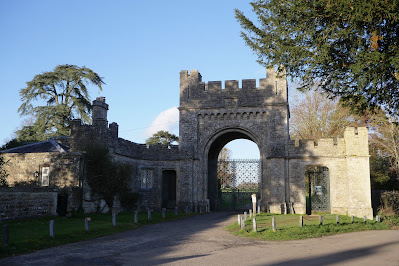
We reached the drive of Crichel House and turned left along the road to reach the rather fine Gatehouse.

 We now turned sharp left and walked past the houses of this small village. I liked the delicate date stone on the gable end of one the houses.

We then skirted a newish housing development (foreshadowed in our walk book) on either side of a watercourse.

We followed a track to reach the B3078 road. At this point we were feeling a bit weary (we had gone off the planned route a few times - a consequence of the very sketchy sketch map). We decided to walk along the road back to Horton Cross. Before long we realised that this road was rather busy and dangerous, so we turned right off it and headed up a lane towards Chalbury. At the top we turned left (by chance rejoining the walk route) heading towards Chalbury Farm.

Quite soon we spotted, on the right, the wonderful Horton Tower which we had last encountered in 2011. Here is a link.

After passing the farmhouse we walked across two massive fields - mercifully with marked-out paths. This brought us back to the Horton Inn.

Source: Pub Walks in Dorset by Mike Power, 1997 (!), but not much seems to have changed.

Map: Shaftesbury & Cranborne Chase, Explorer 118.

Conditions: bright and sunny, though rather cool.

Distance: about 5 miles.

Monday, 7 September 2020

Dorchester and Charminster


We parked in the centre of Dorchester and followed the main road eastwards to reach the Dorset County Council 1954 bridge and turn left along the river bank, a tributary of the Frome. We have visited Dorchester before but have never registered the existence of the Frome.  

Further along there is a narrow bridge-cum-sluice gate.

We turned right and soon crossed the well-named Blue Bridge of 1877.

One more small bridge completed the initial encounter with the Frome.

We headed towards Charminster and as we passed water works came upon this lovely flower, as yet unidentified.

We crossed the road and headed towards Charminster across the fields. We were interested to have fine views towards Poundbury (or Poundbury Hillfort as it was once known).

Reaching Charminster, we made a small detour to see the Church of St Mary the Virgin. The nave dates from about 1100 and the ailes from the late 12th century. The imposing tower is early 16th century.

The next stage was across open country along farm tracks and then doubling back along a track. We passed a farm with a lovely medieval-style double height porch.

We continued southwards towards Dorchester, passing a cottage which was being re-thatched, to rejoin the Frome near the 1748 Grey's Bridge.

A right turn brought us along the main road into the town.

Conditions: mild.

From: Dorset Life magazine.

Distance: 6 miles.

Map: Explorer OL15 (Purbeck & South Dorset).

Rating: 4 stars. A delightful surprise.

Saturday, 15 February 2020

Portugal: Lisbon - Belem


 The Belem Tower

We are trying something different again today – a mixed bus and walking tour focusing on the Belem district, down by the River Tagus. We pick up the Yellow Bus at the Liberadores stop in Praca Dom Pedro IV and make one intermediate stop at the Calouste Gulbenkian Foundation. The Foundation was built to house Gulbenkian's collection after his death in 1955 and opened in 1969. It offers a wonderful journey through art history from Egyptian and Roman artifacts, through medieval and Renaissance painting up to the Impressionists, with tiles, furniture and items by Lalique as well. 

Unfortunately, photos were not allowed inside the gallery, but this fantastic piece in the foyer could be. It is a called La Primavera: A homage to Jean Goujon and was sculpted by Alfred-Auguste Janniot between 1920 and 1924. Janniot does not seem to be well known, but we thought it was a wonderful price of work.


We got back on the bus and followed quite an interesting route down to Belem, which included an aqueduct and the gaol. We learned that Portugal was the first country to end capital punishment.We enjoyed this view over the Tagus.


 The first main sight of course is the Belem Tower. Here is a detailed view.


It was built in 1519 as a defence for Lisbon. A matching fort was built on the other side of the Tagus, but there is no trace of it now. The Tower is a UNESCO World Heritage Site.

We took advantage of a wonderfully entrepreneurial venture: Wine a view. It was a sort of mobile wine bar with a wide selection of wines served in plastic glasses which you keep. A small number of chairs were placed by the retaining wall of the river, or you could sit on the wall if they were full. We enjoyed a delightful interlude sipping wine and enjoying the warm sunshine (!). This is one aspect of the view.


After a while we strolled along the riverside promenade towards the magnificent Monument to the Discoverers. On the way we passed this curious brick lighthouse, seemingly derelict.


Soon after we reached the magnificent Monument to the Discoveries …


The monument was conceived in 1939 by  architect José Ângelo Cottinelli Telmo, and sculptor Leopoldo de Almeida, as a temporary feature of the Portugese World Exhibition opening in June 1940. The building you see today was completed in 1960 and formed part of the of the 500th anniversary of the death of Henry the Navigator. He is the leading figure, more easily seen in the close up below. Vasco de Gama, the only other Portugese discoverer I can think of, is behind Henry on the other side of the monument.


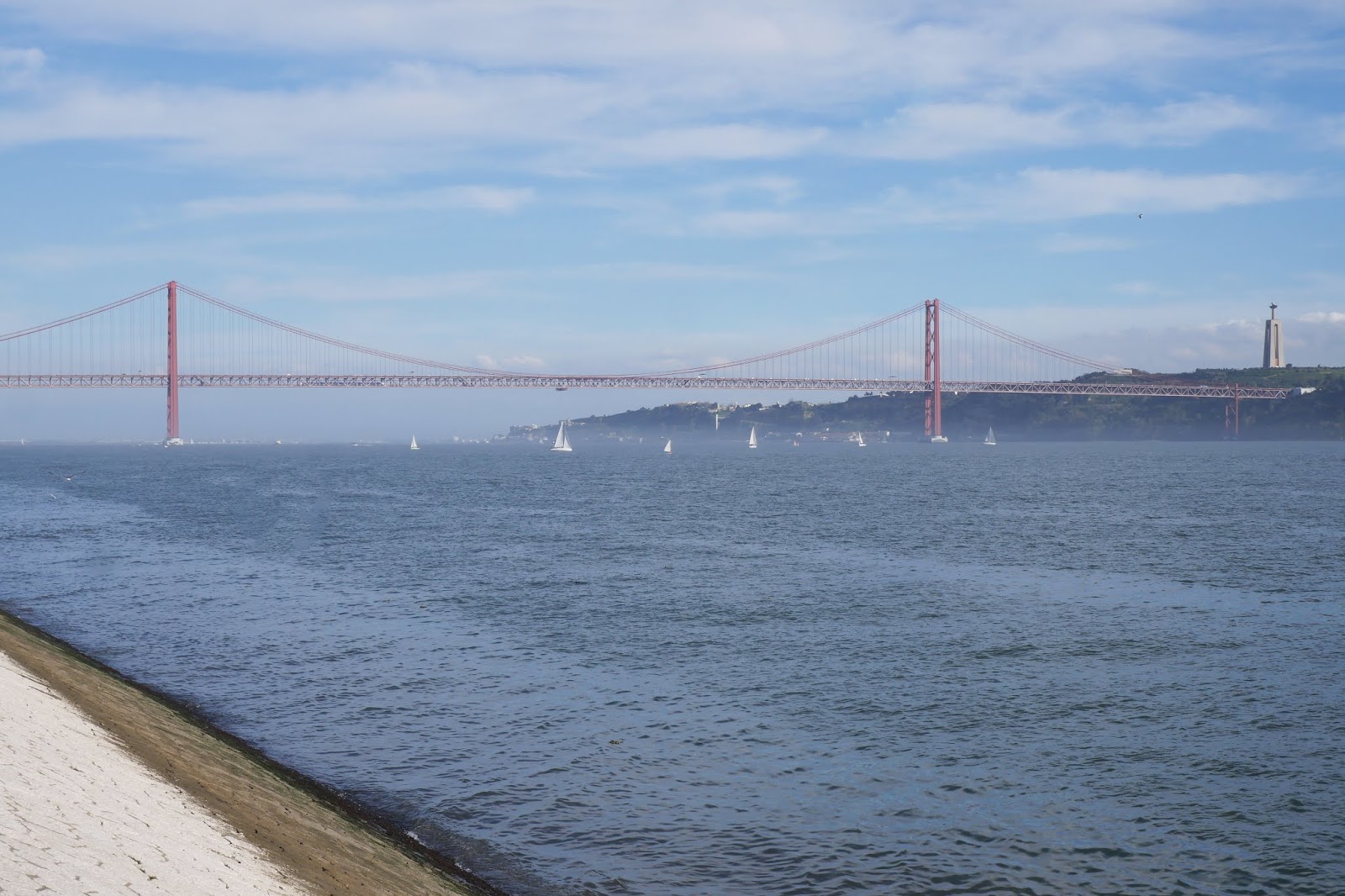
Beyond it was the splendid 25th of April Bridge which we had driven across on our way into Lisbon the previous day. We discovered later that a railway line runs underneath the roadway.


On the far bank was the statue of Christ the King – in the style of the more famous Christ the Redeemer in Rio di Janeiro – towered impressively. It was consecrated in 1958 and was built in thanks for Portugal avoiding the horrors of World War 2, although this possibly owed more to the policies of the Portugese dictator, Salazar.

Now we headed away from the river to take the underpass beneath the road and railway which leads to St Jeronimo's Monastery, which is also an UNESCO World Heritage site. This enormous structure consists of two parts, the Monastery on the left hand side which now seems only to host exhibitions (and the ticket machines for the cloister) …


… and the church and cloister on the right (the cloister is behind the church).


The complex was built to fulfill a promise made by the King of Portugal to do so if Vasco de Gama returned from his inaugural voyage of 1498 to India. Happily he did. Construction began in 1502 in the Manueline style. Vasco's tomb lies inside the church.

The ceiling of the church has beautiful vaulting.


You leave the church and enter the Cloister by its separate entrance (where your machine-produced ticket is validated by a man with a pen). The first sight of the two storey cloister was extremely impressive, especially with the late afternoon sun illuminating the far side. (We had been here before, 26 years ago, but it is still capable of making a tremendous impression.)


The whole thing is on a grand scale: this is one side of the downstairs section.


A staircase leads to the upper section which also offers a view towards the church highlighting its dome.  


Finally, we enjoyed the former refectory with its tiled walls and vaulted ceiling.


It remained only to catch the Yellow Bus back to Rossio square. 

Conditions: mainly warm and sunny.

Rating: five stars.