Showing posts with label OW. Show all posts
Showing posts with label OW. Show all posts
Wednesday, 3 July 2013
The Oxfordshire Way: A review
Background
The Oxfordshire Way runs for 68.25 miles from Bourton-on-the-Water to Henley-on-Thames, from the Cotswolds to the Chilterns. The Path was developed by the Oxfordshire Branch of the Council for the Protection of Rural England (CPRE) as far back as 1978 and later adopted by the County Council. We used The Oxfordshire Way. A walker's guide published by the County Council in 1993 as a resource and found it to be very useful and informative and still largely accurate. There was just one map where the route was wrongly marked, but we soon figured it out. The signposting was pretty good too.
We did the Oxfordshire Way with our friends Merv and Pud and we started by doing the short Windrush Way in two sections from Winchcombe to Hawling and from Hawling to Bourton as a sort of warm-up and to link it to our previous venture, the Cotswold Way. We started on 1 April 2012 and have only just finished. Some personal factors resulted in the odd cancellation of a planned leg, but the weather played a big part - there is just no fun in setting out on a walk when you know it is already pouring down with rain.
Impressions
The walk has three distinct components: the section up to about Charlbury (our third stage) still feels like the Cotswolds, then there is the main body of the path which arcs across Oxfordshire, north of Oxford, which we found surprisingly flat. After that the final two stages through the Chilterns came as a bit of a relief. Overall, then it was an easier walk that the Cotswold Way, but less dramatic and with less stunning scenery.
It was striking how many country house parks we walked through. Blenheim was by the far the greatest of them, but there were several other pleasant, mainly Georgian, houses at places like Kirtlington, Rycote and Waterperry.
Otmoor is an unusual area and important type of habitat. Our guide described the low lying flat moorland as "often boggy". This turned out to be something of an understatement - totally saturated would have been more accurate and just after Waterperry there was a section which could only be described as flooded, which gave us some concern about whether we would be able to get through at all.
We found a good number of excellent pubs to have lunch on afterwards, notably the Kings Head at Bledington, the Crown at Pishill and the Angel on the Bridge at Henley
And finally every walk had its share of Kites, many swooping low to show off their fine colours. At one point we saw five in the air at once. To think that this species was once endangered and had to be re-introduced. "As common as sparrows", somebody said - but of course sparrows are becoming much rarer in this part of the country, so this is a rather two-edge comment.
All in all a most enjoyable walk that did not quite reach the heights of the Cotswold Way, both literally and metaphorically. Would we recommend it? It is an excellent means to get an overall feel for what Oxfordshire is like. The only problem is that it turns out that some parts are perhaps a bit dull.
We now plan to start the Ridgeway this autumn.
Stages
1 Bourton-on-the-Water to Foxholes
2 Foxholes to Grove Lane
3 Grove Lane to Littleworth Farm
4 Littleworth Farm to Kirtlington
5 Kirtlington to Islip
6 Islip to Menmarch Guide Post
7 Menmarch Guide Post to Albury
8 Albury to Wheatfield
9 Wheatfield to Pishill
10 Pishill to Henley

Saturday, 22 June 2013
Pishill to Henley (Oxfordshire Way 10)

Pishill church
At last: the final leg of the Oxfordshire Way - from Pishill to Henley. We met Merv and Pud at Pishill and walked up a lane to find the oddly L-shaped church. Pevsner explains that it was rebuilt in 1854, replacing a plain Norman church, but does not comment on the very strange shape. It feels as though the new church was built at right angles to the old one. Inside there is some very pleasing Victorian stained glass and a single, very striking, window of 1967 by John Piper of the Sword and Gospel.

There was soon a lovely view over the valley which leads down to Henley from Stonor through Middle Assendon. The weather prospects were obviously not great.

Now through the very pleasant Doyley Wood, past the hamlet of Maidensgrove and the Warburg nature reserve - all this mostly in rain - to emerge overlooking Bix Bottom.

We followed the track down to the bottom and then onwards to Middle Assendon, across the B480 and up a steady climb on the other side of the valley. On the way up we saw a lone Speckled Wood and at the top a Small Heath took flight from the long meadow grass, but soon disappeared as it began to rain again. But then we were cheered by the sight of a lark ascending in a welter of song.
We now passed Henley Park, a house so undistinguished that I did not think to take a picture. Fortunately, Wikipedia has one. It was the Dower House of nearby Fawley Court. It is only worth mentioning because very soon you enter the lovely and quite large deer park which descends gently to the very edge of the town. More rain prevented a picture of this.
Once at the edge of Henley we diverted to the ironically named Dry Leas car park where we had left the car to change out of our boots. We delighted to spot on our way back towards the town a pair of lodges, one either side of Marlow Road. Pevsner dates them to 1780. This one is called the Toll House, but Pevsner's description makes me wonder if that was its real origin.

We walked a little further and turned left into New St, with on the right, the Barnaby Almshouses, the speculatively named Anne Boleyn's Cottage and the former Brakspear's brewery. This and the rest of the town is more fully described in a walk around Henley I did a year ago.

At the end of New St you reach the river, where preparations for the Regatta, which starts on 3 July, are well advanced. We were enchanted by this Coot which seemed to be making a nest on a jetty, with the marquees of the Regatta behind. We wished her well, but without much optimism.

Now along the riverside to the bridge (rebuilt in 1786), usually photographed from the other side.

We had lunch at the excellent Angel on the Bridge and I was pleased to get one photograph with some blue in the sky: it is St Mary's church with its "cheerful late Gothic exterior" (Pevsner).

Conditions: reasonably warm, but quite wet.
Distance: 7 miles. Distance now covered: the full 68.25 miles.
Maps: Explorer 171 (Chiltern Hills West)
Rating: four stars.
Monday, 6 May 2013
Wheatfield to Pishill (Oxfordshire Way 9)

Wheatfields: the former stable block
The penultimate stage of the Oxfordfordshire Way. We met up with Merv and Pud at Wheatfield, where all that remains of a country house are the exquisite chapel (see Albury to Wheatfield for a photo) and the stable block above, now Park Farm.
We headed across fields to soon be thrilled by the sight of a pair of hares, unconcernedly going about their business. We were then confronted by the rather incongruous chimney of Model Farm, an early (1857) example of agricultural mechanisation. I haven't been able to discover what the chimney powered - threshing perhaps?

Before long we entered the pretty village of Pyrton, passing an interesting octagonal house to reach the main street.

Here we admired the red brick village hall with its dutch gable, a nice dovecote mounted on the roofline of some cottages ...

... and the charming church of St Mary (12th century, but rebuilt in 1856 by J C Buckler with curious corner buttresses).

Next to the church was a magnificent pair of trees (cherries maybe?) in full blossom.

We enjoyed a fine three storey mansion on the edge of the village too, and walked on down the road to cross the B4001 to begin a long climb into the Chilterns, and fundamentally different countryside from what we have been walking in. We crossed The Ridgeway as we headed uphill: a possible future project? Watlington Hill was on our right and Pyrton Hill (below) on our left.

At the top, we crossed a field to emerge in the hamlet Christmas Common and then enter Prior's Grove, where we were entranced by the delicate green of the young beech leaves.

So entranced in fact that we strayed off the route for a short while, but skilful map reading from Merv brought us back on route to join a descending track through the dramatically named Fire Wood.

Some we some clumps of bluebells on the sunnier slope and at the bottom they became denser, though still not fully out.

At the end of the wood we crossed a couple of fields to enter College Wood, where the bluebells were thicker, an effect increased by the lower camera angle of this shot.

Although we think that everything in nature is late this year, it was interesting to find that last year's first bluebell wood photo was in Bruern Woods when we had just started the Oxfordshire Way, on the same date. The delay is being caught up very quickly it would seem.
We emerged from the wood to follow a path beside the slope of Whitehill Shaw to reach Pishill (pronounced pish-ill for those who might wonder) and a nice lunch in the Crown Inn.
Conditions: bright and sunny, warm, maybe 16 degrees.
Distance: 7.75 miles. Distance now covered 61.25 miles.
Maps: Explorer 171 (Chiltern Hills West).
Rating: four stars.
Sunday, 14 April 2013
Albury to Wheatfield (Oxfordshire Way 8)

St Helen's church, Albury
Last month's planned leg of the Oxfordshire Way had to be cancelled because of heavy rain, but today we were able to meet Merv and Pud and resume the walk at Albury church. It dates from 1830 and is by Thomas Rickman. It is, says Pevsner, "still in the insubstantial Gothic of the 18th century".
We were quickly in open country, with fine open views towards the north east and Brill hill.

Soon we reached Rycote Park. A great early 16th century house here was burned down in 1745 and what was left was demolished in 1800, except for the turret on the right in the photo and some outbuildings. The present house with its very pleasing stepped gable and diaper brick patterns dates only from the 1920s.

Just next to the house is the chapel of St Michael: built in 1449 and, unusually, unaltered externally since. The 17th century interior fittings are described by Pevsner as "sumptuous", but unfortunately the chapel was locked and we couldn't see them.

We were delighted by the gargoyles on the east wall.

Soon after we entered Old Paddock wood and were struck by the beautiful green of the new grass. Such a change from the brown we have seen for so long.

We now crossed a golf course and a massive filed to reach Tetsworth. There were clear signs of shrubs in the hedgerows beginning to come into leaf. We saw some appealing houses in this straggling village and when were on the outskirts when we noticed a house with some large statues of dogs in the front garden. "The Hound of the Baskervilles" said Pud. Instantly, an absolutely massive dog of an unknown breed rushed out at us barking and jumping up, mercifully quickly followed by its owner. We were a touch shaken, but the owner saw no need to apologise or explain that the dog was only being friendly, or some such.
We went round a large muddy field and under the extremely noisy M40 to eventually reach a grassy field on the outskirts of Adwell. At the end of the field we went through an enormous Kissing Gate, which occasioned some hilarity .... suitable for an orgy perhaps?

Now we passed Adwell House, 17th century, but almost completely rebuilt in the 19th. We thought the gardens looked lovely. According to Pevsner, its main attraction is a fine staircase of 1820.

And from there a short section of road brought us Wheatfield, where we had parked. In front of us was the exquisite little church of St Andrew. It is of 14th century origin, but was remodelled in the 18th century, hence the Palladian window in the chancel. Beyond lies Park Farm, the cupola and stable block of which are all that remains of Wheatfield House which, like Rycroft Park, was destroyed by fire, in this case in 1814.

Between the House and the church there was once a street of cottages, but these were felt to spoil the appearance of the park and were demolished at the time the church was remodelled. We encountered the same thing at Milton Abbas in Dorset, but at least there a new model village was built as a replacement.
Conditions: quite bright and sunny, quite warm, maybe 16 degrees.
Distance: 6 miles. Distance now covered 53.5 miles. Two legs to go.
Maps: Explorer 180 (Oxford, Witney and Woodstock) and 171 (Chiltern Hills West)
Rating: three and a half stars.
Sightings
The most exciting sightings were three butterflies - at last! - a Brimstone, a Small Tortoiseshell and a Peacock. We also saw any amount of kites. Several times there were three or four in view at the same time.
As we passed Rycote Lake, we saw this swan patrolling the lake with his wings in a puffed up position, presumably to deter anyone threatening the nest on the island behind.

Sunday, 17 February 2013
Menmarch Guide Post to Albury (Oxfordshire Way 7)

Flooded fields by Bow Bridge, Waterstock
After a foggy start, we met up with Merv and Pud to continue our progress along the Oxfordshire Way. The route led initially along a muddy track and then followed a large, damp, open field which skirted the edge of Bernwood Forest, the southern section of which rejoices in the name Polecat End.
We then followed a lane from Park House farm across the the M40, past Baker's Farm and down into Waterperry. The route skirts the village - thus missing the church of St Mary - and the famous Gardens, to pass quite close to Waterperry House. The house is 18th century, but it was mostly remodelled in about 1820. The Venetian window makes an attractive centrepiece.

The next field was extremely wet and muddy and the prospect of the one beyond looked even worse, but we found our way onto a parallel track which passed a delightful thatched cottage ...

... and brought us down to Bow Bridge, over the River Thame. The river had burst its banks in all directions (see the photo at the head of this post) and the water was still remarkably high under the arch of the bridge.

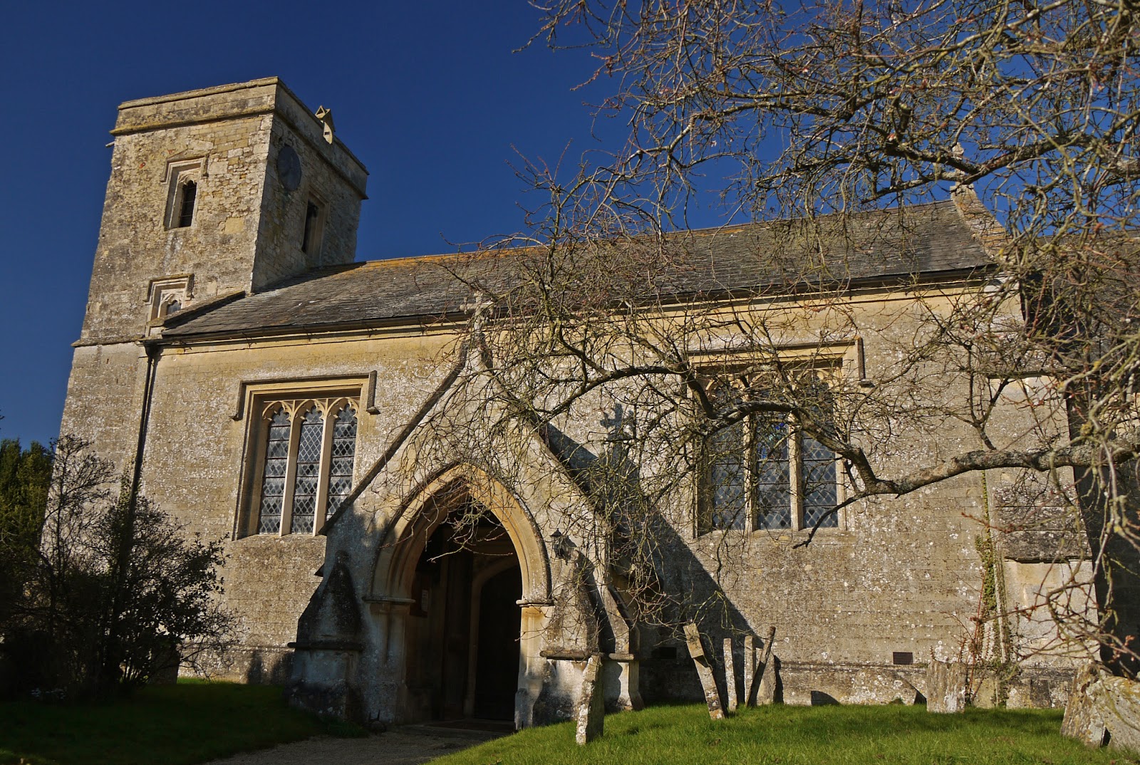
We passed the attractive old Mill and soon found ourselves in Waterstock, passing St Leonard's church. The tower dates from the late 15th century, but most of the rest is the result of a sensitive restoration by GE Street in 1858.
Nearby Waterstock House is now a training centre, but we enjoyed the unusually shaped gothic garden house of 1898 (the year being marked on the leadwork above the down pipes).

We now walked across a golf course to reach and cross the busy A418. Faced with a choice with walking round the edges of a muddy field or following the line of a former railway, we decided to spare ourselves and take the latter.

This brought us into Tiddington from where we followed a pot-holed lane to the edge of the hamlet of Albury where we had parked.
Conditions: bright and sunny, feeling quite warm.
Distance: 6.5 miles. Distance now covered 47.5 miles.
Maps: Explorer 180 (Oxford, Witney and Woodstock).
Rating: three stars.
Sightings
The first snowdrops! And even a few crocuses. How wonderful!

Sunday, 13 January 2013
Islip to Menmarsh Guide Post (Oxfordshire Way 6)

Islip Bridge
We have planned a monthly programme of Oxfordshire Way legs this year and today was the first, picking up the route at Islip Bridge, apparently the scene of a battle in the English Civil War.
You walk up the hill and soon turn left to walk across fields towards Noke. The ground was pretty frozen, so progress was quite easy.
Noke is a small, well-ordered village with a pretty church described by Pevsner as "rustic and homely". It is 13th century, with later changes and the usual 19th century restoration.

Nearby is the charming former schoolhouse, with the school bell over the front door and a droll weather-vane showing a master chasing his pupils. There is a substantial modern extension at the back.

On Leaving Noke you skirt the edge of the vast (well, 400 acre) marshy plain known as Ot Moor, fed by the river Ray and containing a military firing range, which adds to its inaccessibility. It has a ring of small towns and villages around its perimeter - Noke is one and our next destination, Beckley, is another.

We skirt Noke wood, where we are told by a woman walker, in rather a scolding voice, "you should be wearing Wellingtons". We are not much impressed by this, but greet her and her family civilly notwithstanding. The we climb to reach Beckley and St Mary's church.

I learn from Pevsner that it is a Norman church rebuilt in the 14th or 15th century. The interior contains some interesting 14th century wall paintings, including the remnants of this Last Judgement: St Peter and St Paul are either side of the tower arch. The coat of arms above is later.

We leave the village to emerge onto high parkland overlooking Beckley Park. The house dates from 1540 and is "the best preserved small house of this date in the county" (Pevsner).

The view east stretches towards the Chilterns.

However, our immediate route led downhill to a large field, now on Otmoor, and described by our Guide as "often boggy". Today, this was an understatement - a much higher bogginess rating was called for. It was in fact virtually under water. The wellington warning was now seen to have been well-founded, but it still could have been delivered in a nice way.
We enjoyed a small herd of deer racing across the field ...

... but the next mile or so across this and the next field until we reached a road was anything but fun.
The final section, via more but drier field paths, brought us to Danesbrook Farm and thence to Menmarsh Guide Post where we had left the car. We had a late lunch in nearby Stanton St John and enjoyed this simply fantastic sunset to round off our day out.

Conditions: quite cold, but mostly bright.
Distance: 7.5 miles. Distance now covered 41 miles.
Maps: Explorer 180 (Oxford, Witney and Woodstock).
Rating: three stars (half a star more on a less boggy day).
Sunday, 9 December 2012
Kirtlington to Islip (Oxfordshire Way 5)

Kirtlington Park
After quite a long break, we resumed our journey across Oxfordshire with Merv and Pud, picking up the route in the village of Kirtlington. The day had started grey but we entered Kirtlington Park under a blue sky. It is a delightful space, laid out, almost inevitably by Capability Brown, in 1755-62. Kirtlington Hall could be glimpsed through the trees.
Soon we entered farmland and now had a clearer view of the Hall, described by Pevsner as "a handsome Palladian house of local stone". We especially liked the separate pavilions with their cupolas.

The house was built for Sir James Dashwood in 1742-6. The architects were William Smith and John Sanderson, who owed much to designs submitted by James Gibbs in 1741.
Now it was across fields to emerge in the village of Weston-on-the-Green, where we soon found St Mary's church. We received a very warm welcome here and had a pleasant chat with the vicar. The church tower is 13th century, but the wide single nave has a Georgian look from outside and was in fact rebuilt in 1743. The windows are Victorian. The inside is fairly plain, but the south doorway is very handsome.

Leaving Weston, we passed the back of Weston Manor, a medieval house remodeled in 1540 and now a hotel. Soon we crossed the busy A34 road and continued on a concrete road leading to Oddington Grange, accompanied by the sound of extensive shooting off to the left. The Grange seems to have become a location for agricultural light industry.
We couldn't find the expected right fork and had to improvise to find our way back to the official route. We now continued across wet and muddy fields, pretty much all the way to Islip. There was just a hint of moisture in the air, but it was surprising to see a rainbow behind us, extending into the clear blue sky adjoining the clouds.

At Islip I took a quick photo of St Nicholas church. The oldest part dates from about 1200, but what you see today is the result of the usual Victorian restoration. We lunched in some style in the Red Lion.

Conditions: quite cold, but bright.
Distance: 6 miles. Distance now covered 33.5 miles.
Maps: Explorer 180 (Oxford, Witney and Woodstock).
Rating: three stars.
Subscribe to:
Posts (Atom)