
The Market Hall
Merv and I headed off for a distant town walk in Ledbury, familiar to him, but unknown to me. We found a nice simple route on the Herefordshire County Council website. The route began at the John Masefield High School (the poet was born in Ledbury, although only lived there until he was about 13). You follow one of the main streets of the town, The Southend, in towards the centre.
Soon you pass the former Girls' School, founded in 1708, but rebuilt in 1910.

At a crossroads there is a spectacular house called Ledbury Park dating from 1590. The close-set timbers are apparently as sign of wealth.

On the opposite corner is a house of about 1600 with the overhanging first floor supported on pillars.

You now enter the High St with another fine timber-framed building on the left: this is the Feathers Hotel of 1560-70. It displays what seems to be a common feature in Ledbury: where the upper storeys are jettied out the ends of the floor beams are protected by a horzontal fascia called a bressummer. I had never noticed that before or heard the word 'bressummer'.

Just past the inn are the almshouses that form part of St Katherine's hospital (of which more later). The left hand or south range, including the tower, were the work of Robert Smirke in 1822. The right hand north range was by William Chick and dates from 1866.

Opposite the almshouses is the wonderful Market House shown at the head of this post. It dates from about 1617. The same William Chick restored it in 1866. The upper part of the building was used as a grain store, while the open section below housed the market.
You take the turning to the right of the Market Hall, Church St and immediately bear left to enter this house at number 1. Externally, it is not especially distinguished, but there is a surprise inside.

The first floor houses a room containing 16th century wall paintings showing flowers and knot designs supplemented by quotations from the Bible. These were only discovered during building works in 1988.

Continuing up Church Lane you pass the interesting Heritage Centre and the imposing Church House, another fine timber-framed building, to reach the church of St Michael and All Angels.

It was built in 1042 and rebuilt in 1140 and again in the 13th and 14th centuries. Some Norman features were retained or relocated - like waht is now the west door in an otherwise gothic facade. I was struck by the undressed stone on the inside of the walls. Adjoining it is a free-standing bell tower: one of 10 in Herefordshire and only 40 in the whole country.The base is 13th century, but the upper parts date from 1732-3. The steward at the church told us, having checked that we weren't Welsh, that the tower was intended to aid defence against marauders from that country.

Now back to the High Street to continue walking along it, with the imposing Barret Browing Memorial Institute on the opposite corner. It was built in 1894-6 by Brightwen Binyon of Ipswich who won the design competition. According to Wikpedia, his design was based on the Market Hall and it does certainly complement it.

We walked uphill now in the splendidly named The Homend, like at a footbal ground.This is a pleasant enough street but nothing much stood out.

Turning left at the top brought us to Belle Orchard, the former Workhouse of 1836.

Returning down The Homend, we noticed that once or two 1890 or 1900 shop fronts had pleasing glazing bars in cast iron with delicate floral motifs - stirrings opf art nouveau perhaps.

Finally, oppoiste the Market House again, we tunred right to find the older parts of St Katherine's Hospital, originally founded in 1232. This is the 16th century Master's House. It looks unprepossessing, and currently houses a public library, but there is another surprise within.
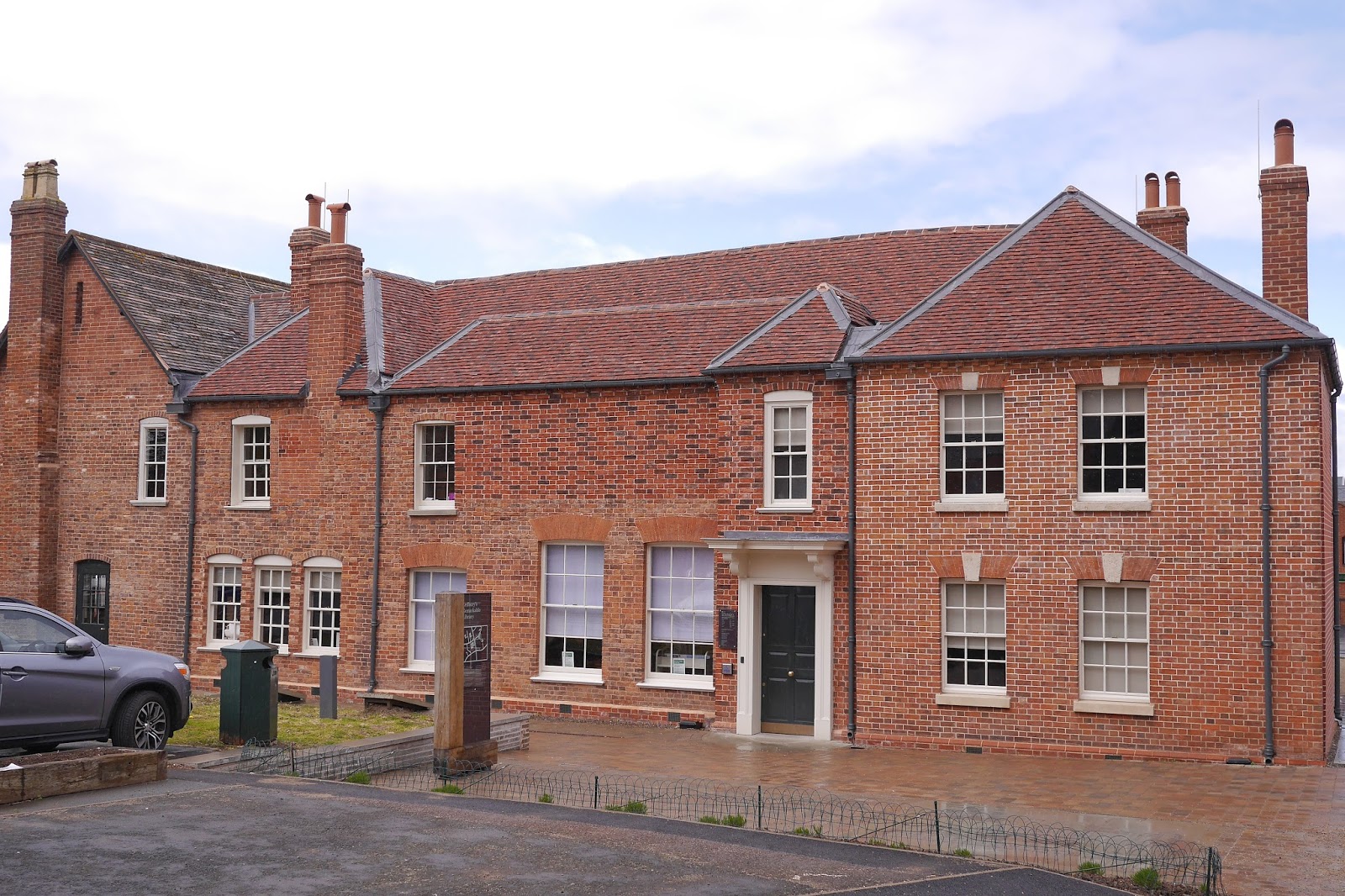
The brick georgian exterior conceals a wonderful timber framed late 15th century hall.

Opposite is the Hall and Chapel of the Hospital. We couldn't unfortunately see inside.

Conditions: cloudy, bright at times, threat of rain.
Distance: maybe 2.5 miles.
Rating: Four stars. A delightful town.


