Showing posts with label lake. Show all posts

Tuesday, 18 October 2022

The Barrage of Emosson

                                                   The Barrage of Emosson, Switzerland

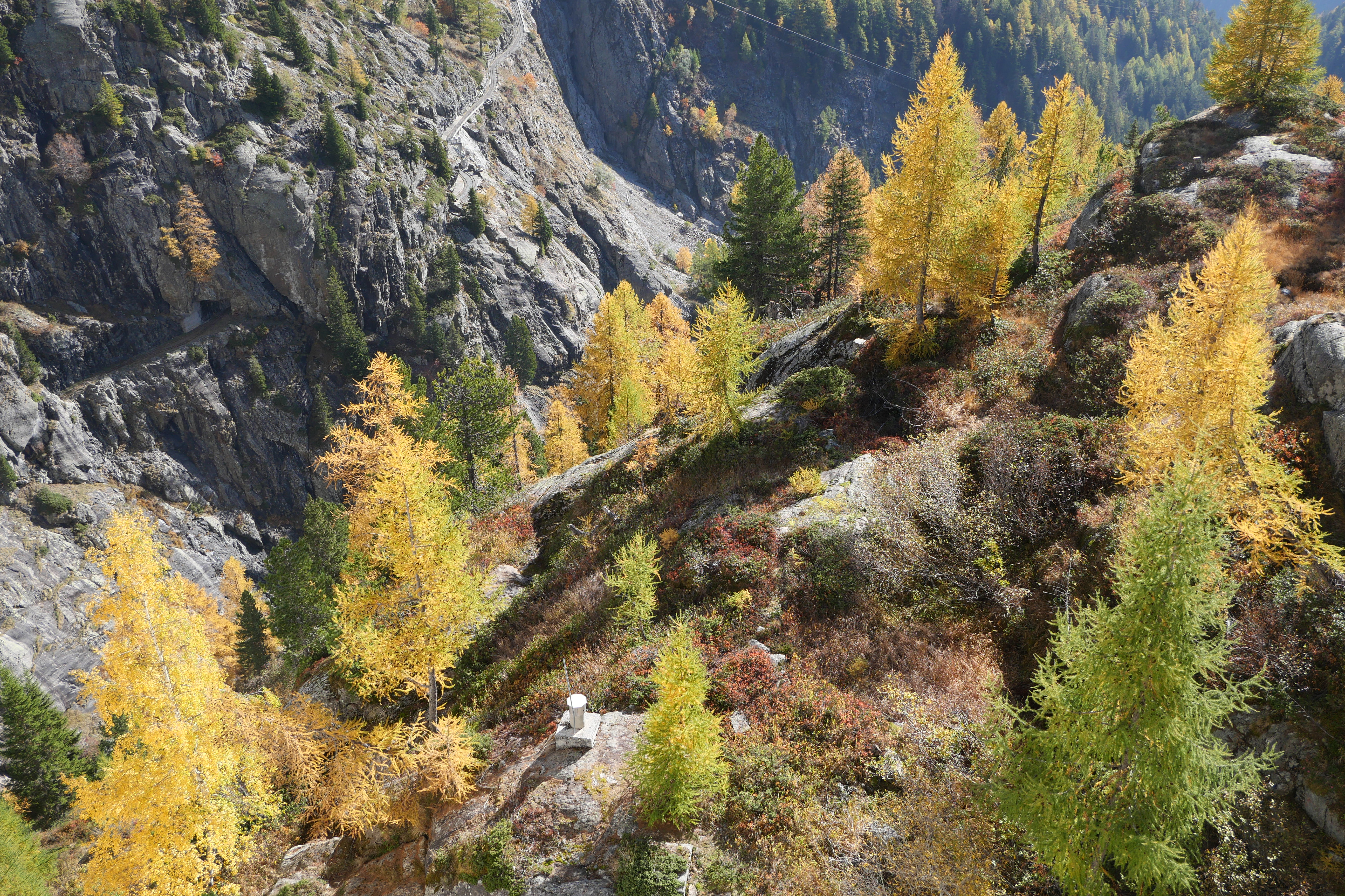
The Émosson Dam (Le Barrage d'Émosson in French) is a hydroelectric dam development located in Switzerland in the canton of Valais. Work began in 1967, and commissioning took place in 1975, eight years later. It is fed by the waters of the Mont Blance massif.

You can walk along the top of the dam (rails make it unlikely that you will fall over the edge) and once you get to the other side there is a wide path which follows the contours of the lake. Eventually it is possible to climb to a cafe quite up up the mountain side.

We hadn't walked around the barrage before and we were keen to take advantage of the opportunity to see the vivid autumn colours. What follows is an assortment of views of the barrage, especially the mountainous ones, and the wonderful plants.


Sunday, 20 September 2020

Coate Water


                                                                        Coate Water

Today's walk is around Coate Water, a country park on the edge of Swindon, and beyond. It's a nice place for a stroll, but there is also an arc deco diving platform (although swimming has been banned since 1958), fishing swims, a cafe and areas of grass for play. Although it looks like a lake, Coate Water is a 56-acre reservoir built in the 1820s as a headwater tank for the Wiltshire and Berkshire Canal. The canal was abandoned in 1915. In the 1970s a smaller lake was created as a flood storage lagoon, which later became Wiltshire's first Local Nature Reserve.

We walked clockwise around the lake passing the Reserve and then following a wide track, shared with cyclists, which led down to the M4 moroway. There was a remarkable spiral bridge, larger on the north side than the south side, which enabled the cyclists to not have to dismount.

We continued along field paths and some woodland to walk along a pleasant valley and then along the edge of a large field to emerge on a road. This led down to a bridge over the M4.

We crossed the bridge and walked along two sides of a large field - all very noisy - to find in the corner a fine pair of sarsen stones.

In the corner of the next field we passed through an absolute quagmire of cold muddy water which went over our boots as we went towards the only gate. Soon after this we re-entered the Country Park and had a lovely view of the bottom end of the reservoir.

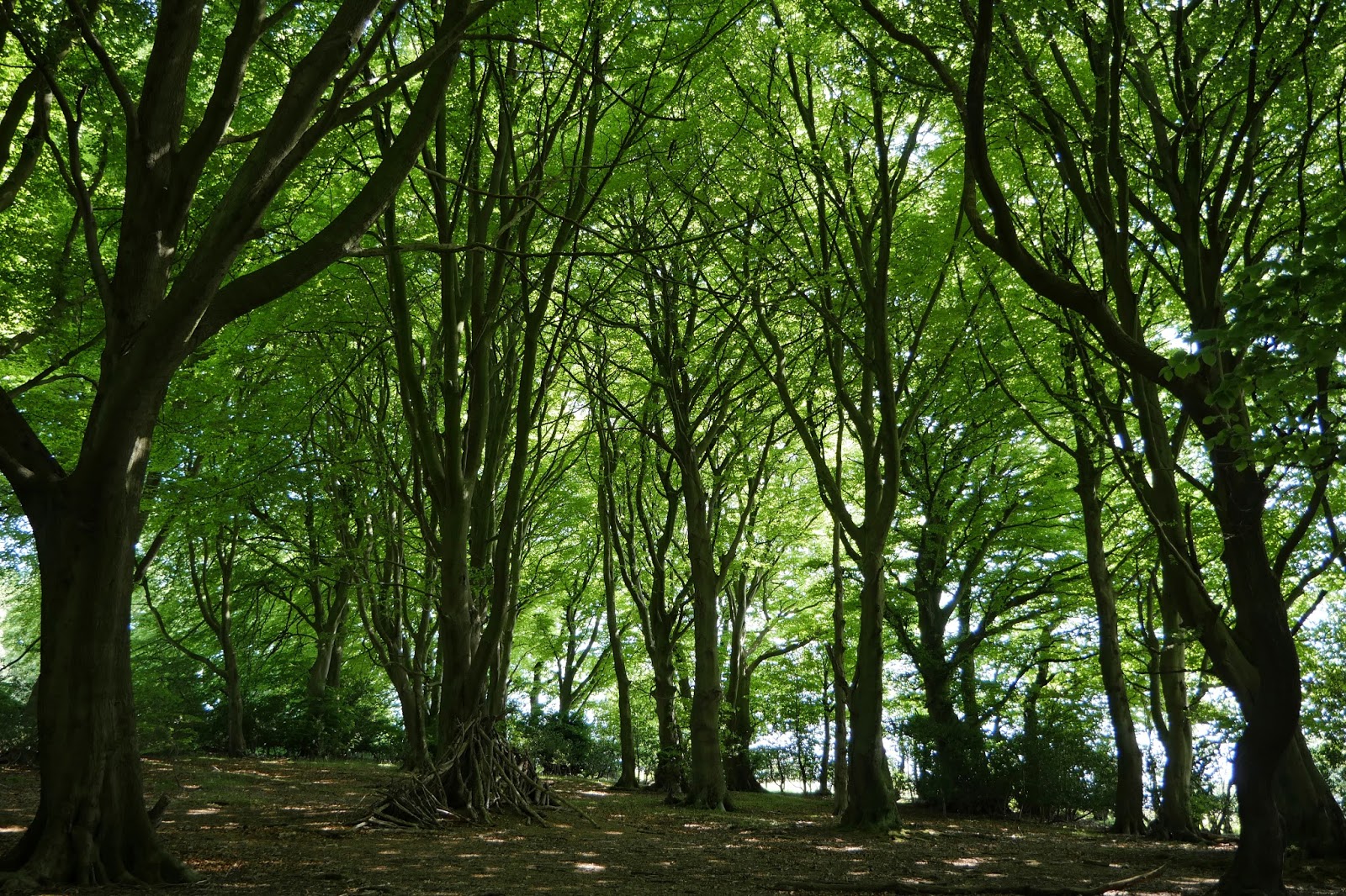
Soon after this, there was a lovely avenue of (beech?) trees.

We then followed the line of the lake on our right to return to the start.

Conditions: bright and sunny.

Distance: 4 miles.

From: 100 walks in Wiltshire.

Map:  Explorer 169 (Cirencester & Swindon).

Rating: three stars. A nice change.

Friday, 31 July 2020

Minterne Gardens

St Andrew's church

On our  way back from Sherborne Castle we decided to stop of at Minterne House and Gardens. It was somewhere we had passed on an excellent circular walk from Cerne Abbas.
 
We parked opposite the estate church of St Andrew. It dates from the 15th century, with rebuilding/restoration in the mid and late 19th century. (This is from the latest edition of Pevsner, which rather contradicts the 1972 edition I used to rely on.)
 
The house was rebuilt in 1904-6 in an idiosyncratic but effective style. It is the third house on the site: the  second was found to have dry rot, rats and drainage problems which led to it being demolished.
 
 
We then headed along a path into the gardens ... 
... which we were surprised and delighted to find were presented as Minterne Himalayan Gardens. There were some delightful trees, especially this one with apparently two different flowers.

The path headed downhill along a narrow valley. At the bottom of the valley, there is a lowest of a series of pools which have been formed in the  River Cerne.
We ambled our way uphill, passing this beautifully shaped tree ...
 
... and this delightful bridge. It was a shame about the algae.
 

At the top we had a nice view of the lake which is at the lowest point in the site.


Conditions: mild and sunny.

Map: Explorer 117 (Cerne Abbas & Bere Regis)

Rating: Three stars.

Friday, 26 April 2019

The Blue Pool and East Creech


A short afternoon walk with our friends Dave and Chris. We started at Furzebrook, south of Wareham and headed along the road to find the first landmark described in our walk book: a telephone box. Alas this was now defunct.

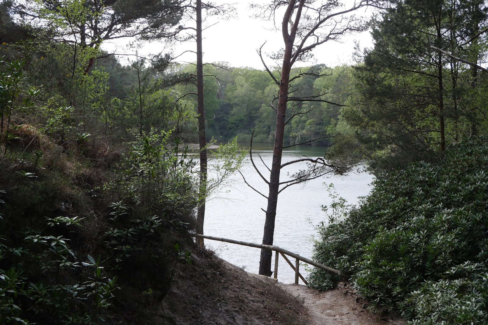
We turned left along the track which led to the Blue Pool and paid the entrance fee to see it. We followed the path anti-clockwise and soon had our first glimpse.


There was a general feeling that it wasn't as blue as expected, and this was strongly borne out from another angle further round.


The gardens were just beginning to come into flower and when the rhododendrons are fully out will no doubt be delightful.


We left the Pool and resumed the walk route along a track which emerged into an area of heathland. We followed a clockwise arc through heathland, gorse and heather, and then a damp area with moss and lichen and overgrown pools. We had now joined a section of the Purbeck Way. We emerged onto a quiet road and now had some fine views of the Purbeck Ridge, looking towards the west.


We passed East Creech farm and its associated buildings and continued up the road to turn right at the next farm. I loved this tree in full blossom.


A field edge path soon brought us to an area of very attractive heathland.


We soon discovered however that a large area of it had been cleared and many trees felled. It seemed to be part of a nature reserve and we supposed there was some robust habitat management underway. We left the heathland and passed an isolated house, agreeing that none of us would want to live there, to soon reach Furzebrook again.

Conditions: bright and reasonably warm.

Distance: four miles (including the Blue Pool).

From: 50 walks in Dorset (AA).

Map: Explorer OL15 (Purbeck & South Dorset).

Rating: four stars. A delightful stroll.

Wednesday, 24 May 2017

Llandegfedd Reservoir

View of the reservoir from the south

Ange's cousin Ruth and husband Jon have taken us on several excellent walks in the area around Usk, and this was the latest. Llandegfedd Reservoir was formed by damming and then flooding a river valley and was opened in 1966. It covers an area of 434 acres (1.76 km2) and is managed by Welsh Water's leisure and conservation company – Hamdden. It is run as a country park and offers boating, canoeing, windsurfing, fishing and nature conservancy. And of course walking - we followed the circular Reservoir trail.

We set out from the large car park which is near the bottom of the reservoir and crossed the large dam, from which the picture above was taken. The water was very still, hence the lovely cloud reflections.

At the end of the dam we turned off to the left to climb into woodland. Just before that I took this pic of the outlet from the reservoir.


We turned right at the top of the hill and followed the contour passing some trees that were trying to cope with growing on the hillside.


We emerged into a grassy meadow which offered our first good views of the end of the lake.


At the end of the field we made a short detour to a bird hide. Not much going on, but we did see a Grebe and a couple of Shags. Resuming the path we found that the reservoir had a hitherto invisible arm going off to the east. We could also see some fish pens which were attracting interest from the Shags.


We continued clockwise in a wide arc some way away from the lake itself and came to a magnificent sunken lane which the trees were projecting out into. The striated rock underneath was also clearly visible.


This led to a lane and great views to some of the well-known local mountains. Jon did carefully trell me the name of the peak on the left, but I confess I have forgotten.


Soon we climbed into a splendid beech wood, Twyn y Cryn.


Emerging from this we headed towards Yew Tree Farm with its fine large wooden house.


Emerging from this, we passed the point where water from the River Usk enters the reservoir and entered an area of wonderful flower meadows. Scattered among them were two species of orchid, identified as ... Common Spotted ...


... and Southern Marsh.


These gave way to grassy track by the east edge of the lake, with nice views across to those mountains again.


There was however one more flower meadow and Jon encouraged me to try to get a pic of a single orchid in focus among all the other plants. It was a great idea and this was my best effort.


We paused for refreshments at the visitor centre and returned to the car park.


Conditions: a lovely sunny day.

Distance: 6.25 miles.

Map: Explorer 152 (Newport & Pontypool).

Rating: four stars. Lovely walk, interesting and varied.

Thursday, 19 January 2017

Singapore: Gardens by the Bay

The Super Trees

Gardens by the Bay is number 1 out of 786 things to do in Singapore according to Tripadvisor and so it seemed the perfect thing to do on our last full day. The Gardens were built on reclaimed land next  to the Marina Reservoir and opened in 2012. According to Singapore's Infopedia, "the Gardens were conceptualised in 2003 as a key component of the government’s City in a Garden vision, which evolved from Singapore’s reputation as a Garden City". Singapore is quite green, there are trees and bushes everywhere, but it is also heavily urbanised (it is the third most densely populated country after Macao and Monaco), so this is a truly inspiring concept.

We walked from the Bayfront MRT station and emerged onto the Dragonfly Bridge over the Dragonfly Lake. To the left there was a fine view towards the Singapore Flyer, three of the Supertrees (of which more shortly) and the Flower Dome.


We made our way to the main Supertree grove and this was our first view, including the inviting walkway.


At the grove your attention is drawn upwards to these astonishing structures. "The tallest steel-framed concrete structure [i.e. Supertree] standing at 50 m and the shortest at 25 m. Each Supertree is covered with nearly 163,000 plants of more than 200 species and varieties, including bromeliads, orchids and tropical flowering climbers. The Supertrees, inspired by the giant trees of the rainforest, also function as exhaust vents for the conservatories and as dining spaces, and 11 of them have environmentally-friendly features such as solar panels and water harvesters" (from
Infopedia).


This is the view from the start of the elevated walkway.


And these are some of the thousands of plants growing up the structure.


Here is the Marina Bands Sands hotel, an extraordinary structure, which appears to be three towers with a ship on top. Apparently there is an infinity pool up there.


There were some great views downwards as well. It's rare to be able to look down into a palm!


After the excitement of the astonishing Supertrees we headed towards the south end of the Gardens where I had read there was a butterfly garden, passing ion the way Marc Quinn's sculpture Planet, which depicts his 7 month old son.


We reached the end of the Dragonfly Lake ...


... and located the Butterfly Garden, where I quickly spotted a Blue Glassy Tiger (Ideopsis vulgaris).


Soon there was also a male Blue Pansy (Junonia orithya) ...


... and a female. Female dimorphism is quite common, but it seems rare for the alternate form to be equally beautiful.


Another first was a Tawny Coster (Acraea terpsicore) 


 But perhaps the most striking of all was this Peacock Pansy (Junonia almana) seen near the entrance on the way out.


Conditions: cloudy at first, becoming brighter.

Distance: a couple of miles.

Rating: 5 stars. Memorable! A really great experience - and some lovely butterflies.