Showing posts with label SVP. Show all posts

Tuesday, 18 November 2014

The Stour Valley Path: A review

Stourhead

The Stour Valley Path runs from Hengistbury Head at the mouth of Christchurch Harbour to Stourhead just over the border in Wiltshire, a distance of 60 miles. We did it in eight legs spread out over fourteen months.

Some things about this Path are a bit confusing. It is in fact generally know as the Stour Valley Way, to distinguish from another Stour Valley Path in Suffolk, but the only guide book is The new Stour Valley Path by Edward R Griffiths, Greenfield Books, 1998. It is marked on the OS Explorer maps, but sometimes there are alternative routes and the book doesn't always match the map. It seems that the local authority is not fully behind it either because signposting and waymarking are a bit haphazard to say the least.

Is it worth doing then? Definitely. It offers a way to see and get to know Dorset from south to north through many interesting places and much beautiful country. We had already walked the Coast Path in Dorset, but this direction was substantially unknown to us.

So what were the best bits? We had already encountered the Lady Wimborne houses in the Poole-Wimborne area, but it was fascinating to go past was is now Cranford School, where she once lived and to see the extraordinary railway bridge on the outskirts of Wimborne which also bears her name.


Crawford Bridge on the outskirts of Spetisbury was a beautiful structure and the weather conditions facilitated this pleasing photo on the day we reached it.


Just along the road on the other side of Spetisbury, the handsome church of St Mary was rebuilt, apart from the base of the tower, in 1713 by Thomas Bastard, father of the celebrated Bastard Brothers who rebuilt Blandford after the great fire of 1731.We had driven past it before (it is on the Poole-Blandford road) and would do so several times again in the course of this and other walks. It was good to know its story.


The two great surprises were the adjacent chalk hills: Hod and Hambledon. They offered excellent walking, with some decent climbs and fantastic views, especially from Hambledon Hill (193m), where the panorama was almost 360 degrees.


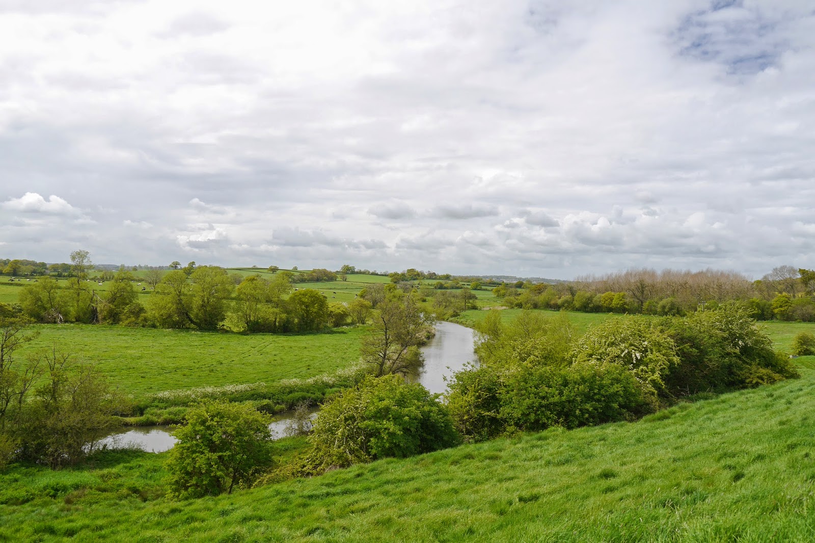
What of the river? Well the Path follows the river valley more than the river itself and indeed one of the disappointing things was that unlike, say, the Thames Path very little of the walking was along the river bank. The longest section was around Wimborne. The Stour is generally a narrow, winding river, pretty enough but never really dramatic.
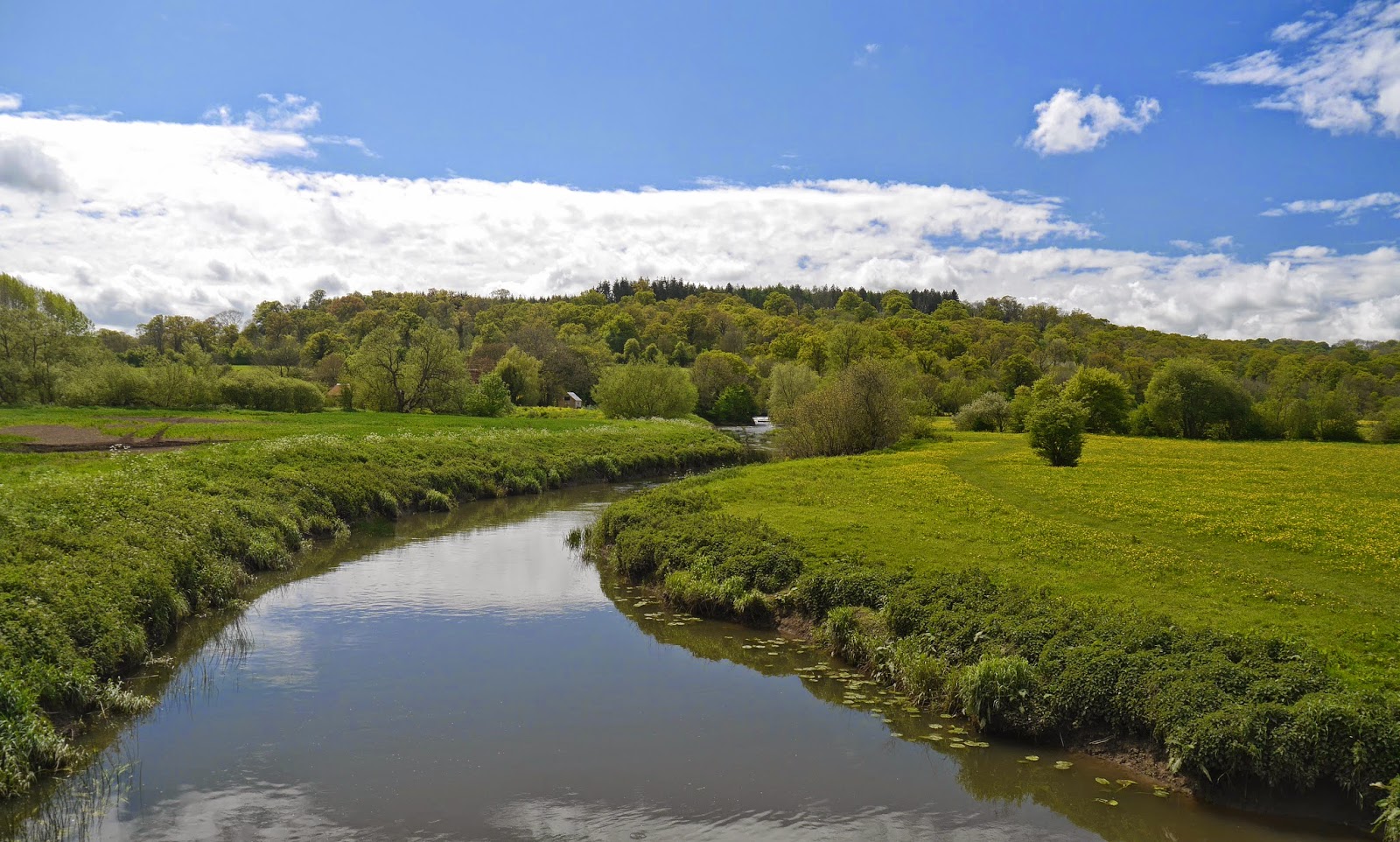

And the best bit? Undoubtedly the gardens of Stourhead, arranged around the exquisitely beautiful lake. Here, to finish on, is another view.


Stages

1 Hengistbury Head to West Parley

2 West Parley to Wimborne

3 Wimborne to Crawford Bridge

4 Crawford Bridge to Bryanston

5 Bryanston to Hammoon

6 Hammoon to Fifehead Magdalen

7 Fifehead Magdalen to Silton

8 Silton to Stourton and Stourhead

Monday, 27 October 2014

Silton to Stourton and Stourhead (Stour Valley Path 8)


Today, after  quite a gap we are on the final leg of the Stour Valley Path. We set out from Manor Farm at Silton, pausing only to photograph the ancient oak tree and the kitch, but quite amusing, sheep.

We headed along the road, past the much restored church to turn left by the village hall and then make the dangerous crossing of the very busy A303. The path leads on across fields into the village of Bourton and then follows the line of the Stour due north.

Now the terrain changes, becoming much more hilly and interesting as we approached Pen Mill Farm.


After passing the farm you cross two small valleys, and in the second of these you get your last view of the mighty Stour.


The path then climbs across some very attractive country. Our Guidebook to the Stour Valley Way is very detailed and a bit quirky. At one point it says, having entered a field by a gate, "a used path goes straight up the hill ... Ignore it!". It continues with stern instructions to navigate to a point 82 degrees left of a telegraph pole. I dutifully did all this and reached the hedge at the top to find that the promised stile was no longer there. The solution of course was to go back some way and joint the "used path". Hmm.

This is the delightful view back from the top of the hill.


A lane and then a long field-edge path led to Bonham, where an interesting Manor House was studiously hidden behind a wall and a hedge. I learn from Pevsner that the churchy-looking part to the right was once a Roman Catholic chapel, and that the house has an Elizabethan plaster ceiling.


From here, it was short walk downhill through woodland to reach the edge of Stourhead's parkland. After walking along a track, the path veers right across fields and soon there is a first sight of the lake and one of the many garden buildings, the Temple of Flora.


The route now skirted the western edge of Stourhead and I gaily followed further instructions to turn right through an unmarked gate and follow a path uphill through woodland. There was in truth no detectable path and veering first left and then right in an effort to correct my line I ended up completely lost. I did eventually find my way into the main woodland and navigating with my OS map and glimpses of the lake I managed to stumble down to the end of the lake, with the Lily Pond and Six Wells Bottom on my left. It is here that the Stour gradually emerges from underground springs.


I headed on reach the Spread Eagle pub in Stourton where we met up with friends Judith and Tony for lunch, before having a very informative walk around the gardens, which were begun by Henry Hoare in about 1744.

This is the classic view of the gardens from the entrance near the pub. The Palladian Bridge is in the foreground and the Pantheon at the other end of the lake. The beautiful tree on the right is a Tulip Tree, named for the way their large flowers are thought to resemble tulips.


We also saw the house, a rather plain Palladian-style building of 1721-4 by Colen Campbell.


This is the truly wonderful view from the Pantheon back towards the Palladian Bridge.


Conditions: mild, cloudy.

Distance: about five miles on the SVP.

Guide: The new Stour Valley Path by Edward R Griffiths, Greenfield Books, 1998, but sadly out of print.

Maps: Explorer  129 (Yeovil & Sherborne) and 142 (Shepton Mallet & Mendip Hills West)

Rating: SVP section three stars; Stourhead five stars. Equalled only by Stowe.

Friday, 15 August 2014

Fifehead Magdalen to Silton (Stour Valley Path 7)


View towards Stour Provost

After an elapse of some three months (when we have at least made major progress along the South West Coast Path) we resume the Stour Valley Path at Fifehead Magdalene). We set off east across the fields towards Stour Provost.

Almost immediately a large clump of wild flowers, notably Common Fleabane, with lots of butterfly activity caught my eye. Almost immediately I was delighted to see my first Brown Argus of the year, closely followed by a pair of mating Common Blues. Also lots of Small Tortoiseshells.


Stour Provost is seemingly so named because between 1450 and 1925 it was owned by the Provost, fellows and scholars of King's College, Cambridge. Your first sight of the village is the restored water mill, now some distance from the river.


We also made a small detour to see the 14th/15th century church of St Michael.


Now we walked across fields to West Stour where we stopped for a rather premature lunch at the  very good Ship Inn. We ate in the garden next to a large Buddleia bush which was absolutely covered with Small Tortoiseshells, a hundred or more. Some flower heads had four or five butterflies jockeying for position.


Suitably refreshed, we headed across a series of fields, many growing Sweetcorn, surely one of the the most boring of crops: its unattractive in itself and it blocks the view.  The final field was mercifully open and offered a great view across open country to the north east.


There was also a view back (south) along the Stour Valley.


 The river is by now very narrow and somewhat overgrown.


At the end of the fields we followed a road, the intriguingly named Nations Road, to reach the outskirt of Gillingham (unlike the one in Kent, it is pronounced with a hard G). We passed through newish housing developments on the edge of the town, which seems to have had substantial growth in recent years.

At Wyke we passed an imposing former brewery. The classical columns and statue on the right are part of the architectural antiques shop next door.


Further fields brought us to Milton on Stour from where we followed the road up to Silton.

Conditions: warm and sunny for the most part, but quite a lot of cloud.

Distance: 7.5 miles. Total now covered 54.5 miles.

Guide: The new Stour Valley Path by Edward R Griffiths, Greenfield Books, 1998, but sadly out of print.

Map: Explorer  129 (Yeovil & Sherborne).

Rating: three stars. Not really very interesting walking, although the butterflies made up for it.

Tuesday, 6 May 2014

Hammoon to Fifehead Magdalen (Stour Valley Path 6)


The Stour near Fiddleford

 We had an unexpected opportunity to make further progress on the Stour Valley Path and so headed to the tiny hamlet of Hammoon to pick up the route by walking along the former railway towards Sturminster Newton (Stur to the locals).


In fact, we got so carried away with the rapid rate of progress along this excellent path that we were almost at Stur before we realised we should have turned off to follow a curving path down to Fiddleford Mill. This is what we should have seen, taken in the evening on the way home.


We had a very nice lunch in the Swan pub in Stur and admired the Museum.


Then we headed down to the river to follow it for a couple of miles to Cutt Mill. The first notable sight was the partly-dismantled former railway bridge.


Why, we wondered? Was there a desire to make sure the railway could never easily be reinstated? After a short muddy stretch we emerged into a grassy area and the path climbed a small hillside giving lovely views to the west. 

We walked along the grassy river bank: the first really sustained walk by the river since we started the walk. Now we started to see some butterflies and I was very pleased to get a photograph of these Green Veined Whites mating.


 There were also at least three different types of dragonfly. This is a Banded Demoiselle.


Cutt Mill was a pleasant spot. The ruined mill is not all that distinguished architecturally, but it was interesting to see how solid the piers of the bridge were: presumably this was once a much more important crossing.


There was also a female Orange Tip showing the delicate underwing markings that enable you to tell it from a Small White.


Walking up the lane from the mill we turned left across fields to enjoy spectacular views to the west over the Blackmore Vale.


More field paths brought us to the sprawling village of Marnhull. It claims to be the biggest village in Dorset and we found this claim to be very convincing. We left the old centre along Love Lane and walked north across fields in the direction of Fifehead Magdalen.

After crossing one particularly enormous field, we touched the winding river again. After this we had a bit of a struggle to find our way to the village, but did eventually succeed. The view east towards Duncliffe Hill on the left was very pleasing.


The little 14th century church of St Mary Magdalene was very attractive.


Conditions: warm and sunny for the most part, but quite a lot of cloud. Muddy underfoot in many places.

Distance: 7.5 miles. Total now covered 47.0 miles.

Guide: The new Stour Valley Path by Edward R Griffiths, Greenfield Books, 1998, but sadly out of print

Map: Explorer  129 (Yeovil & Sherborne)

Rating: four stars. The long section by the river after Sturminster Newton was a real highlight.


Sunday, 13 April 2014

Bryanston to Hammoon (Stour Valley Path 5)


Today we continued walking the Stour Valley Path, picking up the route at Bryanston Village. The first challenge to find our way through Bryanston School. It did offer a nice view back over the village (above).

We also had a good view of the house which was the basis of the school when it was founded in 1928. Richard Norman Shaw built the house in the 1890s for the 2nd Viscount Portman.


Having eventually found our way out of the school - why were there no signs? - we followed the road to the village of Durweston, with the Stour on our right.


The rape field on the left created a dramatic block of colour, contrasting with the bright blue sky.


As we entered the village we saw this old station sign by the local school.


We crossed the A357 and headed towards Stourpaine, passing a rather unexciting mill and under a railway bridge. The defunct line is now a "Trailway".


 The church at Stourpaine was quite picturesque: the tower is old, but the rest was by T H Wyatt (whose work we saw yesterday at Spetisbury).  The deceptively gentle curve of Hod Hill can be seen in the background.


Walking along the main street of this interesting village, we were very taken by this formal garden on the left hand side. The gate was open, but there was no sign and we were unsure whether it was a public or private space.


Soon we began the ascent of Hod Hill, eschewing the option to make a circuit if its base. On the way up, I saw my first Speckled Wood of the year. The poor thing is lacking an antenna.


 Hod Hill was the site of an iron age hill fort and the defensive ditch is still very prominent. It was also covered in the Cowslips can that be seen in the foreground. I was surprised to see a Kite in the sky above. They are now extremely common in the Thames Valley, but I can't recall seeing one in Dorset before.


As you approach the top (143m) of this wide almost flat hill, there are views all around: it is almost a 360 degree panorama. This is the view to the north east.


You can't however see past Hambledon Hill straight ahead.


We descended Hod Hill by the main path, crossed the road and climbed up a steep slope to join a ridge, appropriately enough part of the Wessex Ridgeway. There was a good view north towards Iwerne Minster, with Canford Chase further to the east.

We followed the ridge onto Hambledon Hill itself. It too was the site of a iron age hill fort: were they allies of Hod Hill or rivals? We climbed the tiny pimple which is at 193m its highest point and continued along to the end. It appears to be a cliff edge as you approach, but reveals a sort of lower terrace. When you get down to this, there is another one.


There is a great view down towards the drive of trees which leads to the Manor House of Child Okeford.

Having found a lateral way down, we followed a path then a road into the centre of Child Okeford, where we had refreshments at the village pub before carrying on our way westwards. This led us across fields which offered a view back towards Hambledon Hill, the pimple of the summit could be clearly seen, as could the stages of our descent.


We rejoined the river Stour briefly, crossing over a concrete bridge. It must be admitted that at this point in its life it is not an especially attractive river. We picked up a track heading north and at Ham Hill natural burial ground were diverted onto the route of a railway line which once went all the way to Wincanton. We followed this until we met a road where a right turn led us finally to Hammoon.

Hammoon is a tiny hamlet, but boasts a nice little 12th or 13th century church (St Paul), with a Victorian wooden belfry.


There is also a surprising thatched manor house, much altered over its life. Pevsner dates the bay on the right to the early 16th century and the porch to about 1600. The entrance doorway may be later.


Butterflies

I have decided to add interest to my butterfly spotting this year by noting when I first see each species. Today we saw Peacock, Small Tortoisehell, Small White, Comma, Speckled Wood, Orange Tip, Brimstone. The Comma was also the first of the year.


Conditions: warm and sunny.

Distance: 7.25 miles. Total now covered almost 40 miles - two-thirds of the way.

Guide: The new Stour Valley Path by Edward R Griffiths, Greenfield Books, 1998, but sadly out of print

Map: Explorer 117 (Cerne Abbas & Bere Regis), 118 (Shaftesbury and Cranfield Chase) and 129 (Yeovil & Sherborne)

Rating: four and a half stars. Full of variety and interest. The two hills were a revelation. Much more dramatic than any previous part of this walk.