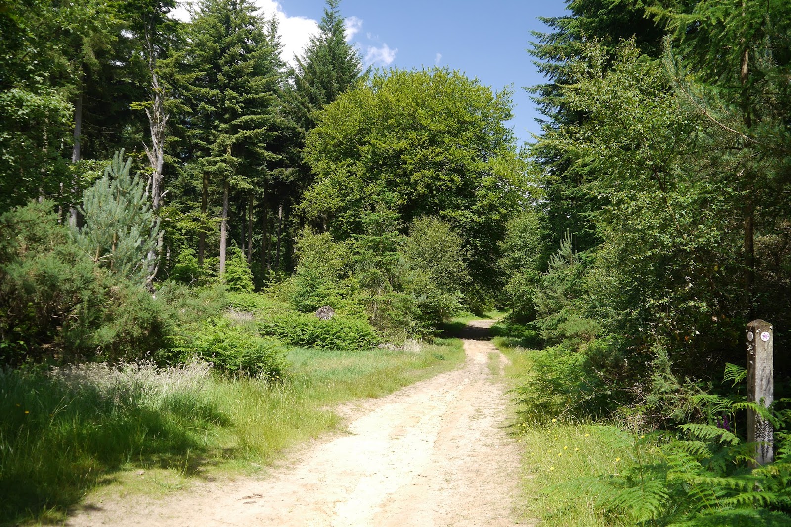
Tuesday 30 June 2015

Le Bettex and Mont D'Arbois

Mont Blanc from a low angle

We are in France for a short visit to our friends John and Anne. This wonderful walk took place under the shadow of Mont Blanc, so it seems only right to head the post with an attempt at an arty photo of it. We parked at the Le Bettex cable car stop and took it up to Mont D'Arbois at 1800. This was the quite open view to the west and Megeve.


 We followed a climbing path with great view to the left of the mountains near Mont Blanc.


 Mont Blanc itself lay in front of us at this point.


We reached Mont Joux at 1958m and paused at a picnic table. This was the view back to the cable car.


 And this was the view down into St-Gervais-les-Bains in the valley below.


The path had twisted on the way up and we were now looking directly ahead to Mont Blanc (the highest point on the massif on the left).


Before we set out in that direction I was very pleased to capture a picture of this Queen of Spain Fritillary.


We reached a junction and turned left heading downhill on a wide grassy track. At the bottom we diverted into a beautiful flowery grassy meadow and enjoyed a lovely picnic looking up towards Mont Blanc.


Restored, we followed a winding track underneath Mont Joux. There continued to be lots of flowers, but I especially liked this drift of Common Bistort and an unknown white flower.


Now we followed a slippery, shaly track downhill. This led to a lovely trail through woodland, with occasional grassy banks where we saw but failed to photograph several different fritillaries. I did however finally get a decent picture this dark little Ringlet which we had seen many examples. It turned out to be an Eriphyle Ringlet - a first for me.


Finally we approached Le Bettex where we enjoyed a much-needed cold drink.


Conditions: 27 degrees and not a cloud in the sky.

Distance: about 4.5 miles.

Rating: five stars. Simply amazing. I am not sure if the pictures do it justice.

Saturday 27 June 2015

Clayton Court to Henley (Serpent Trail 4)

A trail in Tullecombe Woods

We are back on the Serpent Trail with Viv and Giles and the name is starting to make sense. We started in Haslemere, headed south to Black Down and then west to reach Rake. Resuming just south of Rake, we are now heading east to Henley, more or less parallel with the path we trod in May. After Henley the path heads south east to Petworth then west again through Midhurst to Petersfield where it finishes.

We walked up the road from where we had parked on the edge of Durford Wood and quickly turned into a valley path towards Tullecombe Woods. Just as before we reached the main part of the woods, we were entertained by a group of bike riders hurling themselves down steep winding tracks through trees.


A winding path led through deep woodland and up this lovely sunken lane to emerge on a road.


 We skirted the Fyning Hill estate to walk through more woodland (Rondel Wood) and emerge onto a hillside track which offered some nice open views to the north. This was very welcome as we had found the previous leg to be quite claustrophobic


This brought us to the hamlet of Borden and after two further wooded sections we found a wonderful wide open buttercup meadow where we enjoyed a picnic in the midst of many Meadow Brown butterflies. More open fields followed until we reached  a pretty cottage at the entertainingly named Titty Hill.

We set off across Stedham Marsh ...


... and then crossed a road and made quite a steep climb up to Woolbeding Hill. We followed the ridge round to the viewpoint, passing a group of lads who had chosen that spot for a barbecue. The views southwards were wonderful.


We continued into some trees and were struck by the beauty of this grass in the dappled sunlight. The photo doesn't really do it justice.


A track led to Scotland Farm, with a rather splendid barn.


Then we walked across a field and then through more woodland, crossing the busy A287 (mad drivers apparently on the way home from Goodwood) and finishing with quite stiff climb to the Duke of Cumberland at Henley (at about 139m) where we slaked what was now a very well-developed thirst.

Conditions: warm and sunny.

Distance: 8.4 miles. Distance now covered 24.1 miles.

Map: Explorer 133 (Haslemere and Petersfield).

Rating: four stars.

Wednesday 24 June 2015

Trebarwith Strand - Tintagel - Boscastle (South West Coast Path 80)

Trebarwith Strand

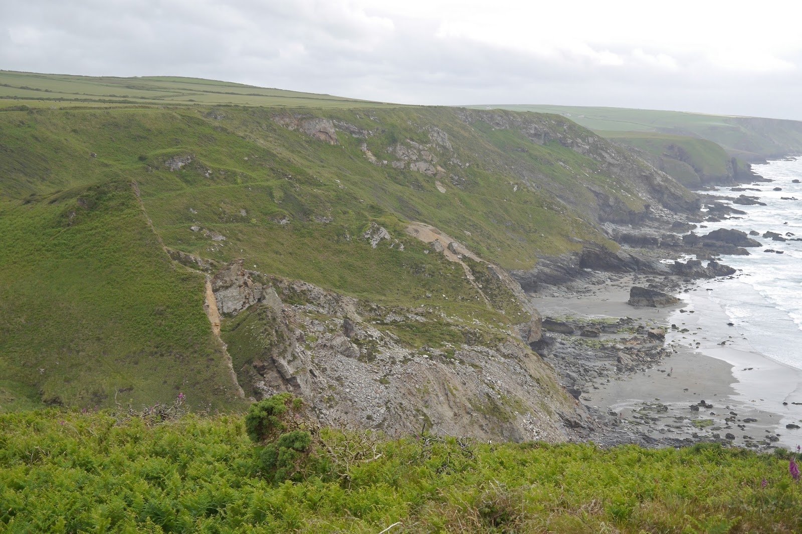
We set out from Trebarwith Strand: the tide was in and no beach was visible, just a large slab of rock. Gull Rock continued to dominate the horizon. We then made the steep climb up to the cliff-top, seeing our first Painted Ladies of the day, and soon had an impressive view back.


The route now continued at a comfortable cliff top level and we continued to see more Painted Ladies. At the end of this section we passed above a series of quarries, one of which had left behind an impressive column of rock. But why? 


We passed behind the two Penhallic Points (Lower and Higher), noticing the white sails of some boats out to sea, the first we have seen on this trip. Approaching Tintagel, we saw the imposing spire of the isolated church of St Materiana. Pevsner calls it the best small Norman church in Cornwall.


Soon after that we had our first view of the great rocky island, linked to the mainland by a narrow footbridge. 


We made a visit and learned that the great castle of Richard Earl of Cornwall from 1233 was in fact in two parts, one on the mainland and the larger on the island. The association with King Arthur is even older and goes back to Geoffrey of Monmouth's History of the English kings of 1133. 


We saw a seal in Tintagel Haven …


 … and several Scarlet Tiger moths flying around on the hillside.


There was also a great view of the next headland, Barras Nose, notable for being the first piece of coast to be owned by the National Trust. From this angle you can begin to see why it might be called Barras Nose.


After we finished our exploration of Tintagel, we resumed the Coast Path, passing behind Barras Nose and following the cliff round to the next headland Willapark, with the Two Sisters rocks just off it (the smaller sister is hidden behind the larger one). Beyond this a pleasant bay opened up with Firebeacon Hill and a large rock (Long Island!) at its end. The coast here was quite indented and we wondered what it would be like.


Soon we descended a little, but still passed high above the exquisite Bosinney Cove.


After a short climb we followed a broad grassy path towards Rocky Valley. This turned out to a well-named and absolutely beautiful winding river valley flowing into the sea. as it wound its way inland the valley opened and became picturesque rather than dramatic.


After a long steep climb up from the valley bottom, we continued at a high level. Soon a view towards a second headland called Willapool opened up. The white lookout station was clearly visible on top of the headland. I liked the large rock on the right, which seemed to me to suggest a dog or bear sitting upright. It appears that no-one else has spotted this.


A wide grassy path descended to another inlet and after a steep climb we passed inland of the second Willapool and its lookout station. I loved the pony to the right and imagined that the lookout had ridden to work. A notice explained that ponies were being grazed on the headland, so perhaps that was the explanation.


I had thought the Boscastle lay just beyond this headland but the path continued relentlessly onwards towards a sort of inlet. What could it be?


As we turned the corner, we discovered the good news: it was the mouth of the long, narrow harbour.


As the harbour ended a river began. It was as though we had suddenly been transported to the Cotswolds. Boscastle of course suffered terrible flash flooding in 2004 as the result of heavy rain. Happily, physically at least, it is now restored.

Conditions: Warm and sunny - a beautiful day to on the coast. Others clearly thought so too and this was the most crowded section of the coast path we have yet walked on.

Grading: Moderate.

Map: Explorer 111 (Bude, Boscastle and Tintagel).

Distance: 6.8 miles. Distance now covered 489.1 miles.

Rating: Five stars. One of the best and most varied sections.

Tuesday 23 June 2015

Port Gaverne to Trebarwith Strand (South West Coast Path 79)


We picked up the route from Port Gaverne and, erroneously as it turned out, walked up the hill to a derelict hotel (we should have immediately turned right past the pub) and joined the coast path along a cliff top. The coast ahead was rocky and the section to Trabarwith Strand stretched out ahead of us (see photo above). The distant headland is Tintagel Island and the offshore rock is the unimaginatively named Gull Rock - just off from Trebarwith Strand. 

Shortly there was a clearer view. We were told by our taxi driver that there were said to be six ups-and-downs on this section (being a lifelong resident of the area he hadn't of course walked it himself) but we couldn't yet see where they were going to be.


The coast was again noticeably flowery and I have been thinking about resurrecting the Flower of the Day which I used to include in my posts some years ago. We saw lots of this beautiful blue flower. 


Now the first major descent loomed before us: down to Barrett's Zawn from a clifftop height of about 100m. A zawn is apparently a cut in the cliff, but it does not seem to be known who Barrett was. The headland is known as Delabole Point.


On the way down we made a pleasing discovery: a Green Hairstreak perching quietly by the side of the path on some bracken.  It was the first one of the year and only the third or fourth I have ever seen.


Once near the bottom, we could see the full extent of the long narrow valley heading inland. I realise that in practice I seldom take pictures of inland views. I think this is because the inland view is most often flat, a continuation of a coastal plateau, or uphill.


Having climbed up the other side, it wasn't too long before we descended again to another steep-sided valley, Dinnabroad. This time there were dramatic rock formations at the waterside. 


Now we climbed again to reach National Trust land called Dannonchapel. This time the cliff top lasted long enough to provide decent views back as far as The Rumps, albeit into the sun, ...


... and forward to Gull Rock and Tintagel, with the next descent and ascent already visible in the foreground.


This next descent was enliven by a Kestrel perched on a fence post and offered another beautiful valley winding inland.


Further on we passed inland of Tregardock Beach, protected at the back by a massive grassy rock named on the map as the Mountain. Viewed from the next cliff top the beach wasn't very inviting but a few hardy souls could be seen down there.


This really brought home to us that the last proper sandy beach we had seen was at Polzeath, ten miles or so back along the coast.

The path continued along the cliff top and was becoming noticeably rocky underfoot. Many of the rocks were beautifully coloured.


We came to a narrow cove with a good view of Gull Rock out to see and thought this might be the final descent, but no, another one lurked round the corner with another massive climb on the other side.


Finally, we made the very steep descent to Trebarwith Strand. Presumably more sand is exposed at low water.


Conditions: Quite warm but cloudy.

Grading: Severe.

Map: Explorer 106 (Newquay & Padstow) and 111 (Bude, Boscastle and Tintagel).

Distance: 6.2 miles. Distance now covered 482.3 miles.

Rating: Four and half stars. Hard, but exhilarating.