
Worbarrow Bay
We picked up the SWCP at Kimmeridge, keen to get through the section which goes through the MOD Lulworth Ranges while they are open in August. We left Kimmeridge along the road, passed the BP "Nodding Donkey" Oil Well and entered the MOD land through the gate, pleased to be wished "Happy walking" - not like the MOD of old!
You walk along a broad grassy path with two of the Kimmeridge ledges, Broad Bench and Long Ebb, below. Hobarrow Bay lies between them and is succeeded by Brandy Bay. The Gad Cliff is in view ahead (see below) as you swing inland to climb towards and then pass beneath the large grassy hill of Tyneham Cap.

At about this point we encountered the advance guard of the heroic runners racing from Weymouth to Swanage (32 miles!). We would see many more in various states of fitness as our walk progressed.
As we walked along Gad Cliff there was a fine view back along the coast with the two ledges clearly displayed and St Aldhelm's head dimly visible in the background.

You then walk along Gold Down to reach the high ground above Worbarrow Bay. As you descend the large mound on the nearside of the bay becomes clearly visible. This is Worbarrow Tout - tout is an old word for a lookout point.

You descend right to sea level at the back of the beach and as you approach it there is a great view of the wide expanse of the bay.

Now the path climbs right to the top of the hill to reach Flower's Barrow. It could clearly be seen to become ever steeper the nearer you get to the top.

Still, after a quite strenuous climb the view back over Worbarrow Bay and Tout was very impressive.

We now left the Coast Path for today and turned inland along a ridge. This is the end of the Purbeck Ridge which runs in a grands curve from Ballard Point via Corfe Castle to here. The main views are inland to the north. It is mainly flat, but Lulworth Castle provides a focal point.

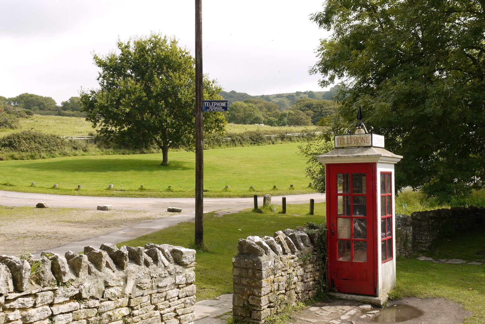
After a mile or so, we left this track and took a path downhill to pass through Tyneham, the celebrated deserted village. It was taken over by the Army in 1944 for rehearsals for the D Day landings and retained in MOD ownership after the war.
There is not a lot there but some of the main buildings, including the restored church, are clearly visible as you approach.

The old telephone box looked suitably nostalgic.
From here, we followed a grassy path zig-zagging up to rejoin the coastal path above Gad Cliff and retraced our steps to Kimmeridge Bay.
Conditions: cloudy, hot.
Distance: about 7 miles, of which about 3.5 were on the Coast path. Distance covered now 24.5 miles.
Map: Explorer OL15 (Purbeck and South Dorset).
Rating: four stars.
Flower of the day
I saw this rather wonderful yellow poppy-like flower on the incline above Brandy Bay. Frustratingly, I have been unable to identify it.

No comments:
Post a Comment