Tuesday, 30 March 2021

Ashmansworth and Crux Easton

The War Memorial

Today's walk is a new departure in that I found it fully-formed on the OS Map I was looking at - the first walk based on reading a map than following a book or following signposts of a Long Distance walk. We parked near the War Memorial and headed north east along the road to reach the Wayfarer's Walk after half a mile or so.

We turned right onto the track, avoiding a couple of people on small motorbikes. All quite legal apparently - only three or more wheelers are banned.

 
After a very short while we began to have clear, but reasonably distant, views of Highclere Castle. Close ups of the Castle can be found here.
 

We crossed the A343 and soon passed Grotto Lodge (seemingly named for the woods on the right of the track, Grotto Wood). The rather pretty lodge is one of the entrances to Highclere Castle.
 

We emerged from the wood into lovely open country with lovely open views to both the east and the west.

 
 It was striking that not a house could be seen in either direction.
 

After about 2.5 miles we turned right, leaving the Wayfarer's Walk, and before long turned right again to head towards the village of Crux Easton. We walked across fields, skirted a wood and crossed a minor road. Two further fields brought us to the edge of Crux Easton. It is a scattered settlement with some large houses, including a manor house. Sadly, we had a deadline to meet and so we couldn't really explore, but we did stop to photograph this interesting structure.
 

It is the Crux Easton Wind Engine. A helpful sign explained that it is a "John Wallis Titt 'Simplex' self-regulating geared wind engine" and dates from 1891-92.

We headed downhill through the village and crossed the A343 to descend to a wood and then climb steadily through it and across a field to reach the road leading back to the War Memorial. It felt a bit harsh to finish with a steep climb! But then Ashmansworth has the distinction of being highest village in Hampshire.

Conditions: bright and sunny.

Map: Explorer 144 (Basingstoke, Alton and Whitchurch).

Distance: about 5 miles.

Rating: four stars.

Monday, 22 March 2021

Whitchurch, Laverstoke & Freefolk


Whitchurch Silk Mill

An exploration of Whitchurch and the river Test with my friend Merv. We started from the railway station and walked downhill to find the town centre. A little further along was the Silk Mill, the only one of the remaining mills which is still functioning. It was founded in 1800.

With the mill behind us there was a nice view of the mill pool and the River Test passing under a shallow bridge.

This was the view looking from the bridge. A good number of trout, some quite large, could be seen in the clear water.

We partially retrace our steps and walked past the town school to find a path following the line of the river to the east. We passed a former mill with with an imposing water wheel ...

... and followed open land, with the river to our left, to reach the village of Laverstoke. We were very struck by this group of houses and then had an amusing moment with some secondary school boys who were completely astonished by the idea of my taking a photograph of the houses. They simply couldn't comprehend why anybody would do such a thing.

At the end of this road (Laverstoke Lane) we turned left into London Road and passed the former Laverstoke Paper Mill. It turns out that the houses were built in the early 20th century for the mill workers. The quality of construction and spaciousness, which were what caught our eye, reflected the philanthropic ideas of the land owners, the Portal family.

We headed across fields towards the intriguingly named Freefolk. Its name is thought to indicated a free settlement outside the feudal system. St Nicholas church was founded in 1265, but it now has an 18th century look.

A path across further fields brought us to the handsomely restored and extended Bere Mill, dating from the 18th century. 25 years ago it was apparently close to dereliction. There was a nice view from the road bridge.

We continued along the road and turned left to pass the mill again over to our left. We noticed this intriguing sculpture on the way past.

We followed a path with the river on our left and as we returned to Whitchurch we spotted another mill, now converted into a house.

We found a narrow and steep path to take us towards main road and the station and were surprised to spot this red brick pill box overlooking the road. There are still a surprising number of these along the Kennet, but they are all concrete.

Conditions: a pleasant sunny day.

Distance: about six miles.

Map: Explorer 144 (Basingstoke, Alton & Whitchurch) and the Whitchurch Walks website. I would have to say that the walk leaflet, although interesting and very nicely presented, was not easy to follow, as the diagram was very small.

Rating: four stars.

Friday, 19 March 2021

Great Bedwyn and St Katherine's church

Cottages in Frog Lane

Today's walk started in Great Bedwyn. We parked by the canal and headed into the village passing the wonderful cottages in Frog Lane. Crossing the canal, we noticed how many barges were moored along it.


We walked through the village and turned right at the pub and walked along the road to reach this thatched house which was being - well what?

We turned left here and walked across a field to enter Chisbury Woods. The walk instructions gave us impeccable guidance through the numerous paths. We passed an isolated house and find the right route across a large field, turning left down a lane to reach Chisbury Lane dairy farm. The old farm house has a plaque in the gable with the date 1629. This handsome building seems to be just one room thick. Our walk description indicates that this was a Long House.

We continued along the road and passed another fine long house on the left.

Soon after this we turn entered Bedwyn Common, which seemed rather misnamed - it was surely a wood!

We followed the main path through the wood to reach the Savernake Road and turn sharp left to find our way to St Katherine's church, just outside Savernake Forest.

The church was built for the Marchioness of Ailesbury by TH Wyatt in 1861. So, an estate church. It is cruciform with the tower tucked in the corner between the nave and the transept. The inside is apparenly very impressive, but of course the church is closed at present.

We followed the path back towards Great Bedwyn, gradually realising that we had come from Great Bedwyn in the opposite direction in an earlier walk. We eventually emerged opposite St Mary's church and walked through the village down to the canalside car park.

Conditions: rather grey.

Distance: 5 miles.

From: Savernake Forest from Great Bedwyn (Fancy Free Walks).

Map:  Explorer 157 (Marlborough & Savernake Forest)

Rating: three stars.

Monday, 15 March 2021

Yattenden and Ashampstead

 Yattendon

A relatively local walk with my friend Merv. Ange and I did a version of this walk last May, but in the reverse direction. We parked (separately) in the car park at Yattendon and headed north skirting the centre of the village with the the Pump House (now a bus shelter) on the left which was the work of the great Victorian architect, Alfred Waterhouse. Behind it can be seen the Royal Oak pub, closed now of course but said to have a very good restaurant.

We quickly left the village and headed along muddy field-edge tracks, all part of the Yattendon Estate. The fields are all staggeringly large. We eventually reached a road junction with the B4009 and admired the line of trees which leads along the lane towards Ashampstead.


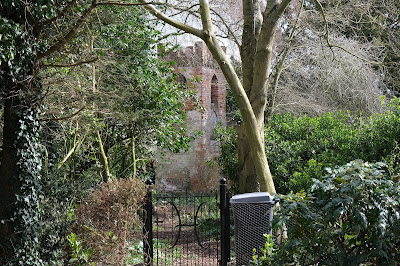
We didn't follow this lane but instead headed north east through a more wooded area to reach Ashampstead Green. We turn right and reached the edge of Ashampstead where I was delighted to see this delightful red brick tower nestling in someone's back garden. I spotted a similar structure nearby on the previous walk.

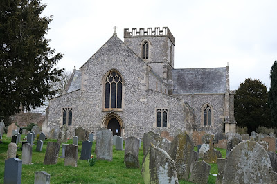
 We walked along the road to pass the 13th century church of St Clement. It is currently closed, of course, which is frustrating as it has the most complete set of medieval wall paintings in Berkshire.

We were intrigued by this large house nearby and spent some minutes trying to analyse it. We thought that the pebbledash part was the original and the red brick part rather later and we were intrigued by the dormers which has been bricked in.

We continued southwards along the lane and then took a right to walk along an area of abandined farm buildings. We walked along the edges of several large fields (back in the Yattendon Estate) and emerged through an area of woodland to reach the church. The church of St Peter and St Paul dates from about 1450.


I was quite taken by a rambling house on the other side of the road. Walking away from this house brought us back to the village centre.

Conditions: grey, but at least the threatened rain didn't materialise.

Map: Explorer 158 (Newbury & Hungerford)

Distance: just over 5 miles

Rating: three stars. It was good to get out in the open country.