
East Titchberry Farm

Lundy was directly out to sea and more gorse gave some framing to this distant picture of it.


At the west end of Beckland Bay we had our first descent: it was like being in a garden, with steps and plantings of ferns and bluebells.

Further along there was a great drift of bluebells on an open hillside. We were quite surprised: we normally only see significant numbers of bluebells in a woodland setting. Is the milder climate something to do with it?


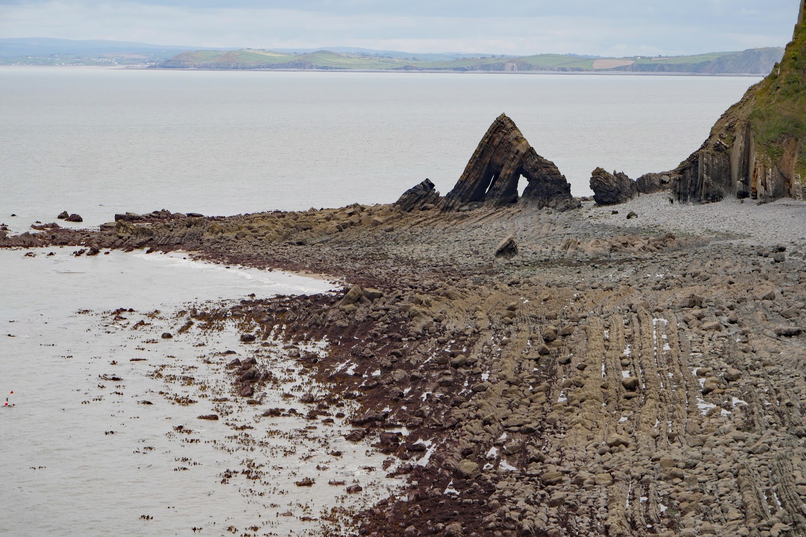
At the bottom, Blackchurch Rock could be more clearly seen at the far end of Mouthmill beach ("beach" is a bit of a misnomer as it looks more like the residue of a quarry). Apparently the rock is the result of natural erosion however.
On our left was a large rock face housing a colony of nesting Fulmars.

Here a small stream reached the sea, passing a number the mill on the left. The bridge across the stream was, mysteriously, decorated with plastic ivy.


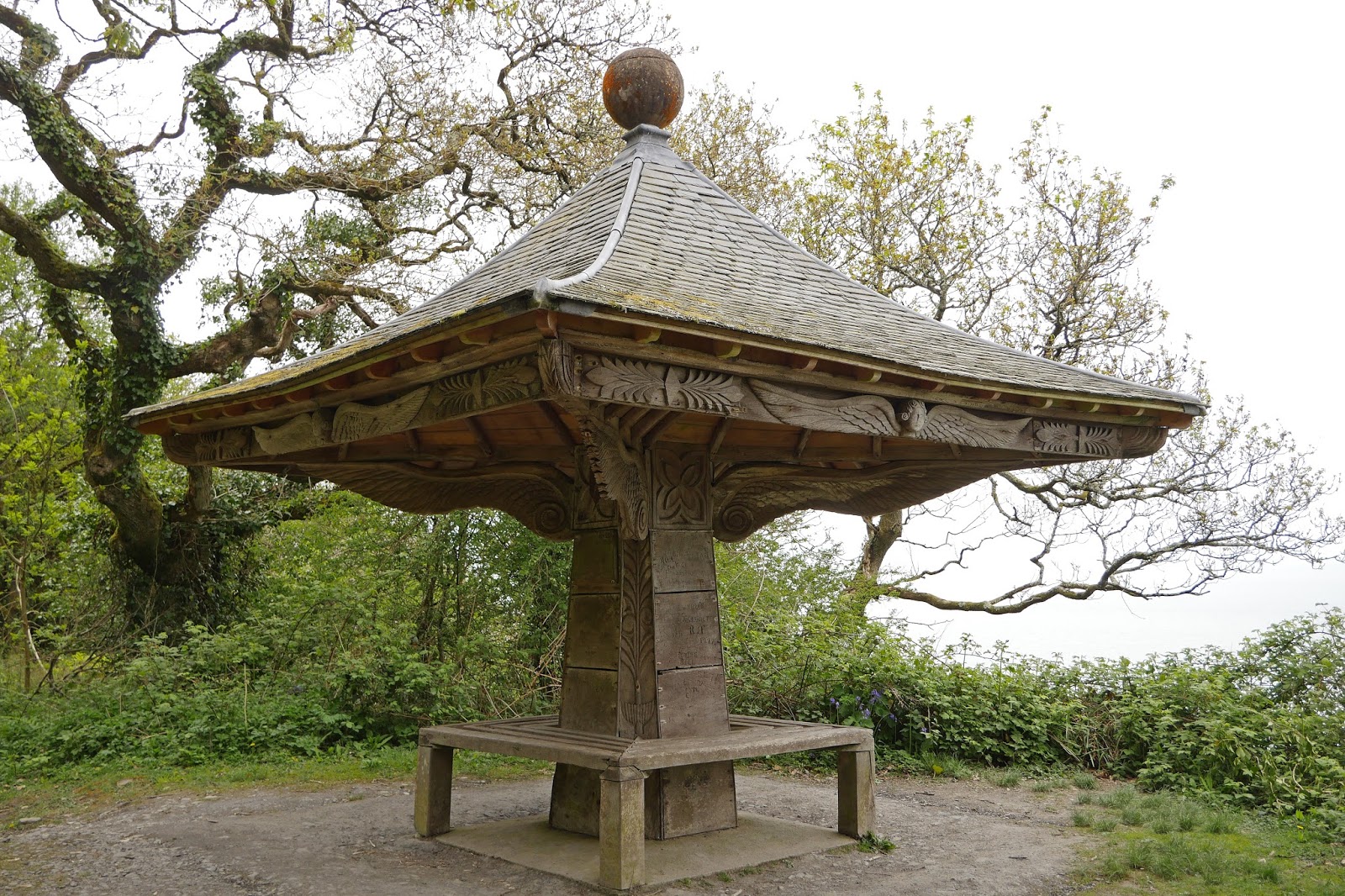
Emerging onto a grassy clifftop with masses of young broom we had our first views of Clovelly Court. As we got closer, we passed the Angel's wings. It was made by (or more likely, for) Sir James Hamlyn Williams in 1826 so that he could look across the bay to Youlston where his daughter, Lady Chichester, lived. It is quite charming. The angels' wings were very like those we saw last year in St Jon Manthorpe church in Norwich.
And then we entered the domain proper of Clovelly Court: the farm outside the park, with the house on the hill. It was good the see that new trees were being planted in the parkland, which otherwise was looking a bit bare.

Conditions: cloudy, but bright.
Distance: 6.5 miles.
Rating: Moderate.
Map: Explorer 126 (Clovelly & Hartland).
Rating: four stars.
Distance: 6.5 miles.
Rating: Moderate.
Map: Explorer 126 (Clovelly & Hartland).
Rating: four stars.
No comments:
Post a Comment