Sunday, 25 November 2007

Axbridge and Cheddar Reservoir (again)

Looking across Cheddar Reservoir to Crook Peak

We had hoped to go out for a walk yesterday, but it was cold and wet. Today however dawned bright and dry. This walk starts in the centre of Axbridge [see photos from the last time we did it], touches the edge of Cheddar Reservoir and then follows the route of the former Cheddar Valley railway, the Strawberry Line, for a while. It then completes a wider circle through lanes and along the waterways of the Somerset levels. All along there are lovely views of the Mendips, especially Crook Peak, which we walked a couple of weeks earlier. 5 miles in all.

The former Strawberry Valley line

Rating: three and half stars.

From: Pathfinder Guides No 21 – Somerset, Wiltshire and the Mendips (Jarrold).

 
Sightings

The highlight was a grey heron standing by the edge of a rhine (waterway). We also enjoyed a willow with a distinctly Mohican look (the ubiquitous Crook Peak is again in the background).


Sunday, 18 November 2007

Swallowfield

Path by Chill Hill

About the walk
Walking and pubs are inextricably linked in many people’s minds. We have decided to join the majority and combine some of our Sunday walks with a pub lunch. Following my usual practice, I have bought a book …
This walk starts from the excellent George and Dragon at Swallowfield, a pub we already know as it is not far from home. The route follows some pleasant tracks to reach the Blackwater river near its confluence with the Whitewater. The 5 mile version which we took (there is a longer 6¼ mile option) then follows part of the old roman road known as the Devil’s Highway, and finally swings back to re-find the pub. Part of the walk goes around the base of Chill Hill which I walked in the summer.
Rating: 3 and half stars
From: Les Maple - Pub walks for motorists: Berkshire and Oxfordshire (Countryside books).
Map: Explorer 159 (Reading, Wokingham & Pangbourne).
Reflections
This walk combined elements of other local walks and added some new paths which I have not previously walked. I do like this sense of “joining up” bits of hitherto isolated geographical understanding. Also I always enjoy seeing a landmark from a different angle. I know most of the roads around here, but it is very welcome to begin to know the paths and how they are linked. I can see the beginning of more ambitious self-designed walks.
Sightings
A cold wet day, so not much going on – or perhaps we were not in the mood to notice. The highlight was a rabbit absolutely speeding across an open field, then stopping dead to presumably reassure itself that it was safe to continue, then another rapid sprint to complete the job. And on the last part of the walk we crossed a field of mint, to be assailed by its smell. A first.

Saturday, 10 November 2007

Crook Peak

Crook Peak

In Somerset for the day, we wanted a good, reasonably quick walk near to our destination. We thought of doing the book version of this wonderful walk. [Sue Gearing – More Mendip Walks (Cromwell Press)] That is a classic circular walk: you park underneath Crook Peak, make a steep climb to the ridge which leads to it, walk along the ridge to the Peak, then along the main ridge of the Mendips to Wavering Down. This walk then swings right to descend through woodlands and returns to the start along the road and then by a stream. In essence, the climb, ridge walk and woods are lovely, but the final couple of miles is fairly boring.
After some reflection we decided to start the walk from the National Trust car park on the edge of Winscombe and walk up through Kings Wood to the other end of the ridge.
Path through Kings Wood

We then walked along Wavering Down descended and then climbed again to reach Crook Peak.

Wavering Down leading to Crook Peak

Crook Peak - closer now


Unusually, we then simply turned round and came back. However, the joy of this walk is the wonderful views in all directions, so this was not much of a hardship. One highlight was a lovely view over Cheddar Reservoir.

Cheddar Reservoir from Wavering Down

Five miles overall.

Rating: four stars.

Maps: Explorer 141 (Cheddar Gorge and Mendip Hills West) for the start of this walk; Explorer 153 (Weston-Super-Mare) for Crook Peak itself.

Crook peak

Crook Peak is a landmark for miles around, and was apparently used as such by ships negotiating the Bristol Channel. It was also the location of one of the beacons which signaled the arrival of the Spanish Armada.

Sunday, 4 November 2007

Burnham Beeches

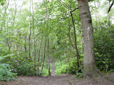
Egypt Woods

A lovely autumn day, dry and sunny - what could be nicer than a walk in Burnham Beeches? Starting to the north of the main part of the Beeches (where it was predictably very crowded with other people who had the same idea) this walk goes first away from the woods to the village of Hedgerley then through Egypt Woods, named after a gypsy encampment.

From: Pathfinder Guide No 25 Chilterns and Thames Valley (Jarrold).

Rating: three and half stars.

Map: Explorer 172 (Chiltern Hills East).


Reflections

What was really striking, apart from the lovely autumn colours of course, was that in the woods you could actually hear the leaves falling. It felt as though autumn was really coming urgently this year.
Sightings

The early part of the walk passed between open fields and it was surprising to see a flock of buzzards wheeling overhead. We couldn't see - or guess - what might be attracting their interest.

Sunday, 30 September 2007

Ecchinswell and Nuthanger Farm

The school house, Ecchinswell

A nice Sunday morning walk. This begins in the village of Ecchinswell, heads south and quite quickly offers lovely views towards the famous Watership Down and thereafter towards Highclere Castle, by the Victorian architect Sir Charles Barry, seat of the Earls of Carnarvon. It then skirts the Sydmonton estate (Lord Lloyd-Webber) and (for the shorter version of the walk) cuts through some nice woodland to return to the start. Four miles (the longer walk is five miles).

View towards Highclere Castle


Woodland path

Rating: three stars.

From: Rambling for Pleasure: Kennet Valley and Watership Down by David Bounds for the East Berkshire Ramblers’ Association Group.

Maps: Explorer 158 (Newbury and Hungerford) and 144 (Basingstoke)


Sightings

Deer are quite common around here and we saw this specimen on the edge of a field, waiting patiently for some action.

Sunday, 16 September 2007

Wasing Church and Hyde End

The almshouse gateway, Brimpton

The walk begins by the excellent Pineapple pub on the B3051 at Brimpton Common - the ideal place for a nice pub lunch afterwards. You head north through Wasing Wood, cross the mighty Enborne and reach the village of Brimpton which has a nice church and the splendid gateway to the Victorian St Peter's almshouses. You then head south via Hyde End to Ashford Hill and then return to Brimpton Common. An easy 6 1/2 miles.

Looking south from Brimpton


Rating: three stars.

From: Rambling for Pleasure: Kennet Valley and Watership Down by David Bounds for the East Berkshire Ramblers’ Association Group.

Map: Explorer 159
(Reading, Wokingham & Pangbourne).

Sunday, 2 September 2007

Arborfield (Carter's Hill and Barkham Brook) 2

Heather

We've done this walk many times before - it's not far away, quick to complete, but also varied and always enjoyable. Ideal when you want to get out but time is short. Here is a fuller description.

Today's key feature was this wonderful heather by the golf course.

Tuesday, 14 August 2007

Stone Allerton and Brinscombe

This is something of a historic occasion: the first walk we have done which is not from a walk book.

The walk begins from the pub in the hamlet of Stone Allerton. A short way along the road towards Wedmore and a path heads northwest towards Axbridge and Cheddar. A short distance across fields and you arrive at the top of Brinscombe Hill with splendid views towards Cheddar across the Somerset levels.

We then descended the hill and followed the River Axe east for a while before turning left and left again to head west along the Cheddar Yeo.

A further left turn brought us back to Brinscombe and walking uphill through a series of lanes returned us to Stone Allerton.

About 5 miles in all.

Rating: four stars.

Map: Explorer 141 (Cheddar Gorge & Mendip Hills West).

Monday, 13 August 2007

Burrington

Burrington Church

The walk begins at the church in the pretty village of Burrington and is essentially in three stages. The first involves a steady climb through woods to to foot of Black Down. The second involves a longer stretch across the foot of Black Down, parallel to the ridge. And the third involves - obviously - a steady descent, across the common of Burrington Ham and finally again through woodland.

Burrington Combe

The natural rock fissure of Burrington Combe is famous as the inspiration for the hymn Rock of Ages. The Rev Augustus Toplady was inspired to write it as he sheltered from a storm in cleft in the rock.

Although only four miles, this walk offers a good work out and some wonderful countryside.


Black Down from Burrington Ham

From: Village Walks in Somerset by Anne-Marie Edwards (Countryside Books 1999).

Map:Explorer 141 Cheddar Gorge and Mendip Hills West.

Rating: 4 stars.


Reflections

Marvellous views from the Down across to the Severn Estuary and Wales. Black Down is the highest point on the Mendips at 1000 ft.

We went off the route on the way back and ended up walking 5 miles, having made a much more comprehensive examination of Burrington Ham than planned. The familiar story of over-confidence - we thought we remembered the way from the last time we did this walk. However, once we realised we were lost, the basic geography kept us straight: keep going downhill, keep the road on the left, keep Black Down behind.

Friday, 3 August 2007

Newtown Common and Horris Hill (south of Newbury)

A short (4 miles) figure of eight walk starting in the village of Newtown at a parking area on the edge of Newtown Common. The walk passes through pleasant woods to skirt the edge of the common, cross two main roads and climb to the fairly inconsequential Horris Hill. It then loops back and ends with a further section through the woods which cover the common. Couldn't find a photograph to capture anything distinctive.

From: Rambling for Pleasure: Kennet Valley and Watership Down by David Bounds for the East Berkshire Ramblers’ Association Group.

Map: Explorer 158 Newbury and Hungerford.

Rating: 3 stars.

Sightings

Two lovely fritillary butterflies in quick succession: a magnificent Silver Washed Fritillary (predominant colour a gorgeous orange - the largest fritillary with a powerful gliding flight) and a Dark Green (actually brownish looking) Fritillary disturbed from its position on the side of a wooden gate.

Then on a nondescript patch of weeds, mainly thistles, a dozen or more Brimstone butterflies - perhaps newly hatched. Every plant seemed to have one.

Sunday, 29 July 2007

East Claydon and Claydon House

Claydon House


We were on our way back from a party (well, the morning after) and keen to find a walk in the locality. The walk begins by the church in the pleasant village of East Claydon and goes across fields to its near neighbour Middle Claydon. From there you soon find the long driveway up to Claydon House, and walk through a classic country house park. The path skirts the house and exits the park by another drive, now the entrance for deliveries. A triangular route over fields takes you to the third of the Claydons, Botolph Claydon and you return, mainly along the road, to East Claydon. 5.5 miles in all.

The park is splendid and the views across the fields in the early part of the walk are very pleasant, but the route back is, as so often, a bit dull and the detour over the fields adds little but length to the walk.

Rating: three stars.

From: 50 walks in Berkshire and Buckinghamshire (AA).

Map: Explorer 192 (Buckingham and Milton Keynes).


Sightings
 

We were very struck by this vast field of dead rape as we made our way through it. It felt somewhat like walking over a deserted battlefield. What had happened?


We were also amused by this elaborate bus shelter on the outskirts of East Claydon.


Claydon House

Claydon House (National Trust) is an 18th century mansion replacing an earlier Tudor house, although only a third now remains. It belonged to the Verney family until 1956. The interior is famous for a series of state rooms featuring rococo carving by one Luke Lightfoot. Florence Nightingale was a frequent visitor to her sister who was married to Sir Harry Verney.

Sunday, 22 July 2007

Chipping Camden and Dover's Hill

The 15th century church

The 17th century market hall

The walk starts in the centre of the town and follows a section of the Cotswold way uphill towards Dover's Hill. This is a long scarp which has a fine view over the Vale of Evesham - with, sadly, signs of flooding in the distance.

The Vale of Evesham from Dover's Hill

From there the walk goes downhill across fields and then swings south for the inevitable long uphill section along the edge of the woods of Weston Park. The return route rejoins the Cotswold way and offers a nice view of Chipping Camden nestling in its valley.

Chipping Camden Church from the Cotswold Way

The final stretch into the town showed disturbing evidence of recent flooding with a pile of ruined carpets and furniture on a grass verge.

Rating: 3 and a half stars.

From: Cotswold Walks (Jarrold Pathfinder Guides number 6).

Map: Explorer OL45 (The Cotswolds).

Wednesday, 18 July 2007

Pangbourne College and the River Pang

The river Pang near Pangbourne

This walk, which I did in the early evening, starts from the centre of Pangbourne and initially follows the Thames for about a mile. This is not quite as good as it sounds because the route is along the main road, and the river is not at its most inspiring here. However, the road is lined with a series of magnificent late Victorian and Edwardian mansions - apparently originally known locally as "the seven deadly sins". The route then turns away from the river through woods and fields to pass through the grounds of Pangbourne School and thence to the village of Tidmarsh. It returns to Pangbourne via the water meadows alongside the Pang.

Rating: three and a half stars.

From: Rambling for Pleasure: Around Reading second series by David Bounds for the East Berkshire Ramblers’ Association Group.

Map: Explorer 159 (Reading, Wokingham and Pangbourne).


Sightings

The latter part of the walk was full of interest. First there were a troop (flight?) of swallows performing aerobatics over a corn field on the edge of Tidmarsh, then some rabbits in a field, including the wonderfully alert one below, and finally some splendid long horn cattle.


Sunday, 15 July 2007

Highland Wood and Walk Shaw (Cane End, north of Reading)

A flower meadow along the way

A pleasant 4 mile stroll which starts by the Fox pub at Cane End on the A4074 Reading-Oxford road. The route crosses a long expanse of fields then passes through the delightful Highland Wood (very good for bluebells in spring), crosses the main road again and then passes through a mixture of fields and woods to return to the start.

A nicely varied mix in a short space.

Rating: 3 stars.

From: Rambling for Pleasure: Around Reading second series by David Bounds for the East Berkshire Ramblers’ Association Group.

Map: Explorer 159 (Reading, Wokingham & Pangbourne).

Tuesday, 19 June 2007

Mortimer/Silchester (Roman Amphitheatre and Foudry Brook)

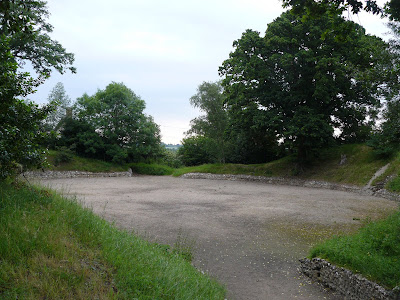
The Roman Amphitheatre, Silchester

You start the walk by Mortimer church, leaving the village by a series of unmade up roads and paths. You head south along a pleasant farm track then through a wood and across fields to reach the edge of Silchester and the splendid Roman Amphitheatre. The return leg follows a track and then a small road for a while before turning off to join the bank of the Foudry Brook to return, through fields, to Mortimer. The final section passes through a small pine wood and crosses the large grass area known as the Fairground. 5 miles.

A nicely varied walk with the added interest of the remains of the Amphitheatre, although some imagination is required as there is now (as the photo shows) only an open space with a raised mound around it. The walk can be usefully extended by going on into Silchester, past the church and waling the circuit of the old roman walls. This is a real delight.

Rating: three stars.

From: Rambling for Pleasure: Around Reading second series by David Bounds for the East Berkshire Ramblers’ Association Group.

Map: Explorer 159 (Reading, Wokingham & Pangbourne).

Sightings

Not very good conditions: early evening and an incipient thunderstorm. Lots of Meadow Brown butterflies took flight as I passed by. And, sadly, what I can only describe as a pile of 5 dead baby rabbits by the side of the track in one place. What on earth can have accounted for that?

The Roman Amphitheatre

A helpful sign reveals that the Amphitheatre was built between 50 and 75 AD and was used for executions, gladiatorial combats and wild beast fights. However, this exciting description is undermined by the next paragraph which says that the evidence is in fact unclear and that most of the bones recovered were of horses. The Roman name for Silchester was Calleva.

Wednesday, 13 June 2007

Reading/Pangbourne: Westbury Farm and Sulham Woods

View towards Purley and the Thames Valley

The walk starts in Tilehurst on the edge of the Reading built-up area, but almost immediately enters surprisingly open country with a great sense of space and lovely views over towards the Thames valley. The path crosses the main road and the railway to skirt the unlovely village of Purley, cuts the edge of Pangbourne and returns via Sulham Woods to Tilehurst. The bit on the edge of Pangbourne is very suburban (and not worth including), but overall this is a delightful stroll, mainly through fields and meadows. 5 miles overall.

Rating: 3 stars.

From: From: Rambling for pleasure around Reading (First series) by David Bounds for East Berkshire Ramblers' Association group.

Map: Explorer 159 (Reading, Wokingham and Pangbourne).

Reflections

A number of personal and work issues on my mind today, so no great thoughts about walking or nature. However, I returned home feeling calmer about the personal stuff and with some clear things to do in relation to two work projects. Part of the magic of walking.

Sightings

Some nice butterflies: small white, meadow brown (appropriately, given that the walk passes through a significant number), small tortoiseshell, red admiral, another painted lady and today's stand-out, a marbled white.

Friday, 8 June 2007

Barkham Church and the Combes

Path through The Combes

Just time today for a bit of local early morning exercise. This walk starts in a quiet lane in Barkham, near Reading, and goes via lanes and fields to Barkham Church, past Barkham Rectory (a surprising distance away) to the delightful wood known as The Combes. Four miles.

Rating: 3 stars.

From: Rambling for pleasure around Reading (First series) by David Bounds for East Berkshire Ramblers' Association group.

Map: Explorer 159 (Reading, Wokingham and Pangbourne).

Reflections

Once nice thing about this walk is that it intersects one of my regular ones, Carter's Hill and Barkham Brook. One of the many things that make for a good walk is surely that sense of building a detailed knowledge of a locality, and seeing the same path, landmark or view from a different perspective is one of best ways to do this.


Sightings

Drizzle, not much going on, but I did spot a single deer in the middle of a field. Every few moments it would look up and freeze, alert for any threat. And I enjoyed this field of pink-headed grass, sprinkled with buttercups.


Tuesday, 5 June 2007

Kingsclere: Hollowshot Lane and Hannington Village [reprise]

The Victorian well-head in Hannington

I did the short version of this walk in April and today returned to do the full version, which goes up and over the North Hampshire downs to the pretty village of Hannington. The first site of the village is Bertha's cottage, but the whole place is full of lovely houses. The well-head is on the village green, near the church. The full walk is richly varied and rewarding.

Rating: 4 stars.

From: Rambling for Pleasure: Kennet Valley and Watership Down by David Bounds for the East Berkshire Ramblers’ Association Group.

Map: Explorer 144 (Basingstoke, Alton and Whitchurch).


Bertha's cottage, Hannington


Reflections

I commented on the impact of bright yellow oilseed rape on the earlier walk, and later on how it had faded by early May. I was struck today by the new yellow of ripening corn. The picture doesn't quite do it justice.

Sightings

A few butterflies about today, none better than a pair of Painted Ladies. A foreign visitor, which my butterfly book says can be quite tame and approachable. And so it was.

Thursday, 31 May 2007

Ecotherapy - or Green exercise

There was a lot of coverage in the press recently of research done for the mental health charity MIND by the University of Essex. The Daily Telegraph reported it under the headline “A walk in the country may beat depression”. The research showed that walking in the country was associated with increased self esteem, while a comparable walk around a shopping centre led to decreased self esteem for many of the participants.

What are we to make of this? I sought out the MIND report “Ecotherapy – the green agenda for mental health” to find out.

First of all, I must congratulate MIND’s PR people for getting so much coverage in the national press – no mean feat. But I wonder if the coverage and the report might contain some elements of a shot in the foot.

The research looks to be seriously flawed. It was based on a sample of “20 members of local MIND associations” who took part in two walks, a week apart. The first was 30 minutes around a country park and the second 30 minutes around a shopping centre. They were asked to complete a Mood State questionnaire before and after each walk and the findings are basically the before and after comparisons.

The main problems appear to be threefold. Firstly, 20 is a very small sample on which to base conclusions which are intended to inform national policy making. Secondly, there is no information on the baseline mental state of the participants – which would surely inform how they responded. Thirdly, all you can really conclude is that as a leisure activity walking in a park is better than walking around a shopping centre, which is hardly a shock. It’s a big leap from there to say that ecotherapy should replace anti-depressants.

What is “ecotherapy” anyway? It seems to be any of gardening, conservation activities or walking (or indeed running or cycling). What is quite interesting however is that searching the University of Essex website reveals an interesting presentation by Professor Jules Pretty, who appears to have done the MIND research, which uses instead the term “Green exercise”. One of the slides explains that there is evidence that physical activity is known to have a positive influence on physical and mental health and exposure to nature is known to have a positive influence on mental health. The Essex team coined the term Green exercise, hypothesising that there should be a synergy if the physical activity takes place while being directly exposed to nature.

So, conclusions?
  • The idea of green exercise makes sense – but why dress it up as ecotherapy?
  • Research to demonstrate its benefit in the mental health arena needs to be more robust to be convincing. Something like a comparative study of two groups of patients through time would make sense: one group have conventional drug therapy and the other green exercise as well or instead. Demonstrable changes there would be impressive and convincing.
  • But well done to MIND for getting their message out so effectively.

Wednesday, 30 May 2007

Farley Hill (Chill Hill and Jouldings Farm)

Chill Hill

Five o'clock and the rain has finally stopped - just time for a quick walk before dinner! This walk starts in the village of Farley Hill and circles through fields and quiet lanes to return there 5 miles later. It just touches the river Blackwater at one point, but you can't see much of the river. Chill Hill is not much of one, but there is a nice view in the foreground and Reading on the horizon.


View from Chill Hill

Rating: 3 stars.

From: Rambling for pleasure around Reading (Second series) by David Bounds for East Berkshire Ramblers' Association group.

Map: Explorer 159 (Reading, Wokingham and Pangbourne).


Reflections

How green and bright it all is after rain, how good to get out after being trapped inside by the same rain - nothing very original. Struck by how lovely a field with lots of buttercups can be.


Sightings

One of my goals is to become more aware of, and informed about, all there is to see while out walking. Today I was very conscious of how many foxgloves there are about and how intricate the patterning is on the inside of the flowers.

Foxglove

There is also so much wildlife that you take for granted: squirrels, rabbits, partridge, pigeons, robins, and so on. So part of the fun is seeing, or at least noticing, new and unusual things. Today, a tawny owl and pair of yellow wagtails. I also enjoyed meeting these cows, who were not impressed at having their domain invaded.


Saturday, 19 May 2007

Beynac

Chateau de Beynac

The walk begins in the car park at the edge of Beynac, climbs to skirt the edge of the chateau and proceeds uphill leaving the town behind and passing through woods (see below - note the yellow waymark on the tree).


From here the path descends into farm land, and the picture shows the precise point where we lost the path for a while. The usual story of over-confidence.


Having regained the right path, the return leg meanders through the rich farming land in the centre of the river valley. The rocky promontory on the opposite bank with the pretty village of Domme

Farmland in the Dordogne valley


Domme

Rating: Four stars.


Sightings

Particularly memorable was a pair of Black Veined White butterflies. Listed in UK butterfly guides, but rarely seen at home.


Beynac

The chateau dates from the 12th century. The oldest part now extant is the 14th century keep. During the 100 years' war the Dordogne marked the boundary between French and English territory. Beynac was on the French side and looked across towards Castelnau on the English side.