Saturday, 4 February 2012

North Oakley to Deane Down Farm (Wayfarer's Walk 5)

Looking back towards Hannington

Another lovely bright, but cold day, and the perfect opportunity to continue with the Wayfarer's Walk. I picked up the route at North Oakley and headed through a farm and uphill in a south-easterly direction. Near the the top of the hill there was a nice view back towards Hannington, quite high at around 200m.

At the top of the hill, I turned left along a track which zig-zagged through a farm and continued parallel to the ridge to the north.


Now the path headed south-east again, around the side of fields and then through some light woodland. I would like to say that it was quiet and peaceful, but low-flying helicopters, presumably on training flights, kept intruding on the rural calm. 

It was very cold and the ground, much marked by horses' hooves, was frozen solid. There were some interesting patterns where rainwater had frozen in the depressions in the mud.


After crossing White Lane, I descended beside Great Deane Wood and watched four roe deer, first grazing then watching me as I got closer. At about 200m I got too close for comfort and they loped off across the large field.


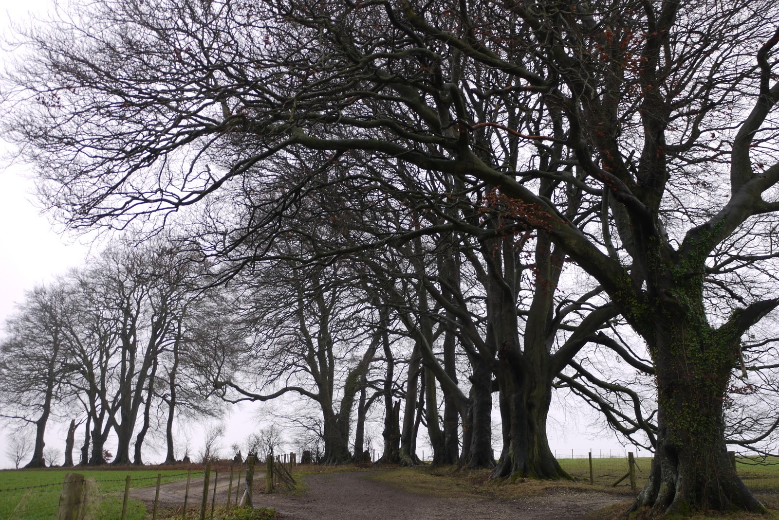
Now there was an area of large open fields. I so liked the look of this curving line of oak trees that I failed to spot a sign for the correct path heading half right across a field of cabbages. Still, a right at the end of the trees brought me back on track.


A couple of further fields brought me to Deane Down Farm. I chuckled at the sign near the farm warning of "free range animals and children". Here unfortunately I had to call a halt because of pain in one knee. I put on the knee support I always carry, just in case, and retraced my steps, without too much discomfort.

Conditions: blue sky, sunshine, frozen underfoot

Forward distance: 3 miles; distance now traveled 18 miles.

Map: Explorer 144 (Basingstoke, Alton and Whitchuch)

Rating: three and a half stars.


Sightings

There were fewer birds about than last time, but I did see a small flock of Lapwings and some Mistle Thrushes. As well as the four roe deer mentioned above, I saw another group of three and a group of seven - presumably all the same group.

Monday, 30 January 2012

Gloucester

The Cathedral

I have visited Gloucester quite often -  my daughter lives there - but never really had a proper walk around the city. It dates back to Roman times, but much of the centre has a rather depressing 1960s sort of feel. Today it is time to have a closer look. I started to plan my route on the basis of a walk around Norman Gloucester that the BBC publicised around the time of a TV series on the Normans. Other influences were the City Council's City Centre map and a work meeting that led me to park at the end of Westgate.

It was mid-afternoon when I started then from the Westgate car park, and walked up Westgate St into the city. The four main streets are Westgate St, Eastgate St, Northgate St and Southgate St: sadly, the gates themselves are long gone. Immediately on the left is the redundant church of St Nicholas.


According to Pevsner, the church is of Norman, with all sorts of later additions and embellishments. The "conspicuous and pretty tower" dates from repair work of 1783.

Almost opposite is the half-timbered Bishop Hooper's Lodging of about 1500,which has been a folk museum since 1935. The house to the right early 17th century (Pevsner).


A bit further up Westgate St, past Shire Hall, I turned left into College St, with a handsome late Victorian Tudor-style block on the corner, and entered the Cathedral Close.

The Cathedral dates from about 1100 with a Norman nave with massive round columns. Much of the rest is  Perpendicular Gothic of the 14th and 15th centuries. It was probably not the best day to visit the Cathedral as the south side is being renovated and so is covered with scaffold, and inside the whole of the nave was taken over for filming. Various figures in chain mail could be observed popping out for a cigarette or a cup of tea.

I managed to enter via the tea room and make my way into the spectacular cloisters. The East walk of the cloister has the earliest known fan-vaulting, dating from 1351-1377 according to Pevsner. The other three sides are slightly later.


It is quite spectacular, as impressive as some of the more celebrated examples such King's College chapel, which we visited recently.

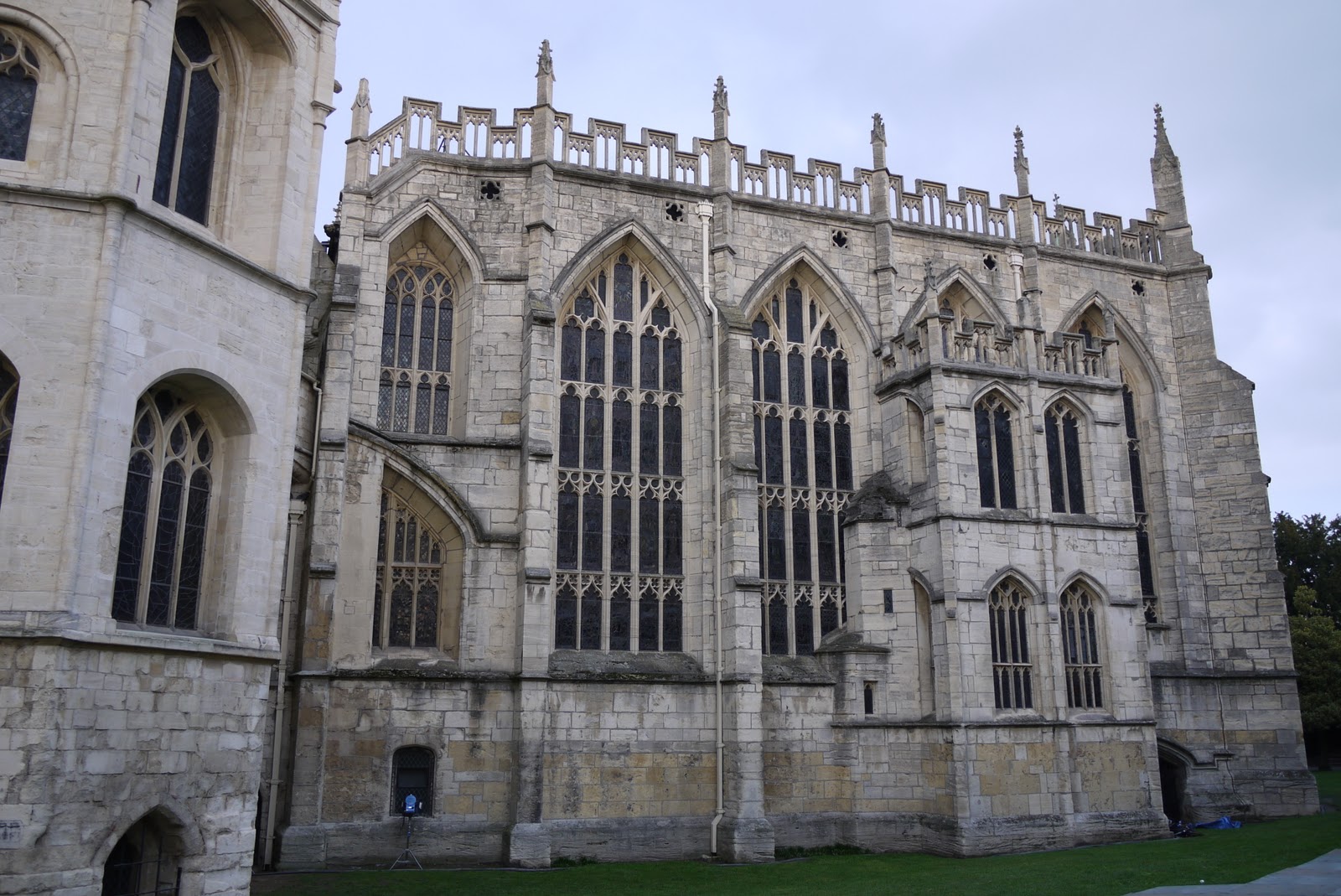
The only other part of the interior I was able to see was the 15th century Lady Chapel. Below is a view from outside, inside you have the sensation of a wall of beautifully coloured glass, held in place by a remarkably small amount of stonework.


I returned to the Cathedral Close, a charming and rather eclectic mixture of styles and exited through 13th century St Mary's Gate.


You emerge into St Mary's square. It is a most extraordinary space, with the medieval gate and houses behind you, the 19th century statue of Bishop Hooper, and the church of St Mary de Lode in front - the oldest church in Gloucester. Behind the Norman chancel and tower, a much larger and rather discordant nave was added in 1826.


So far so good, but both sides of the square are formed of nondescript brick buildings apparently dating from the 1960s and 70s. It creates a very uneasy juxtaposition of old and new (-ish).

Just across the road, in a small grassy enclosure is the ruins of St Oswald's Priory. What you see is a row of Norman arches set in Saxon stonework. According to the BBC, they are the oldest remains which exist above ground in the city.


I now followed Pitt St, intending it as the shortest route to reach Northgate St and some sights in the city centre. I was surprised to find a fragment of the former Bishop's Palace on the right, part of the King's School which forms an extension to the Cathedral Close.


At the of Pitt St is the Probate Registry (1858). Pevsner describes it as "fanciful", but I rather liked it.


I swung right, past St Lucy's garden, to reach Northgate St, where I paused to look into the New Inn. I was amazed and delighted by the open gallery which runs all round the courtyard. Pevsner dates it to 1457 and comments "few inns in England can be so old and retain so much of their original character."


From here, I walked down to The Cross, where the four main streets intersect. There was a famous medieval High Cross here until 1751, when it was pulled down and replaced by a Tolsey House (where market tolls were collected), and in 1984 by a bank, also now demolished. Pevsner says that its current appearance "could hardly be more unworthy". Even the 15th century church of St Michael has only its tower still standing.


Just past The Cross and into Southgate St, there is a wonderful chiming clock of 1894 with a series of large figures (Father Time and representatives of the main parts of Britain).


Further down Southgate St is the church of St Mary de Crypt, with the one-time St Mary de Crypt Grammar School (founded 1539, restored in the 19th century) to its left.


The church is again of Norman origin, but it now appears mainly Perpendicular, with Victorian restorations. Opposite is another lovely half-timbered house, 16th century, but recently restored. It was the home of Robert Raikes, the founder of the Sunday School Movement.


Next I turned right into Blackfriar St to reach Blackfriars Priory. Apparently, only two other Dominican friaries have survived in any degree of completeness (in Norwich and Newcastle).


After the dissolution of the monasteries, it was converted to be a private house and cloth factory, which no doubt explains why one's first impression is that it does not look like a monastery. It is now owned by English Heritage, whose website says that they are converting it into a venue for the performing arts. This is part of its continuing history and will give the building a new lease of life" (!)

Now it was a short walk to the docks, or rather the Historic Docks, most of which have been very nicely restored.


Finally, as I was heading back towards the Westgate car park I diverted to follow a sign to Llanthony Secunda Priory. This was especially interesting as we had seen the ruins of the parent Abbey at Llanthony in Wales last March. It was in the event rather disappointing. The ruined gatehouse was reasonably encouraging, but the only other remains were those of a stone tithe barn and the ruins of a timbered Tudor house.


A notice revealed that the Llanthony Trust was doing some restoration work, so perhaps they will be
more to see in the future.

I walked along the Quay, with the River Severn on my left, and just had time for one more surprise: the 18th century Customs House.


Conditions: cold, but bright

Distance: just under 3 miles

Rating: four stars. Really enjoyable and full of surprises. Gloucester hasn't conserved its heritage awfully well, but there are many delights. The Cathedral is a wonder.


Friday, 27 January 2012

Nuthanger Down to North Oakley (Wayfarer's Walk 4)

Heading East by the gallops

My current idea idea is to push myself a bit to walk further on each walk. The there-and-back approach I am using for the Wayfarer's Walk provides the ideal opportunity, and today was such a lovely bright day that there was no excuse not to get out there.

I picked up the route at Nuthanger Down and headed uphill beside some trees to emerge into the open beside some gallops and above the famous Watership Down. Not that you can see anything of it, because the hillside slopes so steeply.

A bit further on, the grassy track becomes a gravel one and the Hannington TV and Radio mast on Cottington Hill comes into view ahead.


As you approach it, there is a fine view to the north towards Kingsclere: the church is just visible in the dead centre.

To the right lie Combe Hole and The Warren.


You pass behind The Warren and descend to cross the Kingsclere to Overton road. On the other side, the path climbs towards the south east. At the top of the climb, there is a comprehensive view of  the path you have just walked along.


You cross a lane, pass a farm (unusually with a small plane parked in one of the fields) and enter a hedged track to reach a delightful shady cross-roads.


A bit further on, on the right, a curious excavation was visible in a field. Possibly it was the tumulus marked on the OS map.


The track emerges by a farm and a sharp left turn leads you down into the small, but very well-kept, village of North Oakley. I was struck by the berries on this tree behind someone's wall.


By now I had walked four miles and with a four mile return to follow, I had a short rest sitting on a style, but harassed by a corgi, and then retraced my steps for a pleasing 8 miler.

Conditions: blue sky, sunshine, frozen underfoot in places

Forward distance: 4 miles; distance now traveled 15 miles.

Map: Explorer 144 (Basingstoke, Alton and Whitchuch)

Rating: three and a half stars.


Sightings

Kestrels, Red Kites, Buzzards, Fieldfares, Larks, Yellowhammers.


Reflections

The thing that is noticeable about the Wayfarer's Walk so far is how little it touches human settlements. Just one farm house and a few houses in North Oakley. Although it is all farming land, it does feel very remote. Not quiet exactly, because previously there was traffic noise from the busy A34 and today a whole series of helicopters disturbed the rural peace.

Sunday, 22 January 2012

Langton Herring to West Bexington (SW Coast Path 17)

Rodden Hive and The Fleet

Our friends Judith and Tony joined us for today's leg. We did the two car thing (parking one at the end and driving to the start in the other) and started walking from the centre of Langton Herring, retracing yesterday's path to pick up the Coast Path by Rodden Hive.

From here, the route heads inland and stays that way until Abbotsbury. We went across fields then up a steadily climbing field-edge path, then across a hillside with fine views towards the South Dorset Ridgeway and Hardy's Monument to the north.  Then up again, to reach a long straight section half-way up a hillside. This we traversed for a mile or so, initially with great views to the south east. The full length of Portland can just about be discerned in the rather hazy distance in this photo.


Soon we could also see the sea, Chesil Bank, the Fleet - in fact the point where it ends - and Abbotsbury's celebrated Swannery.


The path swings just a little to the down to descend into Abbotsbury and the 14th century St Catherine's Chapel - which we had had glimpses of earlier - is revealed in the full glory of its location.


By now the path had become a ridge descending into the valley, with hills all around. A wonderful piece of walking.


We decided to save Abbotsbury's many charms and attractions for a full day's visit later in the year and skirted round Chapel Hill, almost covered as Pevsner notes with strip lynchets. The path goes down towards Stavordale Wood, with Abbotsbury sub-tropical Gardens hidden behind it.


Here a sharp left brought us finally back down to the coast. We looked with some anxiety at the path which ran behind the pebbly beach, but was little more than an extension of it. We knew it was 2.5 miles to today's end point at West Bexington. Would it all be like this?


Mercifully, the gravel quite quickly gave way to a tarmaced road and we were able to make good progress. Tony told us that in the 1950s it was possible to drive all along here, but now the road has been downgraded to just serve the few houses found on this rather desolate section of coast and there is nowhere to stop. Traffic is actively discouraged. Seems fine to me.

At the point at which we joined the pebble path, the pebble bank was still quite high, though lower than it had been yesterday. It fairly quickly declined in height and after a mile or a mile and half, it was possible to get a clear view of the now normal-looking beach stretching away to the west.


We finished up with an excellent lunch at the recently refurbished Manor Hotel, West Bexington. It would be well worth going back for the sole purpose of eating here.

Conditions: cloudy, extremely strong wind again, not too cold.

Distance: about 7 miles. Distance covered now 70 miles.

Map: Explorer OL15 (Purbeck and South Dorset)

Rating: four stars.The last part was a bit of a struggle, but the walk down to Abbotsbury was magnificent.

Saturday, 21 January 2012

Ferry Bridge to Langton Herring (SW Coast Path 16)

Oyster beds on The Fleet

Time to begin this year's assault on the Coast Path. Last year we did 56 miles in mainly circular walks, but our target this year is another 70, which will take us into Devon. Our plan is to park at the end of each stage and get a taxi or bus back to the start. Eventually of course we will have to stay in the locality for two or three days at a time.

We picked up the route at the Ferry Bridge pub and immediately walked past the Crab House Cafe, where we had a wonderful lunch on my birthday last year. Soon there is a grassy path, then you cross a little beach to continue on a grassy headland. The Fleet - the lagoon which lies behind the barrier of Chesil Beach - with the Crab House Cafe's oyster beds is alongside. There were lots of dog walkers in this area.

After a detour round an army depot, The Fleet widens out into the area known as Littlesea. There was a nice view ahead, although the red flags indicated that the Army Firing Range at Chickerell was in use, which meant another detour.


At least the detour was extremely well signposted. As we went round we heard and then saw a squad of soldiers returning from the firing range. Do they always have practice on Saturday or were this lot especially poor and requiring extra work?

Soon we passed a pair of crows apparently having a fight to death on the ground. A third crow, perhaps the object of their affections, was nearby. Many other crows were in the air, taking no part. We found this rather disturbing: we don't usually see nature so raw.

We now approached Butterstreet Cove and were increasingly conscious of how this coastline is unlike anything else we have seen in Dorset.


We also reflected on the ever-present gravel bank of Chesil Beach. It is still quite high here and it obscures the sea and foreshortens the horizon. It began to feel like a giant wall keeping us away from the outside world.

After we rounded the grassy headland, we were surprised to see an eclectic collection of buildings at the back of a substantial Georgian mansion.


This it transpired is Moonfleet Manor, now a hotel. As we walked on we saw a quite substantial, if somewhat decayed, wall surrounding the whole site and we could imagine it in its original state.

There followed a very quiet and isolated stretch to eventually reach Rodden Hive, another of the various bays along the back of The Fleet. A signboard revealed that it is major winter roost for water birds.

Now for the final stage up the hill into Langton Herring, past the church of St Peter, with its blocky tower ...


... to reach the Elm Tree Inn, where we were just in time for an excellent lunch. Fish is a speciality and we look forward to going back.

Conditions: fairly clear, extremely strong wind, quite cold.

Distance: about 7 miles. Distance covered now 63 miles.

Map: Explorer OL15 (Purbeck and South Dorset)


Rating: three stars.The Fleet is quite interesting and unusual and a haven for sea birds, but overall probably the least rewarding leg so far.


Sightings

Little Egrets, Widgeon, Redshanks, Brent Geese, Mute Swans.

Wednesday, 18 January 2012

Upper Woodcott Down to Nuthanger Down (Wayfarer's Walk 3)

Seven Barrows


We are planning to start this year's onslaught on the South West Coast Path this weekend. Although we had a good walk in the Cotswolds on Sunday, I thought a decent midweek one would aid my preparation. So I decided to continue my solo project, the Wayfarer's Walk. Difficulty accessing where I ended up last time meant a back-and there approach made more sense than the there-and-back model I have been following. However, I will just describe the forward part.

By the time I picked up the route at Upper Woodcott Down, the already dull weather had worsened with low cloud, drizzle and poor light. I began the descent to cross the A34 at about 220m above sea level and walked across grassy meadows with abundant sheep to then take a muddy track, made the more difficult by large tractor wheel ruts, down to meet the A34 at 125m. Just before this point there is the area called Seven Barrows, which a a plaque reveals to be the place where the aircraft pioneer Geoffrey de Haviland flew a home-made plane in 1910. Three of the barrows can be made out in the photo above. Beacon Hill lies behind.

The map shows the Way continuing straight ahead, but the A34 here is a busy dual carriageway with a crash barrier in the middle and no central reservation. So I decided to follow the diverted path .6 of a km south to find an underpass and .6 back again to rejoin the route.

On the other side a narrow defile sloped upwards and I realised that I had come this way before on a walk from Burghclere in February 2009. This was quite significant because it was the moment when I first conceived the idea of doing the Wayfarer's Walk, even though at that point I didn't know where it went from or to. This is the view back to the west.


The route continued on a winding, climbing course past vast open fields and some woodland to pass a substantial cairn, with one of the ubiquitous pheasants silhouetted on the sky line, towards the left.


A bit further on, I reached the highest point - Ladle Hill at 232m. According to Wikipedia it is the best known unfinished iron age hill fort, but has never been excavated. It looked suitably enigmatic in the mist.


I now went across some fields and along a grassy ridge to regain a clear path bordered by some fine trees and return to my car parked at the lay-by at Nuthanger Down.


Conditions: low cloud, drizzle, but quite mild.

Forward distance: 5 miles, including the detour; distance now traveled 11 miles.

Map: Explorer 144 (Basingstoke, Alton and Whitchuch).

Rating: three stars. Would have been much more enjoyable in summer. This was walking just as exercise.