Friday, 18 November 2011

Osmington Mills to Ferry Bridge (SW Coast Path 13)

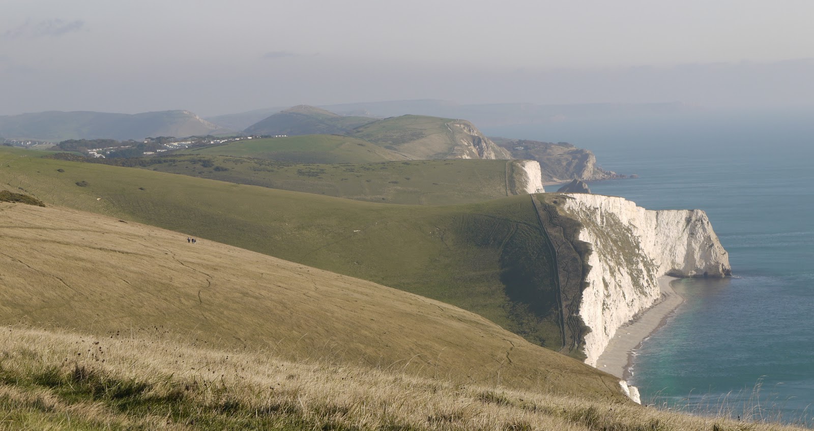
Looking towards Redcliff Point

Our goal for the year is now in sight: Weymouth. We took the train from Poole to Weymouth and then a taxi out to Osmington Mills to pick up where we left off two weeks ago. The route initially goes inland, but soon you take a left to head parallel with the coast.

We skirted route a large sort of holiday camp for kids and regained the coast path above a long shingle beach, unnamed on the OS map, with Redcliff Point at the end.


As we approached the point the path goes over a grassy area, but is forced inland a bit by erosion of the cliff edge, which becomes more and more evident as the Point gets nearer. Looking further inland, there is a view of the Osmington White Horse. This was sculpted into the limestone hillside in 1808 and depicts King George III. There are lots of white horses, but this one is apparently unique in having a rider. George of course played a large part in establishing Weymouth as a seaside resort. I should really have used a more powerful zoom lens, but we were by now walking into a very strong headwind.


You descend to skirt Bowleaze Cove with the massive white Riviera Hotel (no longer operating, but perhaps being restored), an amusement park and a holiday park in close proximity. This gives way to a grassy cliff below a row of expensive-looking houses, until you reach sea level and the wide concrete walkway which speeds you along at the back of the shingle beach, with a sea wall behind.


I had intended to drop in to see the RSPB reserve at Lodmoor while we were passing, but I hadn't understood from the map that once on the walkway you can't get off until you are some way past it. I contented myself with a photo (the structure on the right is a hide) and a plan for another day trip especially for the purpose.


A little further on there were a number of fine beach huts. One set were in a cast iron structure and another in this imposing terrace. The beach hut evolved from the early wheeled bathing machines used by pioneers of sea bathing, like George III.


Soon you are on the Esplanade and you pass the wonderful Jubilee Clock, erected to mark Queen Victoria's diamond Jubilee in 1887.


A little further on there is the celebrated equestrian statue of George III (again) - Victoria's grandfather. It was erected in 1809 to commemorate his diamond jubilee (he came to the throne in 1760). The statue has only been painted since 1949.


At the end of the Esplanade we walked up beside the quayside, past the Customs House and paused for lunch at the Ship Inn. Suitably restored, we crossed the swing bridge and enjoyed the peaceful view of the harbour.


The path then follows the other bank of the river and climbs up to the Nothe fort - a route we followed when we had a lovely day trip to Weymouth earlier in the year. At the top of the stairs from the quayside, there was a great view through the masts of some ships to the Esplanade with its Georgian and Victorian terraces.


You pass through Nothe Gardens and descend behind a housing estate to get a view of the fort, with White Nothe on the coast behind.


A bit further on you pass the sad remains of Sandsfoot Castle, another of those castles that Henry VIII built in 1539.


The final section followed the Rodwell Trail down to Ferry Bridge, the point at which the long causeway to Portland starts. The Trail was very straight and had a sort of embankment on each side. We must have been getting tired by now, because it was only as we were chatting to the taxi driver on the way back to Weymouth station that we realised it was the route of a disused railway.

Conditions: cloudy, sunny intervals, about 12 degrees, extremely strong south west wind, muddy underfoot in places.

Distance: 7.5 miles, all of which, at last, were forwards on the Coast Path. Distance covered now 42 miles.

Map: Explorer OL15 (Purbeck and South Dorset)

Rating: three and a half stars.

Sunday, 13 November 2011

Winchcombe to Hawling (Windrush Way 1)

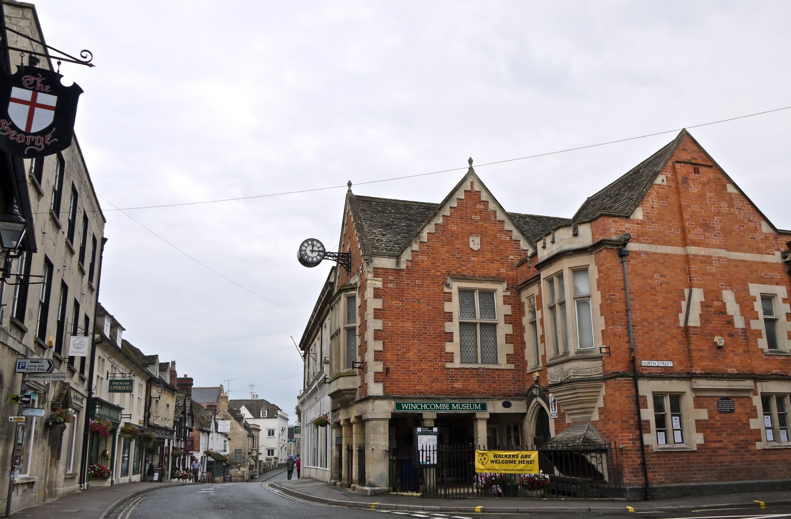
Winchcombe

Last month we completed the Cotswold Way with Merv and Pud. After some research and discussion, we decided to do the Oxfordshire Way next. We are all really looking forward to this, but it struck me that it would nice to join it up to the Cotswold Way - and that this could readily be done by walking from Winchcombe to Bourton-on-the-Water, where the Oxfordshire Way starts. We studied the map and saw that we could leave Winchcombe on either the Wardens Way or the Windrush Way. We decided on the latter, as offering a more lowland route.

The great discovery, made as I started writing this post, is that the Windrush Way is a short self-contained 14 mile walk which simply connects Winchcombe and Bourton. How neat is that?

We set off from the centre of Winchcombe, avoiding the Rememberance Day ceremony, and headed across fields soon to pass close by Sudeley Castle. It looked a lot less perfect from close up (I took a nice photo from a distance when we left Winchcombe on a different angle during the Hailes Abbey to Cleeve Hill leg of the Cotswold Way).


After leaving the surrounding parkland, you pick up a track which meanders through a wide valley bottom, with an imposing ridge to the left. As it started to climb, we looked back at the route of the Cotswold Way climbing towards Belas Knap. We were glad today's walk was less demanding.


Further up the track, we paused again to look back towards Winchombe: Sudeley castle is in the centre, and the town and church tower are to the left.


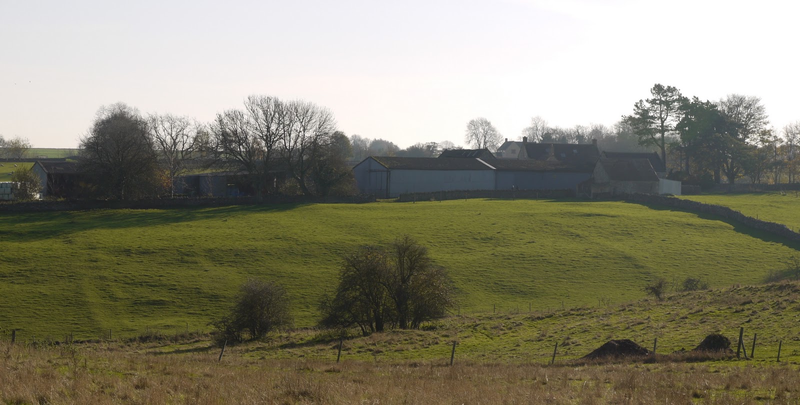
We passed the wonderfully-situated Spoonley Farm and emerged onto the Hawling-Winchcombe road, which we followed for a while.

We took a right to head south towards Hawling and noticed a clear change in the countryside. Now it was more like downland, with several narrow V-shaped valleys heading to the east.


We turned east  just before Hawling and could see the site of the medieval village of Hawling marked on the map: the line of the former streets is clearly visible. (Well, it was once Merv pointed it out.)


We ended the walk near Hawling Lodge, but not before we had spotted a fairy ring.


Conditions: mild, sunny - rather wonderful for the time of year.

Distance: 6.5 miles.

Map: Explorer OL45 (The Cotswolds).

Rating: four stars. Wide open spaces. Still the Cotswolds, but very different from the Cotswold escarpment.

Sightings

Still a few butterflies about: we saw a Red Admiral and a Peacock.

Sunday, 6 November 2011

White Nothe to Osmington Mills (SW Coast Path 12)

Looking back from the start

After a gap of six weeks or so, including a break for a holiday in Arezzo, we resumed the SW Coast Path. We decided to abandon our established practice of doing a circular walk in favour of a there-and-back approach. In fact, the only realistic access point was at the end, Osmington Mills, so we did a back-and-there walk. I will just describe the return section.

We picked up the walk about half a mile short of White Nothe (nose) and followed the gently climbing cliff-top path until we reached it. There is not much there: an odd brick structure which may have been a look-out and a terrace of coastguards cottages. It seems to be at about 170m and there are fine views towards the west. Ringstead is in the foreground, with Weymouth beyond and Portland to the left.


We walked down towards Ringstead enjoying a more elaborate view of Ringstead Bay. The most striking thing is how the coast changes here: the limestone cliffs we have been walking up and down for some time have ended and a new type of terrain awaits.


We passed the chimneys of Holworth House hidden in the trees, a little wooden church dating from 1926 and then Burning Cliff. Burning Cliff is apparently so named because the rapid oxidization of iron pyrites caused the bituminous oil shale to spontaneously ignite in 1826 and burn for a year. As we left the village, with its curious straggling mixture of a caravan park and pleasant detached houses, we saw this entertaining sign.


A little further on, we left the path to briefly go down to the beach and enjoy a fine view back towards the imposing White Nothe.


A bit further on, Osmington Mills came into view.


We finished up where we had started at the car park in front of the Smuggler's Inn pub and admired the view towards Weymouth - the destination for our next walk. We then naturally returned to the pub for what turned out to be an excellent lunch.


Conditions: clear, sunny intervals, about 12 degrees, extremely strong north east wind, muddy underfoot in places.

Map: Explorer OL15 (Purbeck and South Dorset).

Distance: about 7 miles, of which 3.5 were forwards on the Coast Path. Distance covered now 34.5 miles.

Rating: three and a half stars.


Reflections

The circular walk model has served us well so far. We have made slow progress along the coast, but we have also enjoyed exploring the inland areas as well. However, we have decided that the next leg, to Weymouth, we will do as a simple linear walk. We plan to get a train from Poole to Weymouth and then a cab to Osmington and simply walk back to Weymouth - about 8 miles. Then we can have a nice boozy lunch to celebrate the achievement of this year's target and get the train back to Poole. 

As we are now 45 minutes or more by car from our base in Poole, and getting further each time, we conclude that getting a cab or bus back to the start will need to be the model for the rest of the Coast Path. We should at least make faster progress towards next year's target end point: Bridport and the Dorset-Devon border.


Butterfly of the day

We had glimpses of ten or a dozen Red Admirals during the walk, and finally one presented itself for a photograph.

Saturday, 8 October 2011

Mortimer (mystery walking)

St John's church, Mortimer

In May I did a Mystery Walk for the Ramblers around Beech Hill. This is part of a project in which members are asked to walk two miles of path in a given grid square and then rate the walk along a number of dimensions. The resulting data enables an overall assessment of the performance of local authorities. The first report is available on the Ramblers website and the headline message is quite encouraging. I naturally volunteered to do another and was assigned grid square SU6565, just north of Mortimer.

I started by walk in the car park in front of St John's church in Mortimer and headed north along teh side of the recreation ground, and then through woodland (which marked the start of the Mystery element) to reach Bridge's Farm.

After a short stretch of road, I continued northwards through Starvale Woods, already beginning to look autumnal as the bracken dies down.


This gives way to the quite similar Wokefield Common (in fact more woodland). At the edge of Burghfield Common, I turned back at an acute angle to emerge from the woods and walk along Lockram Rd.

Here I turned right and headed south across a series of ploughed fields in welcome open country, with a few gentle hills to provide variety.


Wokefield Park, an extensively modernised Georgian house, now a conference centre, provided a view to the east. At Wheat's Farm I turned west, back to the start.

I gave it the highest possible Mystery Walking ratings, as the signposting, waymarking and condition of the paths were all exemplary. Well done West Berkshire Council!

Conditions: cloudy, mild, 18 ish.

Distance: just over 4 miles.

Map: Explorer 159 (Reading and Pangbourne).

Rating: three stars.


Reflections

I was quite pleased with the ease with which I designed the route and then followed it in the map. My skills in these areas must finally be improving. I have had some practice on the South West Coast Path, although it must be acknowledged that the presence of the sea makes the whole thing so much easier.


Flower of the day

Not many flowers about of course, but this, I think, Oxeye Daisy caught my eye. I have sometimes had trouble getting a good photo of mainly white flowers, but this one came out quite well.

Tuesday, 4 October 2011

The Cotswold Way: A review

The Cotswold Way

The Cotswold Way runs for 102 miles from Chipping Camden to Bath. It was originally developed as a long-distance footpath in 1970, and was formally launched as a National Trail in 2007, with some changes to the route.

I have described our experiences of walking the Cotswold Way in a number of postings (listed below). It now seems time to stand back and offer some reflections. I will divide them into two broad categories: our experience of walking the Way and the route itself. Reviewing the route also identifies a number of places we would like to go back to and investigate further.


Our experience

We agreed that it had been a good idea! The things that the four of us liked were many and varied: wonderful views, friendly people (especially the guy who brought us tea near Birdlip), appreciating how the geography fits together, hospitable pubs, deepening our friendship, little villages, discovering new places on our own doorstep, not too many golf courses, good signposting, great fun, variety, catching up with each other's news, working out the ramifications of the two-car model, learning about butterflies, learning about geology, the miraculous weather, finding that we were all up to it, taking photos, the way it managed to be in country right to the end, how we got fitter and increased our expectations of what we could do.

It was a good move to go from Chipping Camden to Bath. It felt a better place to end up.

We all felt our guide book had been a great help. It took some getting used to, but once mastered was invaluable. The Cotswold Way by Tricia and Bob Hayne (Trailblazer Publications, 2009).


The route

The route follows the edge of the Cotswold escarpment virtually all the way, so there was a long series of fantastic views off to our right. Some personal highlights were views from Wistley Hill, Crickley Hill, Ring Hill / Haresfield Hill and Cam Long Down. (These and other places mentioned can all be located using the search facility above.)

We also passed through many lovely towns and villages, notably Broadway, Painswick, Winchcombe, Wotton-under-Edge and Stanton.

We saw some lovely churches, of which All Saints at Selsley was perhaps our favourite for its Morris and Co stained glass. Hailes Abbey and its nearby church were also very special.

Other especially interesting buildings and structures were: Broadway Tower, the Tyndale Monument and the Market House at Dursley.

Throughout there was a great sense of history: from stone age barrows, to iron age hill forts and civil war and later battles.

And finally, there were many nice pubs, of which the Mount at Stanton was a particular favourite.


Places to go back to and explore properly

Snowshill Manor
Stanway House
Sudeley Castle
Painswick Rococo Garden
Dyrham Park
Beckford's Tower


 Stages

1 Chipping Camden to Broadway Tower

2 Broadway Tower to Stanton

3 Stanford to Hailes Abbey

4 Hailes Abbey to Cleeve Hill

5 Cleeve Hill to Seven Springs

6 Seven Springs to Birdlip

7 Birdlip to Painswick

8 Painswick to Randwick 

9 Randwick to Coaley Peak

10 Coaley Peak to Wotton-under-Edge

11 Wotton-under-Edge to Hawkesbury Upton

12 Hawkesbury Upton to Tormarton

13 Tormarton to Cold Ashton

14 Cold Ashton to Bath

Saturday, 1 October 2011

Cold Ashton to Bath (Cotswold Way 14 - and last)

Looking back towards Cold Ashton

We started the Cotswold Way in April last year, and today we finally embarked on the last leg. We picked up the route at Cold Ashton and headed south west along a long through fields, slowly descending. After Liliput Farm we gradually climbed back up again to reach the site of the civil war battle of Lansdown, fought in July 1643. A series of plaques describe the evolution of the battle. It seems that, just as often happened in the American civil war, the two generals had been personal friends.

Near to one of the plaques was this stone image of a looting soldier, copied from a 17th century print. There are other similar images, which mark the battlefield way, beside the other plaques. Well done to Bath and North East Somerset Council.


A little further on was a monument to Sir Bevil Grenville.  It was erected in 1720. The forward-facing side of the monument is in poor condition, but it looks well from the side.


Sir Bevil was a royalist and the monument commemorates his heroism in the battle - in which he died - and that of his Cornish pikemen.  Apparently his men then refused to fight for any other officer and went home, carrying their leader's body.

A bit further on, at Hanging Hill, we started to get great views down towards Bristol to the west.


Now we skirted then crossed a golf course and then paused for a picnic lunch on a hillside overlooking Bath's northernmost suburb, Upper Weston. From here and for a while afterwards, as we followed the ridge towards Weston, Beckford's Tower could be seen on the opposite ridge.


It was was designed by Henry  Goodridge and completed in 1827 for William Beckford (1760-1844). He used the tower as both a library and a retreat, located at the end of pleasure gardens called Beckford's Ride which ran from his house in Lansdown Crescent. Beckford previously had built the massive gothic revival house of Fonthill (architect James Wyatt), whose enormous spire collapsed soon after it was completed. Beckford had, wisely as it turned out, already sold it by then.

The route now passed behind Bath Racecourse and we could at last discover the source of the loud tannoy announcements we had been hearing for some time. We went past the Racecourse on the way home and established that the event concerned Agility, but of what we could not discover.

We walked through Weston and made an unwelcome climb to reach Summerhill Road, for the final descent into Bath from Sion Hill. We skirted the Royal Victoria Park and walked beneath the Royal Cresent, where many people were sunbathing on the grass in the surprising October heat.


Finally, we reached the Abbey and the end of the walk. It was too crowded to take a photo of the Abbey to mark the occasion, so I am re-using this one from an excellent city walk we did there in December 2009.


Conditions: very hot, about 27 degrees. The hottest October day since records began 101 years ago.

Distance: 10 miles.

Map: Explorer 155 (Bristol and Bath.

Rating: four stars.

Wednesday, 28 September 2011

Cortona

The Porta Santa Maria

For today's outing we have come 30 km or so south east of Arezzo to visit Cortona, which has the distinction of being one of the oldest towns in Tuscany. It is also fully surrounded by walls which date back to the 4th and 3rd centuries BCE, the Etruscan period.

We parked outside the walls and entered the city through the Porta Santa Maria, but almost immediately looked left into via Jannelli, a street which contains a group of medieval houses - among the oldest in Italy apparently - with projecting upper storeys supported on wooden braces.


We carried on up the steep via Roma to reach the small piazza della Republica, dominated by the 13th century Palazzo Communale. The tower was added in the 16th century. It is still the civic offices.


We located the Tourist Office, at the back of the nearby Palazzo Casale, now the Museo dell'Accademia Etrusca, and set forth on the best approximation would could manage to a tour of the walls.

First stop was the Duomo, a 16th century reconstruction of an earlier romanesque church.


Opposite, the diocesan museum contained a wonderful Annunciation by Fra Angelico.

We now walked along inside the walls to reach the Porta Colonia and went to admire the view from the Piazza Mazzini, just outside the walls. Cortona is at 494m and we looked across to a higher round and down to the church of Santa Maria Nuova, it dates from 1554 and was designed by Giorgio Vasari, who has been a presence throughout this holiday.


After a steep climb, we reached the next gate, the Porta Montanina. The startling thing was that as we climbed the city seemed to fall away and we passed vineyards and small fields. We gradually understood that the circuit of walls contains both a tightly built up town and its immediate hinterland. A first!


We now followed the steps of the via San Croce to climb up to the convent church of Santa Margherita.


We had seen no-one since we left Piazza Mazzini, but in front of the church there was a coach party. We did then see one or two others who had ventured forth from the centre of Cortona, but most people's experience will be of Cortona as a pleasant, typical Tuscan hill town. This is a shame when it is perhaps unique. The church is late 19th century.


Now came the final ascent - to the remains of the Medici fortress. Less well preserved than that in Arezzo, it was still a reasonably impressive sight. You could just make out Lake Trasimeno from the viewpoint at one of the corner bastions, but it was too hazy to see clearly.


We now began the long descent. First back to Santa Margarita and down the long via crucis (way of the cross) which was laid out in the late 19th century with futurist mosaics depicting the passion of Christ.

At the bottom, the path turns right to follow the long south east flank of the walls. This is one place where you can actually walk on the walls rather than beside them. The views over the plain below were very hazy.


At the bottom, we joined Via Nationale which leads back to Piazza della Republica. This has the distinction of being the only level street in the whole town. Alleys in the form of steep stairways lead off from it in both directions, up and down. This is the well-named Vicolo del Precipizio - Precipice Alley.


Conditions: 28 degrees, sunny.

Distance: 4 miles or so.

Rating: four and half stars.


Reflections

We could not help noticing the large number of American tourists in Cortona, especially in the area around the Piazza della Republica. They seemed to us to be like the parties you sometimes see off-loaded from cruise ships, wandering around seeming and sounding rather lost. We spent some time pondering what it was all about. Then we remembered the book by the American author Francis Mayes called Under the Tuscan Sun. In it she describes how, after her divorce, she buys a derelict house near Cortona and does it up. Later came Bella Tuscany, A Tuscan life, Every day in Tuscany and others. Apparently she is very popular in America.