
The East Lyn River
Today Jim and Em are taking us on a walk to see Watersmeet. We walked down from Lynton to reach Lynmouth and our first sight on this trip of the East Lyn River. This was famously the location of the devastating 1952 flood which resulted in 32 lives lost. A substantial programme of remedial works successfully prevented a repeat.
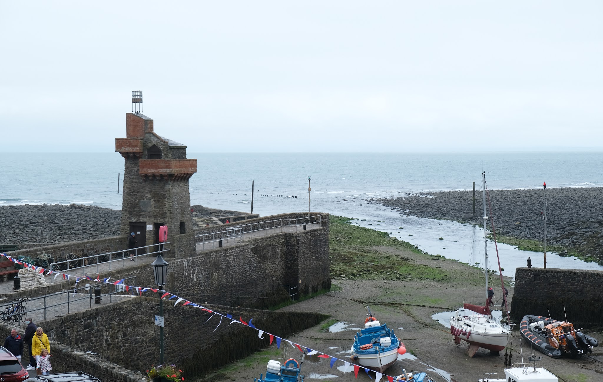
We passed the harbour with its delightful Rhenish tower (c 1860 by one General Rawdon), rebuilt after the 1952 flood. It is a pity the tide was out.
We continued along the right bank of the river and then cross to the left where we had a nice view of the church of St John the Baptist (1869, with later additions in 1908 and 1921).

Soon we saw this delightful creature climbing up the right bank ...

... while on the left we spotted a new horror: artificial hedge! It looked truly awful. I couldn't bring myself to take a picture.
Soon we left Lynton behind and crossed the rather lovely bridge to enter the woodland.

We followed a climbing path through the woods with the pretty river on our left. Quite soon we started to spot Grey Wagtails with their characteristic nodding (or perhaps I should say wagging) behaviour.

As we got nearer to Watersmeet the river became more rock-strewn.

Watersmeet marks the joining of the East Lyn and Hoar Oak rivers. The house usually provides a cafe and loo, but sadly not today.

We headed back along the opposite - and rather quieter - bank, admiring another shapely bridge.

Further along, these trees stood out along the hillside ...

... and a little further on this fallen tree had been embellished by banging coins into the wood. I would love to know whose idea it was and what was its purpose.

We carried on back to the start. My arthritic knee was beginning to play up so we thought about taking the the funicular up to Lynton. When we got to the entry point we quickly realised that this wasn't a viable option as there was a long queue ahead of us. I gritted my teeth and plodded slowly up the hill.
Conditions: grey, but mild.
Map: OL9 (Exmoor).
Distance: about six miles in all, including the descent from and climb to our base in Lynton.
Rating: four stars. Delightful.
No comments:
Post a Comment