Friday, 31 July 2020

Minterne Gardens

St Andrew's church

On our  way back from Sherborne Castle we decided to stop of at Minterne House and Gardens. It was somewhere we had passed on an excellent circular walk from Cerne Abbas.
 
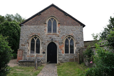
We parked opposite the estate church of St Andrew. It dates from the 15th century, with rebuilding/restoration in the mid and late 19th century. (This is from the latest edition of Pevsner, which rather contradicts the 1972 edition I used to rely on.)
 
The house was rebuilt in 1904-6 in an idiosyncratic but effective style. It is the third house on the site: the  second was found to have dry rot, rats and drainage problems which led to it being demolished.
 
 
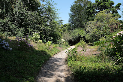
We then headed along a path into the gardens ... 
... which we were surprised and delighted to find were presented as Minterne Himalayan Gardens. There were some delightful trees, especially this one with apparently two different flowers.

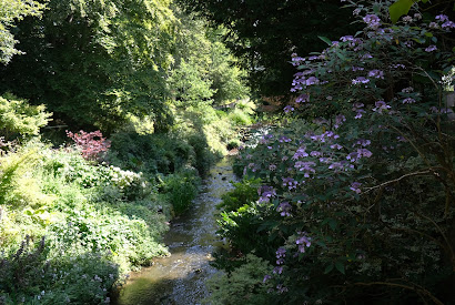
The path headed downhill along a narrow valley. At the bottom of the valley, there is a lowest of a series of pools which have been formed in the  River Cerne.
We ambled our way uphill, passing this beautifully shaped tree ...
 
... and this delightful bridge. It was a shame about the algae.
 

At the top we had a nice view of the lake which is at the lowest point in the site.


Conditions: mild and sunny.

Map: Explorer 117 (Cerne Abbas & Bere Regis)

Rating: Three stars.

Sherborne Castle

Sherborne Castle

We had a very interesting walk around the town of Sherborne a couple of years ago, but we didn't have time to see the castle. As we are currently enjoying a short holiday in Poole, and
it was time to rectify that omission.

We managed to arrive quite early and there were only about ten cars in the parking area (the interior of the castle is closed and one-way waking routes are in operation, which might have dented interest). The first sight was inevitably the castle, which faces on to the car park. As can be seen above, it is a rather unlovely structure.

There are actually two castles in Sherborne. The Old Castle was built in the early 12th century by Bishop Roger of Salisbury as a fortified palace and badly damaged during the Civil War. The New Castle was built nearby by Sir Walter Raleigh. Raleigh rented (and later bought) the Old Castle from Queen Elizabeth and planned to live there, until he decided he needed to build a new one. It was built in 1594 and was originally a simple rectangle according to Pevsner. The corner turrets, of which there are four, two at the front and two at the rear, were added by Sir John Digby in 1617, some time after Raleigh's downfall. The Wingfield Digby family own the house to this day.
 
We headed round to the right side of the castle, where the impact of the turrets is more obvious.

We then headed round the back, where there is a view across Capability Brown's beautiful lake, to part of

the Old Castle.
Continuing on the same line we came to the rather lovely Orangery.
We now left the castle buildings and followed the edge of the lake, passing the former stables on the left, to reach a delightful artificial stream which feeds into the lake.
Further on, after walking along beside the wall enclosing the Old Castle (looked after by English Heritage), we came to a gap which allowed a view of the remaining ruins of the castle.
  
We continued along this route until we reached the farthest point of the Castle grounds. We then headed back on a different path, passing this splendid Folly, built by a local builder in 1756.
Eventually, there was a nice viewpoint across the lake towards the back of the Castle.

Conditions: hot and sunny.

Rating: four stars. Delightful grounds, but the Castle was a bit of a disappointment. According to Pevsner we didn't miss much as a result of not being able to go in.

Thursday, 30 July 2020

Tarrant Gunville and Chettle

Chettle House

We left Tarrant Gunville passing these delightful cottages ...
... and continued via School lane following a path which then led us along the edge of Eastbury Park. There was a lovely avenue of beech trees parallel with the edge. They were difficult to photograph into the sun - this was my best effort.
We followed a green lane with a large field beside it where there were a series of mysterious large hummocks - round barrows.
We followed a field edge and then went through woodland to emerge in a large field, by a long barrow, and turned right to walk through along the field edge and then through Little Wood. A right turn took past fields and some radio masts and we headed north east towards Chettle. This section was trying as the route past Ninety Plantation had been ploughed up and it was difficult to find the continuation of the path on the far side of the next field. A farmer in his tractor put us straight and we passed through a stand of trees expecting to cross a field of rapeseed in a diagonal line. No chance, there was no suggestion of a path, so we had to follow the field edge. It was noticeable how many white butterflies were attracted by this crop.

Now we were back on track and soon reached Chettle House where there was a first of all a view through trees of one side of this beautiful Queen Anne house.
Pevsner describes it as "the plum among Dorset houses of the early 18th century, even nationally outstanding." It was built for George Chafin who held the post of Ranger of Cranborne Chase. The architect was Thomas Archer.

We headed down to the pretty Victorian church ...

... and headed towards the village, which we passed behind as we crossed a large field. We noticed the rather pretty octagonal building on the right, but could not decide its purpose.
We had some uncertainty with the route after this, but eventually worked out how to get back to the large field with the long barrow and then retraced the route back to the village.

Conditions: sunny and warm.

From: 50 walks in Dorset (AA).

Map: Explorer 118 (Shaftesbury and Cranborne Chase).

Distance: 5 miles.

Rating: four stars, mainly for Chettle House.

Wednesday, 29 July 2020

Lulworth Castle


Lulworth Castle

We have passed Lulworth Castle many times on the way to Lulworth Cove and other parts of the Purbeck coast, but until today had never visited it. Nowadays you have to pre-book. We parked in the car park and walked through the attractive stable block ...


... to quickly emerge in front of the wonderful castle. This is the main entrance.


The castle was built in about 1608 by Thomas Howard, 3rd Viscount Bindon, whose main seat was at Bindon Abbey. Lulworth was regarded as a Lodge, a compact house for occasional use.

The surprising discovery was that the castle was burned down in 1929, probably as the result of an electrical fault, and was left as a shell for the next 50 years. A major campaign in the 1980s and 1990s, supported by English Heritage, led to the exterior being restored to the splendid state it is in now.

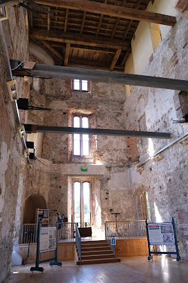
Unfortunately, reinstating the interior was found to be impracticable and it remains a shell.


Isolated examples, like this fireplace and door, provide a slight sense of what it might once have been like.


When we finished our internal tour we headed out to see the castle chapel, a remarkable neo-classical building built in 1786-7. It was the first free-standing Catholic church to be built since the Reformation according to Pevsner. George III allegedly only gave permission on the basis that it should not look like a church.


Beyond the chapel in one direction is Lulworth Castle House, a neo-classical house of 1975, carefully hidden from view. It is possible to get an overview of the park (the estate is 20 square miles in all).


A closer examination of the far side of the park reveals the grand North Lodges of 1875. A bigger zoom lens would have revealed more.


Returning to the opposite side of the Castle, there is the church of St Andrew of 1863-4. The imposing tower is 15th century.


Conditions: bright and sunny.

Rating: four stars. Rather wonderful. I wish we had seen it sooner.
Tuesday, 28 July 2020

Avebury, Silbury Hill and the Kennetts


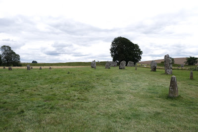
I met up with my friend Mervyn for a socially distant walk starting at Overton Hill on the A4 west of Marlborough. We headed past some travellers' vehicles and continued along a grassy path heading north for about a mile. The rather lovely view back and to the west is shown above.

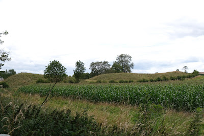
We turned left onto the Wessex Ridgeway heading towards Avebury for about another mile. We knew we were almost there when we reached these earthworks.

We continued towards the site passing this rather wonderful thatched house with an out-building attached.


This was quickly followed by an attractive former United Reformed Church chapel, acquired by the National Trust in 2017.


This wasn't the day to explore Avebury, but here is a sample of the standing stones. I realise that I have now walked through Avebury three times, but never done a comprehensive walk around the site. One for the to do list!

We left Avebury in the direction of Silbury Hill, which became clear once we passed a line of trees. From English Heritage: "The largest artificial mound in Europe, mysterious Silbury Hill compares in height and volume to the roughly contemporary Egyptian pyramids. Probably completed in around 2400 BC, it apparently contains no burial. Though clearly important in itself, its purpose and significance remain unknown."


We crossed the A4 and headed up a grassy path to reach West Kennett Long Barrow. It is, according to English Heritage, "one of the largest, most impressive and most accessible Neolithic chambered tombs in Britain. Built in around 3650 BC, it was used for a short time as a burial chamber, nearly 50 people being buried here before the chambers were blocked.


We retraced our steps towards the A4 and were delighted by this view of Silbury Hill, which gives a clearer sense of its place in the landscape.


We turned right before teh road and followed field paths towards the delightful village of East Kennett. We missed a turning somewhere on the way, but still managed to reach the village centre. We doubled back to see the village church, Christ Church of 1864.


There were some attractive houses, but pride of place goes to the late Georgian Manor House. The parts to the left and right of the main building are later additions. We quite liked the chamfered corners.


Conditions: cool and rather grey at first, becoming brighter.

From: Walking in the North Wessex Downs (Cicerone).

Map: Explorer 157 (Marlborough & Savernake Forest).

Distance: 7 miles.

Rating: four stars.

Saturday, 25 July 2020

Ardington and West and East Hendred


Ardington Hall

Ardington House (1720) was the architectural highlight of this walk, but was studiously saved for the last leg. I thought I would put it up front. We started our walk opposite the busy village shop and turned into Church Road to then go this curious arch and follow a narrow track towards West Hendred.  


You soon reach a track heading east and follow this, passing some barns, to reach West Hendred and Holy Trinity church. It was rebuilt in the 14th century, repaired in the 18th century and restored in 1929.


Another field edge path led us to the largest and most interesting of the three villages, East Hendred. As we approached the village we crossed a stream and were startled by this knitted figure.


Entering the village proper we passed this lovely group of houses ...


... and further along the road, past a pub with some knitted figures, we passed Champs Chapel. It is now a local village museum housed in the former Chapel of Jesus of Bethlehem, built in 1453 by Carthusian monks.


Turning right into the main street we saw more knitted figures and concluded that it must be the work of a knitting group, but it seems one lady is responsible for these delightful and witty figures scattered through the village.


Here is another group along the top of a fence.


At the end of the high street is the Tudor village shop ...


... and further along is this lovely pump with more figures and Hendred House, seat of the Eyston family, in the background.


We turned right here to have a glance at the 13th century church of St Augustine of Canterbury ...


... and then followed a series of grassy paths round to the east of the village which brought us to the path back to Ardington, on a route parallel to the one we came out on. Unfortunately, the path was closed and fenced off so we followed a detour which in the end led us to the path out.

Reaching Ardington we followed a route around the Hall, first seeing this nice little structure in the grounds, before seeing the main facade of the house.


We concluded the walk by passing Holy Trinity church (1200, but restored and enlarged in 1887) to return to our car.


Unlike our last walk, Whiteshard Bottom, when we saw 15 butterfly species, on this walk we saw only 6. It is tempting to think that the agricultural land here was being farmed with less concern for wildlife as there were noticeably fewer wildflowers, hedgerows and set-asides.

Conditions: grey but mild.

From: Walking in the North Wessex Downs (Cicerone).

Map: Explorer 170 (Abingdon, Wantage & Vale of the White House).

Distance: 6 miles.

Rating: three stars.