For our second walk near Grasse we followed another path from the RandOxygene guidebook: a circular one from Le Bar sur Loup to Gourdon (where we were yesterday). The plan is that you walk to a point below Gourdon then climb up to the village, have a look around and then climb back down to the circular route and continue on back to the beginning. Since we saw Goudon yesterday, we just settled for a circular walk.
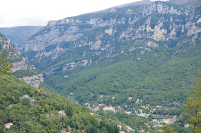
Bar sur Loup is a very pleasant village, a bit larger than Gourdon. The main square faces the church, with a belvedere behind it. The picture above was taken from the belevedere - you can see the source of the Loup in the middle of the picture about a third of the way across from the left.
The wonderful statue is of the Comte de Bar, who was born in Bar and later fought in the American War of Independence.
The walk starts from the cemetery and you walk gently uphill passing the Chapel of St Claude, a 16th century crypt restored in the 20th century.
You continue uphill to join a long-distance path – the GR 51. Gourdon can just be made out on its hilltop, almost lost in the low cloud.
You continue uphill to join a long-distance path – the GR 51. Gourdon can just be made out on its hilltop, almost lost in the low cloud.
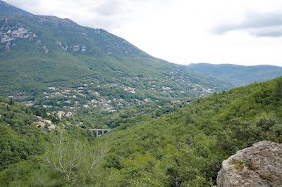
Emerging from the woodland, there is fine view down to the valley below. The stone columns in the valley bottom are all that remains of the Pont du Loup, a railway bridge built in 1880 and blown up during the Provence landings of 1944.
Soon there is a slightly better view of Gourdon. The building on the right is the well named Eagle's Nest.
Then there is a mysterious cellar with two entrances and stone walls. I can't find out anything about it.
At the point at which the path up to Gourdon begins, we begin a long descent, passing a number of examples of beautiful autumn colours.
This is quite arduous and slippery, but eventually we emerge onto a road, which was apparently once the route of a railway line, presumably the one which went across the Pont du Loup. We were getting a bit tired by now and foolishly turned the wrong way along this road. It was easy walking along the flat surface and so it didn't do us too much hard. We also got an unexpected close up view of the river Loup emerging from the mountain: the Saut du Loup.
Continuing along the road in the right direction now and crossed the bridge we saw from afar earlier in the walk.
Soon we reached the outskirts of Bar and not long after that we were back at the car park by the church.
Distance: officially 6.5 km
Source:
RandOxygene Guide for the coastal area (Pays cotier) of the Department
of the Alpes Maritimes. Free from the Tourist Office in Grasse. Two
other guides are available for other parts of the Department.
Rating: four stars.
Change of level: officially +520m and -520m
Time taken: officially 3.5 hours.
Rating: four stars.


No comments:
Post a Comment