
Rame Head: St Michael's chapel
We arrived at Rame Head in cloud yesterday afternoon, but today is much brighter. We head west across grassy cliffs round Queener Point towards Polhawn where we pass above Polhawn Fort, now improbably a romantic wedding venue. It was originally one of Palmerston's many defensive forts and dates from 1867. This is the view looking west.

The mid-cliff path leads ahead and gradually rises to a bench near the road. The view back includes on the right the Chapel of St Michael, then the aerials of the Coastwatch station and on the left the delicate tower of Rame church. Polhawn Fort is visible just above and to the right of the cove.

The next section was a surprise. What had looked from a distance like rocky outcrops on the hillside, were revealed to be single story houses: some little more than large garden sheds, others more substantial. The path snaked up and down through a number of these before coming up to the road. We could see how it would be nice to own one, but we were puzzled that the local authority had ever allowed them to be built.
We walked along the road for a while, a stretch principally enlivened by this spectacular caterpillar.

It turns out to be an Elephant Hawk Moth. The caterpillar is supposed to resemble an elephant's trunk.
A bit further on, past Freathy, it was possible to go out onto the cliff for a short way and enjoy excellent views to the west, right round to the end of Looe Bay ...

... and to the east back to Rame Head. It was instructive to see how beautifully sandy the beach was along a large section of Whitsand Bay.

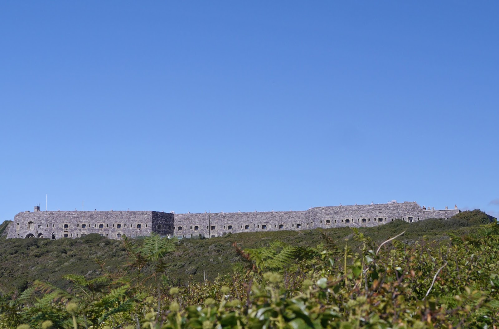
Shortly it was possible to follow a path parallel to the road for a while and once we returned to it the brooding presence of Tregantle Fort loomed above us. It is yet another fort constructed at the initiative of Lord Palmerston. It was completed in 1865 with barracks accommodation for 1,000 men and provision for 35 large guns. It now seems to be a firing range.
Happily the firing range was not in use and we able to walk through the site - much preferable to the alternative road route around the outside. We saw lots of Small Tortoiseshells on the wild Buddleia beside the path.
You emerge from the main shooting area into fields with a fine view inland. The area of water in the photo is the St Germans or Lynher River.

A view back east taken a little further on demonstrates how rural and unspoilt this section of coast can look.

After a few more fields, we emerge above Portwrinkle. The massive building is the Whitsand Bay Hotel. The hotel's website reveals its surprising history: it was originally built 6 miles away in Torpoint in 1871 by the 3rd Baron Graves and was known as Thanckes House. In 1909 Thanckes House was pulled down and re-erected stone by stone to open as a hotel in 1910.

As a footnote to this post here are two pictures I took this morning when we parked at Portwrinkle. The first shows the view back to Rame Head under a lovely sky.

The second, more arty, effort shows a ship on the horizon with the Eddystone Lighthouse to its left. The stump of Smeaton's Lighthouse, now rebuilt on Plymouth Hoe, is just visible.

Conditions: warm, with the cloud clearing to give a clear afternoon.
Distance: 6.8 miles.
Map: Explorer 108 (Lower Tamar Valley and Plymouth).
Rating: Four stars.
No comments:
Post a Comment