
The mouth of the Yealm
Having got to Noss Mayo last night, we resumed our walk on the other bank of the Yealm, at the edge of Wembury. I had noticed that the road down towards the sea passed some Almshouses, and as they are a special interest of mine I proposed that we should begin our walk there.
The Hele almshouses date from 1682. They consist of a terrace of six houses with a chapel in the centre, marked by the higher gable. They were founded by Sir Warwick Hele, the then High Sheriff of Devon. They make a typically picturesque group.

A bit further on we found the path down to the sea and followed a wide hedged track for half a mile or so. There were many butterflies in the hedgerow and just as we emerged to get our first view of the Yealm in sunshine, I had the opportunity to take a quick snap of this lovely Wall.

We now joined the Coast Path and headed along a level track near the top of a slope leading down to the sea. The landward side especially was covered in flowers - it was like walking through a wild garden.
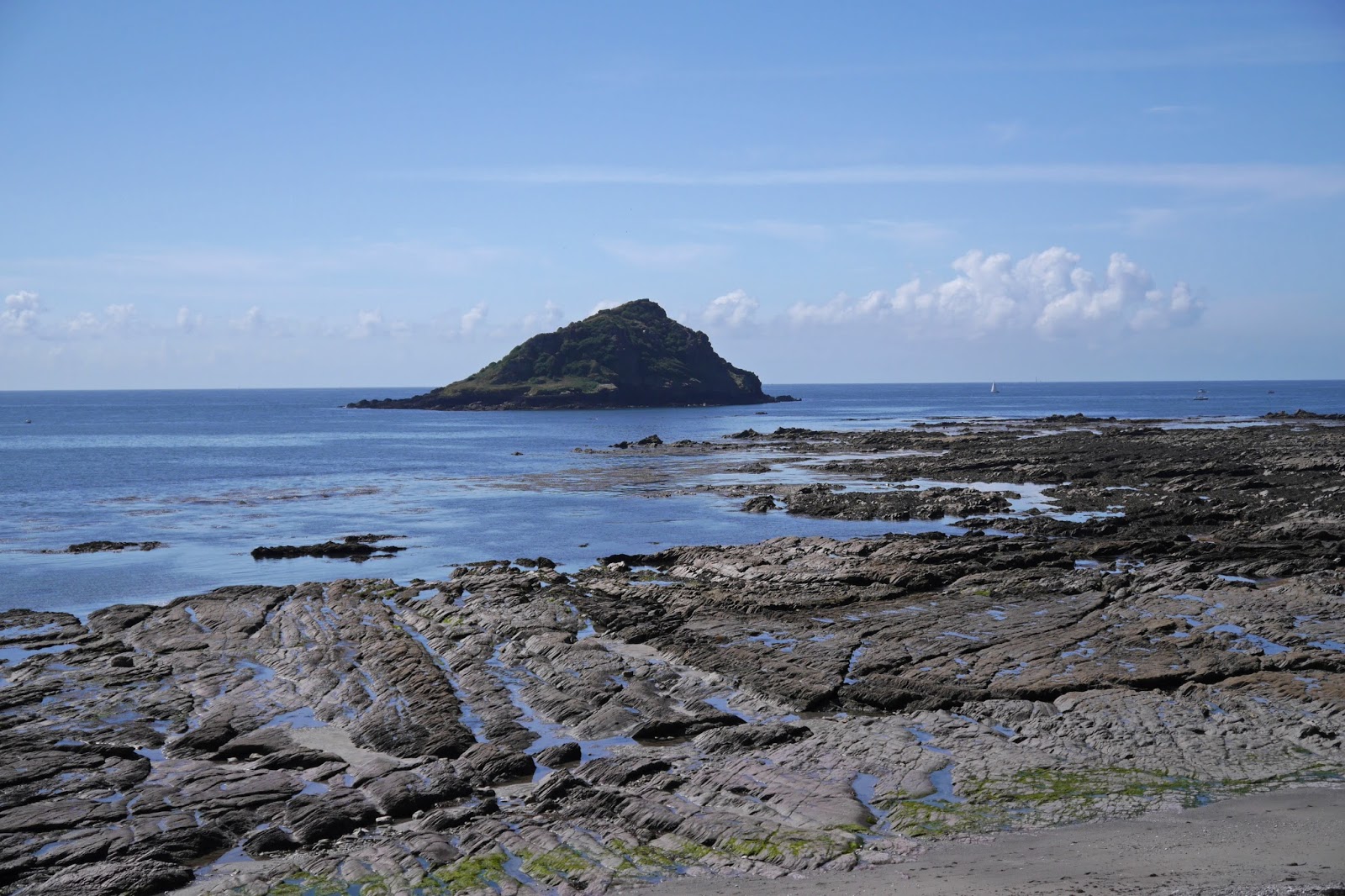
Once on the grassy headland, first viewed in the mist and rain last night, the coast stretched away invitingly. The Great Mew Stone was now on the left and Rame Head could be clearly seen in the distance beyond.

We soon reached Wembury, passing the church of St Werburgh in its remarkable location so close to the sea. The handsome tower dates from the 15th century, although it and the whole south side of the church have been pebble-dashed, presumably to protect the stone underneath from the elements.

The path then goes round the back of the attractive beach, where any amount of rock pools demand exploration. The rocks extend out in increasingly flat shelves towards the Great Mew Stone.
The next milestone is Heybrook Bay, where we resisted a detour to that rare thing, a pub close to the Coast Path. As we turned the corner, a new vista opened up across Plymouth Sound.

At first we couldn't quite work out what we were seeing in the centre of the Sound, having stupidly left the relevant map behind. We subsequently established that the mystery element was the Plymouth Breakwater, curved in shape with a fort standing just behind it. There is a lighthouse at one end and a beacon at the other. Directly behind, on the far side of the Sound, is Picklecombe Fort.

The breakwater was constructed in 1812 as a safe harbour for the English fleet during the Napoleonic wars. The Breakwater Fort dates from 1860 and was thus almost contemporary with the Palmerston Forts near Portsmouth which I passed on the last leg of the Wayfarers Walk.
The path climbed and soon offered a view of Drake's (or St Nicholas's as it says on the OS map) Island. Drake set out from here in 1577 to circumnavigate the world, returning in 1780. In 1583 he was made governor of the island which later fortified against possible Spanish attack. In the 16th century it was used as a prison and bigger guns were installed as part of the 19th century defences of the harbour.

We now passed the holiday centre at Crownhill Bay and the popular beach at next door Bovisand, climbed up behind Bovisand Fort and walked through a wooded area from which we had a clear view of Mount Batten - the small hill on the left with a fort on top.

The large grassy area in the photo is called Jennycliff and having walked along there - a delightful open area so near to the city - we somehow missed our route and walked beneath Fort Staddon, seen here from further down the hill.

This strange building, spectacularly ugly and not especially fort-like, is improbably now a leisure centre and country club. It dates from 1869 and was originally a gun battery.
Soon after this we reached Mount Batten, as already noted a bit of a misnomer. Its tower dates from about 1650 (this time the fear was war with the Dutch) and was still housing guns 70 years later. In the 19th century it was a lookout post.

Conditions: clear, sunny and warm
Distance: again somewhat over 9 miles, of which 8.5 were on the coast path. Just one more leg to do and we will have completed the coast of South Devon.
Map: OL 20 South Devon.
Rating: Four stars.
Butterflies
This was a very good day for butterflies: we saw 16 different species, more than a quarter of the UK total. Red Admiral, Peacock, Painted Lady, Small Tortoiseshell, Comma, Large White, Small White, Green Veined White, Common Blue, Holly Blue, Small Skipper, Meadow Brown, Gatekeeper, Speckled Wood, Small Copper, Wall.
No comments:
Post a Comment