Tuesday, 28 February 2012

Bull's Bushes Farm to Breach Farm Cottages (Wayfarer's Walk 7)

Snowdrops near Dummer

A lovely Sunday for a walk and today Ange joined me on the Wayfarer's Walk: we took two cars and did a linear walk for a change.

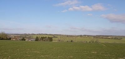
We started by walking across fields and then following the edge of South Wood to cross the busy A30 and pass through the edge of Peak Copse to reach the even busier M3. The snowdrops above were in a small copse just by the bridge over the motorway.

On the other side we followed the motorway for a short way then turned left on the road into the pretty village of Dummer. As we approached, we were struck by how many people were scattered across two large fields, one on either side of the road. We eventually realised that they were members of the Dummer Metal Detection Society - presumably the local farmer was having an open day for them.

At the south end of the village lies the 12th century church of All Saints.


As is normal, the most substantial old parts are the chancel and chancel arch, which date from about 1200 (Pevsner). In front of the chancel arch is a remarkable rood canopy dating from the 15th century. This picture is taken looking up at the ceiling (the canopy would have stood over the cross). The timber framed roof of the nave and the belfry are also 15th century


Other features of the church reflect the inevitable late Victorian restoration e.g. the rather nice glass in the east window by Kempe.

Next to the church is the large, but not beautiful Dummer House, in white stucco with a large pediment. Unusually Pevsner gives no date. And opposite the church is the imposing Victorian rectory.

We now headed on a zig-zagging southerly route along farm tracks through fields to pass Dummer Grange and then walk along its drive to reach the road where we shortly stopped - at Breach Farm Cottages.

Conditions: blue sky and sunshine

Forward distance: 5 miles; distance now traveled 26.5 miles.

Map: Explorer 144 (Basingstoke, Alton and Whitchurch)

Rating: three stars. Modest changes of level, farmland with no real views. Dummer made a nice focal point.


Reflections

Rather shockingly, I managed to leave my walking haversack at home: no camera, no binoculars, no water, no emergency knee bandage. What a muppet! Perhaps fortunately, there were not too many photo opportunities - the few pictures were taken on my iPhone, which at least confirms the value of having a proper camera! 

Friday, 24 February 2012

Warwick

The Westgate

We met up with our friends Sally and Malcolm for this city walk at a point equidistant between our respective homes. We started the walk - in less than ideal conditions, with cloud and rain - outside the imposing Westgate. This already existed in 1129 (Pevsner) and already had a chapel over it at this point. What you see today seems to be 14th century.

We went through the gate and doubled back to visit the wonderful Lord Leycester Hospital, which surely must be one the finest almshouses in the country.


It was founded in 1571 by Robert Dudley, Earl of Leicester, using premises of two Guilds of the town. The little chapel of St James over the Westgate (rebuilt1383) has a small but delightful stained glass window by William Morris.

You go through into a lovely courtyard. I was staggered to discover from Pevsner that the building on the left, the Master's Lodge, dates only from about 1850. Pevsner laments the "overdone" details, but we all found them rather charming.


The Hospital also includes two fine halls, one with the very interesting Museum of the Queen's Own Hussars, and a small millenium garden and the celebrated Master's Garden - closed of course until April.

The Hospital now houses seven ex-Servicemen, known as Brothers, and we rather had the impression that they ran the place as a sort of family business.  One handled reception duties in an exceptionally friendly way, one was in the museum. OK, one was practising the trumpet in the hall, so perhaps this theory doesn't quite hold up.

Across the street, you can see one of the boundaries of the great fire of 1694: the half-timbered houses on the right pre-date it, but the brick one on the left and the rest of the street were the result of subsequent rebuilding. We recently saw an even more comprehensive rebuilding after a fire of a similar period in Blandford Forum.


We now walked along High St and Jury St, mainly Georgian in character. So to the East Gate, which Pevsner tells us was built before 1426. The chapel was rebuilt in 1726 and is now part of the Girls' High School.


We carried on eastwards into Smith St. At the end of this street, which is notable now for some truly niche shops (vacuum cleaner spares, unpackaged tea), is St John's House, which dates from about 1626. It is now a museum.

At this point, we turned round and retraced our steps up Smith St. There is a nice group near the top of the street, with the Landor House of 1692 dominating.


Back into Jury St and left into Castle St for a quick peek at Warwick Castle.


Then back again and into Church St, where the massive tower of St Mary's stands proudly at the end, 174 ft high to the finials.


Inside the church is extraordinary. The tower, nave and aisles were destroyed in the great fire and were rebuilt to the designs of Sir William Wilson - completed in 1704. The windows are massive and the aisles are the same height as the nave, so the effect on entering is of a vast airy space.

The east end of the church survived the fire and at the end of the nave you immediately see the chancel, finished in 1392, with its unusual flying ribs in the roof.


Immediately to the right is the tiny Dean's chapel, with an extraordinary plaster ceiling.


And further to the right is the fabulous and celebrated Beauchamp Chapel: the chantry chapel of Richard Beauchamp, Earl of Warwick. It was begun in 1443. Fantastic tombs, decoration, stained glass.

Now, finally, to the Market Place, a large rather characterless space, dominated by the former Town Hall of 1670, now a museum (another museum!).


We repaired to the excellent Rose and Crown, more a restaurant than a pub, for an excellent and by now much-needed hot lunch.

Conditions: wet, cool.

Distance: about 2.5 miles.

Rating: four stars. Full of character and charm. Many interesting things to see, without even getting a proper look at the castle.

Monday, 20 February 2012

Deane Down Farm to Bull's Bushes Farm (Wayfarer's Walk 6)

Deane House

I picked up my route at Deane Down Farm, crossed a railway bridge and crossed a large field, with extremely clingy mud, to reach the hamlet of Deane. Deane Cottages presents an odd mixture of charming thatched ones and undistinguished brick ones, but soon you come to the impressive Deane House, with its park stretching out in front. Pevsner does not give much information, but dates the main block to the late 17th century.

I noticed a side turning with a church at the end and diverted to explore. The charming church of All Saints bears the date 1818 over the porch and struck me as rather lovely. Pevsner thinks it is the "most complete and successful early C19 Gothic church in the county".


Across the curiously busy B3400 and then the route heads off in a more easterly direction, along a hedged track.


This involves a slight climb, from 105m at the road up to 120 at the highest point. The Hannington TV and radio mast can still be clearly seen across the fields on the ridge in the distance.

The track meanders on between fields and under another railway line to reach a road at Bull's Bushes Copse. For the first time, the waymarked route diverged from the map to go round the outside of the Copse. I decided that I had had enough when I reached the farm.

I came back through the copse and took this photo on an angle which disguised the fact that it was actually a plantation, with the trees all in rows.


Conditions: some blue sky and sunshine, about 8 degrees.

Forward distance: 3.5 miles; distance now traveled 21.5 miles.

Map: Explorer 144 (Basingstoke, Alton and Whitchurch).

Rating: three stars. Modest changes of level, farmland with no real views. Thank goodness for Deane.


Sightings

There were plenty of snowdrops of course, but I was pleased to see these primulas - the first of the year.


Reflections

We saw the David Hockey exhibition, A bigger picture, at the Royal Academy the other day. It had set me thinking about the visual properties of trees and about the choices to be made about the point of view in taking a picture of a tree, a wood or a landscape. The photo of the copse was the first product of this reflection. I thought it worked quite well.

Thursday, 16 February 2012

West Bexington to Eype Mouth (SW Coast Path 18)

Looking west towards Golden Cap

Back in Dorset after a month's gap to resume the SWCP. The last leg (Langton Herring to West Bexington) ended with 2.5 miles along the back of Chesil Beach in a howling wind. Today we start with another 2 or 3 miles until we reach Hive Beach near Burton Bradstock. As the photo above shows, it is fairly unexciting initially - but the enticing prospect of Golden Cap, the highest point on the south coast, can be seen in the distance.

Some interest was provided by Bexington Nature Reserve (Dorset Wildlife Trust), a reedy, wetland. We saw quite a large number of colourful Shelducks here. Then the path leaves the beach and follows the same line across grassy fields behind a line of bushes.

After about 2 miles the path emerges onto a dune behind the beach and begins to climb: you can look down on the beach, gravelly at the back, but with reddish sand at the front.


After passing the first of several holiday-home camps, we descended to Hive Beach, with the famous Hive Beach cafe doing a roaring trade with all the half-term visitors.

We walked down to the shoreline to see and photograph the cliffs with their extraordinary striations. Clearly this marked a transition from the mainly flat coast we have seen since Portland to a new zone of red sandstone. Golden Cap, in the background, is getting closer.


We climbed up, and then walked along, Burton Cliff to descend again to Burton Freshwater, where the tiny and short-lived River Bride reaches the sea (the map shows its source only about three miles away). It is a significant point, because so as we can see, this is the first river we have crossed since we began the Coast Path in Poole, 70-odd miles away.

Burton Freshwater beach is extraordinary. There is a massive gravel slope at the back of the beach, apparently built by the Environment Agency specifically to keep the river flowing smoothly.


You are forced inland here to cross the river and then back along the other bank. It passes through a sort of canyon to reach the sea and it is a fine sight.


Freshwater Bay is dominated by a huge caravan site with a large array of mobile homes at the back of the beach. We spent a moment articulating the difference between mobile homes and caravans and concluded that mobile homes were the ones that weren't in fact mobile - moveable, perhaps.

Now we were really back to classic Coast Path walking. Up the cliff from Freshwater Bay, along a bit, then down a steep slope to nearly sea level, then up again. The crumbling, nearly vertical, East Cliff looks very dramatic.


Bridport was inland to the right and soon West Bay appeared.


Pevsner doesn't have much to say about it, but does reveal that the little harbour is entirely artificial and was first constructed in 1740-4 and was rebuilt in 1824. The fine twin piers are part of sea-defence project and channel the River Brit into the sea.

We had a fantastic fish lunch at the West Bay Hotel. It doesn't look much from the outside, but don't be put off.

We walked past the old Salt House, an early 18th century building once used for storing salt for the Newfoundland fishing trade.


We knew that fishing boats went from Poole to Newfoundland and sold their salted cod in Spain and Portugal on the way back - it was the basis of Poole's prosperity in the 18th century, as evidenced by the fine Georgian houses in the old town. Apparently, a similar trade was carried on from Bridport.

We now climbed the West cliff and soon found ourselves overlooking Eype Mouth where we had left our car. We got a taxi back to the start. I explained that we wanted to be picked up at "ipe" - but was gently corrected - the correct pronunciation is "eep".


Conditions: cloudy, sunny intervals.

Distance: about 7 miles. Distance covered now 77 miles.

Maps: Explorer OL15 (Purbeck and South Dorset) - now completed - and 116 (Lyme Regis and Bridport).

Rating: four stars. The first part was not that interesting, but the stages from Hive Beach were excellent.


Sightings

The most interesting sighting was a Billy Bragg. We knew that he lives somewhere near Burton Bradstock and we were pleased that our paths crossed on a clifftop walk.

Wednesday, 15 February 2012

Portsmouth

The Spinnaker Tower

We met our friends Viv and Giles for this city walk around Portsmouth. Giles had gone so far as to do a test-walk beforehand, which was way above the call of duty.

We started at the Spinnaker Tower and began by taking the lift to its various viewing platforms. The tower is 170m high and was originally conceived as a "Millenium" tower when funding was approved in 1995. It did not in fact open until 2005, but it does provide a striking landmark on the redeveloped waterfront.

Our first view from the viewing deck was over the historic dockyard, with HMS Warrior (launched 1860, Britain's first iron-hulled, armoured warship) in the foreground and new Type 45 destroyer in the background. The bluish tint is the effect of shooting through glass.


Below, is another view of the unknown destroyer leaving the harbour mouth.


We walked along the waterfront past an impressive array of bars and eateries and soon picked up the Millenium Trail, quickly encountering one of the former naval buildings that Portsmouth is famous for. This was the Vulcan Building, an elegantly simple Georgian construction, built in 1814 as a naval storehouse. It has a handsome slightly projecting pediment, a clock tower, and wings coming forward on either side. The right hand wing houses a small art gallery, the Aspex Gallery.


Soon we came to the curved waterway known as The Camber which houses the old harbour. The Bridge pub stands in splendid isolation.


We merged into Broad St and were delighted with this arch, with its painted capitals and precise location recorded in the arch.


We headed right to reach the Point, which is clearly the best place to view the Spinnaker Tower.


Next we walked along the picturesque West St ...


... to emerge by the Round Tower, one of a pair which faced each other across the harbour mouth. Pevsner notes that the ground storey probably dates from Henry VIII's reign.


We walked past further fortifications including the equally imaginatively named Square Tower, originally built in 1494,  to emerge, via an area of amusements and other traditional seaside stuff, onto Clarence Esplanade, laid out in 1847-51. We passed the small hoverport and walked as far as the Royal Naval War Memorial, 1920-4, designed by the Scottish architect Sir Robert Lorimer. The memorial is the handsome column in the photo; a Second World War memorial stands to the left.


We walked back along the Esplanade, this time noting a wonderful shelter ...


... and, turning our eyes inland, focused on the Royal Garrison church.


It was originally the church of the Hospital of St John and St Nicholas, founded in about 1212 to accommodate travellers and was under the control of Southwick Priory. After the dissolution of the monasteries it became a military store and then a residence, and was restored as a church by GE Street in 1866. The nave roof was destroyed by a wartime bomb. According to Pevsner, "both as a basically medieval building and as a piece of Street restoration the church is first-rate".

Now we headed towards the Cathedral. We admired this lovely group of 17th century houses with their Dutch gables ...


... and then entered the Cathedral from the north side, into the most modern part. The Cathedral dates from 1188, but the west end is 20th century and the west front was not completed until 1991. It seems to have echoes of French cathedrals such as that at Albi, while the towers resemble those of the Tower of London. The nave is light and spacious, although not very long, and has the feel of a Wren church.


The older parts of the church are the medieval choir and transepts, and the 17th century nave and main tower. So effectively there are two discrete sections of nave. It is all a bit of a hotch potch, but it sort of works.

Conditions: quite bright and sunny

Distance: About three miles

Rating: four stars. Full of interest. 


Reflections

One thing which makes these walks so much fun is that we usually develop a running joke. This time we had all just seen Steve McQueen's excellent, but in some ways gruelling, film Shame. In the film you do see a lot of that fine actor Michael Fassbender. Fassbender became the basis of today's running joke. I won't say more.

Saturday, 4 February 2012

North Oakley to Deane Down Farm (Wayfarer's Walk 5)

Looking back towards Hannington

Another lovely bright, but cold day, and the perfect opportunity to continue with the Wayfarer's Walk. I picked up the route at North Oakley and headed through a farm and uphill in a south-easterly direction. Near the the top of the hill there was a nice view back towards Hannington, quite high at around 200m.

At the top of the hill, I turned left along a track which zig-zagged through a farm and continued parallel to the ridge to the north.


Now the path headed south-east again, around the side of fields and then through some light woodland. I would like to say that it was quiet and peaceful, but low-flying helicopters, presumably on training flights, kept intruding on the rural calm. 

It was very cold and the ground, much marked by horses' hooves, was frozen solid. There were some interesting patterns where rainwater had frozen in the depressions in the mud.


After crossing White Lane, I descended beside Great Deane Wood and watched four roe deer, first grazing then watching me as I got closer. At about 200m I got too close for comfort and they loped off across the large field.


Now there was an area of large open fields. I so liked the look of this curving line of oak trees that I failed to spot a sign for the correct path heading half right across a field of cabbages. Still, a right at the end of the trees brought me back on track.


A couple of further fields brought me to Deane Down Farm. I chuckled at the sign near the farm warning of "free range animals and children". Here unfortunately I had to call a halt because of pain in one knee. I put on the knee support I always carry, just in case, and retraced my steps, without too much discomfort.

Conditions: blue sky, sunshine, frozen underfoot

Forward distance: 3 miles; distance now traveled 18 miles.

Map: Explorer 144 (Basingstoke, Alton and Whitchuch)

Rating: three and a half stars.


Sightings

There were fewer birds about than last time, but I did see a small flock of Lapwings and some Mistle Thrushes. As well as the four roe deer mentioned above, I saw another group of three and a group of seven - presumably all the same group.