Thursday, 27 January 2011

Horton

The Horton Tower

We did this walk on our way home from a few days in Poole. It was broadly on the way and enabled us to begin to get to know the inland parts of Dorset - we have been focusing on the coastal parts.

The walk starts at Drusilla's Inn, where we had lunch. It's an unusual name for a pub - is it named for the sister of the Roman Emperor Caligula, the character in Buffy the Vampire Slayer or someone else? And the answer is - as all Hardy fans will immediately realise - the aunt of Jude and Sue in Jude the Obscure.

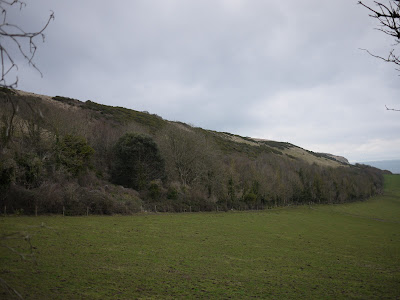
The route goes a short way along the road then across fields, where you get your first view of the extraordinary Horton Tower, and then through woodland.

Leaving the woodland, you follow a track which leads up to the tower. Up close you can see that it is six storeys high and has a hexagonal core surrounded by four round corner towers, with flat-faced towers between them.


Pevsner calls it "a megalomaniacal folly". It was built by Humphrey Sturt of Horton in 1750. It seems to have been a true folly, in that no-one seems to have any idea why Sturt built it. 

The route now leads across fields to the village. On the left is the vicarage. Pevsner explains that it is all that remains of a mansion built on the site of Horton Priory and rebuilt in 1718.


We then made a slight detour to see the church of St Wolfreda which dates from 1701 according to a chronology inside. It was built on the site of a much earlier church. Pevsner describes the tower as "a memorable piece".


We then returned to the route which looped back behind the pub.

From: Pub walks in Dorset by Mike Power (Power Publications).

Map: Explorer 118 (Shaftesbury and Cranbourne Chase).

Distance: 3 miles.

Conditions: cold, biting wind.

Rating: three and a half stars - some very interesting buildings.

Wednesday, 26 January 2011

Studland Bay to New Swanage (SW Coast Path 2)

Swanage Bay
   
Flushed with the thrill of Monday's impromptu start of walking the South West Coast Path, we decided to carry on. We parked at the Knoll Beach visitor centre and walked on down the sandy beach (Middle Beach) towards Redend Point, with Old Harry Rocks in sight beyond it.


When the beach ends, you climb a tarmac road and turn left into woodland. The views of the beach through the trees were delightful and - perhaps fancifully - reminded us of the Costa Brava, for example, a walk from Llafranc to Golfet.


Soon, we reached Fort Henry.


It was built in 1943 and is 90ft long with concrete walls 3ft thick. In April 1944, it was the vantage point from which King George VI (now famous for his stammer of course), Winston Churchill, Lord Mountbatten, and Generals Montgomery and Eisenhower watched Operation Smash, a rehearsal for the D-Day landings which took place a couple of months later.

We then walked along Studland's South Beach and then took the path along to Old Harry Rocks at Handfast Point. This involved retracing - in reverse - the wonderful Studland to Old Harry walk we did last October - on which we took some nice photos of the Rocks.

We carried on towards Ballard Point, with a nice view behind us.


At Ballard Point we descended towards Swanage Bay - see the photo at the head of this post. At the outskirts of Swanage - New Swanage - the path heads inland through a housing development and at this point we followed a path back towards Ballard Down. This climbed steadily until it offered a lovely view of Ballard Down to the right, heading down towards Ballard Point, with the Isle of Wight faintly in view behind it.


Now we began steep, but mercifully diagonal, ascent of Ballard Down proper. After a short while a conveniently located bench offered magnificent views over Swanage. The Victorian pier, on the far side of the bay, was much more noticeable from this height.


We reached the ridge of Ballard Down at the point shown on the map as Stone Seat. Fair enough, there is an aged stone bench, complete with a graffito dated 1852.


We carried on the same direction and followed a path which descended to reach the Norman church of St Nicholas in Studland. We admired the fine chancel arches in the interior.


From here, we headed past the Old Manor Hotel to regain the Coast Path and retrace the last bit of the way to Knoll Beach.

Map: Explorer OL15 (Purbeck and South Dorset).

Conditions: cloudy, threat of rain.

Distance: 7 miles, of which 4 were on the Coast Path. Distance covered so far 6.5 miles.

Rating: Four stars.


Sightings

A nice flock of Brent Geese off Middle Beach on the return leg.


Signs that winter is ending

Catkins on the way to Old Harry Rocks, Vinca in flower by a farmhouse on the way up to Ballard Down, snowdrops in St Nicholas church yard.


Reflections

It was great to be on Ballard Down again and be able to identify all the coastline back to South Haven Point. Of course you could study the map, but there is no better way to get to know an area than to extensively walk it. 

It was also satisfying to do a walk without reference to a walk book. Our dependence on walk books is partly laziness and partly because I am still not very good at calculating distances. Still, our planned approach to the Coast Path will require more of this, which is excellent.

Tuesday, 25 January 2011

South Haven Point to Studland Bay (SW Coast Path 1)

The start of the Coast Path

Since we acquired our base in Poole, we have been pondering when and how to tackle the South West Coast Path, which starts at South Haven Point - on the other side of the chain ferry from Sandbanks. For our previous efforts at long-distance paths we have either taken two cars or walked with friends, again using two cars. Today we had a new idea: perhaps we could cover the route by means of a series of circular walks. Obviously, only part of the route would progress the Coast Path, but it would avoid having to organise a taxi to get back to the start. We will follow our previous principles and do the walk in its correct sequence and walk each leg in the right direction.

At present, we see ourselves eventually reaching Weymouth, or perhaps Lyme, but we will see. There is no hurry.

We crossed the chain ferry and parked at the car park on the other side and stood to attention by the sign post to Minehead (630 miles) before striding off along the sandy beach of Shell Bay.


The tide was quite low and so it was possible to make rapid progress walking on the firm sand near the water's edge. At the end of the beach, we turned the corner and continued our progress along the straighter, and much longer, Studland Bay, passing the famous Naturist area without distraction.


We left the beach at the Knoll Beach visitor centre and headed inland to soon reach Godlingston Heath, where we passed to the east of the wonderful Agglestone, just touching the route of an earlier walk from Studland to Old Harry's Rocks. It was remarkably sandy on the heath, and in places walking was actually harder work than on the beach!


We then headed north to find and cross the road back to the chain ferry and enter the nature reserve that surrounds the lake known as the Little Sea - originally a sea water lagoon. The early evening view across towards Old Harry's Rocks was delightful, with a pinky tinge in the sky.


We followed the line of the road back to the deserted car park.

From: 50 walks in Dorset (AA) - but done in reverse, from a different starting point, and with a bit cut off.

Map: Explorer OL15 (Purbeck and South Dorset).

Distance: just under 6 miles, of which 2.5 was on the Coast Path.

Conditions: dry, cloudy, some mud.

Rating: four stars.


Signs that winter is ending

The broom was starting to come into flower on the heath. Winter's dominion is beginning to wane.

Sunday, 23 January 2011

Birdlip to Painswick (Cotswold Way 7)

St Mary's, Painswick

Rather a murky day, but time to renew our struggle with the Cotswold Way. A planned attempt on 30 December was frustrated by the remains of the snow. We set off from Birdlip and descended through Witcombe Wood, a delightful beech wood, with visibility at first obscured by low cloud.

From there, we entered Buckholt Wood - more beeches. There was now a fine view over Witcombe Reservoir and the surrounding valley - at least there would have been if it had not been so cloudy. According to the map the remains of a Roman villa lie down there too.


The route then led into further woodland - Cooper's Hill Wood - and a steep climb brought us to an open grassy area, with more cloud-obscured fine views. Cooper's Hill is of course famous for cheese rolling - an event which is apparently to be extended to two days this year.

We crossed the A46 at Cranham Corner and climbed up towards Painswick Beacon through very uneven ground which amazingly accommodates a golf course. At the top is a dramatic iron age hill fort and more fine, misty views.


We descended into the small town of Painswick with its handsome off-white stone buildings offering a contrast to the more usual yellow stone of the Cotswolds.


We passed the 15th century St Mary's church and admired the lychgate built in 1901 using old timber from the belfry. The churchyard has 99 yew trees and legend has it that the devil won't let the hundredth one grow.


Map: Explorer 179 (Gloucester, Cheltenham and Stroud).
.
Conditions: cool, cloudy, misty (obviously).

Distance: 6.5 miles.

Rating: four stars.

Tuesday, 4 January 2011

Badbury Rings

 
 Badbury Rings

Back in Poole for a couple of days we headed north, past Wimborne, to start this walk at Badbury Rings, a large iron-age hill fort. It is located on the Kingston Lacy estate, which is owned by the National Trust.

You walk from the car park and make a clock-wise half circuit around the outside of the rings. There are three of them - presumably defensive earthworks for the settlement where the trees now are on the top of the hill. It is all much clearer from an aerial photo, for example this one taken when the site was excavated in 2004.

On the other side you head straight ahead on a track by woodland and then swing right to pass the handsome medieval farm house of Lodge Farm.


You soon reach the B 3082 Wimborne to Blandford Road. This is the famous avenue of beech trees, which must be wonderful in November, and is still extremely impressive even with no leaves.


The trees were planted in 1835 by the then owner of Kingston Lacy,William John Bankes. There were 731 of them: one for each day of the year on both sides of the road, plus one for leap year.

You now cross the road and follow a track along the perimeter of Kingston Lacy's wooded park, to turn right into Sheepbriar Drove, a classic wide, tree-lined drove. After a half a mile or so you turn right again into another track, where there are nice views back towards Badbury Rings.


This U-shaped section of the walk ends back at the B3082, where there is a further fine vista of beech trees and you walk alongside these for a while back to the Badbury Rings car park.

Distance: 4.5 miles.

Map: Explorer 118 (Shaftesbury and Cranbourne Chase).

From: Dorset magazine, December 2010.

Conditions: about 5 degrees C, hazy.

Rating: three and a half stars.

Sunday, 2 January 2011

Kingston - Kimmeridge - Swyre Head

Swyre Head

Our original plan was to walk from Worth Maltravers down to and along the coast, but we discovered an advertised walk taking place there this morning and decided to change our plans in order to avoid being part of - or being overwhelmed by - a large group of walkers. We are not really all that sociable!
This walk begins just outside the pretty village of Kingston at the entrance to Encombe House, a large privately-owned 18th century mansion in the style of Vanbrugh.

You continue up the narrow road from the village as it becomes a track and turn right along the Ridgeway. Unfortunately, we ignored several slight mismatches between the the directions and the terrain and turned right slightly too soon - adding about 2 miles to the route by the time we had realised our error and taken corrective action. Oh dear!

You then walk along a road and down a grassy bank to enter the village of Kimmeridge, enjoying fine views over the small church, with the coast beyond.


The church, which just consists of a nave with a porch, dates from 1872, although the doorway is Norman.You walk through the village, with its thatched cottages, and follow a path through fields down to Kimmeridge Bay.


You then join the South West Coastal Path to climb the cliff past the Clavell Tower.


This splendid folly dates from about 1820 and was spectacularly dismantled in 2005 and moved 80 ft away from the cliff edge because erosion of the cliff was threatening its survival. It is now owned by the Landmark Trust and available as a two-bedroomed holiday let.

You now follow the coastal path for a mile and half to Rope Lake Head. The path was very muddy and this was a hard struggle. The views were rewarding though and we were impressed to see a couple of groups of hardy intrepid surfers trying to ride the incoming tide.

Just after Rope Lake Head you cross a stile to head inland to the highest point on the Purbecks - 203m. It is a steep climb, made harder by the slippery mud. We were glad when we reached the top! There were some great views though back towards Kimmeridge Bay, with the Clavell Tower visible in the foreground and Portland Bill on the horizon.


It was now just a short stroll downhill across grassland back to the start point. There were more fine views over the next section of coast towards Egmont Point, with Chapman's Pool just beyond.


Distance: 6.2 miles (or well over 8 in our case).

Map: Explorer OL15 (Purbeck and South Dorset).

From: Walkingworld [ID 4787].

Conditions: 4 degrees C, very muddy underfoot in places.

Rating: four stars.