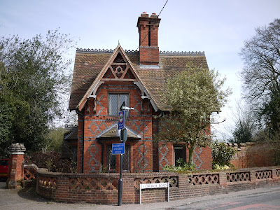
A nice afternoon and we made the impromptu decision to start the Blackwater Valley Path. We had read about it last year and bought the guide book ... but not done anything. A familiar tale.
We decided to start at the northern end, Swallowfield, just before the Blackwater merges with the Loddon and then the Thames. The guidebook describes the route from the source, but it is pretty simple, so we don't anticipate any problems.
The walk is studiously labeled the Blackwater Valley Path and it begins with an early indication that you will not necessarily be walking along the river bank: about a mile along a road and then a lane before you reach the river itself. However, it is quite an interesting mile as first you skirt Swallowfield Park. This 17th century house was designed by William Talman, better known for Chatsworth, and remodeled in the early 19th century. It used to be open on certain days of the year but is now being sold as apartments. From the road, at this time of year, you can see a classic country house bridge, over the river, with part of the house just visible beyond.

A little further on, you cross the river by the road bridge and you can make a small detour to see All Saints church. On first sight it looks Victorian, but going round to the other side a Norman dooorway becomes visible and Pevsner confirms that the nave is indeed Norman. There are Victorian elements, but the timber supports of the bell turret are apparently late medieval.

Leaving the lane and walking beside a field, you finally get your first view of the Blackwater. At its widest here, fast flowing, with all the reeds and bullrushes having been cleared away from the banks.

A little further on you come to the point where the Whitewater flows into the Blackwater. Strictly speaking, the section onwards from here to the Loddon is known as the Broadwater.

Now you follow the bank of the river to Jouldings Lock, but soon after you have to move away from the river along a track and then a couple of lanes to reach the New Mill at Eversley, now a restaurant.

You cross the river here and follow the line of the south bank (although you can't actually see the river for most of the way) through fields and along a track to reach Eversley where you turn left and cross the river again at Eversley Bridge.

From: Blackwater Valley Path (Blackwater Valley Countryside Partnership) Stages 12-11.
Map: Explorer 159 (Reading, Wokingham and Pangbourne).
Conditions: dry, warm.
Distance: 4.5 miles.
Rating: three stars.
Flower of the day
Lots of Yellow Celandine everywhere and some clumps of Greater Stitchweed - quite pretty despite its name.

No comments:
Post a Comment