Thursday, 19 July 2018

Welford to Newbury (Lambourn Valley Way 3)

Cornfields near Welford

This is the third and final stage of the Lambourn Valley Way (Stage 2 is described here). We set off from the edge of Welford Park and walked though a bit of woodland to emerge into a wonderful landscape of corn fields.

We crossed the M4 and arrived at Tulloch Farm which had simple, but elegantly shaped barn.


Further great expanses of golden corn followed.


As we approached Boxford we passed a pig farm with a cast of adult pigs standing or wallowing in muddy water and piglets prancing around likes lambs. I hope my grandchildren will like this photo when I show them.


Entering the village we passed a lovely thatched house on the left ...


... crossed a small bridge over the Lambourn, with a wonderful late Victorian sign warning that "persons in charge of locomotive traction engines and other ponderous carriages are warned against attempting the passage of the bridge".


This was the view of the river from  the other side of the bridge.


And finally there was surely a former mill.


We continued parallel to the river, but out of sight of it, in an arc beneath Hoar Hill. We recently discovered a vineyard in Enborne, rather to our surprise, but here was a rather newer but absolutely massive one. The picture shows maybe a quarter of the vines. It would be great to soon be drinking locally made sparkling wine!


At the end of this section we entered a short but rather lovely section of woodland.


Emerging from it, there was another cornfield with the green river valley behind it.


Soon afterwards we reached Woodspeen and Bagnor Manor. We had just a glimpse of a substantial Georgian house. Reaching Bagnor we passed the Watermill Theatre and crossed the pretty Winterbourne stream.


After a refreshing drink at the inviting Blackbird pub we headed away from the Lamborn towards Speen (there is an alternative route via Donnington, butthat would have taken us too far away from our destination, our home.

Speen offerfed this delightful late Victorian village hall ...


.. this sort of barn raised on stone toadstools ...


... and the substantial church of St Mary, set in very large church yard with a large number of grave stones. The church is medieval in origin, but what you see now is almost entirely the result of 19th century rebuilding.


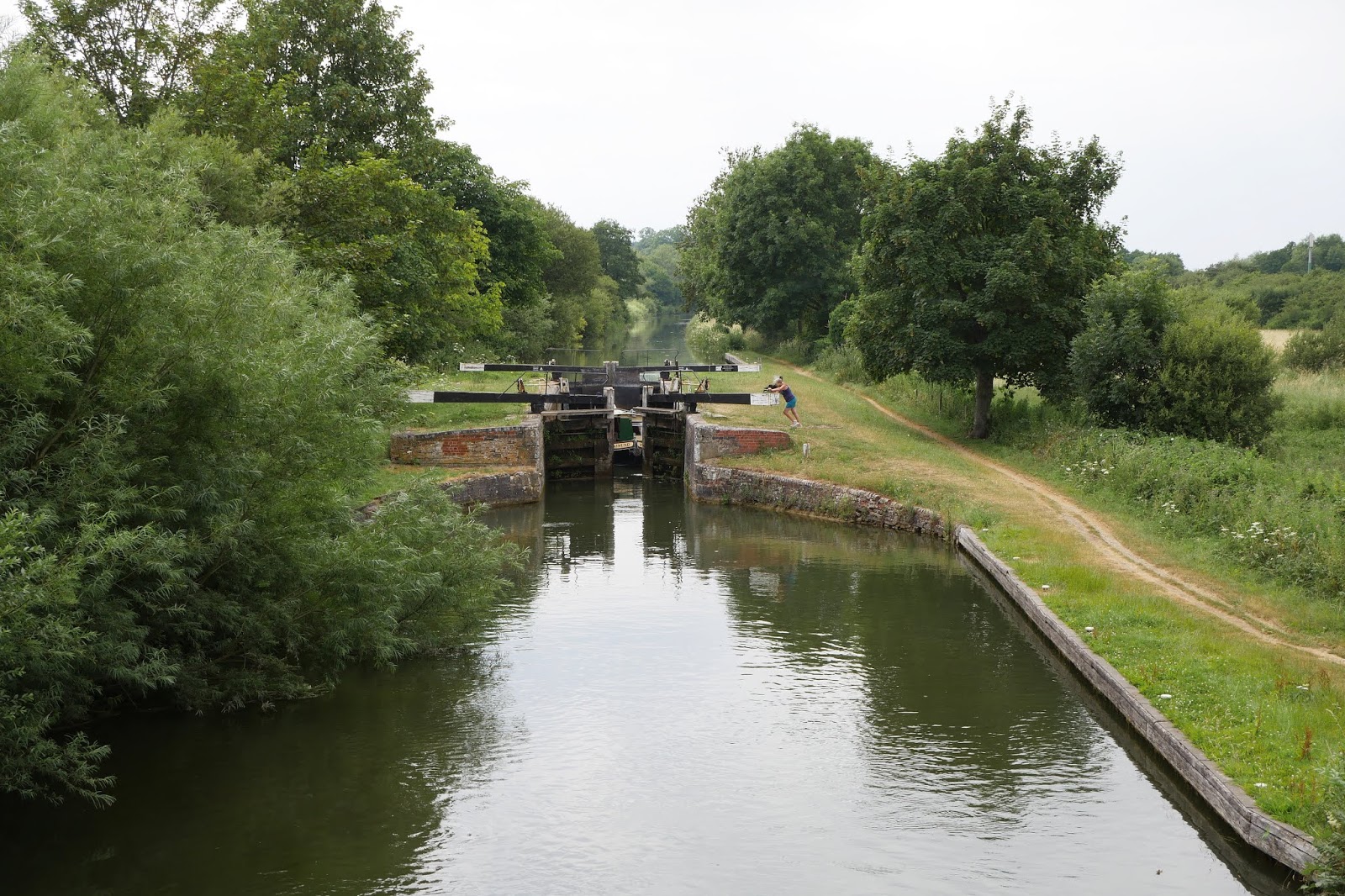
We walked past waterworks and parallel to Speen Lane to arrive at Northcroft Park and, soon afterwards, the Kennet & Avon canal. Another half a mile or so brought us home.


Conditions: a lovely warm day, if a bit cloudy.

Distance: 7.5 miles.

Map: Explorer 158 (Newbury & Hungerford).

Rating: four stars. A really nice walk and rather lovely to end it at our own house.

Saturday, 14 July 2018

Worth Matravers to Kimmeridge


Kimmeridge Bay

We are pursuing an occasional project of re-doing the South West Coast Path in Dorset as a series of longer and more linear walks than we did the first time. Our complete walk along the South West Coast Path, from Poole to Minehead, can be found in a separate blog here. Our most recent walk was the wonderful one from Kimmeridge to Lulworth almost a year ago.

We set out from the car park at the back of the Bay and climbed up to the Clavell Tower. This splendid folly dates from about 1820 and was spectacularly dismantled in 2005 and moved 80 ft away from the cliff edge because erosion of the cliff was threatening its survival. It is now owned by the Landmark Trust and available as a two-bedroomed holiday let. The current guests can be glipmsed on the circular terrace.


We walked along the cliff top admiring the numerous butterflies (Marbled Whites, Meadow Browns, later a few Walls, Skippers). The view ahead to St Aldhelm's Head was magnificent.


The back to the west was also rather lovely. The still, shallow water was fascinating.


We passed Rope Lake Head (on the left in the photo below), with Swyre Head just out of view inland on the right and began the long steep ascent of Houns Tout. I had the delight of seeing my first Lulworth Skippers along this section.


As we reached the top, the view back was really inspiring.


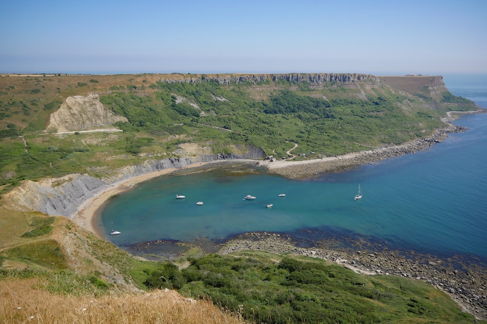
After a nice little rest on a concrete bench we headed on to soon be above the picturesque Chapman's Pool. It is reminiscent of Lulworth Cove in its shape.


The route now is quite confusing. You descend (of course) and are gradually directed inland to join the clear path skirting this large hill (it seems to have no name: at least there is none shown on the OS map).


You go a surprising distance inland and then take a sharp right and climb up an attractive path to West Hill. This is the view if you look back.


At the top there is a wonderful view to the west over Chapman's Pool.


We passed the Royal Marines Association memorial and reached Emmett's Hill, which is notable fro steps down to close to sea level, followed immediately by more steps up to St Aldhelm's (or St Alban's) Head.


At the top, we again encountered St Aldhelm's chapel. It is square with one massive column in the centre supporting four vaults which hold up the roof. There is an altar in the corner opposite to the doorway lit by a small lancet window. It dates from about 1100. It is unlike a normal church in that the four corners are oriented towards the cardinal points of the compass, whereas churches are normally oriented along an east-west axis. It was restored in the 19th century and has definitely been a chapel since 1874.


We now meandered along the coast to reach the strange are of former stone quarries that is Winspit.


It was still more than a mile up a meandering, but always climbing, path to reach Worth Matravers and a cold drink in the welcoming pub. This is the view back from near the top.


Conditions: warm and sunny.

Distance: about 9 miles.

Map: Explorer OL15 (Purbeck and South Dorset).

Rating: Five stars.

Thursday, 12 July 2018

Kew Gardens

The Palm House

It is about eight years since we last visited Kew. This visit, with our daughter and grandson was so interesting that I felt it had to be blogged.

We started from the main entrance (Victorian Gate in Kew Road) and admired the magnificent Palm House. It was built between 1844–1848 by the iron founder Richard Turner to the design of architect Decimus Burton. At the time it was the largest greenhouse in the world.

In front of the Palm House is a pleasant lake with a campanile behind it. Curiously it is not even marked on the official map. It tuns out that it was also built by Decimus Burton in the 1840's. It is 32.42m (107ft) high and was originally designed as a water tower and chimney for the Palm House, to which it is connected by a tunnel. However, it was not very successful and became purely ornamental after changes were made to the Palm House.


In front of the Palm House gardeners were putting the finishing touches to an elaborate and ornate series of flower beds. It seemed to us to be an extreme example of the municipal flower beds found in civic parks up and down the country. Why not have a more natural-looking planting of wild flowers which are more amenable to wildlife?


We headed off in the direction of the famous Kew Pagoda and first passed the enormous and imposing Temperate House. This too was designed by Decimus Burton. Building began in 1860 and it opened to the public in 1863. It is twice the size of the Palm House and is home to temperate plants from around the world.


We continued along the long grassy avenue of trees that leads to the Pagoda (know very reasonably as Pagoda Vista) and spent some time, with a bit of success, trying to identify the trees. This cedar was especially imposing and photogenic.


Here is the Great Pagoda, designed by Sir William Chambers and completed in 1762 as a gift for Princess Augusta, the founder of the botanic gardens. Chambers had previously traveled to China. It is a ten-storey octagonal tower, almost 50m high. Each level is 30cm narrower than the one below.


It has just re-opened after extensive renovation, which included reinstating the 80 dragons which originally adorned the roofs, each carved from wood and gilded with real gold. The dragons were removed in 1784 and were rumoured to have been sold to settle George IV’s gambling debts. However, experts believe that since they were made of wood, they had simply rotted over time. Quite by chance, today was the day of the formal re-opening and if you look closely you can make out Prince Charles talking to an interviewer among the knot of people over to the left.


We walked along the wonderful Cedar Vista (also well-named) and after a break for lunch headed towards the wonderful Aquatic Garden, dating from 1909, on the opposite side of the Gardens.


Our next destination was the Orangery and en route we stumbled upon Turner's Oak. Was it perhaps named for the great painter J M W Turner?


No, it was created by a nurseryman, a Mr Turner of Essex in 1798 by crossing the English oak - Quercus robur - with the Holm oak - Quercus ilex. It is about 6.25m in girth. It was very impressive, but since then I have seen the Cathedral Oak in Savernake Forest in Wiltshire which is nearly 10m in girth and at least 1000 years old.

Soon after we emerged in front of the exquisite Orangery. It was the work of Sir William Chambers (who also designed the Pagoda - and Somerset House in London). The Orangery was completed in 1761. Sadly, it was found to be too dark for its intended purpose of growing citrus plants and they were moved out in 1841. After many changes of use, it is currently used as a restaurant.


We had one final delight: Kew Palace. This charming building in the Dutch style was built in 1631 and was long known as the Dutch House. It was used by the Hanoverian kings but was abandoned after 1844 and many of its ancillary buildings were demolished during the 19th century. It was restored during the early years of this century.


Conditions: warm and sunny.

Distance: maybe 3 miles.

Rating: five stars. A great place to amble round, even without going into the great greenhouses. Maybe next time.

Thursday, 5 July 2018

Martinstown and Maiden Castle

St Martin's church

We set off from Martinstown (or Winterbourne St Martin) to visit Maiden Castle. It is an attractive linear village with what Pevsner describes as a surprising number of larger gentry houses. We start our walk at the imposing 15th-16th church and follow a path from the back of parallel to the main road. After a short way we spied these cows in the field on our left: they seem to have lined up for a charge, but happily did not make it.


We crossed a lane and continued heading east with a lovely vista of fields to our left.


We crossed the main road and headed up a farm track passing through the substantial Clandon Farm. As we left the farm buildings there was a clear view of Poundbury, Prince Charles's village, which we passed on the way to Martinstown. One of the oddest things about it is that there are no sign posts to it from the main road.


We carried on in the same direction fro a while and then turned right up a small track by a corn field where we had our first view of Maiden Castle.


Soon it was more fully in view. It is one of the largest Iron Age hill forts in Britain. There is evidence of a neolithic enclosure, bronze age barrows and a Romano-Celtic temple.


We decided that the most satisfying thing would be to walk round it: that's how we always like to approach a walled town. So we headed east along the north side.


This is the east end.


And this is the view to the south over undulating country.


Finally, this this south side looking back from near the west end.


It took us about 45 minutes to complete the circuit, suggesting a perimeter of about 2 miles.

We now returned to the circular route from Martinstown and were shocked to be caught in a rain shower. It's been dry for some while and it came as a rather a chilly surprise, albeit quite a short-lived one. We headed south down a long a rather attractive combe and west following the valley of the South Winterbourne stream to return to Martinstown.

Conditions: sunny at first, rain, ending up quite grey.

Distance: 5 miles.

From: Found via Walking in England

Map: Explorer OL15 Purbeck and South Dorset

Rating: four stars.

Wednesday, 4 July 2018

Newbury and Enborne


We moved to Newbury at the end of last year and one of many positives is that it is possible to walk away from our house to the west and soon be in open country behind Enborne Gate Farm. It seems that this cornfield were once part of the site of the First battle of Newbury (1643) during the English Civil War. See here for a map.

We walked along two sides of the field and looked south (I think towards Round Hill) towards a further expanse of corn.


There are loads of butterflies around: Meadow Browns and Ringlets, Skippers (including my first Essex Skipper of the year) and lots of Small and Large Whites. This was an especially nice example.


The field edge path passes through a strip of woodland and emerges onto a road. A right turn leads to a path through a grassy meadow and alongside another one right by the busy A34. I see my first Gatekeepers of the year and get a nice group shot of three Marbled Whites. There seem to be lots of this beautiful butterfly to be seen at the moment.


Crossing the footbridge over the A34 brings a new landscape of parkland, possible once part of nearby Hamstead Park


On the far side, we turned left along the road and passed Avery's Pightle, now a nature reserve. A pightle is a small field or enclosure. A right turn brings us past some houses and uphill to a rather wonderful sight just near Enborne Road: a vineyard!


Googling reveals that it is known, very reasonably, as Enborne Vineyard - and is one of six in Berkshire. I hadn't realised that viniculture had reached our county.

Turning right along Enborne  Road, we soon reached Enborne Church. This is a Norman church with arcades dating from about 1170. Much of the exterior is the result of a late Victorian restoration.


We now continued along the road to take a left at Enborne Copse and walk towards the Kennet and Avon Canal. On the right as we left the woodland is a rather lovely plantation of young trees.  


This is the view along the canal looking towards Benham Lock.


Heading east along the canal towards Newbury we kept pace with a canal boat for quite a while, only let it pass us when I stopped to take a picture of these lovely waterlilies. Indicative, I suppose, of a very slow rate of flow.


At Enborne bridge, we turned right towards Enborne Road, passing this rather lovely building on the way.


Conditions: a lovely warm day, if a bit cloudy.

Distance:  about 5 miles.

Map: Explorer 158 (Newbury & Hungerford).

Rating: three and half stars. A really nice walk to be able to do from home.