Monday, 12 March 2012

Napier

The Soundshell

We had been looking forward to seeing the Art Deco delights of Napier and bought a copy of the Art Deco Walk from the tourist office on the seafront. Rather than repeat the guide, I will just describe what we thought were the highlights.

Napier had an earthquake in 1931 which destroyed the central business district. It was rapidly rebuilt in a reasonably consistent Art Deco style, although with elements of Spanish Mission (inspired by Santa Barbara in California, rebuilt after an earthquake of 1925) as well.

The walk guide conveniently describes the walk in east-to-west and west-to-east sections. We opted for an eastern start which allowed us to start at the Soundshell on the seafront (note the classic Art Decon zigzag pattern in the foreground). This not terribly photogenic structure was intended to house open-air concerts. In the 1940s and 50s it was used as a skating rink.

You now head down Emerson St, opposite, past the T&G building (on the left below) and the ASB bank. The bank (originally the Bank of New Zealand) has wonderful carved decorations using Maori motifs. They seem very willing for you to wander in to see the interior and even have an informative leaflet about it.


We looked left down Hastings Street, currently undergoing some redevelopment and rather tatty. WE returned to Emerson St and walked past the large Spanish Mission style Criterion Hotel. This handsome building seems to have come down in the world as it is now a backpackers hotel.


At the end of this section of the street is the Kidson's Korner building, with its pleasing pale blue and yellow colour scheme and zigzag pattern decoration. It is oddly angled to fit in between buildings on both sides which survived the earthquake.


On the diagonally opposite corner is the striking Hotel Central with Egyptian-style columns with lotus leaves and stylised falcons.


Also inEmerson St, we especially liked the Fenwick Building with its pilaster capitals, which one book I read described as being reminiscent of car radiators. I thought they were stylised palm trees.


At the end of Emerson St you emerge into Clive Square, where the former Fire Station now houses the Art Deco Trust. Ironically, it pre-dates the majority of Napier's Art Deco buildings, having been originally constructed in 1921. The original brick facade was replaced by a duplicate in concrete after earthquake damage and later the huge fire-engine doors were glazed.


We now turned down Tennyson St to reach the Municipal Theatre. Internally, this apparently has elements of the Streamline Moderne style of Art Deco: curving forms, long horizontal lines, and sometimes nautical elements.


Further along you pass the Classical Revival Public Trust Building. It is a rather massive, block-like building and its solidity enabled it to survive the earthquake. A contemporary photo shows it surrounded by rubble. Further along is the wonderful (New Zealand) Daily Telegraph building. The walk guide describes it, rightly, as Napier's most flamboyant Art Deco building with almost all the classic elements of Art Deco on display.


A left into Hastings St brought us to the AMP building, now a wine store (we also brought something for an aperitif later). The guide notes a debt to Louis Sullivan and Frank Lloyd Wright.


As we made our way back to the Marine Parade, we could not fail to notice how the Masonic Hotel with its dramatic parapet ornaments, provides the image on the cover of the Art Deco Walk guide.


Reflections

I confess that I had imagined walking round Napier on a sunny day and photographing its lovely buildings against a blue sky. We were also looking for somewhere nice for lunch as we wandered around and were deeply disappointed by the apparent total lack of restaurants. So those factors contributed to a slight feeling of disappointment.

Perhaps more objectively, we felt that Napier's streets were rather cluttered: hanging banners, lights, palms, bollards, cars. It is wonderful that in the 1980s the Art Deco Trust was founded to promote the retention, renovation and promotion of Napier's architectural heritage. They have done a great job in that 140 of the 164 buildings constructed between 1920 and 1940 are still standing. To our minds, the next challenge is to make the buildings easier to really see and appreciate by pedestrianising the key streets and de-cluttering them.


Conditions: Cloudy, cool.

Distance: only a couple of miles.

Rating: four and a half stars.

Postcript

Rather by chance we were staying in the suburb of Ahuriri and we were thrilled to find one of Napier's finest Art Deco buildings just a few hundred yards away: the National Tobacco Company's headquarters. The extraordinary flower decorations seem to hark back to Art Nouveau.
  

Saturday, 10 March 2012

Whangapoua and New Chums Beach

New Chums Beach

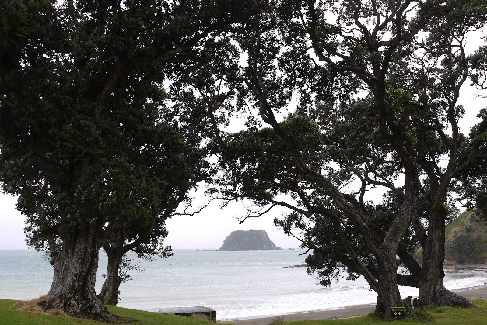
The strangely named New Chums beach was apparently voted one of the Top 20 Beaches in the world in 2006 by The Observer. It is also quite hard to get to and requires a bit of local knowledge - in our case provided by our hosts at the B&B we were staying at in Coromandel. So although the day we chose was not ideal, reasonably warm but very cloudy, it was an irresistible proposition.

You park at the far end of Whitianga beach and carry on walking in the same direction, crossing a stream which flows into the sea here until you come to an area of large rocks at the end of the beach. You walk across the rocks - confident continuous steps worked much better than more hesitant ones - and after a while come to a track which leads through bush across a saddle to New Chums Bay.

The first view as you emerge from the bush was very impressive.


The beach is made of beautiful golden sand but there are rocky areas ay each end.


I decided to walk the length of the beach, past the surfing area, with a view back to the head in front of the saddle.


At the far end, there was a fine view back.


The return beach walk was three quarters of a mile. On the way back to Whangapoua, I climbed the head. It was an arduous and steep climb, but allowed the photo at the head of this post to be taken and also this one of the main Whangapoua beach and Opera Point at its left hand end.


Conditions: warm, cloudy

Distance: three or four miles

Rating: four stars


Sightings

Earlier that day we had wondered around Opera Point - the other side of the headland in the photo above and been delighted by this wonderful gathering of Oystercatchers. The black and white ones are familiar enough from Poole harbour, but the all black Variable ones were new, and I have never been able to get so close. It took some time to get them in line for the photo, but eventually they cooperated.


Reflections

Today's photos have a irritating brownish cast. Unfortunately, I accidentally altered the White Balance setting on my camera without being aware of what I had done. I have tried to improve the picture in iPhoto, but with limited success. The one picture which I took on Intelligent Auto is all too obvious. I suppose there is a lesson about being more careful and aware.

Friday, 9 March 2012

Hahei Beach and Cathedral Cove

Hahei beach

Today's outing was something we spotted in the guide book when we were planning our trip: a walk to a sandy beach, where there was a natural stone archway, to be made at low tide. We didn't really know what to expect beyond that, but we decided to make it more of a walk by starting at nearby Hahei beach, rather than the Cathedral Cove car park. When we pulled up at the car park at the back of Hahei beach we were very glad we had decided to start from there: the Pacific was blue, the sand was white, the sky was blue and off shore there were numerous small islands making for a fantastically interesting and varied view out to sea. While we were getting ready to start walking we were staggered to see an elderly couple pull up, get out of their car and take a quick photo and roar off. This was a view to be enjoyed and cherished, and they had experienced it for as long as it took me to get my boots on.

We saw a DOC sign and started walking along the back of the beach, but fairly soon we - alright, I - made a mistake and took a track heading inland and then uphill, parallel to the sea. After quite a steep climb we found ourselves on a road high above the sea. It was obviously the road to the Cathedral Cove car park. Oh dear! However, there were brilliant views back over Hahei beach which we would not otherwise have seen.


Even better, a Monarch hove into view and then landed in a good place for a photo. I was able to get a good picture even without changing to the long telephoto I normally use for butterfly pictures. This was a very friendly and accommodating Monarch - more Prince Harry than Prince Charles we thought.


We now followed the marked trail from the car park - and noted the trail we should have taken joining it from the right - at least we could come back the right way. The route first went downhill through bush for some way, then carried on along a level and then climbed to a view point, with a lovely view along the coastline.


Now the terrain opened out to something a little reminiscent of Dorset heathland. There was a fine view towards the coast.


At the end of the open area the trees closed in again and it was downhill all the way to the cove, which was invisible until you were right there. We made a short detour to Gemstone bay - a small rocky cove, apparently a good site for scuba diving, but a bit disappointing otherwise. We resisted a further detour to Stingray bay.

We emerged onto Cathedral Cove to be immediately overwhelmed by the scale of the stone arch to the left and drama of the view through it to the smaller beach beyond, only accessible at low water.


We walked to end of this beach to admire the curiously shaped sea stack ...


... and photograph the archway from the other side


After a certain amount of paddling and lounging about, we retraced our steps, following the path past the car park on a level round the side of the hill and then down to Hahei beach. We had not gone far enough along the beach at the start.

Conditions: sunny and hot, but cool in the shade.

Distance: four or five miles.

Rating: five stars.


Sightings

A pair of quiffed Californian Quails, a flock of yellowhammers and a number of Long-tailed Blue butterflies.

Thursday, 8 March 2012

The Coromandel walkway

Fletcher Bay

We have now relocated to Coromandel Town, the main settlement in the Coromandel Peninsula on the North Island's east coast. We had read about the Coromandel Walkway, a coastal walk at the tip of the peninsular and promptly booked to go on it the next day. It some ways it seemed odd to have to book a tour: it doesn't look to be too far north of Coromandel Town and surely there would be some way to get back to the car if we did it under our own steam?

In fact the drive from Coromandel to Fletcher Bay where the walk begins takes near enough two hours, most of which is over a twisty gravel (or "unsealed" as it is known in NZ) track. But more important, there is nothing at either the start or the finish apart from very basic campsites. So we booked with Coromandel Discovery. Barbara, the owner, told us that it would take her a further two hours to get from Fletcher Bay to the end point at Stony Bay. The main reason being the almost complete absence of roads and the presence of Mount Moehau (892m) in the way.

We arrived at Fletcher Bay in late morning with the weather cloudy and drizzling, having had an interesting journey up, enlivened by Barbara's informative commentary and a nice chat with the Swedish/Dutch couple and their baby who we shared the minibus with.

You cross the back of the bay and climb a clear grassy track behind a small headland. Soon there is a fine view back over the bay.


You continue along behind the next, rather rocky, bay, with a much more substantial headland ahead - in fact it is a rocky promontory jutting out to sea - the Sugar Loaf (220m).


We imagined we would climb it, in the manner of the South West Coast Path we have been walking at home - Swyre Head is only 20m lower - but the path headed inland to pass behind it. Further inland we were struck by the folds in the hills, and this seemed very characteristic of the whole area.


After a remarkably muddy area (very heavy red clay), we continued on a grassy track and could now see the Sugar Loaf from the eastern side and the Sugar Loaf Rock that lies beyond it.


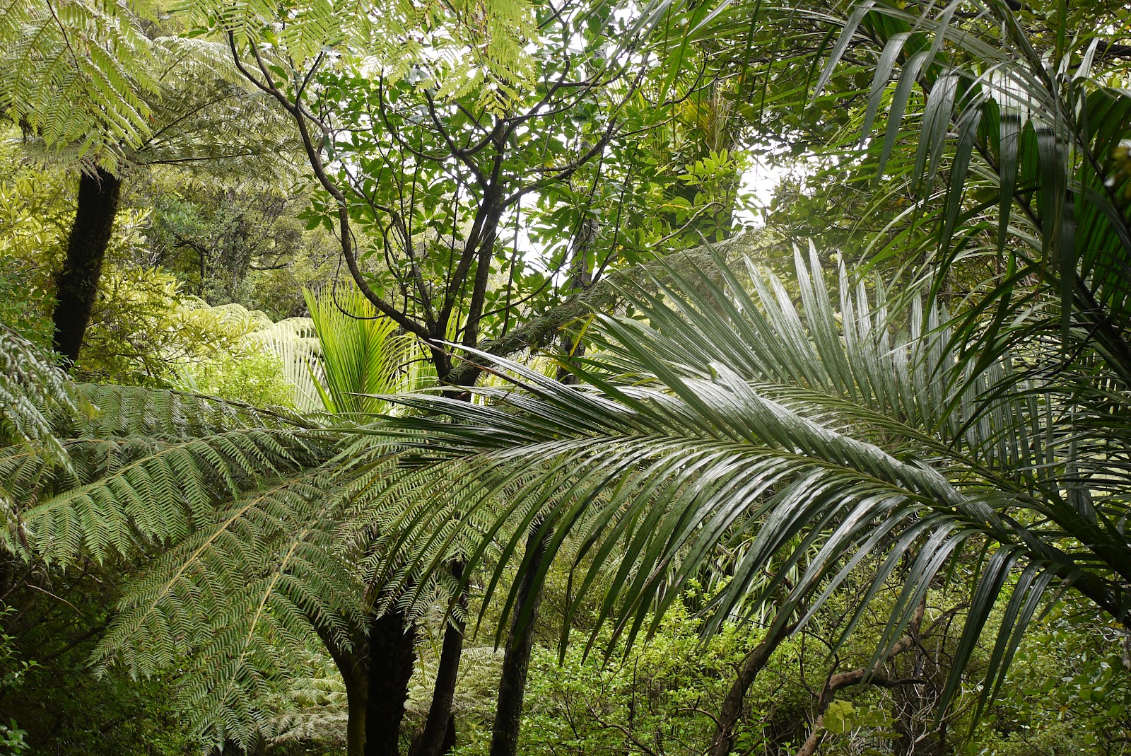
Now we began a long descent through resplendent Nikau palms ...


... and tree ferns ...


... to reach sea level at Poley Bay. We took a break from the walk to explore this rocky cove, with its black sand and layered black volcanic rock. The sea was pretty rough and I succeeded in being overrun by a wave as I took my artistic low vantage point photos. I completed the walk with wet feet.


As on any coastal walk, the consequence of this descent was a steady climb, to then walk along a horizontal path along the side of the mountain. We paused at a a strategically placed bench and enjoyed the dramatic view back along the coast.


A bit further on a steep side track led to a lookout (NZ for a viewpoint). It turned out to be just a bare mound of hard earth, but there were great views back and forwards along the coast. Our destination, Stony Bay, was around the first headland.


There now followed a long, gentle descent through native bush. Many of the trees were marked with coloured plastic triangles and we had been told that theses were not some arcane system of way-marking, but rather part of a campaign to trap and kill possums. There are apparently some incredible number of possums - 70m comes to mind - which were originally introduced to tackle other pests and now prey on native species such as the Kiwi.

The last section seemed to go on for ever, and was indeed about an hour and half of steady walking, but eventually Stony Bay could be clearly seen and the walk was complete.


Conditions: dully, some drizzle, but quite warm.

Distance: we read various distances, but 10-11km seems right. It took us four hours with breaks.

Rating: four stars. Not entirely unlike the SWCP, but with more rugged and exotic scenery. Perhaps the only disappointment was a general lack of wildlife.

Reflections

We are starting to realise that walks in New Zealand are not so easily found as they are at home. This path was originally constructed as a bridleway between two farms in the late C19. In general, paths must have begun because people wanted to get from A to B. Up here, there are no settlements, so there are no paths, and the difficult terrain means that paths have to be specifically made, rather than evolving as a consequence of people's desire to get from one place to another. Maori presumably mainly travelled by water.

Tuesday, 6 March 2012

Auckland: Coast to Coast Walk

Auckland from the Sky Tower

We read about the 16km Coast to Coast walk when we were planning our trip to New Zealand and it seemed such an improbable idea that we set aside today to do it. The walk goes from Waitemata Harbour (which leads out to the Pacific Ocean) to Manukau Harbour (which accesses the Tasman Sea), across the narrowest part of the North island, a route that was used by Maori for canoe portage. It is also effectively a walk across the sprawling city of Auckland, famously built around 50 extinct small volcanoes and accommodating a quarter of NZ's 4 million people. It is one of the least densely populated cities in the world.

The official route starts at the Ferry Building, but since we have already walked from our hotel to there and back twice, we decided to start at the hotel and pick up the route at Princes St, duplicating just a little of yesterday's city walk.

This time, instead of going through Albert Park at the Clock Tower, we turned left and wandered through Auckland University to eventually emerge at Auckland Domain, the city's finest park. It is centred on the extinct volcano known as Pukekawa and also houses the Auckland Museum, one of the city's main sights.

From this direction, you enter the Domain via a leafy path, loud with the noise of cicadas ...


.. and walk uphill, past a pond, to eventually find yourself beside a vast green playing field, beneath the cone of the volcano.


You leave the Domain at its southern extremity and now have quite a long section of road to negotiate. One landmark along here was Auckland School. This is no doubt a highly prestigious academic establishment, but we thought that its dominant building: a vast rectangular structure with churchy towers on each corner, in I suppose the Spanish Colonial style, was absolutely gross. It was brilliant white and covered in a sort of giant pebbledash, which we promptly christened stonedash.


Mercifully, soon after this we turned down a smaller road and soon reached the foot of the extinct volcano Mount Eden, Maungawhau to the Maori. It is the southernmost point of the land purchased from the Maori in 1860 to extend Auckland city. The volcano erupted from two craters 28,000 years ago, with the last eruptions from the southern crater filling the northern crater. The visible crater is 50m deep and the volcano is 196m high, making the highest natural point in the Auckland peninsula. The photo looks down into the crater from its southern lip; the north shore of Auckland and Rangitoto can be seen in the distance.


Off to the left is Eden Park, home of the Auckland Blues Super 15 rugby team. I have seen the stadium on the television often enough and it was great to see it in the flesh, albeit from some distance.


We had a bit of trouble finding the way down from the summit as a sign post was missing at a critical point. However, we did eventually and emerged into the suburb of Epsom, with many wooden colonial style houses, many of them single storey. After some distance through suburbia, noting the two bowls clubs, no doubt locked in fierce competition, we arrived at Alexandra Park, which extended over a main road into Cornwall Park. The initial section was quite narrow but had a fine row of palms beside the road.


The park was once the rural estate of Sir John Logan Campbell, an emigrant Scot who trained as a doctor, but became a very successful businessman and local dignitary. He donated it as a public park on the occasion of the royal visit of the Duke and Duchess of Cornwall and York (later King George V and Queen Mary of England) in 1901 and named it in their honour.

You pass Acacia Cottage, one of the earliest surviving timber buildings in New Zealand, and the oldest in Auckland. Built in 1841, it was originally the home of Campbell and his business partner, William Brown and was located behind their store. It was relocated in 1920 from its original location off Shortland Street in the centre of Auckland.


Cornwall Park in turn leads into One Tree Hill Domain. Its centre is another former volcano, known as Maungakiekie to the Maori,which erupted from three craters at least 28, 500 years ago. The cone and its surroundings were an important Maori pa or hill fort and are said to have been home to a population of up to 5,000.


It all sounds a bit Tolkien, but the English name One Tree Hill derives from the single tree that grew there in 1840. That tree was chopped down in 1870 and efforts to grow replacement trees were only partially successful. The two final trees were the subject of attacks by Maori protesters in 1994 and 2000. Wags have renamed it (N)one Tree Hill.

The gold-tipped obelisk which is all that is at the summit now was not, as one might imagine, a replacement for the One Tree. It was instead constructed in accordance with John Campbell's will to commemorate his admiration for the Maori people. There is a statue of a Maori warrior near the base.


Looking ahead, it was now possible to see Manukau harbour and our destination.


We now walked back down the road through the park and emerged on Manukau Road. A somewhat tortured route took in a loop around the busy Royal Oak roundabout and past Jellicoe Park, with its rather extravagant entrance.


Another mile of road led to the official end of the walk in Beachcroft Avenue. This was really odd. You are faced by a lagoon with a motorway on the other side, and you can't see the harbour at all. We spotted a footbridge over the motorway which we had just decided to take, when a passing motorist stopped to explain that that was indeed what we should do. The spontaneous helpfulness of kiwis was something we saw quite a lot.

We crossed the bridge and finally reached a sort of beach at the edge of the harbour. I have taken my best Joe Cornish-style photo, with a low camera angle and lots of foreground, but nothing I could do makes this anything other than quite desolate and disappointing. We could have been in Weston-super-Mare. Even the ducks on the stream were Mallards!


The next problem was to get back to our hotel. We walked into Onehunga and found a taxi, which added yet more distance to an already long walk.

Conditions: dull, but pleasantly warm.

Distance: 13 miles in all. The furthest we have ever walked.

Rating: four stars. Some great bits, but also a lot of road and an extremely downbeat ending. Signposting eccentric in places and some indications that the route is not being maintained. A good sense of achievement though.