Tuesday, 27 September 2011

Camaldoli


The monastery of Camaldoli

Another trip into the Casentino, where earlier in the week we saw the delightful chapel of Santa Maria della Gratie near Stia, and several other lovely places. Today's outing was more focused: to see the monastery at Camaldoli and then walk up to the hermitage a few kilometers away.

The Benedictine monastery dates from 1023 and was founded by St Romuald. As a visitor, you can see the 16th century pharmacy and two lovely cloisters: a delightful renaissance once and this stirring gothic one which you enter by descending from the main door shown in the photo above.


There is also a baroque church.

We left the monastery and followed a winding tarmac road which led up to the Hermitage. The monastery is quite high up at 850m and the hermitage appreciably higher at 1094m. Our impression was that there was a track which was criss-crossed the road as it followed a more direct - and hence steeper - route through the trees.

The woodland path was lovely in the dappled sunshine and we made good progress uphill.


In several sections there were ravines with mountains streams descending, and the sound of rushing water accompanied us most of the way.


We passed a couple of pilgrimage chapels on the way. However, after crossing and re-crossing the road several times, we made one crossing too far and headed up another path. It was waymarked, but, we later realised, not in the same way as the path we started out on. We ascended increasingly rough terrain, confident from the position of the sun that we were going in the right direction and certain we were not lost by the knowledge that the road was somewhere to our left.

Eventually we hit a level area and a path going across our line of march from right to left. We naturally headed left and, following a fine broad path, found our way to this lake. A nearby noticeboard explained that it was artificial - a monastic fish pond of the kind we have seen in Berkshire. Clearly we were nearly there!


And indeed we were. Soon we rejoined the road and reached the open area in front of the hermitage. Although quite high, it is so surrounded by trees that there is no view and very little sense of being in a high place. The hermitage was of course closed for lunch. However, we had brought a picnic which we enjoyed on a bench by the wall. Later we had a drink in the curious cafe-cum-religious-bookstore which was in the building on the right of the photo.


When we went through the gate we were struck by just how big and elaborate the hermitage was - not really what we had imagined. We saw St Romuald's cell and had a glimpse of the private area where the modern monks have their cells.

The hermitage church was an imposing building from the outside ...


... but was, shockingly to our minds, decorated in a most over-wrought baroque fashion inside. We felt there was a surprising disconnection between this ostentation and what we imagined was the simple life of prayer led by the monks.


We followed the road back down to the monastery, with the dense woods all around.
 It was much quicker than the way up!


Conditions: 28 degrees, sunny.

Distance: 4 miles or so.

Rating: three stars.


Reflections

We should probably steer clear of any building described as baroque. We always find them impossibly ornate and over the top.

On the one hand, our navigation through the woods was successful and we ended up where we intended to go. We were never exactly lost - we could always have retraced our steps to where we last left the road. On the other hand, we had no map and could easily have gone wildly astray. An exercise of skill or a lucky escape? I think I might try harder to find a suitable map next time. At  a deeper level this means discovering first what map series are available.

Sunday, 25 September 2011

Santa Maria della Grazie near Stia

Santa Maria della Grazie

This is one the shortest walks I have ever blogged, but it was full of interest. We were on a day's outing from Arezzo, where we are on holiday, to explore the Casentino valley. The northernmost on our list of places to see was the tiny 15th century chapel of Santa Maria della Grazie (literally Holy Mary of Grace in English. I suppose we would say Our Lady of Grace). If I understand the Italian edition of Wikipedia correctly, it was built following a miraculous appearance of the Virgin.

To reach it, we walked a few hundred yards up a path from a minor road, and as we did so, we noticed a waymark for a long distance path. At this point we made the impromptu decision to turn this little bit of sight seeing into a short walk.

Inside the church consists of a nave and chancel - and the chancel features a stunning surround by Andrea della Robbia made of painted terracotta.


This is the panel on the left hand side and is typical of della Robbia's work, which can be found in a number of churches in this part of Tuscany.


There was also this delightful fresco.


We returned to the waymarked path and followed it as it climbed through light woodland in the bright sunshine. We decided to reach the top.


On the way, we were delighted by what seemed to be wild cyclamen by the wayside in several places.


After a while, the path leveled out and offered fine views across the forests of the Casentino


Around this time, I began to notice several large brown butterflies, with a distinct white stripe on the upper wings. They were rather like a White Admiral, but the underwings were wrong. They were in fact Great Banded Graylings, which I had previously spotted in Spain.

They normally roost with their wings closed, revealing only their rather drab underwings, which make for excellent camouflage when they land on the ground. I was thrilled to spot a pair engaged in what I assume was a mating dance which involved a degree of flashing the upper wings.


Having now reached the literal and probably the metaphorical peak as well, we retraced our steps.

Conditions: 28 degrees, sunny.

Distance: just over 2 miles all told.

Rating: four stars.

Saturday, 24 September 2011

Arezzo: a fuller exploration

The Piero frescos in the church of San Franceso

On the second day of our stay in Arezzo our initial objective was to visit San Franceso to see the fresco cycle called the Legend of the True Cross painted by Piero della Francesca in the middle of the fifteenth century. There are three bands of frescoes on both the left and right sides of the chancel, as well as the ones on the wall behind the altar visible in the photo. They depict episodes in the legend, which essentially postulates that the cross that Christ was crucified on was effectively a descendant of the tree of life whose apple Adam ate and so created original sin. The true cross is thus the agent of man's redemption from original sin. We had seen reproductions of the frescoes, but they did not fully prepare us for their beauty and grandeur.

After that we went back down the road to the church of the Badia. It is an old church with a handsome campanile and plain, vaguely gothic, facade, but inside it was remodelled into a cool elegant renaissance design by Vasari in the later 16th century (more on Vasari in yesterday's post).


There is one older fresco on the inside of the facade: this beautiful 15th century image of St Laurence in a trompe l'oeuil niche.


Now we walked back up the busy Via Cavour and turned left up another main street, the Corso Italia, to reach the facade of Santa Maria della Pieve - the beautiful romanesque church whose apse end is a major feature of the Piazza Grande. The extraordinary square facade with its rows of columns is hard to photograph from the narrow streets in front of it, but is simultaneously both austere and extravagant.


 Now we walked through the Piazza Grande, as we had yesterday, but approaching it from a different direction.  We looked again at the grand side of the square which we enjoyed yesterday.


 And then the picturesque cluster of buildings on the side opposite.


Now we walked up to the Prato Park and turned right to see the star-shaped Medici castle. Unfortunately, it was closed for restoration. The austere walls remain impressive.


Our route now involved a long descent through a quiet quarter, with our eventual goal being the former amphitheatre in the south east of the city. At the bottom we passed these two towers dominating the entrance to a street, inevitably named the Street of the Two Towers. A nearby plaque explained that they were typical of 13th century dwellings.

A little further on we entered the modern-looking piazza of St Agostino


After a lengthy pause for lunch, we finally made it to the amphitheatre. It is oval in shape with low remains on one side and pleasant renaissance building on the other, designed along the same curve.  


From here it was quite a long walk round the peripheral boulevard to the Porta San Lorentino where we enter and leave the city. This time we looked inside the gatehouse at the bronze replica of an Etruscan statue of the Chimera.


This fierce mythical creature has three heads: one of a lion in the usual place, one of a goat coming out of its back and one of a snake at the end of its tail.

Conditions: 28 degrees, sunny.

Distance: 6 miles all told.

Rating: five stars so long as you see the frescoes.

Friday, 23 September 2011

Arezzo: an introductory stroll

Porta de San Lorentino

We have just arrived for a week’s holiday based in Arezzo and decided to immediately go for a walk to get our bearings. The hotel is out to the west of the town, so the first task was discover where the road that we are on enters the city. 10 minutes later we discovered that it was at the Porta de San Lorentino (St Lawrence).

This was one of four gates in the town walls erected by the Medici rulers in 1664 and the bit of wall next to it seems to be all that remains of them. 

Once inside we walked straight ahead, gradually uphill, in the direction of the Duomo. We emerged into a delightful piazza with the cathedral on the left on a high plinth, reached by steps. It was begun from 1278 and mostly finished by 1510, but the facade was only finally completed in 1914.


To the right was the imposing complex of the Palazzo Communale.


We carried on in the same direction, passing the Cathedral on our left. We went briefly in to the Park il Prato to see if there was a view from its belvedere. There was, but it was not especially interesting.

We now headed right, aiming for the Piazza Grande. We passed the very undistinguished-looking house where the poet Petrach was born and headed down the street towards the tower of the Church of Santa Maria della Pieve. This remarkable romanesque church will feature again in this walk, but for the moment I will note that the "tower of a hundred holes" dates from 1330.


On the right was a fine palazzo with an extraordinary facade. This is the Palazzo Pretorio, now the city library. Rather wonderfully, just to the right is a public cloister with tables and chairs where you can go to work. There is even WiFi.


Now we turned into Vasari’s loggia, the beautiful renaissance arcade designed by the Arezzo-born Georgio Vasari, famous still for his Lives of the Artists, but also a painter and architect of some renown in his own day. It is his 500th anniversary and there is an exhibition to celebrate. We plan to visit his house later in the week.


The loggia forms the north side of the Piazza Grande and we paused for a light lunch and a read in the late afternoon sunshine. First we studied the view across the Piazza, which being on a slope reminded us of the famous one in Sienna. On the left is the apse of Santa Maria della Pieve and to the right is the Palazzetto della Fraternita dei Laici, with Vasari’s loggia completing the picture. We noticed that one of the many columns in the wonderful apse had a kink in it (bottom row, third from the left).


Finally, we headed downhill to just see the church of San Francesco, the site of the famous fresco cycle by Pierro della Francesca, the Legend of the True Cross. This is what brought us to Arezzo in the first place, and will be our first stop tomorrow. The facade is dreadfully plain, but what riches lie within!


After an early dinner we headed back to the hotel impressed with what we had seen and looking forward to a further exploration tomorrow and later in the week.

Conditions: hazy sunshine, 28 degrees.

Distance: about four miles.

Rating: four stars.

Monday, 19 September 2011

Kinoulton

The Grantham Canal

We were visiting friends in Kinoulton and were taken for a walk direct from their front door, which is always a fine thing. We walked along the long straggling main street of the village and turned right to follow the towpath of the Grantham Canal. As the photo shows, it is rather overgrown.

The Grantham Canal website reveals that it is 33 miles long and runs through Lincolnshire, Leicestershire and Nottinghamshire to join the Trent in Nottingham near Trent Bridge. The website, perhaps rather ambitiously, identifies it as "The romantic canal". It was opened in 1797 with the main purpose of bringing coal from Nottingham to Grantham. Its prosperity seems to have peaked in 1841 and then declined rapidly after the Nottingham to Grantham railway opened in 1850. Indeed by 1861 the railway company had gained control of it. In 1968 the canal was placed into a 'remaindered' state, which involved maintenance of the water level and general maintenance of the line. Many of the hump-backed bridges had by then been flattened, with the water flowing through culverts. A restoration process is underway.

Further, along the towpath we saw the abandoned Vimy Ridge Farm with its large landmark water tower. The farm was bought and renamed by Sir Jesse Hind in memory of his son and other men of the Sherwood Foresters Regiment who were killed during the battle of the Somme in 1916. After the war it was used to train ex-Serviceman and later orphans in agriculture. There is also, at right angles to the canal towpath an avenue of Lombardy poplar trees.


We were struck by the size of the water tower and thought at first that it might be some sort of folly, perhaps inspired by northern French church towers. The truth however was more prosaic.


Standing on the Poplar path as it crossed the canal, it was clear that the next section had been cleared and was full of water - for fishing as we discovered. Looked at through the bushes, it was positively romantic.


Further on, it was possible to see more clearly what the canal was once like.


But later it became overgrown again and then dried up completely. Restoration will clearly be a massive task.

After a couple of miles along the excellent towpath, we turned right and right again to walk back to Kinoulton across fields. To the left we had a brief view of Colston Bassett Hall, which dates from 1704 but was remodeled in the 19th century. It seems to be privately owned.


Conditions: cloudy, mild.

Distance: 5.5 miles.

Rating: three and a half stars.

Friday, 16 September 2011

Lulworth Cove to White Nothe (SW Coast Path 11)

Lulworth Cove

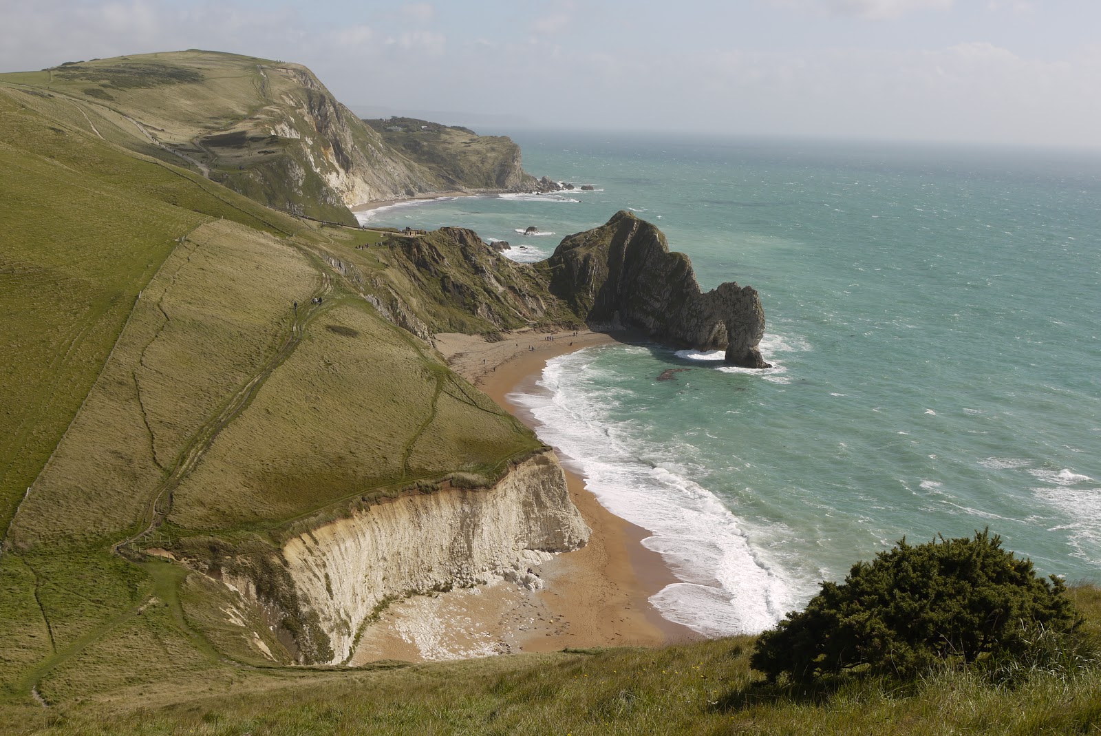
Much better weather today, so we decided to resume the Coast Path. We parked in the massive public car park at Lulworth and followed many others up the white brick road towards Durdle Door. I have been down this path a couple of times before, but I had been saving going up for an official Coast Path walk. The splendid view you get as you look back is shown above.


At the top you begin the descent towards Durdle Door, with St Oswald's bay in the foreground


I tried a new angle for a photo to try to capture the waves, which were more in evidence than on two previous occasions I had been here this summer (first on 14 April).


After Durdle Door there is almost nobody on the path as it descends further as it passes Scratchy Bottom, a glacial valley. Ahead lies a steep climb to the top of Swyre Head. This is not the Swyre Head which is the highest point along this section of the coast at 203m, and which we encountered earlier in the Coast Path (stage 7 and stage 8, finishing and staring at nearby Rope Lake Head), but another one. It's rather confusing! This one looks high, but is actually only about 100m above sea level.


When you get to the top, you are rewarded with great views back.


In the way of the Coast Path you then descend to near sea level and climb up to the top of Bat's Head, from which a new sort of coastline is visible: chalk cliffs still, but less indented and now there is a longer continuation of the beach which starts at Durdle Door.


The path now descends and bit then climbs steadily to pass a navigation obelisk. As you look back, you can see the jagged curve of the cliff edge as it erodes and also the way in which it has been thrown up.


Just before White Nothe we turned sharply right to follow a grassy field edge track which doubles back along a broad grassy ridge parallel to the sea. The views from here are pleasant rather than startling. This is West Bottom.


Further on, you walk on the more dramatic ridge above Scratchy Bottom, and as  you descend, there is a good view of the valley itself.


After passing the Caravan Park, we took the inland route back to Lulworth Cove, with the coast fully in view ahead. We now know that the deep dip which is so clearly visible is down to Arish Mell, and we will probably never forget climbing down and up both sides of it in quick succession in the Flower's Barrow to Lulworth section we did prior to today's walk.


Conditions: mainly cloudy, some sunny intervals, extremely windy, mild.

Distance: about 6.75 miles, of which 3 were on the Coast Path. Distance covered now 31 miles.

Map: Explorer OL15 (Purbeck and South Dorset).

Rating: four and a half stars.

Saturday, 10 September 2011

Milton Abbas and Gallows Corner

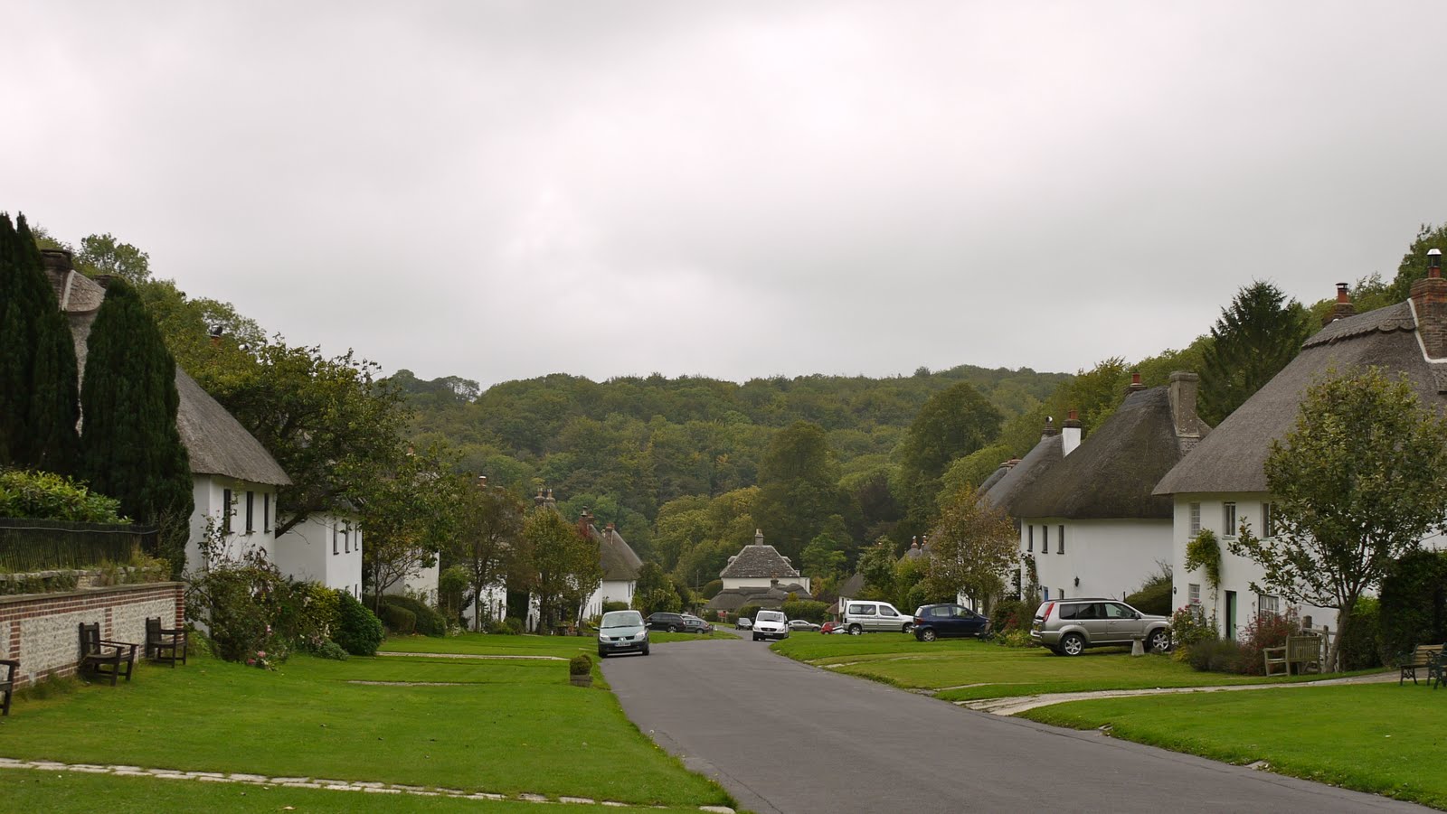
Milton Abbas

We had hoped to make further progress along the Coast Path today but the weather continued to be very uncertain, so we decided to try our luck inland, at Milton Abbas.

As you drive up the main street to park opposite the church, where this walk starts, it is immediately obvious from the uniformity of the houses that this was a planned village. It turns out that the new owners of nearby Milton Abbey decided in 1771 that the house needed to be rebuilt and placed in a landscaped park. They (almost inevitably) engaged Capability Brown to do the landscaping, which included a large artificial lake. The price of this was that the medieval town was simply moved out of the way, and was seemingly downsized at the same time.

The church, St James's of 1786, was covered with scaffolding and so we couldn't form much of a view of it. Opposite however was the delightful Sir John Tregonwell's Almshouses. They were built in 1674 and re-erected in the new location in 1780. Pevsner is quite sniffy about the "crude" Tuscan and Corinthian columns. We thought they made a delightful group.


The village was located in a narrow valley and so the walk began with quite a steep climb out of it by the side of the church. You emerge onto a high plateau with views of the undulating farm land to the south through which the rest of the walk would pass.


You follow a series of paths along the sides of fields, first south east, then making a sharp turn south west. As we approached the Milton Abbas to Milbourne St Andrew road, we were becoming increasingly conscious of how few flowers we had seen - and we were getting just a little bored with fields. Then all of a sudden a field of sunflowers appeared on our left. A closer look revealed a small set-aside in front of it with an absolute profusion of wild flowers in front. Very cheering!


Across more fields on the other side of the road and then finally we joined a green track which immediately brought us to Gallows Corner - a junction of six green paths. Presumably there was once a gallows, but just for once googling yielded no insight - the premier Gallows Corner seems to be in Romford.

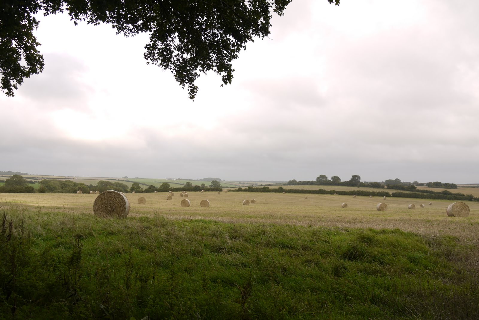
We followed one of the lanes back towards Milton Abbas and enjoyed the view over fields of hay wheels. They were bound with transparent plastic which we thought was much easier on the eye than the more usual tight black plastic wrapping.


We crossed the main road again and a few more fields to eventually walk up the road into Milton Abbas, past Capability Brown's lake, now available for coarse fishing by the day. This gave us the opportunity for a closer look at the village houses. Each building originally contained two houses with a shared front door, and although some are now single dwellings most still seemed to conform to this model. This was evidenced by the separate house numbers either side of the front door and by the two different sets of curtains in the central window on the first floor.

They were obviously quite cramped then and it was fascinating to see the range of rear extensions that had been added over the years. In some cases, a whole further house seemed to have been added at the back.


Conditions: mild, cloudy, threat of rain.

Distance: 5 miles.

From: 50 walks in Dorset (AA).

Map: Explorer 117 (Cerne Abbas and Bere Regis).

Rating: three stars - an interesting village, but the field paths were a bit repetitive.