Friday, 30 November 2012

London Art Deco


 Abbey House, Baker St

We stayed in London last night after going to the Rolling Stones concert (whoopee!) and the plan for today was to do an Art Deco walk. I spent quite some time devising it, using London Art Deco by Arnold Schwartzman and various websites as my inspiration.

We were staying near Baker St so we started the walk there with a quick look at Abbey House. It dates from the 1920s and the architect was John James Joass. The tower brings to mind the work of Lutyens. The building has more recently been redeveloped as luxury apartments and only the facade is original.

An amusing sidelight is that Abbey House is located at 219-229 Baker St and of course 221B is the celebrated address of Sherlock Homes - although the numbers, and presumably the street, did not extend that far when Conan Doyle wrote his stories. For many years Abbey National apparently had an employee whose sole job was to respond to letters addressed to Holmes. Nowadays, there is a blue plaque at the Sherlock Holmes museum further up the road at 237-241. I have to confess that I can't get my head around the idea of a museum to a fictional character.


It being Angela's birthday, we then went to one of the several hotels which have strong art deco links. Breakfast at Claridges was a memorable way to start the day. The entry lobby has fine mirrors, Lalique statues and Egyptian pilasters.


We now undertook the first of two cheats and took the tube to Mornington Crescent to see the former Carreras tobacco factory, now refurbished as offices, Greater London House. The building was erected in 1926-28 and was the work of architects M.E and O.H Collins and A.G Porri. It has a strong Egyptian theme, highly fashionable at the time, four years after the discovery of the tomb of Tutankamun.


A close-up reveals the cat theme - there are also two large cats standing guard at the entrance. This had a double meaning: the Egyptian god Bast and also a brand image used on packs of Craven A cigarettes.
 

From here, we walked down Hampstead Road, right into Euston Road, and left into Portland Place (via Park Crescent), passing John Nash's famous terraces on the way. Our first destination was the RIBA building (1932-4, by G Grey Wornum).


One of the great things about this building is that it is an open space with a library, bookshop and cafe available to all. So, unlike all the others on this tour you can go inside and look around the interior. It proves to be notably spacious and well-proportioned, with wonderful etched glass in geometric patterns and delightful mouldings on many of the ceilings, echoing the extensive external sculpture.


Further down Portland Place is Broadcasting House of 1931-2 - note the miniature radio mast on the roof. The architects were Myer and Watson-Hart. The sculpture of Prospero and Ariel over the main entrance is by Eric Gill.


There are other relief sculptures over the lesser doors. This one is Ariel between Wisdom and Gaiety, also by Eric Gill.


Just next door is All Souls church. It's not art deco obviously, but I am including it because it is a fine London sight which I have ignorantly walked past many times. It dates from 1834 and is the only church designed by the great residential architect John Nash.


The porch and tower are a great composition, but the rectangular nave and two aisles now feel more like a concert hall than a church.

Now we walked down to Oxford Circus and straight across into Regent Street, taking second left into Great Marlborough St. There on the corner of Argyll St is one of London's most wonderful - and probably least known - art deco buildings, the fabulous Ideal House (now known as Palladium House). I have walked underneath this building numerous times, heading away from Oxford Circus tube station, unaware of its existence.


Pevsner is quite scathing about it and the near-contemporary Liberty building opposite: "the traveller will stop and consider which of two evils of our present civilisation he may be readier to put up with". He describes Ideal House as a "piece of commercial showmanship".  The architects were Raymond Hood and G Jeeves and it dates from 1928.

After a break for an excellent lunch at Fishworks in nearby Swallow Street we resorted to the tube again to go to Barbican. We then walked to Charterhouse Square to see the curving lines of Florin Court. It was built in 1936 and designed by Guy Morgan and Partners. It was notable for its roof garden and basement swimming pool.


It wasn't until I researched this walk that I realised why the square is so called. In the opposite corner is Sutton’s Hospital in Charterhouse. This former Carthusian priory (established 1371), became a private house after the Dissolution of the monasteries but in 1611 it was sold to Thomas Sutton who
endowed a charitable foundation to educate boys and care for elderly men. Charterhouse school was relocated in Surrey in 1871, but the almhouses continue in operation.


The next building was supposed to be Chambers and Co at 23 Long Lane, but I was distressed to find that it had been knocked down as part of the construction of Crossrail. There is an image of what it looked like here.

We continued past Smithfield market (Horace Jones, 1868) ...


 ... and took a circuitous route to Ludgate Circus to begin the final stage of the walk, along Fleet St.

At 120 there is the wonderful former Daily Express building, now Goldman Sachs. It was designed by Ellis & Clarke, in collaboration with Sir Owen Williams. It seems remarkably modern and Pevsner says that "it was certainly a daring design at the time".


A few doors away, at 135-141 is the more classically influenced Daily Telegraph building (also Goldman Sachs). It is the work of Elcock  & Sutcliffe, assisted by Thomas Tate and dates from 1928. It was too dark by now to get a good photo, but there are some nice art deco details and a celebrated clock. Pevsner is not impressed however, writing that it has "little to recommend it". It is extraordinary that two such different buildings could be near contemporaries - and the same point could be made about Ideal House and Liberty's.


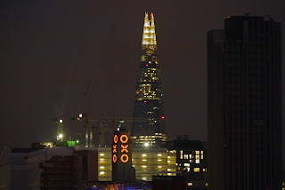
 As we reached Waterloo Bridge, we made a short detour to snatch a glimpse at the Oxo Tower, with the Shard pleasingly in the background.


After all this, the only way to finish seemed to be at another art deco hotel, the Savoy, where we joined the throng for a drink in the American Bar.

Distance: maybe 5 miles.

Conditions: cold but bright.

Rating: four and half stars.

Thursday, 22 November 2012

Ventnor

Ventnor from the Esplanade

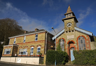
On day two of our short trip to the Isle of Wight, we set out from where we had been staying, the excellent Hillside hotel and walked further up the hill. We soon passed a nice pair of Victorian buildings: the one on the left is the former station tavern, while the one on the right, although looking like a chapel, has a stone plaque (dated 1888) linking it to the Ventnor Gas and Water Company. The long-vanished railway started in Ryde and entered Ventnor via a tunnel under St. Boniface Down, of which more later.


We turned right here and climbed a steep path to reach the downs that lie above Ventnor.  There was a fine view over the western side of the town, with the end of St Boniface Down on the left. The sun was in the wrong place to make a photo fully successful.


We joined and followed a road for a while, walked just below the radio masts and enjoyed fine views to the west from an elevation of about 235m.


We followed St Boniface Down with the radar station now to our left to reach the grassier Bonchurch Down. As the wide grassy path descended towards the sea, Sandown Bay opened up to our left, with the white chalk Culver Cliff prominent to the east. There were a number of yellow gorse plants here - we weren't sure whether they were late or early to be in flower.


We descended Nansen Hill and admired the breakers at Luccombe Bay, with Culver Cliff again in the background.


We decided we had better halt our forward progress at this point to be sure of catching the 3 pm ferry and followed the road back towards Ventnor. With some difficulty, we found our way down to the Coastal Path at Wheelers Bay.


We were staggered by the three-spoked concrete shapes used as shore defences. Were they interesting or weird? We couldn't decide.


Then past the elaborately defended harbour to the town, where we had a nice tapas lunch, and up the hill back to the hotel.

Map: Explorer OL29 (Isle of Wight).

Conditions: Not too cold. Quite a lot of blue sky, but some haze and spray in evidence and less clear than yesterday.

Distance: 5 miles.

Rating: four stars.

Wednesday, 21 November 2012

Tennyson Down and the Needles


Tennyson's Monument

We met up with our friends Viv and Giles for a two day walking trip to the Isle of Wight, and staretd by driving through Freshwater to reach the car park below Tennyson Down. We climbed up to Tennyson's Monument. The great poet lived at nearby Farringdon House for nearly 40 years and (according to Wikipedia) used to walk on the down almost every day, saying that the air was worth 'sixpence a pint'. The monument stands on the highest point of Tennyson Down (at 147m) and was erected after the poet’s death in 1897. The down, originally called East High Down, was renamed in Tennyson’s honour.

Looking to the north you can see right across the narrow rend if the island to get a very good view of Hurst Castle, which we walked to recently as the end point of the Bournemouth Coast Path.


Looking east, there is a fantastic panorama across the south coast of the island, with St Catherine's Point at the end.


We headed west however, across the grassy downland towards the Needles. After a while we could look back, to the north, towards Alum Bay. It is famous for its multi-coloured sands which are used to make souvenirs of the island. The colours in the afternoon sunlight were very impressive, especially the flash of maroon in the upper left.


As you approach the end of the down you pass the striated chalk cliff of Sun Corner, appropriately basking in bright sunshine.


But hereafter progress is more difficult. The south coast is fenced off and you are forced towards the north, past coastguard cottages and second world war concrete gun emplacements. As you descend towards the Needles it becomes clear that the only unencumbered view is from the top of a path descending towards the Old Battery. It is a pretty good view, but it requires a telephoto. I took about 10 pictures struggling against a howling wind. Most suffered from camera shake, but this one is not too bad.


We now headed back along the north side of the promontory which ends in the Needles past a cottage with an extraordinary profusion of garden gnomes, toys, mottoes and jests - all apparently to stimulate contributions to the RNLB. I gave a pound and we then followed a path on the north of the downs back to the car park.

Conditions: Clear after morning rain, sunny, but very windy.

Distance: 4 miles.

Map: Explorer OL29 (Isle of Wight).

Rating: four and half stars.

Sunday, 11 November 2012

Corhampton Down to Hambledon (Wayfarer's Walk 15)

Bottom Copse

The weather forecast was for a sunny day and I decided to resume the Wayfarer's Walk after a gap of two months. Ange came too, so it was possible to do a linear walk and make some impression on the 22 miles still remaining.

We picked up the route by Corhampton Down and initially followed the edge of Bottom Copse (above). Then through Corhampton Gold Course. As we emerged, there was a fine view west towards Shepherds Down.


 Now heading south along a road, the view to the east was across the Meon valley between Meonstoke and Droxford.


The path soon left the road and passing through woodland and then fields brought us to Droxford. The fine church of St Mary and All Saints stood close to the 17th century Manor House


Its Norman origins could be seen by the repositioned doorway in the north aisle and, I imagine, by the tower, with its stair turret.

The route now headed across the valley crossing the mighty Meon, running fast and clear, and then parallel to it through fields. At one point the path came close enough for a picture, which includes the unusual sight of a fence running across the river.


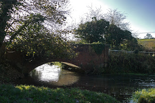
Further on we came to a nicely arched brick bridge. The sun was in the wrong place really, but it was a pleasing sight so I have done my best to salvage something with the aid of Photoshop Elements.


Now up the hill into Soberton. The first thing you see is Soberton Towers, designed and built by Colonel Charles Brome Bashford in the 19th century. Following Pevsner, it is impressive and picturesque at first, but disappointing on closer inspection.


 The rather messy looking Norman-Gothic church of St Peter and Paul lies just around the corner. According to Pevsner there are some impressive wall paintings, but we did not stop to look inside.


 There follows a quite steep climb up the other side of the Meon valley, reward as ever by fine views back. The church tower can be seen to the right.


The climb gave way to a grassy plateau where model aircraft enthusiasts ruled the skies. This gave way to a series of fields paths, past the red brick East Hoe Manor to descend into Hambledon through a beech hanger. A path at the back of the village brought us to the third church of the day, St Peter and Paul.


The church is of Saxon origin, but has been much altered and added to through the centuries. This marked the end of today's leg.

Hambledon is of course famous as the "cradle of cricket". The Hambledon Club was formed in about 1750 and played on Broadhalfpenny Down, a couple of miles to the east of the village. The famous Bat and Ball inn overlooks the down. Hambledon was apparently England's leading cricket club from about 1765 until the formation of the MCC in 1787.

Conditions: sunny and surprisingly warm.

Distance: 7 miles, so 57 now covered. The remaining 15 can be dealt with in two more linear goes, so the end is in sight and should be accomplished before the year is out.

Map: Explorer 119 (Meon Valley, Portsmouth, Gosport and Fareham).

Rating: three and half stars. Enjoyable and quite varied.

Saturday, 3 November 2012

Dewlish and Cheselbourne

All Saints church, Dewlish

Out for a Dorset walk after a long gap and we chose this one from our archive of walks published in Dorset magazine (March 2012). The walk begins at All Saints church in Dewlish and we set out to the accompaniment of blue sky and sunshine. The church is a typical mixture: Norman doorways, an early 14th century tower and a Victorian south aisle (TH Wyatt, 1872).

We walked down through the village, past the incongruous sight of a palm tree in a field, set off by an interesting sky.


We climbed a track up to chalk downlands with wide open spaces all around and views to the north west over Whitelands Downs.


The downland path gave way to an ancient tunnel-like track which led to Gallows Corner - a five-way path junction in the middle of nowhere.


I thought it seemed familiar and searching the blog reveals that we were here a year ago on a walk from nearby Milton Abbas.

There now came a long and increasingly muddy descent into the valley and across the dramatically named Devil's Brook - a brook nonetheless. Naturally, we then climbed the other side of the valley and had a nice view back across.


A series of fields brought us down to Cheselbourne, with its beautifully positioned Early English and Perpendicular church.


Then it was along more field paths back to Dewlish for a late lunch in the The Oak.

Distance: 5.5 miles.

Map: Explorer 117 (Cerne Abbas and Bere Regis).

Conditions: sunny, becoming increasingly cloudy; wet and muddy underfoot in many places.

Rating: three stars. A good work out, but our long distance walks mainly on tracks have left us less tolerant of muddy, uneven field paths.

Friday, 2 November 2012

Southampton

The Civic Centre clock tower

We were en route for Poole and decided to finally do the city walk around Southampton that we had been thinking about for some time. Our only previous visit to the city was to IKEA, but further investigation revealed that there were interesting medieval survivals and a good art gallery.

We parked near the Civic Centre and walked over to find the tourist office to collect a copy of the Jane Austen trail - I had already downloaded a very promising Old Town Walk. The Civic Centre is very obviously a 1930s development: Pevsner describes it as "perhaps the most ambitious civic building erected in the provinces in the inter-war years". The architect was E Berry Webber. The clock tower is very impressive.

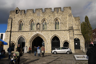
We now tried to follow both the Old Town walk and the Jane Austen trail, and started by walked along Above Bar, into a pedestrianised shopping area, to reach Bargate. Pevsner calls it "probably the finest and certainly the most complex town gateway in Britain. It dates from about 1180 and flanking towers were added a hundred years later.  The coexistence of modern shops and ancient buildings - and the street market which made it difficult to fully see the gate, put us mind of a recent visit to Rimini.


The appearance of the town side of the gate is very different, with 18th and 19th century embellishments, and in the centre an incongruous 1809 statue of George III in Roman dress.


From here we briefly headed east to see our first section of walls, with York Gate. We thought they were surprisingly extensive, but rather hemmed in by the modern buildings behind them.


We retraced our steps and passed behind the Bargate again to head west the handsome Arundel Tower on the north west corner of the walls, with the Catchcold Tower beyond it. Nearby is the site of the Dolphin Hotel, where Jane Austen attended balls - now offices with Costa Coffee and Watersons on the ground floor. This rather established a pattern for the JA Trail - the places where she had been were generally no longer in evidence.


In between the two towers are the well-named Forty Steps, a staircase which in mid-Victorian times led down to the Western Esplanade below. This overlooked what was once the tidal estuary of the river Itchen. It is not quite clear to me when it was filled in.

Further along, the west walls end and the mound where the castle once was is visible, along with traces of the castle vault. This area too has modern housing right up against it. A little further on is a section of wall known as the Arcades.


These were originally quayside warehouses, but after a French raid of 1338, the largest and most dramatic of a long series, King Edward III ordered that they be blocked up.

We went through the central gateway to walk along Blue Anchor Lane to reach St Michael's Square. As you enter this quiet square you pass the impressive Tudor House, now a museum.


It was mainly built between 1491 and 1518, but incorporates a banqueting hall a century older (Pevsner).

On the other side of the square is St Michael's church, the only remaining medieval parish church in the city.

It dates from the time the city was first settled by the Normans, about 1066-76, although only the base of the tower remains of the original church. The airy nave with its slim columns is the result of a 19th century rebuilding.

We returned to the Western Esplanade to reach the Westgate (built after the French Raid of 1338) and have a quick refreshing drink in the delightful Pig in the Wall next door.


We followed the line of the Town Quay to find the rather pleasing 1913 memorial to the Pilgrim Fathers who departed from the West Quay in the Mayflower and the Speedwell in 1620. "Quite a nice design", says Pevsner, perhaps a bit meanly.


A little further along is the Wool House, an imposing 14th century warehouse.


We headed into the town again at this point along French St to see some other non-existent place where Jane Austen was walked. But it did bring us past the Medieval Wine Merchant's House.


Back to the quay, and the Watergate. We had an excellent lunch in the Spanish-run La Regata tapas bar next door. Afterwards we completed the old town walk with a look at God's House Gate and Tower. The gate is 14th century and the defensive tower early 15th century.


We followed the line of the east walls, of which only traces remain to return to the Bargate and then retraced our steps to the Civic Centre to visit the City Art Gallery. The exterior is a bit forbidding and rather churchy, but inside it is magnificent.


There is a long gallery with a barrel roof and lower side-aisles of the same design. The undersides of the arches are picked out with coloured lines. The overall effect is spacious and visually very stimulating. The paintings are very good too, with the highlight being Burne-Jones's Perseus Series, a set of gouache studies of the legend of Perseus. In the end only four of the studies were painted in oil and they are in a gallery in Stuttgart.

Distance: 3.5 miles.

Conditions: sunny, quite cold.

Rating: four stars.