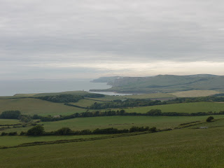
Thursday, 30 June 2011

Emosson Lake

Today John took us past Mont Blanc and the Aiguille du Midi, through Chamonix and over the Swiss border to see the Lac d’Emosson. Border  control was minimal consisting of a momentary glance and a wave through.
It was cool (12 degrees) with very low cloud when we set out, although the forecast was that it would clear later. As we snaked up through the clouds towards the lake, we did just begin to wonder if we would be able to see anything at all when we arrived. And when we did finally reach the car park at the Col de Gueulaz (1960m), beside the dam which created the lake, the cloud was so low that we could hardly see the other side of the car park.

The walk begins in a most unusual way: you walk through a tunnel through the rock for about half a mile. I took this photo without flash and although the very slow shutter speed has led to it being blurred, it gives a reasonable sense of the tunnel - although in reality it was much darker.


When we emerged at the other end, we began to walk along a causeway high above the lake, which was apparently to our our left. The first views through the cloud were tantalising.


However, we did see the first of many wonderful alpine flowers: this lovely Alpine Rhododendron - rather like an azalea.


A bit further along the path we saw this fine collection of plants growing up the base of the overhanging cliff. We had the sense of a Japanese garden lovingly tended, but presumably it was the fruit of natural processes.


As we walked further on the cloud began to lift and the bright periods grew longer. The original 1920s dam came into view, with mountains behind it.


And now there was another fine flower sighting: this wonderful Red Gentian, just coming into flower. We also saw large and small Blue Gentian, but I could not seem to get satisfactory photos of either.


I still haven't identified this similarly coloured flower shot against the background of the mountains on the far side of the lake.


As we descended to reach a locality called Barberine, where a old workmen's camp was ornamented by a traditional French cockerel, the sky cleared further and the farthest limit of the reservoir became apparent. The water is unusually low at present as major engineering works are undertaken.


We decided to turn round here and head back. In due course the new dam finally revealed itself to us, with bare rocky mountains behind. Mont Blanc was hidden in the clouds high above to the left.


Conditions: hot (mid 20s), although cooler under the clouds. Sunburn was discovered later.

Distance: 4 miles or so.

Rating: four stars.

Other sightings

We spotted three splendid varieties of orchid.


We were too high up to see many butterflies. Some blues, a lone Apollo, but right at the end a Mountain Ringlet decided to land on my leg. A first.

Wednesday, 29 June 2011

Le Chatelet and Ayères des Rocs

View across the valley

We are in St Gervais-Les-Bains, near Chamonix, visiting my friend John for a few days to experience a little of the joys of walking in the Alps. The day dawned bright enough, but the weather forecast and the barometer warned of a thunderstorm later.

John took us to the tiny hamlet of Le Chatelet, consisting of a bar and a couple of houses. It is located a bit north of Servoz  at 1418m above sea level.

We parked the car and carried on up the track, which was soon blocked for cars by resurfacing works. It quickly became clear that we would see lots of butterflies in the areas beside the track which were resplendent with a lovely assortment of wild flowers. It was like walking through a garden. Yellow Gentian was to the fore.


Progress was slow as I sought to take some pictures and I was quickly rewarded with reasonable shots of a High Brown Fritillary and a Pearl-Bordered Fritillary, of which there were lots. They look quiet similar, but the High Brown is rather bigger and closer inspection reveals differences in the shape of the wings and their markings.


We also saw, what I have since identified as a Marsh Fritillary - a quite beautiful creature.

Soon there were further successes: a Black Veined White and an Apollo, dancing together in the air before separately landing to take some nectar.


Further along, at Chalets du Soulay, the track made a hairpin turn left to continue on to Ayères des Rocs. We paused to look ahead to a delightful little river valley, where several separate streams made their  way down from the higher rocks above.


We followed the track onto a wide plateau underneath a high massif, with the clouds hanging down below the edge to the left and a further massif, still partly in sun, ahead. The high sides and the low cloud created a peculiarly enclosed feeling. We were now at 1641m.


At this point we decided to head back rather than push our luck with the approaching thunderstorm.  We paused to investigate the enclosed little valley. It was a charming quiet spot, with flowers, a stream and more butterflies - including now some Blues. This view reminded me of Millais's famous picture of John Ruskin - without Ruskin of course.


After this refreshing break, we headed back on down the track to regain the car and head off to find a restaurant for lunch.

Conditions: hot (mid 20s), although cooler when we came under the clouds.

Distance: perhaps 4 miles.

Rating: four stars.

Saturday, 25 June 2011

Arne

View towards Middlebere Lake

Yesterday's planned walking was rained off and the forecast fro today wasn't much good either, but by late morning it seemed bright enough for a walk on the good tracks around the RSPB reserve at Arne.

Like the last time I walked here in March we followed the red route up past the church of St Nicholas, beside fields, through woodland and heathland to reach the edge of Poole harbour.

Once of the little pools by the track had some wonderful waterlilies ...


... as well as a couple of dragon flies which would not pose long enough for a photo.

We walked on to Shipstal Point and along the beach, quite a bit of which was visible at low tide. Just as we left the beach, there was this nice view towards Long Island.


We continued along the Red route which would have led back to the car park, but spying a gate on the left we nipped through it and headed a track across the heath towards the other section of the reserve. The heath was alive with purple heather and made a wonderful sight with the subtle variations in shade.


It turned out however that this track did not quite lead to the other section of the reserve, even though there were some lovely views towards Middlebere Lake. The path inexorably bore right and we ended up on the edge of the overflow car park. Still, it had been a delightful stroll across the purple heath.

We decided to call it a day there as lunch was now overdue. We had seen remarkably few birds, a possible sighting of a Green Woodpecker being the most interesting, but it was great to get after after a frustrating day yesterday.

Conditions: bright and sunny, about 19 degrees.

Distance: about 4 miles.

Map: Explorer OL15 (Purbeck and South Dorset). Not that you need it, except perhaps to find your way to the reserve from Wareham. Otherwise, the paths are very well marked.

Rating: three and a half stars.

Hinton Ampner

Hinton Ampner

We met up with our friends Viv and Giles at Hinton Ampner, a National Trust property famous more for its garden than for its house. We started with a little detour to see the Saxon church of All Saints. Most of what you see is 13th century, although the wooden tower dates only from 1879.


We crossed the A272 to follow a track which quickly passed an information panel telling us that the field to our left was the site of the Civil War battle of Cheriton. It was apparently a strategically important victory for the Parliamentarians and meant that Charles I never regained the offensive in South East England. Of course, it looks like any other field.


Heading north, we crossed the Wayfarer's Walk (one of many long distance paths I aspire to walking) and continued along a hedged lane. On a better day this would probably have been a good place for butterflies, but we saw only a few whites and Meadow Browns, and a single Comma and Small Tortoiseshell.


After a mile or so, we turned left beside a corn field ...


... crossed a small road and reached the tiny, but clear and fast-flowing, river Itchen, near to Cheriton Mill.


The mill race was still visible, but the watercourse which passed under it was choked with reeds.

We followed the track parallel to the course of the river and were puzzled by the sight of a stationary figure one the other side of a field. As we got closer it was revealed as a remarkably life-life statue of a huntsman. It really was an excellent piece of work.


There was no clue as to its identity, but bit of Googling unearthed a report in Horse and Hound which revealed that it was the work of artist "Miranda Michels, a former joint-master of the Radnor and West Herefordshire, [who] spent last season crafting The Huntsman out of hammered and welded stainless and corten weathering steel". I have to confess I was disappointed to find that her motivation was to support the repeal of the Hunting Act. Still, it is a fine statue and it enlivened this section of our walk.

We soon came into Cheriton village and stopped to see the church of St Michael and All Angels. It is predominantly 13th century, with some interesting tracery in the chancel, a scratched mass dial by the porch and a priest's door visible on the side of the chancel. The church was altered after a fire in 1744 and the squat tower dates from this period.


After a sustaining lunch at The Flower Pots pub and brewery, we walked down the lane towards New Cheriton, crossed the A272 again and found a track which passed beside fields to go behind Hinton Ampner. One more turn past a field full of very noisy sheep brought us to the house.

It now started to rain and while we enjoyed a look around the house, we had to forgo the garden.

Conditions: cloudy, but quite warm.

Distance: about 6 miles.

Map: Explorer 119 (Meon Valley, Portsmouth, Gosport & Fareham).

Rating: four stars.

Tuesday, 14 June 2011

Chapman's Pool to Rope Lake Head (SW Coast Path 7)

Looking back towards St Aldhelm's Head

After a two months' gap, today offered an opportunity to resume our progress, by means of circular walks, along the South West Coast Path. We started at a car park to the west of Kingston, just by the entrance to Encombe Park, and walked back along the lane to the village. There were fine views to the left towards Corfe Castle. You could very clearly see the way in which the castle perches on a self-contained hill, with the Purbeck ridge rising on either side of it. What led to the interruption of the ridge?


In Kingston, we turned visited the church of St James and then turned right towards the sea. We were pleased to immediately identify it as Victorian. It turns out to be by the eminent architect G E Street  and was built in the 1870s, lavishly funded by the third Earl of Eldon. Pevsner describes it as his (Street's) "grandest church in the country".


We followed the road due south as it gradually became a track. After about a kilometre, we forked left on a permissive path aiming for the precise point at which we left the Coastal Path in April. We were pleased to find it successfully, but something went slightly awry because we had to carefully climb over a barbed wire fence at the end.

The path is a long way inland here, forced away from the coast by the steep ravine at the back of Chapman's Pool. As we walked along we could see the rocky side of Emmetts Hill, and remembered the many steps we had climbed up to reach it on the last leg from Winspit to Chapman's Pool.


Soon the path opened out into a wide glacial valley as we curved round under a fine rounded, but seemingly unnamed, hill 136m above sea level. When then took a path on the left, leading right down to the coast. This is the view back.


Now we climbed this leg's set of steps: about 200 of them leading up to the top of Houns Tout cliff, at 140m. The view back towards Chapman's Pool and St Aldhelm's head was exhilarating.


We were delighted to find a sun-warmed stone bench looking west and sat there for a while taking a breather and enjoying the view towards Rope Lake Head - the second headland in the picture, the first is Egmont Bight.


There now followed a long descent and then a relatively flat section, with Swyre Head, the highest point along the Dorset coast at 203m, rising to the right.


Just before Rope Lake Head, we took the path which leads, over a kilometer or so of steady climbing, to the top of Swyre Head. We came this way in January walking from Kimmeridge, to the west, so we knew exactly what to expect. Last time, it had been raining and the slippery mud added considerably to the difficulty. Today it was dry, but still a decent climb.

As we approached the top, with a hint of early sunset, the view to the west towards Kimmeridge Bay opened up.


The final stage back to the car park followed the line of the ridge overlooking the stretch of coast we had just walked along. The curve of the ridge mirrored the curve of the coastline. In the valley below Encombe House nestled, almost invisibly, in its private park.

Conditions: sunny, hot.

Distance: about 6 miles, of which about about 3 was on the Coast Path. Distance covered now 19 miles.

Map: Explorer OL15 (Purbeck and South Dorset).

Rating: four and a half stars.


Sightings

Quite a good day for butterflies: Large and Small White, Meadow Brown, Small Heath, Small Tortoiseshell, Speckled Wood, Painted Lady (our first of the year), Large Skipper, and two Blues - I think Silver Studded and Adonis.

On the bird front, we watched a Kestrel circling around the cliff edge at Houn's Tout and admired the gliding flight of a number of Fulmars. Later we saw a small flock of Goldfinches and a pair of Yellowhammers. The highlight though was to definitively identify some Stonechats: a male, a female and a chick.


Flower of the day

This Viper's Bugloss grew in a number of places on the top of Houn's Tout. I have had it as my Flower of the Day before, but never in such a dramatic location.


Sunday, 5 June 2011

Wotton-under-Edge to Hawkesbury Upton (Cotswold Way 11)

Almshouses, Wotton-under-Edge

We are now over two-thirds of the way through the Cotswold Way. We picked up the route in the centre of Wotton-under-Edge and soon turned into Church Road where the wonderful Hugh Perry and Thomas Dawes almshouses (above) are to be found. Hugh Perry was born in Wotton and became Sheriff of London in 1632. He left money in hill for the erection of almshouses for six poor men and six poor women. You can go through the central doorway to emerge into a charming small courtyard with the Thomas Dawes hospital of 1720 opposite, with six further apartments and the small 17th chapel to the left.

A bit further on we passed the 13th century church of St Mary the Virgin, with its 14th century tower. A service was underway, so we did not look inside.


There now followed a quite steep climb out of the town and then a dog-leg to the east and back to reach a point with fine views to the south, with the monument at Hawkesbury Upton, today's destination, visible on the horizon.


We almost took a wrong turn here, descending into the valley, seemingly drawn by the lure of the strangely-named Nanny Farmer's Bottom which lay ahead. However, we managed to resist and followed the line of the ridge round to Wortley Hill and down into Wortley.

We left Wortley across a grassy meadow with a fine view of Alderley on the hill on the other side.


Alderley seemed to be a characterful village and we passed the church of St Kenelm, rebuilt in 1802, but with a fine tower of about 1450. We passed also an imposing gateway which clearly led up to what we thought was probably a folly built on the side of Winner Hill.


A bit of Googling confirms that this supposition was correct. It dates from 1779 and has recently been restored. The great house which lay between the gates and the folly has long been demolished.

We headed south east from Alderley, walking under Winner Hill and were delighted by the view along the valley towards Kilcott.


We walked along the narrow road through this hamlet and made one last climb through Claypit Wood to finally walk beside a lovely flower meadow to reach the Monument to General Lord Robert Somerset, on the road just north of Hawkesbury Upton.


It dates from 1846 and is by Lewis Vulliamy. Somerset was a son of the 5th Duke of Beaufort (whose ancestral home was at the nearby Badminton House). He had served with distinction at Waterloo.

Conditions: quite wet.

Distance: about 7 miles.

Map: Explorer 167 (Thornbury, Dursey and Yate).

Rating: four stars.