Showing posts with label SW. Show all posts

Friday, 7 February 2020

The Solent Way: A review


Buckler's Hard

The 60 mile Solent Way starts at Milford on Sea and stretches as far east as Emsworth. It covers most of the coast of Hampshire. We had already walked the South West Coast Path, the Bournemouth Way and the Wayfarers Walk (from Inkpen to Emsworth) and this extends the total continuous distance walked to 787 miles. The next step will be to walk from home (Newbury) to Inkpen - then we will be able to say that we have walked from Newbury to Minehead.

The route divides into three distinct sections, although shoreline birds are in evidence along much of the way. The first is from Milford to Hythe via Buckler's Hard and Beaulieu. This is more rural much  than the rest and brought us to the first of several river crossings (in fact we carefully avoided having to be ferried across, instead using them as start or finish points. Here is the astonishing pier at Hythe.


The second section covered Southampton and Portsmouth - two of Hampshire's three cities (the other is Winchester). The feel here was urban or suburban on shore with the Solent and the Isle of Wight dominant influences to our right. The biggest surprises were the ruins of Netley Abbey and the chapel of the Royal Victoria Hospital (the only remaining part) 


Gosport and Portsmouth were especially interesting for their military history, of which there were constant reminders. Out eye was caught by HMS Warrior ...


... and the world's last Hovercraft.


The final section ran from Southsea to Enborne, around Langstone Harbour. This was perhaps the least rewarding although there is a great pub at Langstone and a lovely wildlife reserve for birders at Farlington Marshes.


Stages


1 Milford on Sea to Lymington

2 Lymington to Buckler's Hard

3 Buckler's Hard to Hythe

4 Southampton to Hamble-le-Rice

5 Warsash to Lee-on-the-Solent

6 Lee-on-the-Solent to Gosport

7 Portsmouth to Farlington Marshes

8 Farlington Marshes to Emsworth

Sunday, 19 January 2020

Farlington Marshes to Emsworth (Solent Way 8)

Farlington Marshes

The final leg of the Solent Way! We set off from the car park at Farlington Marshes, following the sea wall on the right and the marshland on the left. The tide was out so all that was visible on the right was mud. The marshes form a nature reserve and were clearly a good site for birding. Reed Warblers seem to have been the main object of attention. There were also lots of Brent Geese and I have since discovered the extraordinary statistic that 20% of the world's population of Brent Greese over-winter in the Solent area. A small-scale murmuration of Starlings caught our attention as well.

We followed the track which leads around the harbour/reserve (depending on whether you look inland or out to sea) and reached a large lake with a series of stands which a sign told us had been installed for gulls to roost on.


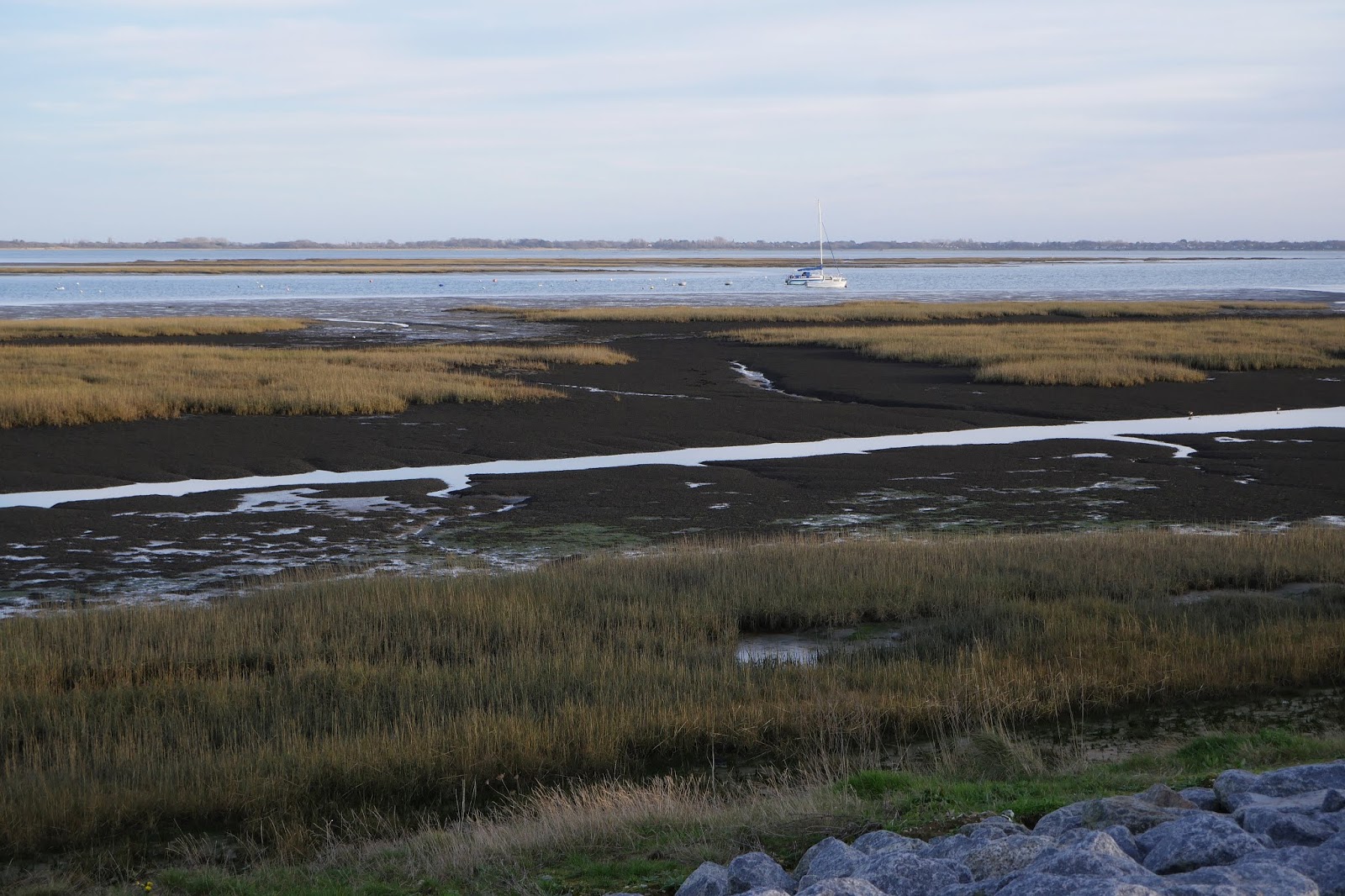
The marshes ended pretty much where the path came close to the busy and noisy A27. We carried on, with the harbour floor now covered in reeds.


In lieu of anything much else to report in this area I include the Solent Way way-mark.


As we approached Langstone, the Langstone Bridge came into view. It connects Hayling Island to the mainland. I remember holidaying there as a child.


We paused at the excellent Royal Oak pub for a drink. It was so pleasant a day that most people seemed to be sitting outside. Resuming the walk we passed the one-time Langford Mill (tidal).


As the tide was still out - and would be until the evening - we decided to follow the lead of many others and walk along the back of the harbour rather than take the inland path.


After a couple of miles we reached Emsworth and followed the path around the delightful Emsworth Millpond. The water was so shallow and still that you could still see ice on the surface.


About two-thirds of the way round the light over the area outside the millpond was so lovely that I just had to take a picture.


We passed the one-time tidal mill, now the headquarters of a sailing club and headed into the town to regain the car and head home.

Conditions: a lovely sunny day.

Map: Explorer 120 Chichester, South Harting and Selsey

Distance: about 7.5 miles.

Rating: 4 stars.

Saturday, 18 January 2020

Portsmouth to Farlington Marshes (Solent Way 7)

HMS Warrior

We started this latest leg of the Solent Way near to the arrival point of the Gosport Ferry. The first main sight was HMS Warrior which was launched in 1860 and was Britain's first iron-hulled, armoured warship.

We diverted slightly from the official route to pass under the railway and reach the Outlet Centre on the other side. This seemed to be swarming with shoppers in search of a bargain and has presumably been a very good innovation. Our real goal of course was to get a close up view of the dramatic 170m high Spinnaker, opened in 2005.


We looped round to go through the Landport Gate ...


... and follow the outside wall of the dockyard. We turned into Broad St and were delighted with this arch, with its painted capitals and precise location recorded in the arch.


Walking along Broad Street we were struck by this modern building over on the right. It seems to have been designed to resemble a ship. It is a very reasonable idea for a city like Portsmouth, but we thought it was rather clumsily executed.


At the end an excellent view point towards Gosport. Fort Blockhouse was directly opposite and Fort Gilkicker, which we passed on the previous leg, can be made out on the extreme left.


We headed through the Round and Square Towers and headed along a splendid walkway with a glimpse of the Cathedral off to the left.


This was the view back. We were surprised to discover that amidst all these defences there was also a beach.


At the end there was a fine view, with the ruined Royal Garrison church (destroyed by a wartime bomb) on the right and a statue of Nelson on the left. The building in the centre looked worth a look too.


We now walked along beside another part of the city's defenses, the Long Curtain, a defensive rampart with a moat outside it. At the end the projecting part is the Spur Redoubt which was built in about 1680.


We continued along the Millenium Path towards Southsea passing the Clarence Pier with typical seaside amusements and fast food. Shortly after this we saw a hovercraft crossing from the Isle of Wight. We thought the hovercraft was a defunct form of transport - and we were almost right, this is apparently the last one operating in the world.


Soon it zipped across the Solent at an impressive speed. Long may it continue!

A little further on was the art deco War Memorial which we admired on our one earlier walk around Portsmouth in 2012.


We approached Southsea Castle, which was a bit of a surprise. It turned out not to be very grand, but it was one of the chain of castles built by Henry VIII in the 1540s to defend against the threat from Spain. Other examples can be found at Brownsea Island and the Isle of Portland,


Just past the castle there was a fine view of Southsea's South Parade Pier. It was opened in 1879 and fully restored in 2017. When we reached the pier we felt we just had to have an ice cream.


We followed the path along the back of the beach, which became gradually more covered with vegetation, until we reached Eastney. Here we cut inland through Milton to re-emerge on the east side of Portsea Island. We followed the path along the west side of the shallow Langstone Harbour. I just had to take a photo of this lone boat, wonderfully named El barco (The boat, of course).


Just before the path comes close to the busy dual carriageway (i.e. very noisy) A2030 we found the intriguing people's war memorial. You can find out more about it here.


The final section up to the car park at the corner of Farlington Marshes was not too thrilling. In truth, Langstone Harbour is shallow, muddy and pretty featureless.


Conditions: a lovely sunny day, but eventually quite cool

Map: Explorer 119 Meon Valley, Portsmouth, Gosport & Fareham.

Distance: about 7.5 miles.

Rating: 4 stars. Lots of interest in Portsmouth, but less rewarding after Southsea Pier, i.e. the great majority of the walk.

Friday, 3 January 2020

Lee-on-the-Solent to Gosport (Solent Way 6)

Browndown

After something of a gap we rejoined the Solent Way at Lee-on-the-Solent. We continued along the shoreline path for a short way before going through a gate into Browndown, an Army Firing Range. Just like at Lulworth a sign explain that you could only enter the range if the red flag was not flying. Happily it was not!

There was a choice between walking along the shingle beach or taking an inland path. We chose the latter as being easier to walk on, although doubtless a bit longer. We wandered along a grassy path with patches of shingle and then, realising we were getting further away from the coast, headed towards the sea. This brought us past this strange structure ...


... which turned out to be a firing range, presumably for smaller weapons.

As we reached the back of the shingle beach we passed this mysterious structure, rather reminiscent of a mushroom. There seemed to be no way into it and the top seemed to lack any obvious vent (I thought it might be some sort of ventilator for unfathomable underground activity). It remains a mystery.


Shortly after this we reached the exit gate and were hugely amused to discover that the firing range had been closed since .... 1977!

On leaving Browndown we passed a busy car park with some mysterious metallic structures at the back. Another information board, hopefully up to date, told us that this was part of a diving museum


We had had enough of shingle so we followed the edge of Stokes Bay along a nice solid path at the back of the shingle. On the landward side there was a car park, a fish restaurant, a lifeboat station and a vast grassy area. There were also these brutalist beach huts - we are becoming connoisseurs of beach huts.


The end of this stretch was marked by a golf course to the left and a fort which you have to skirt on the landward side. There is a large mound but not much else to see at first. As you skirt the the unusually named Fort Gilkicker you reach the entrance, which looks pretty derelict. A sign suggests there is a plan to convert it to housing, but there is nothing to suggest anything is happening.


We walked away from the fort with a golf course on both sides to reach Fort Road where we turned right towards the centre of Gosport. Reaching Haslar Road we walked along the side of the huge Fort Haslar on the left ...


... and passed the former Naval Hospital on the right. It too is being converted into apartments, seemingly with more success. The entrance tower was rather splendid. We thought we might fancy an apartment on the upper floor.


At the end of Haslar Road there is the Submarine Mueum on the right and a little further on you come to the Haslar Bridge ...


... with the Haslar Marina on the right.


We followed a harbourside walkway to return to the car park where we had left the car. Across the harbour there was a fine view of the 170m high Spinaker Tower which opened in 2005.


A bit further along to the left on the Portsmouth I was astonished to see two giant aircraft carriers moored side by side. They are HMS Queen Elizabeth (right) and its identical sister ship HMS Prince of Wales and apparently this is the first time they have been moored in this way.  This information is courtesy of BBC News, which also pointed out that the carriers cost £3.1bn each


Conditions: a lovely sunny day.

Map: Explorer 119 Meon Valley, Portsmouth, Gosport & Fareham.

Distance: about 5 miles.

Rating: 3 and a half stars. A strange, but unexpectedly interesting, walk which was unique in places.

Monday, 18 November 2019

Warsash to Lee-on-the-Solent (Solent Way 5)

The Rising Sun

We picked up the Solent Way at Warsash on the opposite side of the River Hamble to Hamble-le-Rice and walked away from the rather inviting Rising Sun pub. A plaque reveals that this was where 3,000 Commandos set sail in landing craft for the Normandy Landings in 1944.

We followed the track towards the mouth of the Hamble: this was the view towards the other side.


This area (the Hook with Warsash Nature Reserve) offered a great variety of bird life - I must must put some time into improving my shoreline bird identification!


Further along, once we were walking along the side of Southampton Water again, we noticed this dramatic structure on the other side: from the map it looks to be Fawley Power Station.


We followed the path until we reached a point where the signage disappeared, just before the Solent Breezes Caravan Park - and so did the path! We found some steps which led up to the caravan park, a strode confidently across it to reach a sign saying the coastal path was closed (but not offering anything in the way of an alternative). After talking to some residents who explained that the problem was (a) coastal erosion and (b) an out of date map (dating from 2005 it turned out).

We found our way down to the gravel beach. This was the very eroded clifftop we had expected to walk on the top of.


This was the view ahead to Hillhead - it looked like a tiring walk.


Happily, after a while we spotted a steep path leading up to the cliff-top path, which was here set back much further from the cliff edge. Now we made faster progress, observing a massive flock of Brent Geese in a truly massive field on the land side.


As we approached Hillhead we were forced inland by a fine house (Dreamfield) whose construction required the path to be diverted inland - again without any signs to get you back on track.


Fortunately, we were able to find our way to the beach where we passed in front of the Meon Shorre Chalets and then round the corner to Hillhead Harbour. Across the entrance to teh harbour we could see a a line of beach huts in shades of blue, looking was nice in the afternoon sun.


Passing the beach huts led to a pleasant walk way with overhanging foliage.


We left Hillhead along the road passing the Osborne View pub, altering us to the distant sight of Osborne House, allegedly Queen Victoria''s favourite.

Further on, we turned right down onto a path at the back of the shingle beach which offered quite a nice sunset.


My final image is this platform in the Solent, presumably for oil drilling or something similar.


After that it remained only to follow the path into Lee-on-the-Solent, where we had parked. We were surprised - and rather saddened - to learn that there there was once a pier with an art deco tower at the back of it. It was built in 1935 and demolished in 1958. The advent of package holidays was blamed for its early demise.

Conditions: bright and sunny for the most part.

Distance: 7 miles, not counting the various detours.

Map: Explorer 119 (Meon Vally, Portsmout, Gosport and Fareham).

Rating: four stars.