Friday 23 May 2014

Rushton and Rothwell

Rushton Triangular Lodge

We owe today's outing with Sally and Malcolm to a TV programme about the English Renaiassance. The presenter, James Fox, described the extraordinary Rushton Triangular Lodge and it came to me that I could base a walk around it.

The Lodge was the work of Sir Thomas Tresham a devout Roman Catholic who lived in nearby Rushton Hall (now a luxury hotel). He was imprisoned for his faith for 12 years under Queen Elizabeth and when finally released he constructed this extraordinary building as an expression of his faith. The principal theme of the building is the Holy Trinity and this is reflected at numerous levels: the Lodge has three sides, and internally three floors, each side has three gables and three sets of windows, the windows have trefoil or triangular patterns. There are also various inscriptions, symbols and numbers, not all of which are understood. It dates from 1593-6.

We arrived just after a party of schoolkids and we were delighted that they were inside while we wandered round the exterior and marveled at it.

At length we began the walk over to nearby Rothwell along an roughly straight path across fields, crossing the tiny river Ise on the way.


Rothwell is a charming market town, but it was the ideal destination because of its most notable feature: the Market House. (Unfortunately unavoidably photographed directly into the sun.)


It was designed by William Grumbold for - yes - Thomas Tresham. It dates from 1578 and also incorporates trefoils, Tresham's coat of arms and inscriptions, but no religious motifs. It is a most impressive small building, looking a little run down now.

Just behind the Market House is the large and imposing Holy Trinity church. We liked the warm colours of the local stone of which it is built.


It is mostly 13th century although the tower dates from the 1170s. The church has one of only two known bone crypts or charnel houses in the country, containing the remains of around 1,500 people.

And just beyond the church lies Jesus Hospital, a lovely set of almshouses founded in 1586 by Owen Ragsdale.

The two buildings which project forward are linked to the main building at the back: an unusual variant on the common E shape for almshouses. The left one has a date stone 1835 and the right one 1855. Perhaps they were sympathetic Victorian additions or renovations.

Conditions: warm and sunny

Distance: four miles

Map: Explorer 224 (Corby, Kettering and Wellingborough)

Rating: Four and a half stars

Wednesday 21 May 2014

Coverack to Kennack Sands (South West Coast Path 54)


Coverack

Today's starting point was the lovely beach at Coverack - which was visible today as the tide was out.

We followed the line of the bay, turned the corner and presented with a choice of paths opted - obviously - for the more challenging coastal route rather than the softer inland one. We were soon looking at the rocky Chynhalls Point.


 Having passed behind it, we entered the area of Chynhalls Cliff. This was quite hard work, very rocky underfoot and never on the level. This is reflected in the view back.


Once we joined the inland path the way ahead to Black Head was pretty flat. The Head is marked by a small hut.


We headed onwards through Beagles Point and could now see the Lizard Point on the horizon, with the rocky Carrick Luz on the right.


Here is another view with the tiny Lankidden Cove on the right.


We had seen a few butterflies: Speckled Wood, Large and Small White, Small Tortoiseshell, Wall and the first Small Heath of the year. But now we saw something much more exciting: a Small Pearl- bordered Fritillary. The first of the year of course and only the second I have ever seen. Sadly, my photo was not up the mark.

The next section was quite hard work. It was very rocky underfoot and mostly gorse-covered heathland: not the most inspiring country. At length, we descended to Kennack Sands and walked across the back of the grey sand beach.


We climbed the hill back to where we had parked the car. This is the view, taken earlier in the day.


Conditions: warm, but quite hazy.

Grading: Moderate, Strenuous in parts.

Distance: 5.0 miles (distance now covered 323.3 miles).

Map: Explorer103 (The Lizard).

Rating: three stars. Hard and not very rewarding going.

Tuesday 20 May 2014

Porthallow to Coverack (South West Coast Path 53)

The midway marker at Porthallow

It was a great thrill to arrive in Porthallow last night and know we had completed half the South West Coast Path. Today we start the second half! Unusually, this means climbing the road out of the village and walking inland for a couple of miles. It is the consequence of quarrying along this section of coast. After a while there is a nice view across a field - perhaps surprisingly, of daffodils - towards the church of St Akeveranus (!) at St Keverne.


We rejoin the coast briefly at Porthoustock. The entry to the hamlet features these lovely thatched cottages, but the cove has the look of a loading bay for stone rather than a pretty beach.


Again, the route heads inland and missing a path across a field enables us to pass the the Giant's Quoins. These great stones one stood on the coast, but were moved here in the 1960s when they were in the way of quarrying.


Reaching the hamlet of Rosenithon, a footpath brought us down to the private - and totally secluded and unspoilt - beach of Godrevy Cove.


We climbed up the south side and began to notice some butterflies on a sunny hillside. So far we had seen the usual Specked Woods, Green Veined Whites and Walls, plus a late Orange Tip, but now we saw the first Common Blue of the year.


And moments later, the first Green Hairstreak.


Eventually, I tore myself away from this promising butterfly site and we carried on through the vast disused Dean quarry to approach Lowland Point. It is a pretty spot, covered in wild flowers, notably thrift and bluebells, and just a few metres above sea level. We have passed many Points and Heads on the coast so far and this is definitely the lowest. Dean quarry can be seen in the background in this picture.


The path on towards Coverack was rich in wildflowers and surprisingly steep and rocky in places. We saw a splendid example of a distinctive Cornish type of stone stile where you climb a series of step parallel to the fence you are crossing, rather than at right angles as in a wooden stile.


 Gradually we approached Coverack in its curving bay.


And eventually arrived to find the tide in and work still underway on repairing damage caused by the February storms.


Conditions: warm and sunny.

Grading: Moderate.

Distance: 5 miles. Distance now covered: 318.3.

Map: Explorer 103 (The Lizard).

Rating: four stars.

Monday 19 May 2014

Helford to Porthallow (South West Coast Path 52)

Boats in the Helford River 

After a delayed start because of heavy rain, we set out from Helford Point, walking though this pretty village as the rain began again. We climbed past a former chapel, now a cafe, and walked along a wooded path parallel to the river. The rain water dripping from the leaves above evoked, perhaps a bit fancifully, memories of the rain forest of Costa Rica which we visited earlier in the year..

The signature flowers along this section were bluebells and pungent wild garlic. Later there was a profusion of cow parsley.

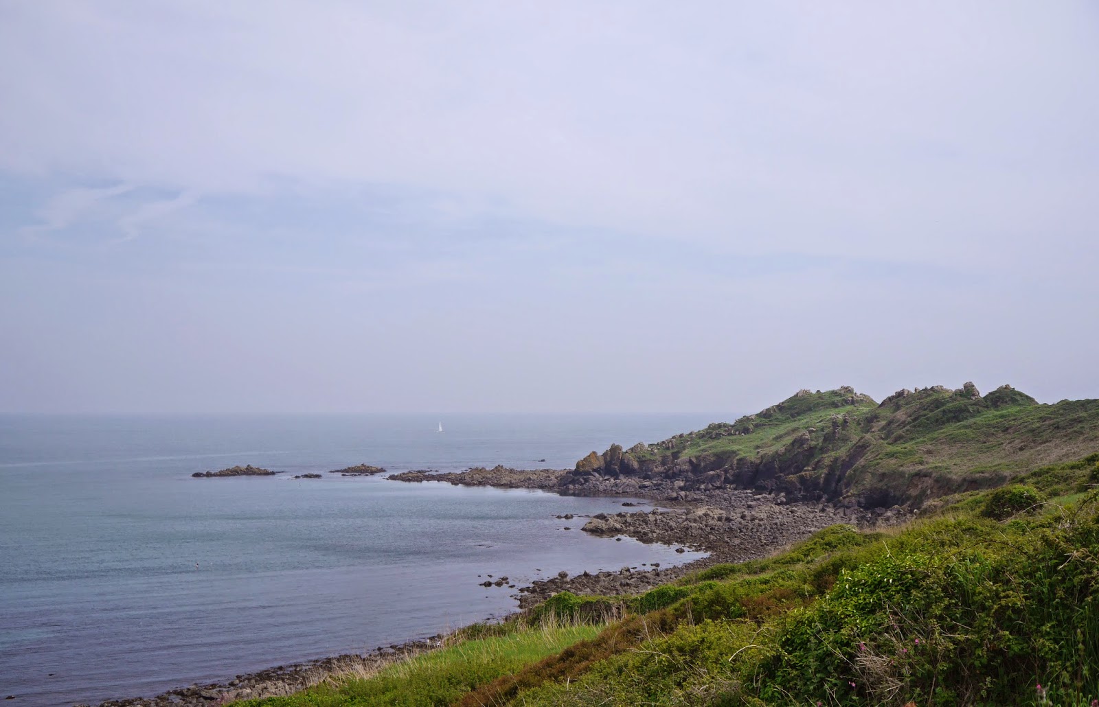
The whole area is part of the Bosahan estate, and Bosahan Cove was a pretty, secluded spot as we neared the mouth of the river. Eventually, the rain stopped and we could see across Falmouth Bay, dotted with stationary ships - are they fishing? The white St Anthony lighthouse can be clearly seen to the left.


Soon Dennis Head lay ahead, with Nare Point stretching out behind it. The inlet on the right is Gillan Creek.


 However, it was not as "nare" (forgive me) as it seemed. As we headed round Dennis Head, it became clear just how long Gillan Creek is.


We could see from the map that that the path essentially ran up one side and back along the other. There seemed however to be some possibility of a crossing. We walked down to the village of St Anthony-in-Meneage and photographed the church, which looked quite old. Pevsner says that the oldest part is 13th century.


We learned from a chap working on a boat that there were stepping stones across the creek, but that the water was already too high. Soon after, we saw a sign that they were currently closed for being unsafe. So there was no option but the 2.75 mile road tour. This was at least enlivened by a dramatic subsidence which had closed the road, mercifully not to pedestrians. 


Eventually we reached a point opposite the church and took a lane towards Gillan. An open field-gate offered a lovely prospect over the mouth of the creek.


We lunched at the back of a delightful cove and then followed a flowery, grassy path for another mile to turn Nare Point. Standing behind the Coastwatch station it was striking that the left half of the view was all coast - from at least Dodman Point round to the Helford River. This picture shows the Coastwatch station on the left and Falmouth and St Mawes across Falmouth Bay. St Anthony lighthouse is the white dot on the right.


Soon there was a nice view along the coast towards Porthallow, the white houses in the centre of the picture.

Porthallow is a tiny place, but it is significant to Coast Path walkers because it is the official half-way point. As we entered the village however, the first thing we saw was this droll weather forecasting device.


We then press-ganged a passerby into taking our souvenir picture. It is a bit blurred, so perhaps I would have done better to rely on the selfie I had been planning to take.


Conditions: mild, but very hazy.

Grading: Moderate.

Distance: 8 miles (distance now covered 313.3 miles).

Map: Explorer 103 (The Lizard).

Rating: four stars.

Sunday 18 May 2014

Falmouth to Helford Passage (South West Coast Path 51)

 Penryn River

We resume the Coast Path at Falmouth's Prince of Wales jetty, with pleasant views up the Penryn River. We head through the town in the direction of Pendennis Head, pausing to see Customs House dock. 

The former Customs House faces the street and is of a surprising Greek temple design from the early 19th century. It has a sadly abandoned air


 We leave the surprisingly large town centre to pass the quite large docks and reach Pendennis Head. The whole area has signs of fortification. Nearest the water is a well-preserved blockhouse, looking across Carrick Roads to the white St Anthony lighthouse.


We continued along the road, soon coming to Falmouth's pleasant Gyllyngvase beach. Looking back as we walked along, you could see the round Pendennis Castle on its hilltop, but it was too hazy for a decent photo.

Round the headland was the sandy Swanpool beach, with the large Swan Pool across the road behind it. We glimpsed some swans on the the far side. Now the path became rural again and a flower-strewn path led us to the lovely beach at Maenporth.


This was about the halfway point and we had a light lunch at the excellent Cove Inn. The tide had mysteriously departed the shallow beach by the time we had finished. 


We climbed High Cliff (not in fact too taxing) and enjoyed a hazy view back over a thick bed of Red Campion, definitely today's signature flower.


And soon there was a nice view forwards across Bream Cove to Rosemullion Head.


The path took us behind the Head into a truly delightful area of wide-open grassy slopes leading down to shallow cliffs overlooking rock ledges at sea level. Quite soon we had turned the corner to follow the north bank of the Helford River.

We crossed some lovely flower meadows at Bosloe - no butterflies, alas - and reached the hamlet of Durgan, with its former one-room Victorian schoolroom (1876) overlooking the river.


The Helford River presented the now familiar, but always attractive, picture of moored boats.


The river appears to an estuary at this point, but is in fact a drowned river valley or ria, caused by some long ago rise in sea level. A key characteristic of rias is that there is an estuary which is quite disproportionate to the size of the river flowing into it. A glance at the map reveals that this is clearly the case here.
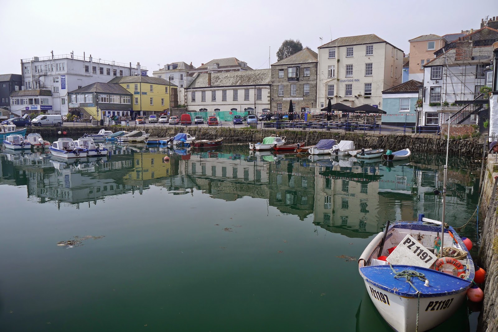
Before long, the Helford Ferry, the Ferryboat Inn and the end of our walk were in front of us.


Conditions: mild but very hazy.

Grading: Moderate.

Distance: 9.9 miles (distance now covered 305.3 miles).

Map: Explorer103 (The Lizard).

Rating: three and a half stars.

Wednesday 14 May 2014

Amsterdam art nouveau

The American Hotel

Amsterdam isn't generally seen as a major centre for art nouveau, but in fact it has some absolute gems scattered about the compact city centre. I concocted this walk based on internet research and some buildings we had already read about or stumbled on.

We started in the south-west at the remarkable American Hotel of 1902 designed by Willem Kromhout. The side wall has some lovely decorations and the cafe has very pleasant art deco lighting and other details together with stained glass.

We followed Leidesstraat towards the centre and on the corner of the junction with Herengracht there is this building of 1904, now a very large branch of Boss.


The decoration under the eaves is delightful.


We turned left and followed Herengracht north. Three bridges later we saw on the opposite bank this jolly house of 1900 by Gerrit van Arkel on the corner of Gasthuismolensteeg.


Two bridges further on we turned left onto Leliegracht and found on the corner where it meets Keizersgracht (174-176) the Astoria building, once the headquarters of the Eeerstholland Hollandsche Levensverzekerings Bank, of 1904-5. (The spire of the Westerkerk can be seen in the background).


We carried on to Prinsengracht and turned right passing a house with some colourful tiles at 181 on the opposite bank, somewhat spoiled by graffiti.

At the end of Prinsengracht, left onto Brouwersgracht and then right brought us to the end of Haarlemmerdijk . The Movies theatre at 161 was closed, but apparently has a nice art deco interior. We enjoyed 140 which seemed new - either a reconstruction or perhaps a new creation.


A house nearby had some lovely tiles on the side wall of its porch.


At 43 Haarlemmerdijk there was a shop with beautiful windows and exterior windows. 


And at 39 this simply fantastic shop facade, which has been well restored. 


Continuing into Haarlemmersttrasse, 83 (now a Steakhouse) has a more austere curving front, more suggestive of Nancy. It dates from 1906.


At 51 the one-time shop of J J F Mollmann had a date of 1736 and beautiful tiles especially under the circular windows. Presumably the facade was given an art nouveau makeover.


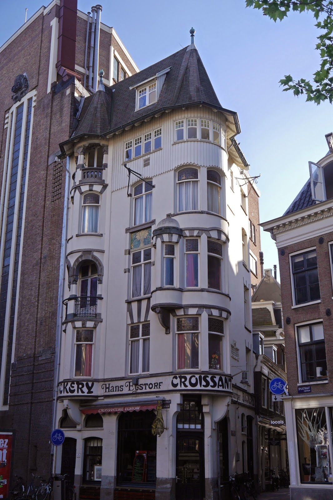
There was a bit of a hiatus while we turned right and continued into Spuistraat. At number 274 there was the former Stahle bakery, happily still selling croissants.This is another work by van Arkel and dates from 1898.


At bit further on, we turned left into Spui to find the Helios building (1895-6), by van Arkel again, incongruously located opposite the Beguinhof, and now occupied by a Japanese restaurant.


The second floor has a lovely tiled design of owls and flowers.


Overall, some nice buildings with a preponderance of shops and offices.

Conditions: sometimes bright, sometimes cloudy.

Distance: about three miles.

Rating: four stars.


More information

Two sections of Klaas Schoof's website (in Dutch unfortunately) were very helpful and include many things I missed:

http://www.klaasschoof.com/amst12.html
http://www.klaasschoof.com/amst4p7p2.html


Postcript

It's not art nouveau and not very close to the route, but I just wanted to mention the Tuschinski cinema in Amstel. It was built in 1923 and has a rich art deco interior which you can take a tour round, before I think 11.30 in the morning. I have to say that from the outside this is one of the most bonkers buildings I have ever seen, but you've just got to love it.


This becomes clearer when you see the facade in more detail.