Friday 29 June 2012

Henley-on-Thames

Henley Bridge

We had our friend Kathy staying and she expressed a wish to visit Henley, so here we are. As we were heading along the Twford to Wargrave road to Henley I was surprised by the amount of traffic - surely it couldn't be the Henley regatta in the same week as Wimbledon? It was (I thought the "season" was better planned than that) and so we had to park in a field on the Berkshire side of the Thames and walk in from there.

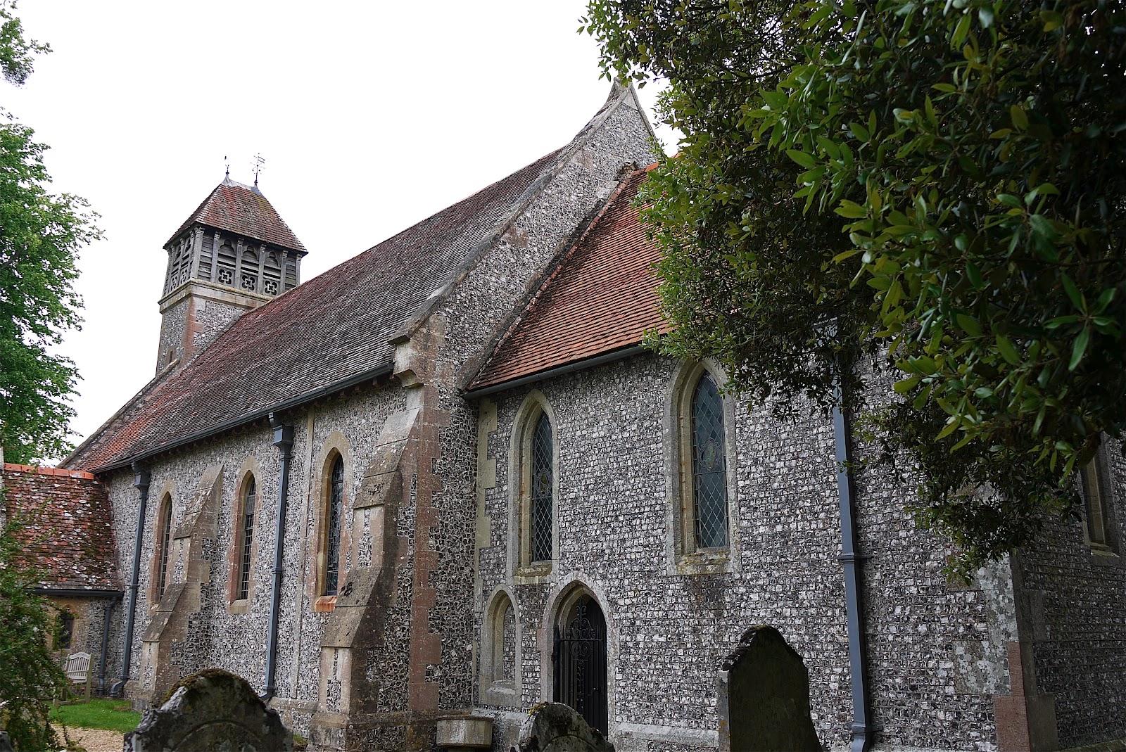
This meant that the first sight of Henley was the bridge of 1786, which really is the ideal place to start. We headed across, ignoring for the moment the regatta on the right and walked ahead into Hart St, with St Mary's church on the right.


Pevsner describes it having a "cheerful Late Gothic exterior". Two churches in nearby Reading have the same checkerboard pattern; I must see if there is any link.

Hart St is a wide street lined with shops and hotels and presents a mainly Georgian character. Just in front of the church is this handsome drinking fountain of 1885.


Pausing to look at it revealed that the churchyard housed a number of almshouses. It seems that they were endowed by John Longland, Bishop of Lincoln, in 1517 (who is also credited with building the church tower), but were rebuilt in 1830 in a Tudor style.

I am very fond of almshouses and although I know Henley reasonably well, I had never noticed these before. It it just further evidence for one of my principles of city walking: approach even places you know as if you were a stranger.


At the end of Hart St stands the Town Hall, with the market place behind. It dates from 1900 and was designed by Henry Hare in the Queen Anne style. A footnote in Pevsner reveals that its 18th century predecessor was moved to nearby Crazies Hill and converted into a house.


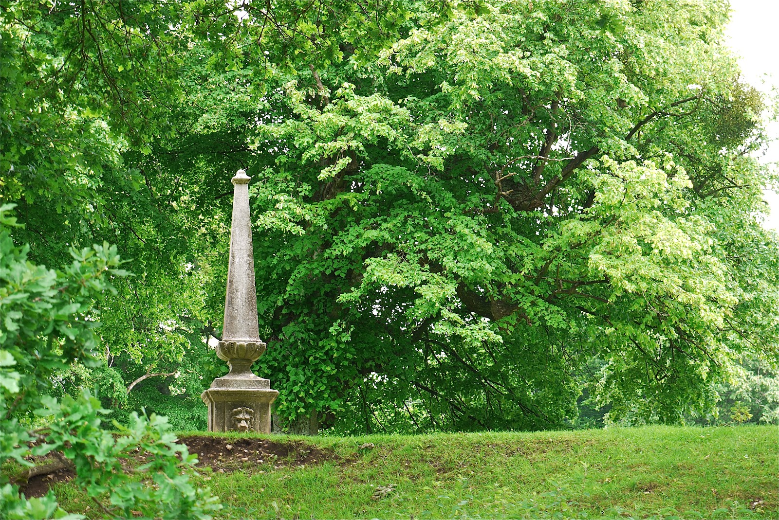
We continued further up the hill to reach Friar Park. I did not know of its existence until I did a bit of research to plan this walk. It is a fantastic late Victorian mansion set in a vast park. Pevsner describes it as "a bizarre folly .... a long sprawling building in unfashionable French Flamboyant Gothic style". It was built by a rich solicitor, Sir Frank Crisp, who probably also designed it. You can't see the house, but the gate and gatehouse give a flavour of the style. It looks fabulous.


Of course, nowadays, Friar Park is famous as being George Harrison's house - his widow Olivia and son Dhoni still live there. I knew about the big house near Henley and rows with the neighbours about having razor wire on the perimeter fencing, but I did not know its name and had not realised that the house was actually right in the town. You can see from the map that it accounts for a significant percentage of the area.

We walked back down the hill, past the Town Hall and turned into Bell St and then into New Street. On the right were more almshouses, Barnaby Cottages, originally given by William Barnaby in 1582 and several times restored.


Further along were Anne Boleyn's Cottage and the Tudor Cottage dating from the 15th century. The latter is less fancifully named!


The lower part of the street is dominated by the imposing buildings of the former Henley Brewery.


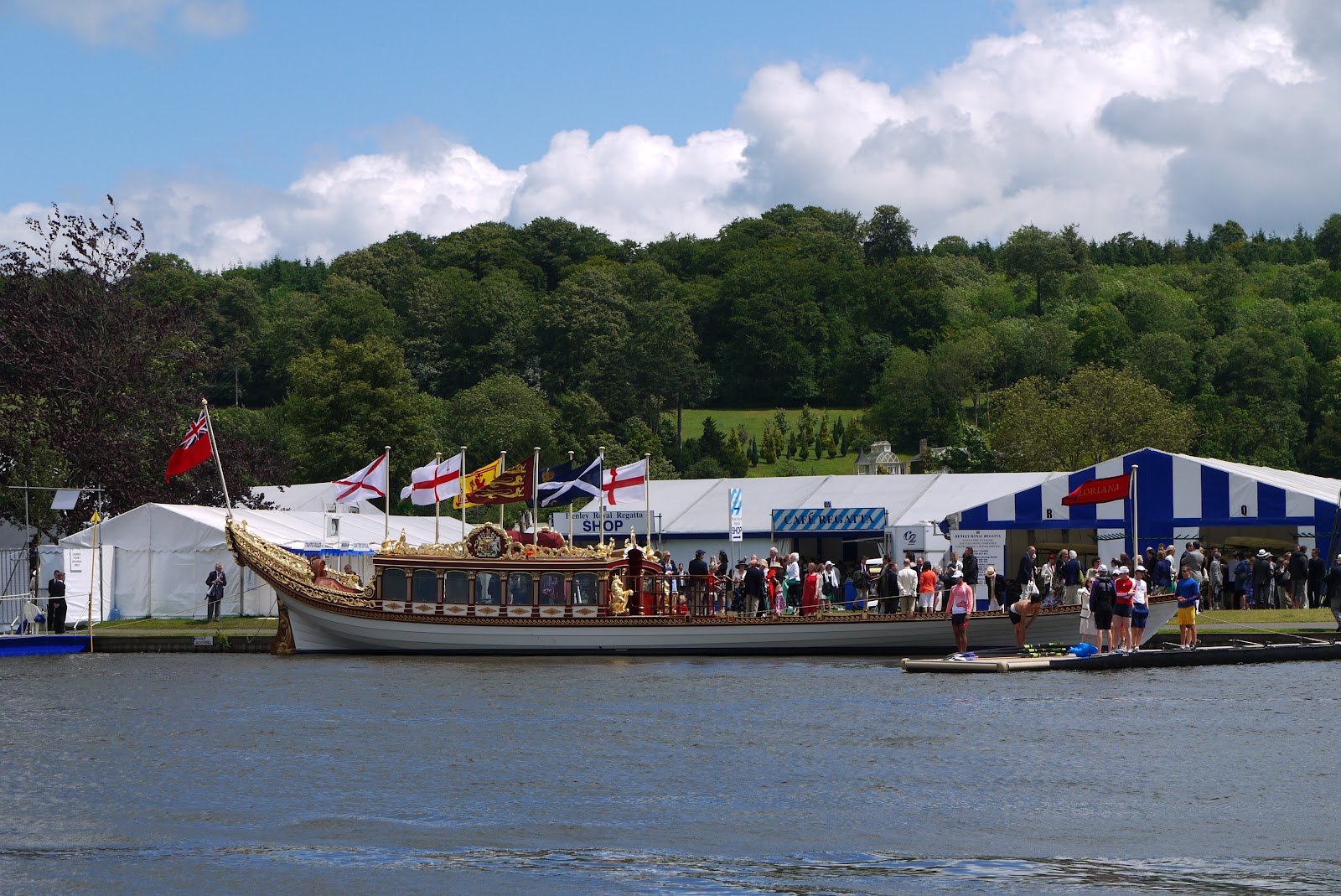
We turned right into Thameside to follow the river and on this occasion offered great views across to the regatta sight. For some, the sight of the Royal Barge, recently seen in the flotilla down the Thames in honour of the Queen's Jubilee, was a great delight.


On the town side of the street, I enjoyed the decorated gables of the former Little White Hart Hotel (c 1890).

For the final part of our walk, we crossed Hart St into Duke St and wandered down to the riverside to follow the promenade as far as Marsh Lock. All along there were Regatta-goers enjoying drinks and food in moored boats or cruising along the river. We were a bit envious. I was surprised however to see a man in a splendid rowing blazer sitting on a park bench eating fish and chips out of the paper.

The approach to the lock is impressive, with a lovely wooden bridge across the river.


There is also a weir and on the bridge a plaque describes the installation of a salmon ladder. We looked hopefully across the weir pool and - improbable as it sounds - immediately saw a salmon leaping, presumably in search of the ladder. We waited for some time but we did not see another - it seems now like a dream.

We retraced our steps and crossed the bridge for one last view of the regatta, with Remenham Hill behind.

Distance: almost 4 miles.

Conditions: Warm and sunny, though with a threat of rain.

Rating: four stars.


Sightings

Three years ago I saw an exotic duck on the river Blackwater. It turned out to be an Egyptian Goose. The RSPB, who kindly identified it for me, explained that it was probably an escapee. I was surprised to see this group of Egyptian goslings on the Thames, but at least I could confidently say what they were. At this rate they will soon be everywhere.


Sunday 24 June 2012

Grove Lane to Littleworth Farm (Oxfordshire Way 3)


Sheep Street, Charlbury

Another leg of the Oxfordshire Way with Merv and Pud. We picked up the route at Grove Lane and headed south east across fields to soon reach Charlbury. We have a special interest in Charlbury because Liz and Bob who we bought our house from in 2000 moved there - we still exchange Christmas cards. It was amusing to walk past their house as we made our way through the village. In Sheep St we checked out the suitability of the Bull Inn for lunch.

We passed the handsome Friends Meeting house of 1779 with its red brick arches and enjoyed the mainly stone houses of the town. I especially liked this late Victorian cottage.

At the south east corner of the village we followed a narrow - and extremely muddy - path towards Stonesfield. There were nice views to the west through gaps in the bushes.


A bit further on Cornbury Park came into view. There was a hunting lodge there, in the Royal Forest of Wychwood, as early as 1337 according to Pevsner, but the earliest part of the present house is 16th century.


Eventually we emerged into fields, which we crossed to reach Stonesfield. This seemed to be an interesting village, but we did not pause to investigate it because the heaviest of the numerous showers came on us just as we were entering the village. It appears that Stonesfield is notable as the one-time source of the stone slates which adorn many Oxfordshire houses. We did not unfortunately see the Early English parish church, described by Pevsner as having undergone a "lunatic restoration" in 1876.

From the village a track leads down to a bridge and swimming place by the River Evenlode, today in use by dogs rather than people.


Here we turned sharply left (north east) to join an old Roman road, Akeman Street. It once linked Watling Street with the Fosse Way. We followed it past the site of a Roman villa ...


... and across a couple of fields to reach the end of today's section. Next time we will continue along Akeman St for another 5 miles, through Blenheim Park.

Conditions: warm but showery; muddy under foot in many places.

Distance:  just under 7 miles.

Maps: Explorer OL45 (The Cotswolds), 180 (Oxford, Witney and Woodstock), 191 (Banbury, Bicester and Chipping Norton).

Rating: three and half stars.


Flowers of the day

It was good to see some poppies in full bloom in the corner of a field of rape.


More unusual was this wild Mignonette.


Saturday 23 June 2012

Usk: Usk Castle and Gwehelog Common


Twyn (Town) Square

We were in nearby Llangybbi on family business and decided to do a walk from Usk. I found this one on the excellent Usk Walks website. I chose it because it goes past the Castle. The walk starts in Twyn Square, a charming and picturesque square, notable for its clock celebrating Queen Victoria's Golden Jubilee in 1887. We saw another Jubilee clock in Margate last month; it's a tradition which seems to have died out.

We then walked up to the Castle, which is located in what is now somebody's back garden. The first sight is impressive: the Great Keep (originally the Gate House), which dates from about 1170.


You go up a path and through the entrance gate into the surprisingly spacious inner ward, with the imposing Garrison Tower of 1209 opposite across the grass.


There are also the ruins of the Treasure Tower and the Hall. And fine views towards the Priory Church of St Mary and the hills beyond. Altogether a hidden gem.


We now started the walk proper, following a track up to Castle Farm. Just before the farm there was a fine view to the north west towards the Blorange (561m) and the Sugar Loaf (at the extreme right of the photo, 596m).


We now walked through Lady Hill Wood, alive with birdsong, and across fields to reach the outskirts of the scattered settlement of Gwelelog Common. At this point we took the shorter option and followed the lane in an arc through a pleasant valley down to the B4598 road which leads down into Usk.

Just before we reached the road junction, we spotted this splendid windmill over to the right.


It is the Llancayo Windmill. It was built around 1850, but burned down in 1876 and remained a charred shell until it was restored in recent years. It now offers holiday accommodation.

We walked along the grass verge for a way and in due course were joined by the river Usk on the right, noticeably full and fast-flowing. A bit further on there was a section of grassy river bank that could be walked on and as we entered Usk we took the Conigar Walk which led along the bank to the handsome bridge.


From here, we walked along Bridge St to return to Tywn Square.

Distance: about 5 miles.

Map: Explorer 152 (Newport and Pontypool).

Conditions: warm and sunny.

Rating: four stars.


Flowers of the day

We saw a lot of small yellow flowers by the wayside as we walked along the lanes of Gwelelog Common. This is Wood Avens (or Herb Bennet).


And a cluster of these larger ones, which turn out to be Perforate St John's Wort.


Monday 18 June 2012

Ringstead Bay and Osmington Mills

Portland from South Down

After yesterday's enjoyable inland walk at Sydling St Nicholas, today we thought we would like to see the sea. This walk starts from the National Trust car park at South Down above Ringstead. The Down is at about 125m and there are fine views towards Portland (above) and over Weymouth Bay (below).


We walked to the east end of the car park and continued along a gravel track to eventually meet our old friend the South West Coast Path as it comes from White Nothe. We turned right onto it to repeat a section we did in November 2011.

The path descends to almost sea level and soon passes the wooden St Catherine's chapel. It is unusual in being wooden, but to be truthful it does look like little more than a large garden shed.


Last time we just marched briskly past, but today we went to see the small graveyard at the back of the chapel. It is a wonderfully quiet place with fantastic views to White Nothe to the left ....


... and Portland to the right.


We passed through Ringstead and soon enjoyed another nice view of the shingle beach with Portland ever-present in the background.


Before long Osmington Mills came into view.


We paused for an excellent lunch at the popular Smugglers Inn and then back-tracked a short way to climb the grassy slope, pass the Chalet Park and walk up a track which eventually meets the road from Osmington Mills. A little further on you turn right into the road to the car park and follow it uphill for about a mile to complete the circuit. This sound rather boring, but there are lovely views over the valley on the lefthand side.


From: Jurassic coastal walks by Nigel J Clarke (Nigel J Clarke publications).

Conditions: clear, sunny, about 17 degrees, quite windy.

Distance: 5 miles.

Map: Explorer OL15 (Purbeck and South Dorset).

Rating: four stars.


Flower of the day

We saw a lot of a tall, branched yellow flower which so far as I can see is the famous Woad, source of the blue dye favoured by ancient Britons. 


Sunday 17 June 2012

Sydling St Nicholas

Sydling St Nicholas High Street

We walked in this area with our friends Judith and Tony recently, but relentless rain precluded any photographs, interesting events or reflections. Warm, if cloudy weather was promised for today so we thought we would try again.

This walk starts at the cross-roads at the centre of the lovely village of Sydling St Nicholas. The stump on the left in the photo is all that remains of the town cross. The substantial Georgian house beyond it is the biggest in the village, and the only one like it, but the two hidden behind the hedge are earlier and more interesting.

We walked up to the 15th century church of St Nicholas. Pevsner notes that the chancel (which looks odd) is an 18th century remodelling and that the tower was built independently of the church.


We followed a winding route steadily uphill towards The Combe and Breakheart Hill. As we climbed it changed from a hedged track to a narrow path through woodland and finally a field-edge path. We crossed into the next field to begin the descent and enjoyed fine views across the valley below with a long ridge beyond.


The descent across the valley brought us past the substantial, but very battered tithe barn and then out of the village along another track which eventually emerged into open fields on Combe Hill. We climbed and then followed a path around the top of the hillside in a long curve with more wonderful views.


Perhaps the best of the views were at the head of the valley.


We now circled behind a small copse and followed a rutted track through the centre of a large cow pasture to gradually descend Hog Moor to reach the road. As we did so,a sign revealed that this nature reserve was home to a colony of Marsh Fritillary butterflies. Sadly we saw none, which was a great pity as this is very much the right time of year for them. We did see a few Meadow Browns and a Small Tortoiseshell, but that was all.

The final section follows the road back into the village with the fast flowing Sydling Water on the right hand side. Many of the houses here have beautiful flower gardens on the river bank and this was easily the prettiest.


Conditions: cloudy, but quite warm.

Distance: said to be 4.5 miles, but seemed to be over 5.

From: Dorset magazine February 2011.

Map: Explorer117 (Cerne Abbas and Bere Regis).

Rating: four stars.


Flower of the day

We saw this Selfheal nestling in the long grass as we climbed Combe Hill.


Saturday 16 June 2012

Hinton Ampner to Wind Farm (Wayfarer's Walk 13)

 Hinton Ampner

The weather forecast promised a morning free from rain, so I thought I would make the most of it and continue the Wayfarer's Walk. I picked up the route near Hinton Ampner House, catching a glimpse of the house - neo-Georgian in style, dating only from a substantial remodelling of 1937. Eventually I will get to see Ralph Dutton's celebrated gardens, but not today.

The nearby church is of Saxon origin, although the tower dates only from 1879.  I then followed the fenced path around the boundary of the National Trust property.


At a cross roads of paths I diverted briefly to the right to photograph this obelisk (marked on the OS map as "Monument") at the edge of the grounds of the house. I know not what it commemorates.


The path now led uphill through grazing sheep, all the time with fine views back to the house.


Soon you reach the village of Kilmiston. The official route goes through fields at the back of the village but I decided to take an alternative route through the village itself, in case the church or manor house were of interest. The small church looks Victorian, although a sign says that it dates from 1730. The early 18th century manor house is substantial, but currently being restored.

Now the path went beside a paddock and through a lightly smelly field of rape to pass through a hedge and head straight across a vast cornfield. Well done to the farmer for marking such a fine wide track!


This led, via another couple of fields to Wind Farm where the route merges briefly with the South Downs Way. This made a sensible stopping point so I headed back after admiring the pleasant view over the country I had just traversed.


The route back was notable for the sighting of a Small White butterfly: the only one today and the first I have seen for what seems like weeks.

Conditions: cloudy, but some glimpses of the sun; reasonably mild.

Distance: 6 miles of which 3 were forwards along the Wayfarer's Walk; 46.5 now covered.

Map: Explorer 132 (Winchester).

Rating: three and a half stars.


Flowers of the day

There was quite a bit of White Campion about.


And, less familiar to me, also this dramatic Bladder Campion.