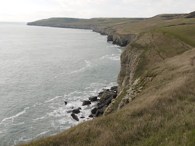
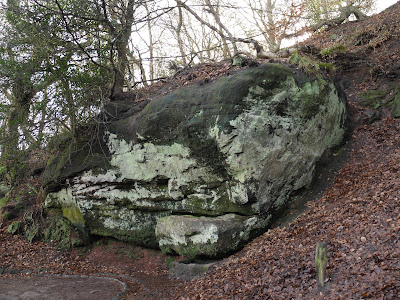
Saturday 26 February 2011

Dorchester

The High St

We decided to visit Dorchester and researched some walks around the town from the Visit Dorset website. In the end we collected a leaflet from the Information Centre and did a sort of hybrid of the four possibilities. The online version has better directions, but the leaflet version has a much better map.
We started at the top of South Street at the so-called Town Pump - "a banded obelisk with a ball finial" (Pevsner). We turned left along the West High St. At the end, we briefly turned left to see the sad, token remains of the old Roman walls. The walls were removed in the late 18th century, but a series of pedestrian tree lined"walks" remain along the lines they formerly followed. This is West Walks.


We returned to the cross roads at the end of West High St to see the inevitable statue of Thomas Hardy. Judging from photos of the great man, it seems to be a very good likeness.


We then continued along Colliton Walk, effectively the northern extension of West Walks.


You pass the unappealing 1930s-1950s County Hall and at the end you turn right to soon find the Roman Townhouse. This was discovered in 1937 as a result of excavations for the new County Hall. The informative information panels explain that it was originally three separate dwellings. The parts that are under cover have interesting fragments of mosaics. 


A little further on you drop down to see the unusual curved Hangman's Cottage, which was apparently the home of the town's executioner.


Now you walk along by the fast, shallow, clear River Frome, turn right up Friary Hill, past the prison (where I believe one of my uncles worked in the 1950s or 1960s) to return to the High Street via the quiet Grey School Passage.

Turning right into the West High St we passed in quick succession the Dorset Museum (1883), the 15th century St Peter's church and the Shire Hall.


This handsome building dates from 1795-7. Echoing our walk the other day around Tolpuddle, the Tolpuddle Martyrs were tried here in 1834. The courtroom has been preserved in its original state by the TUC.

We now headed back down South Street and turned left into Durngate Street, which follows the line of the main Roman road through Durnovaria (Roman Dorchester). At the end we turned right into a path beside Salisbury Fields, marking the eastern line of the Roman walls. At the end we made a small detour to see St George's church on Fordington Green.


It makes a pretty village scene. The church is Norman in origin, but Pevsner explains that it was more than doubled in size in 1906-27. The result seems out of proportion, both with itself and with its surroundings.

The three figures comprising Elisabeth Frink's 'Dorset Martyrs Statue' (1986) form a striking and memorable composition at the corner of Icen Way and South Walk.

We now walked along South Walks a wide chestnut-lined promenade, which the leaflet thinks is "arguably the most attractive in Dorchester". Then right into Acland Road past a large car park which we were staggered to learn covers the Roman Baths, which were excavated in 1978 and then covered over again. "It is hoped that one day they will be re-opened to the public" (!).

From here, we went through the Tudor Arcade (a modern shopping precinct with a Tudor archway tucked away in a corner) to return to South St and now head south back to where we had parked.

Soon on the left is the delightful Napper's Mite, built as almshouses for ten poor men under the will of Sir Robert Napper in 1616. The beautiful arcaded street front is of 1816.


Further on down the we came to the site of the former Eldridge and Pope brewery, now being redeveloped as upmarket apartments. It dates from 1880 and Pevsner decries the "clashing contrasts of red and cream bricks, machicolation and little windows with huge fanning voussoirs". This block is more restrained, but as fans of Victorian brickwork we thought the whole thing was impressive.


Conditions: dry, a bit chilly.

Distance: about 3 miles in all.

Rating: three and a half stars. Interesting and worthwhile, but a little underwhelming. It seems as though Dorchester has missed opportunities to make the most of its cultural heritage and is now frantically trying to make amends.

Wednesday 23 February 2011

Tolpuddle

The Martyrs' Tree, Tolpuddle

This walk starts in the small, but famous, village of Tolpuddle - home of the Tolpuddle Martyrs. They were six early trade unionists who were sentenced to seven years' transportation in 1834 for taking illegal oaths - although their real crime was fighting against a cut in agricultural wages. They used to meet under an old sycamore tree (above). I didn't know that after a public campaign they were released a few years later and five of them immediately emigrated to Canada. The sixth, James Hammett, returned to live in Tolpuddle and died there in 1891 at the age of 80.

We started our walk with lunch at the Martyrs Inn and quickly turned north to climb a lane up to the busy (i.e. noisy) A35. We crossed this and followed field paths and then a lane away from it towards Weatherby Castle, an iron age settlement.


We climbed up to it and then went in through the outer screen of trees to explore. A substantial defensive ditch and mound is immediately revealed.


Further inside lies an obelisk. Our walk book helpfully mentions its existence, but adds only that it can be difficult to locate among the trees. The map makes clear its location however. It is dated 1761 on a little plaque which also gives the initials of Edmund Morton Pleydell who erected it. Pleydell owned Milbourne House and, before the trees took over, would have been able to see the folly from it.


From here, we descended a bit and followed a track along the bottom of a shallow valley, heading west. Looking back, there was a find combination of a dark threatening sky with sun striking a grassy field.


After some while, we encountered a track and turned left to head up a narrow hedged path, cross several fields and then the A35 to return to Tolpuddle. We now walked back along the main street past the 13th century church of St John.


Hammett's grave is signposted in the churchyard. Although by the celebrated sculptor and graphic designer Eric Gill, it is says Pevsner "totally undistinguished". It is impossible to disagree.

At bit further on, near the Martyrs' Tree, there is a covered seat erected in 1934 as a memorial and a smaller sycamore planted in 1984 by Len Murray, General Secretary of the TUC, in commemoration of the 150th anniversary.

From: Pocket pub walks in Dorset by Nigel Vile (Countryside Books).

Map: Explorer 177 (Cerne Abbas and Bere Regis).

Conditions: rain and sun, quite mild, muddy underfoot again.

Distance: 5 miles.

Rating: three and a half stars.

Tuesday 22 February 2011

Painswick to Randwick (Cotswold Way 8)

Leaving Painswick

We have got into a nice rhythm now with the Cotswold Way and we picked up the route in Painswick, which we reached a month ago. You walk down a lane opposite the church and turn left into a field to be met by the delightful view above.

We admired these snowdrops - the first of many thick clumps seen on the walk - as we crossed a pretty stream.

The nearby cottage had some extraordinary stonework on its outside walls. A plaque seemed to have Tudor roses in the corners and below it was what seemed to be a fireplace surround covered in ornate carving. Over the door of the house was the date 1691. It would have been interesting to know its story.


We then climbed to reach the Edgemoor Inn and crossed over Rough Hill, a nature reserve on the site of a former quarry. Soon there was a good view back towards Painswick, with the church spire a clear landmark.


We now followed the edge of the scarp through woodland (Halliday's Wood, then Cliff Wood) to reach the badly weathered Cromwell Stone, which commemorates the raising of the siege of Gloucester in 1643.


We are at this point just a few miles due south of Gloucester. It was a Parliamentarian stronghold during the Civil War and was besieged by the Royalist army for a month.

The path continues through further woodland with glimpses of the River Severn to the north.


Eventually you emerge onto open land (Ring Hill, an extension of Haresfield Hill) and enjoy marvelous views in all directions, especially to the west and south. (Well, they would be marvelous on a better day.)


A little further on, on another corner of Haresfield Hill, there is a lovely contoured toposcope.


We now followed a pleasant woodland track through Standish Wood to reach the end point of today's leg at Randwick.

Map: Explorer 179 (Gloucester, Cheltenham and Stroud.

Conditions: cool, cloudy, misty (obviously). Quite muddy underfoot.

Distance: 6.5 miles.

Rating: four stars.

Saturday 19 February 2011

Anvil Point to Dancing Ledge (SW Coast Path 4)

The lighthouse at Anvil Point

On a brief visit to Poole we saw a chance to make a little further progress along the Coast Path. We parked at Durlston Country Park and followed a winding tarmac path down towards Anvil Point to resume our route. According to the Trinity House website, the lighthouse dates from 1881 and was opened by Joseph Chamberlain, father of Prime Minister Neville Chamberlain.

There was a fine view down to the lighthouse as we drew closer. Out to sea the sun broke through the clouds in a few places creating bright circles on the surface: a searchlight from heaven.

Before reaching the lighthouse there is a small preserved stone quarry, with a little four wheeled cart, called a quarr, used to bring the stone up.


We joined the Coast Path, initially walking along a grassy area, but soon joining a narrower and increasingly muddy path. We rapidly formulated a law to the effect that the depth of the mud was inversely proportional to the width of the path - some of the narrow sections were extremely sticky.

This section of the Coast Path is fairly straight, without major features. We went through a National Trust section named Belle Vue, although it did not seem any more belle than the adjoining areas. The first landmark was Blackers Hole and there were by now impressive views along the coast towards St Aldhelm's or St Alban's Head.


Another half a mile or so of struggle through the mud and we came to Dancing Ledge.


We found our way down the ledge itself and noticed that some climbers had descended from there down to sea level to make an assault on the cliff face further along. We naturally had a little dance on the ledge, doing some of our favourite jive moves.

We had planned this walk by reference to the map and now climbed the steep hillside leading to the ridge which runs parallel to the coast along this section - an ascent of about 50m. On the way up we saw our first daisy of the year, which we found strangely cheering. At the top we briefly sat and enjoyed the feeling of the warm sun on our faces - for a moment we felt that we might have been in Nice.

The walk back along the ridge was a delight by comparison with the walk out and we fairly sped along over the short grass. The sky had cleared somewhat and we were surprised by how blue the sea was in places.


The route continued over grassy paths interspersed with dry stone walls.


We reached Round Down and soon returned to the car.

Map: Explorer OL15 (Purbeck and South Dorset).

Distance: about 5 miles, of which about 2.5 was on the Coast Path. Distance covered now 12 miles.

Conditions: cloudy, some sunshine, about 9 degrees; did I mention that it was very muddy underfoot?

Rating: four stars.

Tuesday 15 February 2011

Surveying walking habits and opinions

I completed an online survey yesterday issued by my local Council.  "This survey is designed to help the Borough Council find out how many local residents are walking and to identify any barriers preventing you from walking. The results will be used to support Local Transport Plan projects." This is very welcome and the Council is to be commended for undertaking it. It also raised some interesting and difficult questions of definition and measurement.

First, of course, is what is "walking". The Council's answer is "any walking you do as part of a journey, for example walking to a bus stop or to a train station, as well as walking all the way to a destination, and any walking you do just for enjoyment, including walking the dog. We include any walking even if you use a mobility aid, for example a wheelchair, or a skateboard, micro-scooter or skates. Jogging also counts."

Does this make sense? The elements in the list from skateboarding onwards all seem to be leisure activities which use pavements, but is it helpful to include them in "walking"? I think not. Including them means that people are responding to the survey in relation to very different activities.

The more puzzling definitional question however is whether there is some sort of de minimis level of walking that isn't worth counting. The first question in the survey asks about "journeys made the previous day that included walking" and tries to capture the nature of the walking element, the time spent walking and the purpose of the journey. The walking element could include walking to use public transport or private transport (e.g. a parked car). But what if the car is in the drive or the bus stop is outside the front door? All journeys involve you taking some steps, but are these ancillary steps usefully understood as "walking"?

I suppose it depends on your purpose. If the purpose is transport planning and you are interested in the "modal split" of journeys to work or school or to some public facility, then you are most interested in identifying the people who walk all the way or who have to walk some material part of the way. It would be crazy for every car owner to describe their journey to work as involving walk-car-walk as the modes of travel. In this context, the implicit focus is on the factors which influence the choice of mode of transport, perhaps with the goal of increasing the proportion who walk, for all the well-known benefits that flow from it.

From a step-counting perspective however, the more the merrier, all steps are equally valuable. But this is walking viewed purely as a physical activity.

Thirdly, you might be interested in promoting walking as a leisure activity. In this case "walking" is just going out for a walk, as distinct from undertaking a "journey" for a purpose. The implicit focus here is on the choice of walking over other forms of leisure activity. A survey of walking in this sense also opens up issues about walking in the country, issues of access, the state of paths and styles and of choice whether the walk started from home or whether some other mode of transport was used to get to the start.

So it seems to me that you can view walking as a mode of transport (in competition with other modes),  as a leisure activity (in competition with all other leisure activities) and as a physical activity (in contrast with inactivity). It is all of these things of course, but a survey which muddles them up will collect data that is very hard to interpret, perhaps meaningless.

However, I am grateful to the Council for getting me thinking about this. The survey is being done in partnership with Walk England, a social enterprise dedicated to promoting walking, that I wasn't previously aware of. It has some very useful resources, so that is a useful discovery.

That site in turn led me to Walk 21- Walking Forward in the 21st Century, an international organisation which "exists to champion the development of healthy sustainable and efficient communities where people choose to walk". There is a section on Measuring walking, which I will study with interest.

Monday 14 February 2011

Alderley Edge

To the Edge

I visited this area a lot in the 1990s, and often saw the splendid sign "To the Edge", but I never actually went. A visit to friends provided a chance to rectify the situation. I knew of course that the edge in question was really an escarpment of soft sandstone overlooking the Cheshire Plain.

This walk begins in fact at another of the parking places on the Macclesfield to Alderley Edge road, by Beacon Lodge. You cross the road and head south east in a meandering route that takes in woodland, Artists Lane (presumably there is a story behind the name), Bradford Lane and some nice undulating open country.


Having almost circled back to the start, you then head off east along a track in the direction of Alderley Edge. The great disc of the Jodrel Bank observatory is soon dramatically visible on the horizon.


A bit further on the track becomes a drive then a road and you enter one of the smart residential areas of Alderley Edge, passing by houses which range from substantial in size to vast. You follow a path to the right back down to the main road, which you cross to walk along more residential streets.

Soon, you climb up Squirrel's Jump (!) and at the top continue climbing to enter the National Trust property of Alderley Edge. Here at last, you look down on the Cheshire Plain.


Now things start to get more interesting. You walk along the side of the escarpment for a way with pleasant views through the beech trees. After a while you have to turn right up a steep-looking set of steps.


Having struggled to the top you now walk along just underneath the escarpment, passing a series of rocky outcrops. The first is the Wizard's Well, which apparently looms large in Alan Garner's book Weirdstone of Brisingamen. Carved in the rock above the well is the face of a wizard and the inscription "Drink of this and take thy fill for the water falls by the Wizhard's Will". The carving was added around 200 years ago by Robert Garner, Alan Garner's great-great grandfather. The book passed me by - I guess I am the wrong age - so I  did not give the Well the attention others would think it deserved.


One of the other outcrops shows the red sandstone very clearly.


After the outcrops end, you climb through woodland to reach Stormy Point, a red sandstone plateau, with fine views over the Cheshire Plain and the Peak District beyond. I had finally reached the edge!


From: Macclesfield Outdoors, an initiative of the local council.

Map: Explorer 268 (Wilmslow, Macclesfield and Congleton).

Distance: a bit over four miles.

Conditions: cloudy at first, but later mild and sunny. Muddy underfoot.

Rating: four stars, but only for the National Trust section. It was good to approach it from below.

Sunday 6 February 2011

Swanage to Anvil Point (SW Coast Path 3)

Swanage Beach

We used the visit of our friends Judith and Tony to continue our progress along the South West Coast Path. We skipped a couple of suburban streets in New Swanage and picked up the route at the start of the Swanage sea front.
At the end of the sandy beach we passed the curious column with three cannon balls on the top erected by John Mowlem (the founder of the building company) in 1862 to commemorate the defeat of a Danish fleet in 877 in Swanage Bay by King Alfred. This does invite some questions - mainly, why?

We followed the edge of the bay and then detoured to pay our 40p and walk along the Victorian pier. According to Swanage Pier Trust website, "The original Swanage Pier was constructed in 1859/60 by James Walton of London for the Swanage Pier and Tramway Company and opened by John Mowlem. The Pier was built primarily for shipping stone. Horses were used to pull carts along the narrow gauge tramway which ran along the Pier and seafront." We had noticed traces of the railway as we walked around towards the pier. The original pier was found to be too small and was rebuilt in the 1890s.

There is a fine view from the pier towards the Wellington clock tower. There is a wonderful story behind this. It was originally built in 1854 in honour of the Duke of Wellington near London Bridge, but was soon found to be impeding the traffic and taken down. George Burt, a nephew and business partner of John Mowlem, of whom more will be heard shortly, removed the stones to Swanage and rebuilt the tower in its present location. The clock never followed, and a spire was removed in 1904 as it had become unsafe.


We left the pier and continued on our way to pass a pair of Ionic columns, which mark entrance to Prince Albert Gardens. They were apparently date from the early 19th century and were brought to Swanage by John Mowlem, who clearly liked his columns.


A little further on there was a fine view looking back to the pier. Its dog-legged character was more evident from this vantage point.


We now climbed up to skirt Peveril Point with its lighthouse and continued to climb as we walked along a grassy cliff overlooking the sea. After a short detour along a road we entered Durlston Country Park and walked along a well made path to pass beneath Durlston Castle. The Castle's website explains
that it was built as a restaurant by George Burt and was part of his grand plan to create an exclusive housing estate on his land as part of his dream of transforming Swanage into a fashionable resort. The castle is currently under restoration and most of it is hidden under scaffolding.


A little further on, right below the Castle, is the Great Globe, 40 tons of Purbeck stone with a map of the world, nestling in an enclosure in which there are a series of stone plaques carved with quotations from poets and the Bible, as well as facts about the natural world.


We now followed the path above Tilly Whim Caves. (A whim was apparently a type of crane or hoist and Tilly was possibly a quarryman. As just-so stories go, we thought this was pretty weak.) Soon we reached the lighthouse at Anvil Point.


Here we left the Coast Path, turning inland to climb Round Down. From here a grassy track which later joined a road led us down to Swanage High Street, where we saw another wonderful contribution to Swanage's character from the indefatigable George Burt. This is the Town Hall.


It is essentially an unremarkable building to which has been added a superb facade by Sir Christopher Wren no less. Burt rescued it from the Mercers Hall in London's Cheapside.

We now retraced our steps to the start and  enjoyed an excellent lunch at the Ocean Bay restaurant.

From: 50 walks in Dorset (AA) - but from a different starting point and with the sea front element as an addition.

Map: Explorer OL15 (Purbeck and South Dorset).

Distance: about 5.5 miles, of which about 3 was on the Coast Path. Distance covered now 9.5 miles.

Conditions: cloud, drizzle and rain, about 9 degrees.

Rating: four stars.