Showing posts with label Wiltshire. Show all posts

Wednesday, 8 February 2023

Axford and Ramsbury Manor


The first walk of the year with my walking partner, Mervyn. He had kindly developed a circular walk starting to the west of the delightful Wiltshire town of Ramsbury at the rather prosiaic Axbury Pumping Station (marked as S).

We start along the narrow road which followed Sound Bottom and was soon delighted to see my first Snowdrops of the year.

After a while we took a path on the left which led south to reveal a fine vista across the fields and then passed a pleasing red brick house ...

... and along a lane to skirt a rather imposing Georgian (or more probably Georgian-style) house.

We followed the path down to Stichcombe and after crossing the Kennet we had an informative chat with a couple who were clearly very familiar with the area, pointing out to us Little Egrets and other wildlife. 

We passed Cowleaze Cottage and followed the border of Ramsbury Manor Park. According to Wikipedia it belongs to the Capricorn Foundation, a trust which has the task of maintaining the house as a museum and cultural resource for the nation. It dates from the 1680s.

The best views were of the beautiful lake with the House beyond it ...


... and then the gates on the other side of the grounds.


The final section was rather arduous as we had to follow White's Hill for a mile or so. This is the main road from Ramsbury and has no footpath. Fortunately, we made it OK.

Overall, a delightful walk of about 8 miles.

Thursday, 13 January 2022

Little Bedwyn and the Long Walk

                                                     St Michael's Church, Little Bedwyn

My first walk of the 2022! Merv and I start our walk in Little Bedwyn, which I thought was just in Berkshire, but turns out to be in Wiltshire. Pevsner's entry on Little Bedwyn  is succinct: "A lane with estate housing of 1860, brick with diapers of blue brick and or without gables, leads to the church."

The church seems to date back as far as the 12th century, although with various alterations. We liked the square tower and the clock.

We cross a footbridge and head north along the frosty Kennet and Avon Canal.


At the next bridge we head away from the Canal, skirting Jugg's Wood to reach the start of the Long Walk through Stype Wood, which once led to Stype Grange. This is the view looking back at the end of the Walk. We saw various buildings as we tramped through the Stype Estate, but nothing that resembled a Grange.

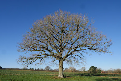
We carried on in the same direction to reach a road and then turn sharp right, passing this handsome tree in a field on the right.

Now we entered the large Polesden Estate - where again the big house was carefully out of site. We had a bit of a struggle with the route through the estate. There were a lot of paths, many of which had No entry signs. After frequent reference to the map and some swearing we reached Baverstock's Copse and headed east along clearly marked paths towards Great Bedwyn.

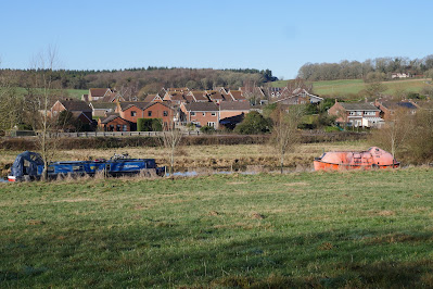
We turned right at Jockey Green to reach the tow path beside the Kennet and Avon Canal again. We were struck by one unusual craft on the right in the picture below.

It remained only to tramp the mile or so along the tow path to return to Little Bedwyn.

Map: Explorer 158 (Newbury & Hungerford)

Distance: about 7 miles, but actually walked nearer to 8.

Conditions: muddy, clear, cool.

Rating: three stars.

Sunday, 22 August 2021

Tollard Royal and Ashcombe House

 St. Peter ad Vincula

We are on our way back home from a visit to Poole and it seemed like a good idea to do a walk on the way. This 4.5 mile walk from Tollard Royal, just in Wiltshire, seemed the perfect choice. We parked by the interesting church of St. Peter ad Vincula (St Peter in Chains") which dates from 1469, with later alterations. It is one of only 15 churches in England with this dedication, which is taken from the Basilica of San Pietro in Vincoli in Rome.

Nearby is King John's House. It has nothing to do with King John and is instead a former manor house which was later a farmhouse, and has at its core a 13th-century hall house. Remodelling in the 16th and 17th centuries added wings, in part timber-framed. Augustus Pitt Rivers restored and extended the house, and opened it to the public around 1890 as a museum, but by 1907 it was again a residence. (Information from Wikipedia.) You can get a glimpse of half timbering, but nothing more.

The village is charming and a delightfully whimsical programme is clearly underway to enhance it. The first house we passed had this delightful workman suffering a slight mishap. 

Across the main road is the village pond and here a gnome seems to be fighting off a large snake. There were several other examples.

Now we started the walk proper and walked up path to the left of the pond and then forked left to follow a delightful track at the bottom of a sloping hillside.

There were innumerable Meadow Brown, White and Common Blue butterflies.

Further along we began to diverge from the hillside and some very attractive open country lay before us.

Soon we encountered a series of path junctions and after some deliberation managed to work out the right route heading north along a ridge. We walked through the wide-open spaces to reach a decision point. "Cross a stile and turn right along the byway" said the walk book, but we could not locate these vague descriptions. We spotted a trig point which gave us confidence to head off to the right and we followed a path which had other people heading towards us, though not close enough to intercept.

This route led us skirt the edge of Ashcombe House, of which we could see nothing at all. There have been several buildings on the site and according to Wikipedia, the current Ashcombe House was originally part of the much larger mid-eighteenth century structure, and is an L-shaped three-bay survival of the eastern wing.

Once we emerged from the wooded grounds we found difficulty in finding the route back to Tollard Royal. We followed a tarmac road which meandered through the countryside confident that we were on the right route.

Near the end of the road we realised that we had somehow missed a turning as we were back at the "delightful track at the bottom of a sloping hillside" as described earlier. Chastened, we followed the track back to the village pond.

Conditions: very pleasant.

Distance: 4.5 miles.

Map: Explorer 118: Shaftesbury & Cranborne Chase.

Rating: four stars.

Source: 100 walks in Wiltshire (The Crowood Press). The walks in this book are very inviting, and we have done several of them, but the walk descriptions seem always to be lacking in precise detail. We have several times got lost.

Saturday, 17 July 2021

Stanton Fitzwarren, Hannington & Broad Blunsdon

We started this walk at the village of Stanton Fitzwarren, not far from Swindon on the north east tip of Wiltshire. We parked in slightly the wrong place but as we walked down the road we did get to see this wonderful piece of thatching.

We left the village street and walked across grassland and then a field-edge path to reach Staples Farm. We crossed the road and walked along a grassy green lane with numerous butterflies, Meadow Browns and Ringlets especially.

The walk took us to the eastern side of Hannington and offered a fine rural vista as we got closer.

We emerged into Hannington close to Hannington House. According to Pevsner it dates from 1653. The building on the left bears the inscription Henricus Breke CB 1836, presumably a former owner.

We walked into the village passing what looks like a former chapel on the right ...

... and soon reached the delightful Jolly Tar pub. We found we just had to pause for a glass of beer. We would perhaps have had lunch as well except that it was fully booked.

We headed along the main street and took path to the left and then followed a series of paths heading south west. We passed Lower Burytown Farm and were very taken by the large yew drums in its garden.

We climbed steadily to enjoy fine views to the north ...

... and then to reach Castle Hill, a typical iron age hill fort.

The final section was disappointing. We continued along a lane to turn south east at the cemetery and cross fields to reach a quite busy road. We walked along the narrow verge and turned right past a farm and then were directed to go through a gate and continue in the same direction across several fields to reach Mill Lane and then Stanton Fitzwarren. We succeeded in accomplishing this, but the odd sign post would have helped.

From: 100 walks in Wiltshire.

Distance: 5.5 miles.

Map: Explorer 169 (Cirencester & Swindon).

Rating: 3 stars.

Thursday, 10 June 2021

Ebbesbourne Wake and Bowerchalke


St John Baptist church

We were in this remote Wiltshire village to recce the large house we have booked for a birthday celebration - now sadly cancelled as the final stage of reopening has been postponed. Having checked out the Horseshoe Inn pub (very nice) and located the venue (very isolated down a narrow lane with no passing places), we decided to do the walk we found on the www.discoverchalkevalley.org.uk website.

We started at a spot known as The Cross and paid a visit to the church. Pevsner's account is unusually vague, but it seems to be some 13th and 14th century elements, as well as the usual 19th century work.

Returning from the church, the road to the left had a couple of lovely thatched cottages. 

We walked downhill from The Cross and where the road turned left, took a track going straight ahead, then right uphill to reach Hill Farm. On the way up we admired this fine clump of Russian Comfrey

Now we headed across fields towards the larger village of Bowerchalke. We reveled in the glorious wide open spaces with a range of hills behind.

Leaving the fields behind we walked along a road into the village to reach the church of Holy Trinity. Pevsner tells us that the transepts and nave may date from the 13th century while the while is later. The chancel was rebuilt in 1866 when the south aisle was added.

However, the main interest is in the churchyard (not mentioned by Pevsner) where you can see the graves of William and Ann Golding. William Golding was the author of Lord of the flies, published in 1953. I remember devouring it perhaps ten years later: a tale of school boys marooned on a desert island. Popular in schools, especially in the English-speaking world, a 2016 UK poll saw Lord of the Flies ranked third in the nation's favourite books from school. It was only beaten by George Orwell's Animal farm and Charles Dickens' Great expectations.

We partially retraced our steps and then took a new field path from which we had great views of the ridge where Hill Farm is located. 

We then followed an enclosed path through light woodland and emerged on a farm track which led up to Cleves Farm. Here we joined a road which we followed downhill for about three quarters of a mile back to Ebbesbourne Wake. There were some marvelous views to the left as we descended.

Conditions: mild if rather grey.

Map: Explorer 118 Shaftesbury & Cranborne Chase.

Distance: 5.5 miles.

Rating: four stars.

Footnote: Ebbesbourne Wake is a great name for a village. The Ebble is a small bourne which runs through the Chalke Valley; Geoffrey de Wak was granted the manor by King John in 1205.

Sunday, 9 May 2021

Great Bedwyn & Crofton

The lock on the Kennet & Avon Canal at Great Bedwyn

This walk overlaps with two other walks we have done from Great Bedwyn: one to Wilton and the other to Crofton. It was still very enjoyable.

We started from the car park by the Canal and headed southwest along the tow path to the first lock where we left the tow path and climbed up a grassy hill. I paused after a while to take a different picture of the church of St Mary the Virgin than previously.

We headed across a field and entered some very muddy woodland to meet a broad path where left came from Bedwyn and right was signposted Windmill (i.e. Wilton). Soon we passed through a delightful stand of beech wood ...

... and soon after, the first concentration of bluebells we have seen this year. There would be several more.

We continued along this main path until we reached Bedwyn Brail and these two interesting wooden sculptures.

We turned right here and headed towards Wilton Brail, going downhill, across a quiet road and then up again. This is the view looking back.

We turned left in Wilton Brail and continued along the track emerging into a large field on the edge of Wilton.  On our left was surely the largest haystack I have ever seen.

A bit further along there was a nice view of the Wilton Windmill. It dates from 1821, after the Canal was opened. It continued in operation for a hundred years, but by 1931 it was derelict. It was restored in 1971 and now produces stone-ground wholemeal flour.

We reached a lane and turned right along a track leading to the canal and the railway.

It remained only to walk about a mile and a half along the tow path to return to our starting point in Bedwyn.

Conditions: grey, but pleasant enough.

Distance: 5.5 miles.

Map: Explorer 157 (Marlborough & Savernake Forest)

Rating: four stars.


Sunday, 18 April 2021

Pewsey Wharf and the Giant's Grave


We started this walk from Pewsey Wharf on the Kennet and Avon Canal and walked east along the tow path, to soon pass under Pains Bridge. The still water provided a nice reflection.

Just beyond the bridge was a World War II pill box. They are scattered all along the canal and I recently discovered that their specific function was to provide a second line of defence in the event of a German invasion. It is just as well they didn't invade as it seems unlikely that a line of pill boxes, tank traps and blown up bridges would have provided much of a barrier.

In the background can be spotted the long ridge which ends in the Giant's Grave.


At first we didn't spot the Heron standing quietly on the opposite bank.


We left the canal at the next bridge - below is the next stretch of canal ...


... and headed north along a lane passing a few houses and walking along a delightful avenue of trees leading to West Wick. A little further on there was a glimpse of the House, with the Farm behind it.

We continued on the same line and began a steep climb which brought us to a ridge, where we admired the view of the ridge that lay ahead.. 


and shortly afterwards the view back ...


We continued along the ridge, part of the Mid Wilts Way (a new discovery, which we hope to do in its entirety). Walking along the ridge was exhilarating and soon we reached the top of the fancifully named Giant's Grave, more prosaically an Iron Age promontory fort, according to Pevsner.

We looked across towards the village of Oare and spotted to the left what had to be Oare House. Pevsner describes it as "an impressive townish house built in 1740 by Henry Deacon a London wine merchant".


As we descended we spotting this intriguing building over to the right ...

... and soon afterwards we had a great view back to the Giant's Grave

A series of field paths led us back to Pains Bridge where we turned right along the tow path to return to Pewsey Wharf.

Conditions: bright and windy.

Distance: 5.5 miles.

Map: Explorer157 (Marlborough and Savernake Forest).

Rating: Four stars. An excellent and varied walk.