Showing posts with label WW. Show all posts

Monday, 8 April 2013

Ports Down to Emsworth (Wayfarer's Walk 17)

Fort Nelson

About the walk

Having finally resumed the Wayfarer's Walk last week,  I was keen to finish the job and headed off to Ports Down to do so. Ports Down is notable for the series of polygonal red brick Palmerston forts built in the 1850s. There was thought to be a serious threat of invasion by the French and although Portsmouth could probably resist a direct assault, it could easily be encircled by land by a force which landed elsewhere. The Ports Down forts were part of the defensive strategy - others were built on the Gosport peninsula. En route to the start point, I took a quick look at Fort Nelson, now a Royal Armouries museum.

I passed Forts Southwick and Wibley and started the walk proper at the car park by Collier's Pit walking east along the B2177. Soon I came to Fort Purbrook, now an activity centre.


Further along the road, just as walking a road was starting to get boring, you come on Belmont Castle, a retirement. It is a most entertaining 18th century gothic structure.


Fairly soon after this, having crossed the high bridge over the A3(M), you turn right into Bidbury Mead, a very pleasant park which extends almost to the church of St Thomas a Becket. Like so many, its appearance is now mainly the result of Victorian restoration, but it does have a fine chancel arch of 1140.

The arch itself is slightly flattened, with typical Norman patterns. There are a couple of substantial Georgian houses nearby, but I was especially taken by the Old Grain Store of 1868 with its polychrome brickwork and preserved upper storey door.


At the end of the road past the Grain Store you double back under the railway bridge and head through a more industrial landscape (water works, light industry, sewage works, electricity station, gravel works) to eventually emerge at Langstone Harbour, glimpsed far afar on the last leg.


The next section follows the coast and was enlivened by a selection of sea birds on the shoreline (see below). You are forced inland to pass through the village of Langstone, entering the High St at the modern end, but soon reaching a very pretty group of cottages leading down to the harbour. Pevsner explains that it was once the port for Havant and is now "a small, self-conscious, impeccably preserved hamlet" - that was 1967, but at least in this corner still seems true.


You now enter the Emsworth section of Chichester Harbour and are immediately confronted by an intriguing lighthouse-like building. Pevsner explains that this was once a combined tide and wind mill.


Further along, these rotting pilings revealed by the low tide suggest a long-ago jetty.


Although it would have been possible to continue at sea level round to Emsworth, I followed the official path into Warblington, drawn first of all by the lonely ruined tower of Warblington Castle. It was built 1514-1526 by Margaret Pole, Countess of Salisbury (later martyred by Henry VIII and later known as Blessed Margaret Pole) and ruined in the Civil War. What remains is part of the gate house, in a style reminiscent of others of that date e.g. St John's College, Cambridge.


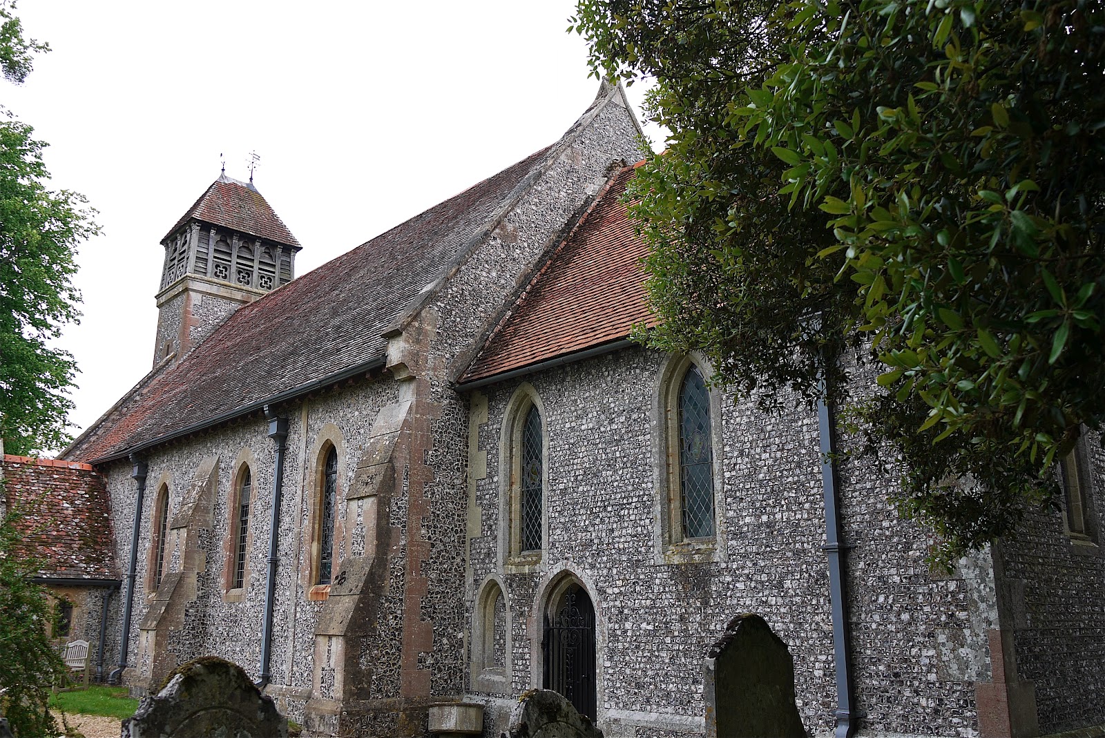
Nearby is another church of St Thomas a Becket. Its core is Saxon, but most of what you see dates from the 12th and 13th centuries. It is a lovely church.


In opposite corners of the churchyard are watchmen's huts dating from 1828, used to protect the newly buried from body snatchers. I saw a more elaborate, slightly older one, near St Bartholomew's hospital in London just recently


The route now leads across fields to rejoin the harbourside near Emsworth.


I followed the path to South St and then into the centre of the village, where I caught a taxi back to the start. I took some other pictures on a walk covering both Thorney Island and Emsworth in 2011.


Conditions: not too cold, maybe 8 degrees. Cloudy and hazy.

Distance: 7 miles or so.

Map: Explorer 119 (Meon Valley, Portsmouth, Gosport and Fareham) and 120 (Chichester).

Rating: four stars. Some dull bits, but overall a lot of variety and interest.


Sightings

These two Black-tailed Godwits were the highlight, but I also saw Redshanks, Oystercatchers, Little Egrets, Shelduck, Brent Geese, a Heron, and what may have been three Ringed Plover.


Saturday, 30 March 2013

Hambledon to Ports Down (Wayfarer's Walk 16)

 Church St, Hambledon

I had set aside yesterday and today to finish a report for a client, but a great effort yesterday nearly completed the job and I decided to go out for a walk today as a reward. Angela suggested doing the penultimate leg of the Wayfarer's Walk and off we went in two cars to do so. It was actually last November that we did the leg from Corhampton to Hambledon, in bright, warm sunshine - it seems hard to credit it.

We picked up the route in the pretty village of Hambledon and walked along the street opposite Church St to climb the short, steep Speltham Hill. From the top there were excellent views down over the village, nestling in its valley.


The route now led across brown, recently plowed fields, to the outskirts of Denmead. It then followed a straight line through housing developments to emerge on the southern edge of the village and cross a golf course. All pretty dull. Only at Closewood House did we see anything to catch our interest - these lovely curved upstairs windows, pushing through the line of the roof.


Now past a pig farm, a stream, more fields, a copse or two and a road to reach Purbrook Heath. At the entrance to the heath - seemingly actually more farmland - was the wonderfully restored Tudor Cottage.


 Now we followed a track between fields and then a path at the back of a housing development to emerge onto the high ridge of Portsdown (well, at 116m it is not really very high, but it does a commanding position over Portsmouth). We admired the delicate birds on this gable.


Soon we reached today's end point: the car park above Collyer's Pit with fine views, albeit very hazy in the late afternoon, towards Portsmouth. The Spinaker Tower which we climbed on last year's city walk around Portsmouth can just be made out on the right. The Isle of Wight is clearly visible in the background.


Slightly to the left, was a fine view over Langstone Harbour, with its surprisingly narrow mouth.


Conditions: not as cold as of late, maybe 5 degrees. Cloudy, but some sunshine.

Distance: 7.5 miles, so 64.5 now covered. The end is in sight.

Map: Explorer 119 (Meon Valley, Portsmouth, Gosport and Fareham).

Rating: three stars. A difficult time of year: the brown fields and leafless trees and hedgerows made for a walk that lacked visual stimulation.


Sightings

We saw some clumps of Lesser Celandine, offering the proof that many people are demanding of the end of this long cold Winter and the arrival of Spring. I didn't take a picture this year, but I was pleased to find that last year's rather good one was taken on almost the exact same day, on a earlier leg of the Wayfarer's Walk.

We also saw a fine, bold Mistle Thrush on the golf course and heard the remarkably loud drumming of a Greater Spotted Woodpecker in a Newlandsmoor Copse.

Sunday, 11 November 2012

Corhampton Down to Hambledon (Wayfarer's Walk 15)

Bottom Copse

The weather forecast was for a sunny day and I decided to resume the Wayfarer's Walk after a gap of two months. Ange came too, so it was possible to do a linear walk and make some impression on the 22 miles still remaining.

We picked up the route by Corhampton Down and initially followed the edge of Bottom Copse (above). Then through Corhampton Gold Course. As we emerged, there was a fine view west towards Shepherds Down.


 Now heading south along a road, the view to the east was across the Meon valley between Meonstoke and Droxford.


The path soon left the road and passing through woodland and then fields brought us to Droxford. The fine church of St Mary and All Saints stood close to the 17th century Manor House


Its Norman origins could be seen by the repositioned doorway in the north aisle and, I imagine, by the tower, with its stair turret.

The route now headed across the valley crossing the mighty Meon, running fast and clear, and then parallel to it through fields. At one point the path came close enough for a picture, which includes the unusual sight of a fence running across the river.


Further on we came to a nicely arched brick bridge. The sun was in the wrong place really, but it was a pleasing sight so I have done my best to salvage something with the aid of Photoshop Elements.


Now up the hill into Soberton. The first thing you see is Soberton Towers, designed and built by Colonel Charles Brome Bashford in the 19th century. Following Pevsner, it is impressive and picturesque at first, but disappointing on closer inspection.


 The rather messy looking Norman-Gothic church of St Peter and Paul lies just around the corner. According to Pevsner there are some impressive wall paintings, but we did not stop to look inside.


 There follows a quite steep climb up the other side of the Meon valley, reward as ever by fine views back. The church tower can be seen to the right.


The climb gave way to a grassy plateau where model aircraft enthusiasts ruled the skies. This gave way to a series of fields paths, past the red brick East Hoe Manor to descend into Hambledon through a beech hanger. A path at the back of the village brought us to the third church of the day, St Peter and Paul.


The church is of Saxon origin, but has been much altered and added to through the centuries. This marked the end of today's leg.

Hambledon is of course famous as the "cradle of cricket". The Hambledon Club was formed in about 1750 and played on Broadhalfpenny Down, a couple of miles to the east of the village. The famous Bat and Ball inn overlooks the down. Hambledon was apparently England's leading cricket club from about 1765 until the formation of the MCC in 1787.

Conditions: sunny and surprisingly warm.

Distance: 7 miles, so 57 now covered. The remaining 15 can be dealt with in two more linear goes, so the end is in sight and should be accomplished before the year is out.

Map: Explorer 119 (Meon Valley, Portsmouth, Gosport and Fareham).

Rating: three and half stars. Enjoyable and quite varied.

Monday, 3 September 2012

Wind Farm to Corhampton Down (Wayfarer's Walk 14)

Looking east

There seem not to have been many opportunities to walk lately, with our strangely busy social life and the uncertain weather, but today offered a chance to get out so I returned to the Wayfarer's Walk for the first time since June 16. I picked up the route at Wind Farm and followed a field-edge track shared with the South Downs Way to Lomer Farm, where the Wayfarer's Walk turned off to the south. It's all agricultural land here, but the view east (above) was very pleasant.

This is all part of the Preshaw Estate, and soon I was looking across to Preshaw Down.


The trail headed on along a long shallow valley with the splendid name of Betty Mundy's Bottom and then detoured through woodland around a rather grand looking house, mysteriously marked on the map as Betty Mundy's Cottages. Then along through the continuation of the valley to St Clair's Farm. I went just a bit further, along a narrow road heading south beside Corhampton Down before deciding that it was time to turn round.

All of this raises the key question of who was Betty Mundy. A bit of Googling reveals that others have asked, but no-one seems to know for sure. The best answer I found here is that it may be a corruption of the Latin beati mundae - the most blessed place in the world - a name given to the place by a Roman legion. Or Betty may have been a way-layer of sailors or a curser of cattle.

There was a nice view of the Bottom on the way back, with the sun behind me and my new Polarising filter on my camera delivering the promised bluer skies. This filter seems to have been a great buy. It reduces glare from sunlight on leaves, water and the sky, and makes the sky look more blue. I did a number of comparative tests and there seems no doubt that these claims are true. You may just have to lighten the foreground afterwards.


Conditions: hot and sunny, very still, puddles in the bits of woodland.

Distance: 6.5 miles altogether, 3.25 forwards. 49.75 miles - OK, call it 50 - now covered. Just about two-thirds of the way.

Map: Explorer 119 (Meon Valley, Portsmouth, Gosport and Fareham)

Rating: three stars. Pleasant enough, but no real drama.


Sightings

Not much to see in fact, apart from simply hundreds of young pheasants. I think I have read that 7m are released each year. Poor things, they know not what awaits them. Here is one gathering of twenty or so.

Butterfly of the day

Not many butterflies either: large and small Whites, several Speckled Woods, a Red Admiral, A Peacock. I was quite pleased however with this shot of a Speckled Wood with folded wings: normally they seem to roost with wings wide open.


Saturday, 16 June 2012

Hinton Ampner to Wind Farm (Wayfarer's Walk 13)

 Hinton Ampner

The weather forecast promised a morning free from rain, so I thought I would make the most of it and continue the Wayfarer's Walk. I picked up the route near Hinton Ampner House, catching a glimpse of the house - neo-Georgian in style, dating only from a substantial remodelling of 1937. Eventually I will get to see Ralph Dutton's celebrated gardens, but not today.

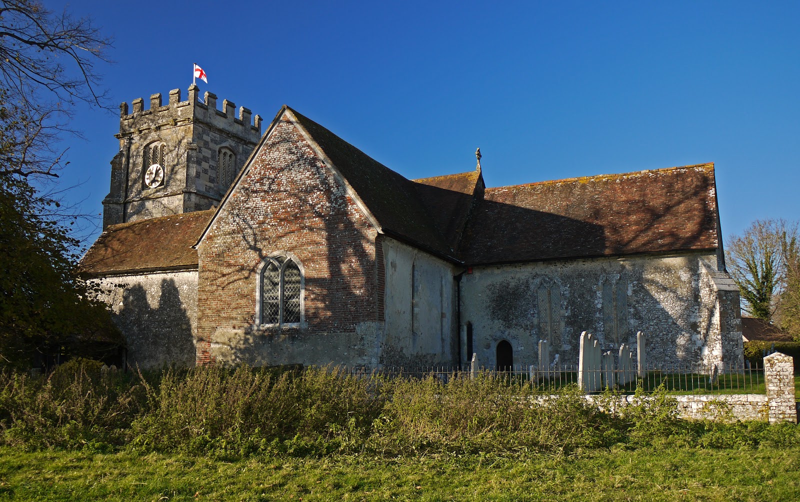
The nearby church is of Saxon origin, although the tower dates only from 1879.  I then followed the fenced path around the boundary of the National Trust property.


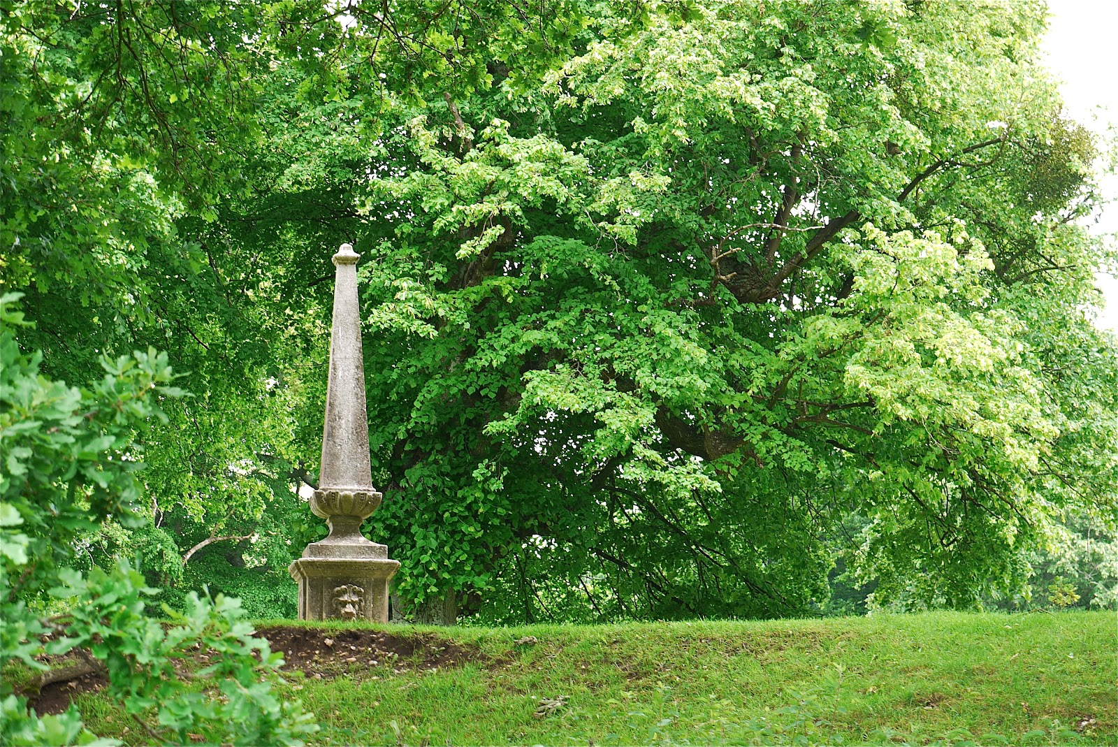
At a cross roads of paths I diverted briefly to the right to photograph this obelisk (marked on the OS map as "Monument") at the edge of the grounds of the house. I know not what it commemorates.


The path now led uphill through grazing sheep, all the time with fine views back to the house.


Soon you reach the village of Kilmiston. The official route goes through fields at the back of the village but I decided to take an alternative route through the village itself, in case the church or manor house were of interest. The small church looks Victorian, although a sign says that it dates from 1730. The early 18th century manor house is substantial, but currently being restored.

Now the path went beside a paddock and through a lightly smelly field of rape to pass through a hedge and head straight across a vast cornfield. Well done to the farmer for marking such a fine wide track!


This led, via another couple of fields to Wind Farm where the route merges briefly with the South Downs Way. This made a sensible stopping point so I headed back after admiring the pleasant view over the country I had just traversed.


The route back was notable for the sighting of a Small White butterfly: the only one today and the first I have seen for what seems like weeks.

Conditions: cloudy, but some glimpses of the sun; reasonably mild.

Distance: 6 miles of which 3 were forwards along the Wayfarer's Walk; 46.5 now covered.

Map: Explorer 132 (Winchester).

Rating: three and a half stars.


Flowers of the day

There was quite a bit of White Campion about.


And, less familiar to me, also this dramatic Bladder Campion.


Wednesday, 16 May 2012

Alresford to Hinton Ampner (Wayfarer's Walk 12)

St Michael and All Angels, Cheriton

This week's good day, so back on the Wayfarer's Walk. I started on the edge of Alresford, walked down the road and crossed the A31 by a footbridge. Then across a golf course, along a section of road and a triangular route around fields brought me to Cheriton Mill. All pleasant enough, but undistinguished.

However, things began to look up with the crossing of the small, but clear and fast-flowing river Itchen. It is near its source here, but goes on to merge with the Alre and then swing south through Winchester.


The path then follows the line of the Itchen through fields to reach the pretty village of Cheriton. We were here last year on a walk from Hinton Ampner with Viv and Giles. I briefly detoured to visit the  the church, which I described last year, based as ever on Pevsner. The re-set 13th century porch is very attractive.


Walking back along the road to rejoin my path, I was struck by this sign, later repeated on a small bridge over the river. It is clearly an early example of the modern trend towards notices whose function is not so much to inform as to disclaim responsibility.


The path away from Cheriton was through delightful open country with Middle Farm to the left.


The view looking up through the wayside trees was pretty good too.


A hedged track brought me to the edge of Hinton Ampner, the latter part being the reverse of last year's walk. I decided to stop there and was pleased to find on the map an excellent direct track which took me most of the way back to Alresford. So this became something closer to a circular walk.

Conditions: bright, sunny and increasingly warm.

Distance: 8 miles in all of which 4.5 were forwards along the Wayfarer's Walk; 43.5 now covered.

Map: Explorer 132 (Winchester).

Rating: four stars.


Sightings

Another reasonable crop of birds, a bit different from the last couple of times:  Mistle Thrush, Nuthatch, Goldfinch, Heron, Sky Lark, Black Cap, Swallow, Kite, Buzzard.


Flower of the day

Lots of members of the Buttercup family in evidence, including some fine Marsh Marigolds by the river. This I think is the Meadow Buttercup.