Saturday, 20 February 2016

Stamford

 Browne's Hospital

On a visit to friends, we were taken to see Stamford, somewhere I have always wanted to visit. We broadly followed this walk on the AA website. Starting at the now defunct Museum in Broad St, we quickly reached one of the town's most famous buildings: Browne's Hospital. This fine almshouse was founded in 1480 by William Browne, a wealthy wool merchant. Behind the chapel there is a cloister garden which was rebuilt in 1870 and modernised in 1964.


We walked down Ironmonger St and along High St to reach Red Lion Square where we wandered into the, sadly redundant, church of St John the Baptist. The wooden roof is an absolute marvel with its rows of carved wooden angels.


To the right is the church of All Saints, which has the look of an East Anglian wool church. It is essentially 13th century in origin, and it is from this period that the wonderful blind arcading dates. The tower and much of the rest of the church are the result of a 15th century rebuilding funded by the same William Browne as founded the Hospital.


The route now took us past the east end of the church at up Barn Hill, an attractive street with a nice mixture of houses, including this imposing Georgian mansion.


You have to turn left at the top and this brings you down to Scotgate, directly opposite Truesdale's Hospital. This was founded in 1700 by Thomas Truesdale, a successful attorney and rebuilt in 1833. The architect of the present building was George Basevi, a pupil of Sir John Soane, who went on to design the Fitzwilliam Museum in Cambridge and Belgrave Square in London. To the right is the (former) Snowden's Hospital of 1604.


At the town end of Scotgate, passing All Saints Church again, we turned right into All Saints St. At the end of the street is St Peter's Callis (a local word for an almshouse), founded in the 15th century, but rebuilt in 1863. And recently cleaned it would appear.


At this point we departed the AA route and continued into St Peter's Street, passing another former almshouse, Williamson's Callis  on the left, and then reaching the lovely Hopkins's Hospital. This was built on the line of the demolished town walls in 1770, by John Hopkins, then mayor of Stamford. It was extended in the 19th century.


Just beyond the Hospital, we enjoyed two lovely terraces of 1829-31: suddenly we could have been in Cheltenham.


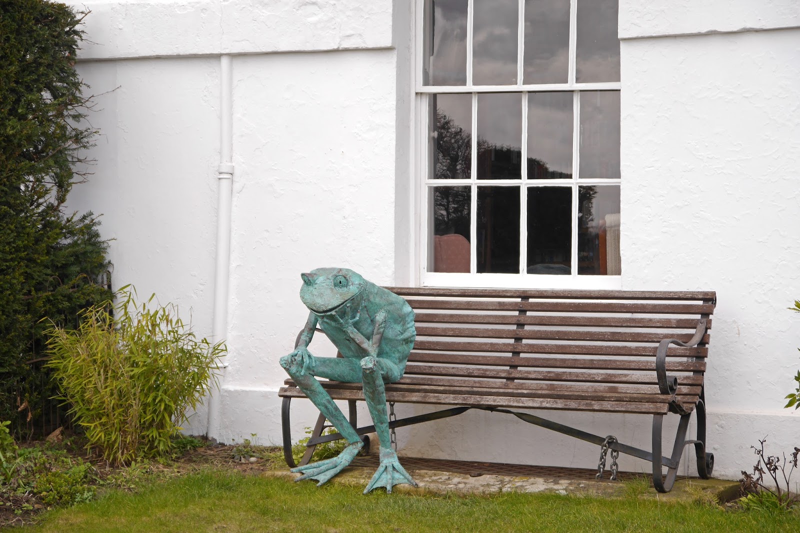
The nearest house had this wonderful front garden feature which set us all chuckling.

We walked back into town and along St Mary's St and then right towards The Bridge. There were a delightfully ornate pair of shopfronts on the corner of St John's Street.


And on the approach to The Bridge, another imposing Georgian building.


Immediately on the opposite side of the river were Lord Burghley's Hospital, a pretty enough group, but not as grand as the name would suggest. It was founded in the 12th century as the hospital of St John and St Thomas and administered by Peterborough Abbey. After the Dissolution of the Monasteries, it was bought by William Cecil, later  the first Lord Burghley, one of Elizabeth I's principal advisers. He formally endowed the Hospital in 1597.


It was raining quite hard by now and so a short way along High Street St Martins, we adjourned to the George, a famous old coaching inn for lunch. The scaffold sign which crosses the street was used occasionally as a gallows for highwaymen.


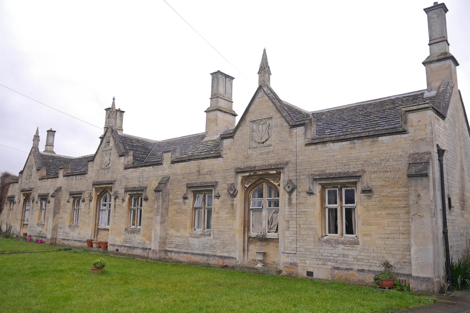
Finally, with it still raining when headed further along the road and right into Kettering Road to find our (OK, my) final set of almshouses, Fryer's Almshouse of 1832. This was  built by Henry Fryer, a surgeon, and like Truesdale's, which we saw near the start of the walk it was designed by the architect George Basevi. There is a considerable stylistic similarity.


Conditions: cool, grey and damp.

Distance: about 3 miles.

Rating: four and a half stars. A lovely, characterful town with a great selection of almshouses as well as many other fine buildings.

Thursday, 11 February 2016

London: Westminster

Big Ben

Another great walk from London's Hidden Walks vol 1 by Stephen Millar: around Westminster starting from Westminster tube station. You cross the road and are immediately confronted with the Houses of Parliament and Big Ben. You walk across the bottom of Parliament Square and crossing the road into Old Palace Yard, there is this wonderful view of the Henry VII's chapel. It is remarkably different from the rest of this great church, dating from 1503-12, while most of the rest of the Abbey dates from the 13th century.


A little further on on the same side is the Jewel Tower, built about 1365, and something else I had never noticed, although I have walked around Westminster many times while at work.


I crossed the road into Victoria Tower gardens and admired Rodin's Burghers of Calais, one of 12 casts of the original. Calais was about to fall to Edward III in 1347 and he promised to spare the citizens if six leading burghers emerged from wearing nooses and carrying the city's keys. They too were spared after the intervention of Edward's Queen, Philippa of Hainault.


As you walk through the gardens there is a great view back towards the Victoria Tower. On the right is the Buxton memorial, commissioned by Charles Buxton MP to commemorate the abolition of slavery in 1834 and designed by the Gothic revival architect Samuel Sanders Toulon.


The route now follows the Embankment with a lovely view of the pinkish Lambeth Bridge.


Along on the right is the rather uninspiring Tate Britain building, opened as the National Gallery of British Art in 1897.


Across the river stands the imposing MI6 building, which I photographed from the Lambeth side only a few ago while on a self-designed walk around South West London.


Now round the back of the Tate and along John Islip Street, with the red brick buildings of the massive Millbank estate on the left. This early social housing scheme was built between 1897 and 1902, the bricks being recycled, according to Wikipedia, from Millbank Prison which had closed in 1890. I enjoyed the Arts and Crafts solidity of this porch.


After passing Smith Square you go along Lord North St where there is a rare reminder of the Blitz in this sign locating the nearest air raid shelter.


At this point I departed the route for a while to locate one of London's few art nouveau features: this fabulous peacock terracotta panel over the door of a building in Abbey Orchard St by W J Neatby.


I rejoined the route as it entered Dean's Yard, part of Westminster Abbey and home to Westminster School, some of whose pupils were enjoying a pleasant game of football on the grass,


An archway in the corner leads into the Abbey cloisters and the College garden, where the main facade of the School can be seen.


On the way back out I went through the cloister to see the Chapter House. This dates from 1250 and its own way is astonishing as the one we saw last week in York. There is also another wonderful one in Lichfield. Another project?


Emerging from Dean's Yard, you find yourself in front of the Abbey.


To its left is St Margaret's church. It was founded in the 11th century when the monks of the Abbey decided they didn't want to continue to share their abbey church with the local populace. The present building dates from the 15th century.


At this point I had almost run out of time, so I did my second planned detour and left the section of the walk which goes into Whitehall undone. I was heading towards the United Westminster  Almshouses in Rochester Row. On the way, I realised I was passing the famous Greycoat Hospital. It was founded as a school in 1698 and took over these premises, a former workhouse, in 1701.


The almshouses date from 1879 and resulted from a scheme to consolidate and rebuild several sets of almshouses on the site of Emery Hill's almshouses in Rochester Row.


Conditions: a beautiful winter's day.

From: London's Hidden Walks vol 1 by Stephen Millar (Metro Publications).

Distance: about 3 miles.

Rating: five stars. Some world-famous sites as well as all sorts of less well-known things. I used to work a lot in this area - I must have passed the offices of a dozen former clients - but I still discovered much that was new.

Sunday, 7 February 2016

York: the City walls

Bootham Bar

York first had walls under the Romans in about 71AD, but the ones you can see today mainly date from the 12th to 14th centuries and were reinforced during the Civil War. By the 19th century they were felt by some to be an encumbrance and there were calls for their demolition. This produced a campaign for their survival and the outcome was that a programme of restoration coupled with some new gaps being introduced to allow easier access for traffic.

We started our walk at Bootham Bar, with the Minster towers in the background. Just as York's streets are confusingly often called Gate, its gates are know as Bars. Bootham Bar is one of the four main gates and the lowest storey dates from the 11th century, the upper storeys from the 15th.

You climb the stairs visible in the photo and walk through the tower to join an initially very narrow walkway. We had to wait while a tour party came the other way - what must it be like in high summer? This section of wall was built in Victorian times on the original ramparts.


At the north corner the wall turns sharply right and there are clearer views of the Minster, with the back of the Treasurer's House in Minster Yard in the foreground. The pointed roof belongs to the wonderful Chapter House which we visited yesterday.


In the next section, alongside Lord Mayor's Walk, there is a nice view across to the Tudor-style buildings of the York St John University. Soon after, you reach the second main gate, Monk Bar, the tallest and strongest of the four. It was built in the 14th and 15th centuries.


Not long after this there is an interruption to the walls and you have to descend to ground level at a busy road junction - suddenly you could be anywhere. This area was once a large marshy lake, which prevented wall building and attack alike. There is however a wonderful industrial survival, the massive chimney known as the Destructor, which belonged to an incinerator for the city's rubbish.


The path follows the River Foss for a while and the walls resume at the unprepossessing Red Tower. This was built round 1500 and is the only one built of brick. The land level was raised here in Victorian times, making the tower seem more squat than it originally was.


This section looks over rather suburban housing, but soon leads to a medieval gem Walmgate Bar. The view from inside the walls is very surprising with a rather lovely loggia-like Elizabethan extension, now housing a cafe.


Outside, there is the one remaining barbican (the other Bars had theirs removed in the early 19th century).

At Fishergate Bar, a little further on there is a handsome plaque to commemorate repairs completed in 1487.

From the next section of wall we spotted this old shop front with art nouveau style lettering.


The wall ends briefly at Fishergate Postern Tower, which was built to defend a narrow pedestrian entrance.  We were now near the site of York Castle and we had a fine view of Clifford's Tower, the ruined keep of the original Norman castle, which we saw yesterday from the town side. It seemed to be very popular.


We crossed the River Ouse and rejoined the walls, to soon reach a long straight section, with grassy banks on both sides. These are planted with daffodils which apparently make a famous display in early spring. They were just beginning to come into flower.


This section ends with the imposing Micklegate Bar, once the main entrance to the city: it guards the main road south.


Soon after Micklegate Bar the walls turn right towards the River Ouse and the Minster, with modern offices and a large hotel on the inside and the Railway Station and another large hotel on the outside.


Walking across Lendal Bridge, we were struck by the very decorative lamps.


The final section goes through Museum Gardens, with the best surviving stretch of Roman wall and a Roman tower.

Conditions: bright at first, becoming progressively more grey.

Distance: 2 miles.

Rating: five stars.

More information: Simin Mattam - A walking guide to York's City Walls. (Very comprehensive and informative, but I didn't like the way it was organised.)

Friday, 5 February 2016

York: inside the City

York Minster

In York for the weekend and we start with this walk based on one around hidden York from the AA website. The walk starts in Museum Gardens and our first sight was the ruins of St Leonard's Hospital. Erected on the site of the former hospital severely damaged in a fire in 1137, it was said to be the largest in the North of England. In the manner of medieval hospitals it would have cared for travelers and the sick, poor, elderly and disabled.


On the other side of the Gardens are the ruins of St Mary's Abbey: a Benedictine abbey founded 1088 and once the richest in the north of England, it was destroyed at the Dissolution of the Monasteries in 1539.

We then walked up Museum St towards the Minster, noting on the right the rather wonderful York Dispensary building of 1889, now offices.


We admired the west front of the Minster, especially the tracery in the great window (see post at the head of this post) and went in to be amazed by its sheer size. It is allegedly the largest gothic cathedral in northern Europe. The nave roof is certainly inspiring, and although built over two centuries in different styles of gothic architecture, the overall effect is remarkably harmonious.


Perhaps the most remarkable part was the Chapter House, along a passageway from the corner of the north transept. It was built between the 1260s and 1280s and its magnificent, vaulted ceiling is supported by timbers in the roof, instead of by a central column as was normal - and can be seen in places such as Lichfield.


The Minster also has an Astronomical Clock dating from the 1940s - who knew that such a thing had be made so recently. I think of this as a truly medieval creation as our most recent encounter, in Lund in Sweden (dating from 1380), would attest.

Outside again, we headed north towards the Minster Library and couldn't get the whole length of the Minster into a single shot. The Chapter House is the building on the left with the pointed roof.


Now our route took us along Chapter House St, Ogleforth (the first of many weird and wonderful street names) and Goodramgate into Bedern, a modern housing development which yet contained the lovely red brick Bedern Hall, the 14th century refectory of the Vicars Choral of York Minster.


Some small streets took us to St Saviourgate at the end of which is the extraordinarily named Whip-Ma-Whop-Ma-Gate, York's shortest and most famous street.


The plaque says that it derives from it derives from the phrase Whitnourwhatnourgate meaning "What a street!"- which sounds like nonsense to me. Wikipedia says that "most modern sources translate the phrase as 'Neither one thing nor the other'", which doesn't get us much further.

The route continues past the half-timbered Herbert House (1620) down an alleyway to reach Fossgate.


You are confronted by this extraordinary building, which turns out to once have been the Electric Theatre, York's first cinema, built in 1911.


Fossgate leads down to a bridge over the River Foss, where there was recent flooding. Some shops and restaurants, sadly, are still closed. Crossing the river and turning right and right again you come to Merchant Adventurers' Hall. This was originally a guild hall built in 1357. Its undercroft housed an almshouse for the poor of the city. The chapel was added later.


Following the bank of the Foss, we came next to the wonderful Clifford's Tower, this is all that remains of the Norman keep of York castle.


Nearby is the handsome 18th century building which began life as the Debtors' Prison and is now part of the York Castle Museum. Pevsner said that "this building is, next after the Minster, the most monumental of York". The tower has an unusual clock, with only one hand, installed in 1716 by  a York clockmaker, John Terry.


We departed from the AA route here as it was getting too dark to see, passing the celebrated Fairfax House and the less well-known, but more imposing, Castlegate House (below), both by the great local architect John Carr of York.


Castlegate and Spurriergate led us back to our hotel in Coney St where we could not fail to admire this wonderful clock outside the church of St Martin-le-Grand. It is known as the Little Admiral and dates originally from 1779.


One final thought: you can't help but notice than any amount of streets in York are called "-gate", which seems at bit puzzling. It turns out that this a corruption of the Norse word "gata" which in fact means street.

Conditions: pretty grey.

Distance: maybe three miles.

Rating: five stars. The Minster is magnificent and there is just so much to see.