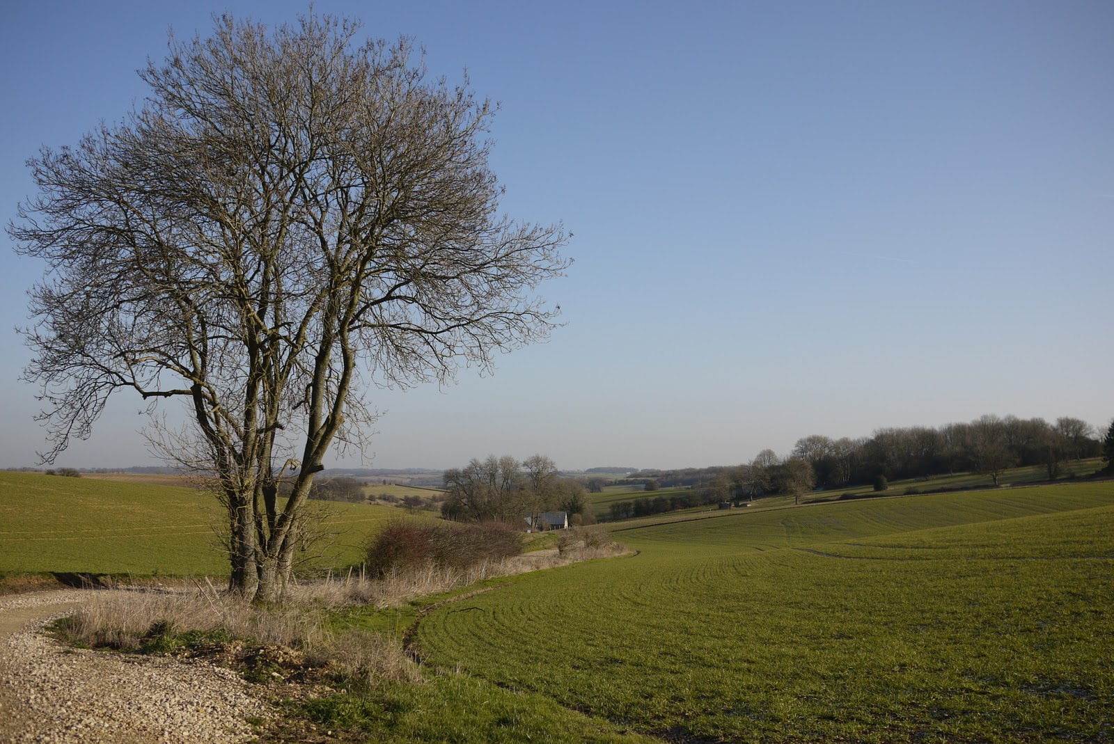
Sunday, 15 January 2012

Hawling to Bourton-on-the-Water (Windrush Way 2)

The Windrush Way

Our next project with Merv and Pud is the Oxfordshire Way. Today was the second stage of the Windrush Way which links the Cotswold Way (last year's project) with Bourton-on-the-Water, where the Oxfordshire Way begins. We picked up the route near Hawling Lodge.

We walked across a field and then along one side of a narrow valley. At the end we turned south to walk through Gazeley Wood and then across fields almost to the A436. Here we turned east once more across the wide open valley in the photo above.

We passed a clay-pigeon shooting centre (must try that some time - not as a substitute for killing animals, of course). Then the valley began to narrow.


Somewhere round here we found ourselves on the Gustav Holst Way which runs the 35 miles from Cranham to Wyck Rissington and apparently connects places where Holst lived and worked. He was born in Cheltenham and the house is now a Museum to him.

Now at last there was enough of the River Windrush for us to be able to walk beside it for a while.


Later, we were forced away from the river again and climbed through woodland to then descend and rejoin it after a mill, and soon thereafter come to the edge of Bourton-on-the-Water. To the right we noticed a couple of solidly constructed railway arches and the route of the railway is very clear on the map: it was the  Banbury and Cheltenham Direct Railway.

The route into the town delightfully follows the right bank of the river and emerges opposite this imposing Georgian house, Harrington House. Pevsner describes it as "by far the most splendid house in the village" and dates it to about 1740. He comments on the "wonderful golden ashlar", which clearly continues to shine.


In the very centre, the river is crossed by three low bridges, with the Green on one side and lovely golden stone houses, mostly 18th century, all around. No wonder it is so popular!


Conditions: cold, sunny - rather wonderful.

Distance: 7.5 miles.

Map: Explorer OL45 (The Cotswolds).

Rating: fours stars. The country part was maybe not as special as the previous leg, but Bourton was a delight.


Sightings

We were pleased to see these fine Snowdrops. Looking back through this blog, I see that the earliest I have previously commented on Snowdrops was 27 January.


I wish I could master the technique of focusing successfully on white flowers!

Friday, 13 January 2012

Cambridge: Trinity to Corpus

 
King's College Chapel

Were were in Cambridge to catch the excellent Vermeer exhibition at the Fitzwilliam before it closed. Having to queue for an hour to get in - and then needing a nice lunch - left us with little time to walk, but this shortened version of the walk I had planned was still extremely worthwhile.

We started at the imposing sixteenth century Great Gate of Trinity.


Then across Great Court to Nevile's Court and then through to see Wren's great Library of 1768.


 The two ranges which adjoin it were apparently added on almost immediately, and not much later as one might expect.

We now retraced our steps to exit into Trinity Lane and walked past Clare to enter King's for a quick look at King's College Chapel. Pevsner describes it as "one of the major monuments of English medieval architecture" and explains that the first stone was laid in 1446 and that it was completed in 1515. The dominant impressions are of size, height, light and harmony. The fan vaults are spectacular.


We then walked round the great lawn down to and along by the river and wondered at the incongruity of the Gibbs Building which is at right angles to the Chapel. Why couldn't they at least have used the same colour stone?

Leaving King's through the screen-walled front by William Wilkins (1823), we turned right into King's Parade to quickly reach the extraordinary Grasshopper Clock on the Bene't St corner of Corpus Christi college. I must confess to being unaware of its existence until I was doing some research for this walk.


The blue lights in the two inner circles display the time as hours and minutes (4.22), while the seconds flash rapidly around the outer edge. The pendulum swings, but sometimes pauses alarmingly. The clock is mechanical: the grasshopper escapement mechanism (an eighteenth century invention) converts pendulum motion into rotation. It was conceived and funded by John C Taylor, an old member of the college, as a piece of public art. It is entirely successful. I like the way in which my photo has caught the pink evening light.

Finally, we popped into Corpus to see The Old Court, which Pevsner says gives the best idea of what a 14th century Oxford or Cambridge College was like.


 Conditions: dry, dusk.

Distance: a mile at most.

Rating: four stars.


Reflections

This walk illustrates perfectly that a "walk" doesn't have to cover a great distance or involve great difficulty to be wonderful. It just needs to be undertaken deliberately in an enquiring and attentive way.

Even in places you think you know well, there are wonderful things to see if you go looking for them. Obviously, Cambridge is better endowed than most with wonderful things, but I think this is, if not universally true, certainly a good philosophy.

Friday, 6 January 2012

Blandford Forum

East Street

We were in Poole and fancying a walk, but not fancying the high likelihood of heavy mud on the Coast Path, so we decided on an urban walk to explore Blandford. I took the route mainly from the "perambulation" described in Pevsner and was helped by a nice little leaflet downloaded from the Blandford Town Council website.

We arrived in Blandford from the south and found a large car park just across the river Stour. The handsome bridge dates from 1783 and 1812. The river was swollen and muddy after the recent rain.


We walked up West St to reach the Market Place, the centrepiece of the town. Blandford has a remarkably uniform Georgian character and it is all due to the great fire of 1731 which destroyed almost the whole of the centre. The architect-surveyors in charge of rebuilding were the brothers William and John Bastard, who were already important citizens.

On the north side of the Market Place is the stately Town Hall of 1734 - quick work! Inside the pediment over the central window is the wonderful inscription "BASTARD ARCHITECT". We had to chuckle.


To the right of the Town Hall is the fire monument, erected by John Bastard in 1760. It was not merely ornamental, having a head for a water supply for fire hoses in the event of further incendiary problems.


The inscription concludes, "This monument of that dire disaster and provision against the like, is humbly erected by JOHN BASTARD, a considerable sharer in the general calamity". What a lovely phrase.

Behind the monument is the church of St Peter and St Paul of 1733-9, by William and John B. It was hard to photograph as the street in front was clogged with traffic resulting from lorries unloading in the centre of the town. It is a handsome church ("noble" in Pevsner's assessment). The tower and cupola, which are visible from all directions, were for once not the work of the Bastards, who had intended a spire.


We now walked up Salisbury St to find the Ryves Almshouses (described as a Gerontocomium on the plaque under the main pediment). They date from 1682 and make a lovely group. This means that they pre-date the fire and must have been right on the edge of the town when they were built. They are in beautiful condition.


We then walked back down Salisbury st and turned left into a street with the wonderful name of The Plocks and turned right into Church St to pass Coupar House - the "finest post-fire house in Blandford" according to Pevsner.


It is certainly imposing. It is now the home of the local outpost of the Royal British Legion.

Reaching the church, we turned left into East St (see photo at the head of this post). We remarked on Eastway House and were childishly delighted to then read in Pevsner that it is "the only house to deserve comment"in the street.


This part of the town was unaffected by the great fire of 1731, but had already suffered an earlier one in 1714.

We walked to the end, crossed the river and walked back to the car park via a path around the water meadows and then a footbridge.

Conditions: cool, cloudy coming on to rain as we reached The Plocks.

Distance: no more than two miles

Rating: three and a half stars.

Thursday, 22 December 2011

Bunkhanger Copse to Upper Woodcott Down (Wayfarer's Walk 2)

Ox Drove

It was a lovely morning at home, with a bright blue sky, and it suddenly felt exactly right to do a bit more of the Wayfarer's Walk. Naturally, by the time I reached the start it was cloudy with a threat of rain. I picked up the route by Bunkhanger Copse and followed a pleasant path along the edge of the wood to emerge on a muddy track with fields on both sides.

The track crossed a road and became the wider and better Ox Drove. I met some chaps on motorbikes here who said they were enjoying the challenge of staying on their bikes as they slid this way and that in the muddy ruts in the track.

The route then crossed the A343 and became tarmaced for a while until it reached this splendid building. It is Grotto Lodge (Grotto Copse is opposite), a gatehouse of Highclere Park.


The Lodge was followed by a pleasant track with fields to the left and woodland to the right.


After a while you reach a vantage point marked on the map as Rabbit Warren, at 260m. The track now descends with wide views over open country all around.


The fractionally higher Beacon Hill (261m) is a major landmark to the east (left).

Time was now almost up: I would have to turn round if i wanted to get back to the car before it became dark, so I descended another quarter mile / 50m of descent and began to retrace my steps just short of this fine oak tree.


Conditions: cloudy with a threat of rain which fortunately did not materialise, but quite mild.

Forward distance: 3 miles; distance now traveled 6 miles.

Map: Explorer 144 (Basingstoke, Alton and Whitchurch).

Rating: three and a half stars.


Sightings

I was surprised to see a few examples of Red Campion still in flower.


I was even more surprised to see this fantastic growth on the edge of a fallen branch.


A bit of Googling identified it as the jelly fungus Tremella mesenterica,  known as witch's butter in the US. In the UK the name seems to denote a similar looking but black fungus, Exidia glandulosa.

Friday, 9 December 2011

Portland Bill to Ferry Bridge (SW Coast Path 15)

Portland Bill

Today marks our 15th and final leg of the Coast Path for this year. We picked up the route at the Lobster Pot and walked down behind the light house to Portland Bill itself. The Bill marks the contact point of two different currents: the relative calm to the east contrasts markedly with the the rougher sea to the west.

As you can see from the photo it is marked by an obelisk: it is 23 ft tall and was put there is 1844. The inscription also carries the initials TH - presumably Trinity House. It was apparently installed as a warning of a low shelf of rock extending 30 metres South into the sea.

We passed to the back of the active lighthouse which was built in 1906 and is 35 metres (115 ft) high.


There are two other older lighthouses nearby: one is now a private house and the other is a bird observatory.

Soon afterwards, we passed the fancifully named Pulpit Rock. Apparently it was left after a natural arch was cut away by quarrymen in the 1870s.


The route now crosses a grassy area to reach the west coast proper and then continues along the cliff top. The rocky headland of Blacknor dominates the view.


As you approach it, you pass the soviet era buildings of Southwell Business Park and the village of Weston.

Then there is a curious single-storey round house, quite modern in appearance built right on the cliff top. Our taxi driver on the way into Weymouth told us that the site was once a gun emplacement. The house appeared abandoned. We wondered what the full story was.

Just after this we headed inland to see the church of St George which we had noticed on our taxi ride down to Portland Bill. This striking church is built of Portland stone, as is only proper and has an Italianate feel (the tower and the sort of dome over the crossing), as well as echoes of Wren's London churches in the design of its windows. Our taxi driver thought it was in fact the work of Wren.


Pevsner describes it as the most impressive 18th century church in Dorset (which could be seen as fairly faint praise). He reveals that it was designed and built 1754-66 by a local mason, Thomas Gilbert. "His conception has true grandeur" says Pevsner. We thought that the ends of the transepts were especially dramatic. The church is no longer consecrated and was closed, so we could not see inside.

After this cultural interlude, we returned to the Coast Path and soon found ourselves walking along West Cliff and then above Chesil Cove, where the eponymous beach begins. There were some great views of Chesil Beach.


We descended some steeps steps to reach sea level and were struck by just how steep the beach is. From the landward side, it does appear like a great gravel dune.


That was about it really. We wandered through Chiswell, had a refreshing drink at the pub, and walked the two miles or so back along the causeway, the last part into the face of an icy shower.

Conditions: fairly clear, very strong wind, quite cold.

 Distance: about 6 miles. Distance covered now 56 miles.

Map: Explorer OL15 (Purbeck and South Dorset)

Rating: three and a half stars. We preferred this side of Portland.


Reflections

When we started the Coast Path in January, I said that we intended eventually to get to Weymouth or perhaps Lyme. Having already reached Weymouth, we are now beginning to contemplate doing the whole thing. At the current rate of progress, that would take 10.25 more years, by which time we would be into our seventies (ouch!). But as we have now shifted to doing linear rather than circular walks, it should be possible to make faster progress. We are moving towards a goal of completing it by the I am 70, in 2020. How thrilling is that?

Monday, 28 November 2011

Walbury Hill to Bunkhanger Copse (Wayfarer's Walk 1)

I fancied a walk today, after a couple of days of mixed work, personal admin and DIY, but all the local walks seemed too familiar and dull after this year of more exciting walks along the Dorset coast and in the Cotswolds - not to mention the Alps. Then it came to me as I was looking at the map of the area around Kingsclere: I could do a there-and-back walk along the Wayfarer's Walk, which starts at Walbury Hill and later passes south of Kingsclere. 

The Wayfarer's Walk runs for 70 miles from the car park at Walbury Hill to Emsworth near Portsmouth. A detailed account can be found on the British Walks website.

In trying to discover why it is so named, I found that it has been adopted by Macmillan Cancer Support and you could register to support the charity and access a wealth of information about the walk. Unfortunately, when I tried to do so I found that registration had closed. I still haven't found out where the name comes from.

About the walk

The start point is at 267m and the view over Berkshire, with the scattered village of Inkpen in the foreground is very impressive.


You follow a chalky track which initially passes over the iron age hill fort of Walbury Hill. It runs just below the ridge line of the North Hampshire Downs, but briefly you are on the ridge and can see south into Hampshire as well.


After a short stretch along a lane, there follows a long section on a grassy (read muddy initially) with fields on the left great views down to the flat Berkshire farmland below. The path ahead looks very inviting.


A bit further on, behind a projecting section, the Hannington radio mast - a landmark for miles around, can be seen on the horizon.


In this whole section the geometric pattern of the farmland is a fine sight.


It is remarkably quiet and isolated up here, and then all of a sudden you come upon a rather splendid modern house - Charldown. I often take photos of impressive old farmhouses and cottages, but this may be the first modern one.


The path leads down the drive of Charldown to reach a quiet lane and now Highclere House is increasingly clearly visible.


I walked along the lane as far as the point where the path leaves it to enter the unusually named Bunkhanger Copse. There is a handy parking area here, so it will be easy to pick up the route again. And now I turned back, puzzling about the car parked half on the grass verge whose driver was intently studying something, looking towards the fields below us. She had seemed a touch sheepish when I first passed, and drove up as I turned back towards her. What was she up to?

Conditions: cloudy, some sun, cold and windy in the open, but quite warm when sheltered.

Forward distance: 3 miles.

Maps: Explorer 158 (Newbury & Hungerford) and 144 (Basingstoke, Alton and Whitchurch).

Rating: four stars.


Sightings

I startled any amount of pheasants into flight as I passed by and as I drove back down to Inkpen I must have seen at lest fifty pheasant chicks wandering along the lane.

At least three kites wheeling around the sky, often very low.

Friday, 25 November 2011

Ferry Bridge to Portland Bill (SW Coast Path 14)

The gates of Portland

We had more or less decided to end this year's onslaught on the SWCP at Weymouth, but we saw an opportunity to keep on going, and now we hope to complete the circuit of Portland before Christmas. This would be very satisfying as for a large part of the walk so far, certainly since we turned St Aldhelm's Head, the western horizon has been closed by Portland. It will be great to continue the walk in the new year with open views to the west.

We picked up the route at Ferry Bridge and followed the causeway which links Portland to the mainland for about two miles to reach the gates of Portland above. The gates were funded by the six Masonic Lodges on Portland - a surprisingly large number we thought for a population of around 13,000.

Once on the island proper, we headed for the castle - another of Henry VIII's coastal forts, of 1539 (see also Sandford on the previous leg of this walk and Brownsea Island. This is landside view.


And below is the view from the shore side. In this view the tunnel entrance to the Verne citadel can be seen near the top of the hillside behind. It was initially a prison for convicts who were employed building Portland harbour in Victorian times and then became a military base; is now a prison again. To left is a large block (I first wrote "blot" - a nice slip) of flats, which had apparently been left unfinished.


The path follows the right side of the hill leading up to The Verne and as we got higher there was an increasingly good view back along Chesil Beach, which starts at Chesil Cove on the west coast of the island and forms the west side of the causeway. It was unfortunately rather hazy.


The route then follows the back of the peak, passing the route of railway lines which were once part of the Portland quarries to come to an entrance to the prison - presumably not the only one! Apparently The Verne, a category C prison (for prisoners who cannot be trusted in open conditions but who are unlikely to try to escape), is known for the large number of separate nationalities which are represented there.


The route now heads east with a "family farm" improbably located on one side and a working quarry on the other.


We then followed the East Weares (which I think means cliffs) and passed the Young Offenders Institution to emerge onto an open grassy area, crossed by quarry tracks which led down to the village of Church Ope. We were struck by Pennsylvania Castle which was built by John Penn, the grandson of the founder of Pennsylvania on land given by his friend King George III (who has been frequently mentioned lately). It is has recently become privately owned, but before that was a hotel.


After a short section of road, the path finally descends to the coast. It is wilder and quieter here and there is a good view back towards towards white chalk cliffs of the south Dorset coast.


This whole area was formerly stone quarries and the evidence is everywhere. We had the rather melancholy feeling of walking through a town that has been devastated by heavy bombing, with piles of rubble all that remained.


There were several of these derricks, which were used for loading stone onto barges.


As we approached Portland Bill along a grassy headland, a whole collection of huts came into view. They looked more like garden sheds than the more typical beach huts you see in Mudeford or Weymouth. But beach huts they are. On the way back to the station our taxi driver told us that they were highly prized and changed hands for "silly money". We had more the sense of a shanty town, but no doubt it all looks different in summer.


Then as one of the three lighthouses loomed ahead and we were fading fast, we saw the Lobster Pot restaurant. At first I thought it could not be open, but we were in luck and enjoyed a reasonable, but extremely welcome meal and a bottle of dodgy sauvignon blanc.


Conditions: cloudy, hazy, mostly quite mild.

Distance: about 8 miles, all forwards on the Coast Path. Distance covered now 50 miles.

Map: Explorer OL15 (Purbeck and South Dorset).

Rating: three and a half stars. Penal settlements, military remains, transport links and industrial archeology dominated the walk. Interesting, but not very pretty.