The Wayfarer's Walk runs for 70 miles from the car park at Walbury Hill to Emsworth near Portsmouth. A detailed account can be found on the British Walks website.
In trying to discover why it is so named, I found that it has been adopted by Macmillan Cancer Support and you could register to support the charity and access a wealth of information about the walk. Unfortunately, when I tried to do so I found that registration had closed. I still haven't found out where the name comes from.
About the walk
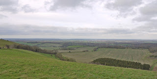
The start point is at 267m and the view over Berkshire, with the scattered village of Inkpen in the foreground is very impressive.
You follow a chalky track which initially passes over the iron age hill fort of Walbury Hill. It runs just below the ridge line of the North Hampshire Downs, but briefly you are on the ridge and can see south into Hampshire as well.
After a short stretch along a lane, there follows a long section on a grassy (read muddy initially) with fields on the left great views down to the flat Berkshire farmland below. The path ahead looks very inviting.
A bit further on, behind a projecting section, the Hannington radio mast - a landmark for miles around, can be seen on the horizon.
In this whole section the geometric pattern of the farmland is a fine sight.
It is remarkably quiet and isolated up here, and then all of a sudden you come upon a rather splendid modern house - Charldown. I often take photos of impressive old farmhouses and cottages, but this may be the first modern one.
The path leads down the drive of Charldown to reach a quiet lane and now Highclere House is increasingly clearly visible.
I walked along the lane as far as the point where the path leaves it to enter the unusually named Bunkhanger Copse. There is a handy parking area here, so it will be easy to pick up the route again. And now I turned back, puzzling about the car parked half on the grass verge whose driver was intently studying something, looking towards the fields below us. She had seemed a touch sheepish when I first passed, and drove up as I turned back towards her. What was she up to?
Conditions: cloudy, some sun, cold and windy in the open, but quite warm when sheltered.
Forward distance: 3 miles.
Maps: Explorer 158 (Newbury & Hungerford) and 144 (Basingstoke, Alton and Whitchurch).
Rating: four stars.
Sightings
I startled any amount of pheasants into flight as I passed by and as I drove back down to Inkpen I must have seen at lest fifty pheasant chicks wandering along the lane.
At least three kites wheeling around the sky, often very low.


No comments:
Post a Comment