
The harbour is in two sections. The larger outer section is fully tidal
and at this stage had no water - at this time of day the ferry across to
Rock runs from much further downstream. The small and picturesque inner
harbour always has water as it is closed off by massive gates. It
contains an interesting mixture of fishing vessels and pleasure craft.
But Padstow is better known for its restaurants than for its architecture, but we avoided Rick Stein's offerings to eat at the wonderful Prawn on the Lawn with its famous Small Plates.

For me, the Padstow Almshouses in Middle Street (above) were the most interesting building in Padstow. They were built in 1875 in red brick English bond, which is unusual in Cornwall.
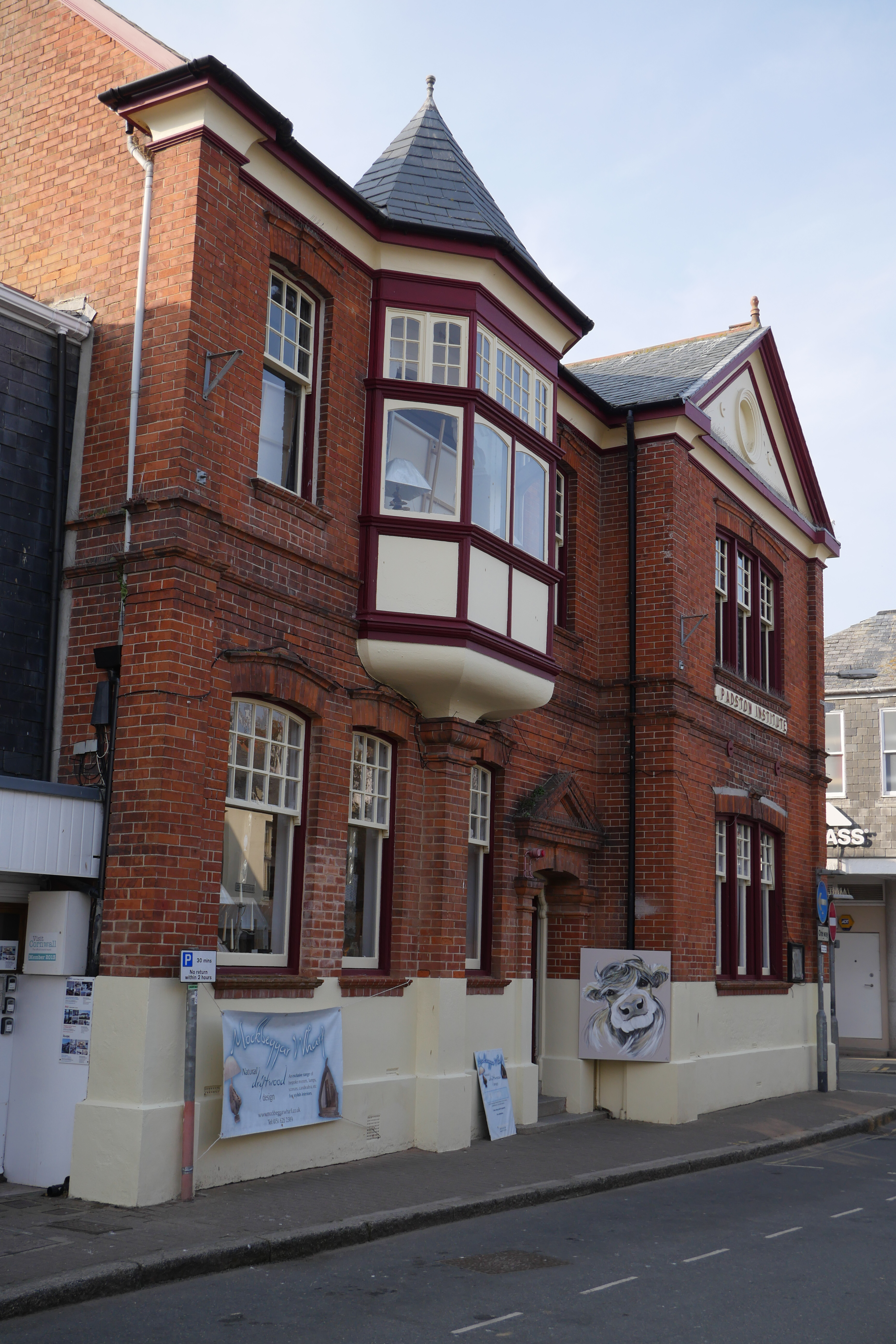
We also wondered about the Padstow Institute, Library and Museum in the Market Place. It was erected by public subscription in 1881-2 (the Library and Museum roles were added more recently). I have been unable to establish what the functions of the Institute were or are.
So today we decided to have a trip down memory lane and do a there-and-back walk along the Coast Path. We did the linear version of this (Trevone Bay to Padstow) in 2015.
We skirted the harbour and followed the path beside the Camel Estuary, with Rock on the other side.

After a while we reached the war memorial (apologies for the for the spots on my camera lens)

Now we followed the meandering path always with the sea on our right. The Rainer Rocks can just be spotted out to sea.

Large areas of sand were exposed as the tide went out.

We followed the path overlooking the sands and overcoming minor concerns about the precise route to reach the Coastwatch Station. I walked a little further to look again at the Daymark.The Daymark is a rather pleasing structure. It was possibly built in the early 19th century and was originally whitewashed. Its function of course was to guide mariners entering the Camel Estuary. The unexpected thing about it was the two small gothic style windows on the seaward side

After a while we headed back, with larger areas of sand now exposed. The wonderfully named Doom Bar sandbank was still clearly visible in the centre - the safe passage for ships is the wide channel to the left. Now we understood where the Doom Bar beer you see everywhere in North Cornwall got its name.

No comments:
Post a Comment