We have arrived in Cornwall with a plan for three days walking, but immediately had to modify it because we couldn't find a taxi to meet us at the end of the walk we planned. We are staying at the excellent Bush Inn and Morwenstow and fortunately the owner there was able to find us a taxi back to Duckpool.
We set out from there to walk to Morwenstow and climbed the hill to Steeple Point, enjoying a fine view back along the coast of Bude Bay to Bude (we will do this section on Monday before we go home).
At the top of the climb there was a helpful waymark indicating we should turn right rather than throw ourselves over the cliff top. The waymarking on the Coast Path is generally very good, but this one was perhaps superfluous.
The rocky coast stretched ahead …
For a while we would mainly walk along the cliff top. And soon we would have our first view of what is marked on the OS map as "Radio Station", but seems to be widely acknowledge as GCHQ Bude. We emerged onto a grassy plateau and could see the various structures more clearly.
Our taxi driver told us that the round one was covered in Kevlar, one of the functions of which was to prevent interested parties knowing which way the radar dish inside was facing. He said had he learned this on an annual open day.
I was delighted to spot my fourth Painted Lady of the year on this grassy area, but as ever it didn't hang around long enough to be photographed. We were starting to see a few Common Blues and Small Heaths and a few instances of this as-yet unidentified caterpillar.
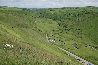
At Stanbury Mouth we had a sharp descent to sea level and a great view inland.
On the other side, there was a very steep climb, but a great view back at the top over Stanbury and Rane beaches.
Soon there was more excitement with Green Hairstreak number 2 of the year.
We would also see several Speckled Woods and a lone Small Copper and Large Skipper (the first of the year). Soon afterwards we reached the back of Higher Sharpnose Point.
The view of the point looking directly out to sea was rather wonderful.
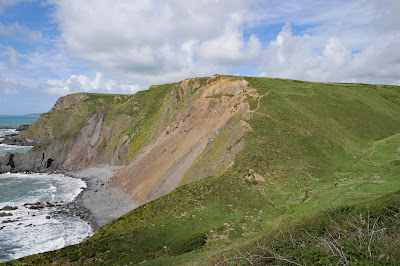
At the back was a semi-ruined hut, presumably once used by the Coastguard. Off to the right was the next high cliff, unnamed on the map, which had clearly suffered some recent rock falls.
We had already been told by some very pleasant local walkers we met that the path was blocked ahead and when we descended to Tidna Shute we weren't surprised to find that here was the blockage point: the cliffs were now regarded as unstable and a diversion inland to Morwenstow was required. We headed inland along the path of the tiny River Tidna, initially in open county and then in woodland. After about half a mile a steep path to the left brought us to the edge of Morwenstow and the pub.
Conditions: Grey at first, becoming bright and sunny.
Distance: 3.5 miles.
Grading: Severe.
Rating: five stars.


No comments:
Post a Comment