
We picked up the route from Port Gaverne and, erroneously as it turned out, walked up the hill to a derelict hotel (we should have immediately turned right past the pub) and joined the coast path along a cliff top. The coast ahead was rocky and the section to Trabarwith Strand stretched out ahead of us (see photo above). The distant headland is Tintagel Island and the offshore rock is the unimaginatively named Gull Rock - just off from Trebarwith Strand.
Shortly there was a clearer view. We were told by our taxi driver that there were said to be six ups-and-downs on this section (being a lifelong resident of the area he hadn't of course walked it himself) but we couldn't yet see where they were going to be.

The coast was again noticeably flowery and I have been thinking about resurrecting the Flower of the Day which I used to include in my posts some years ago. We saw lots of this beautiful blue flower.

Now the first major descent loomed before us: down to Barrett's Zawn from a clifftop height of about 100m. A zawn is apparently a cut in the cliff, but it does not seem to be known who Barrett was. The headland is known as Delabole Point.

On the way down we made a pleasing discovery: a Green Hairstreak perching quietly by the side of the path on some bracken. It was the first one of the year and only the third or fourth I have ever seen.

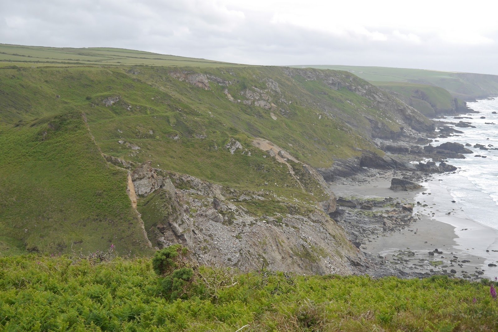
Once near the bottom, we could see the full extent of the long narrow valley heading inland. I realise that in practice I seldom take pictures of inland views. I think this is because the inland view is most often flat, a continuation of a coastal plateau, or uphill.

Having climbed up the other side, it wasn't too long before we descended again to another steep-sided valley, Dinnabroad. This time there were dramatic rock formations at the waterside.

Now we climbed again to reach National Trust land called Dannonchapel. This time the cliff top lasted long enough to provide decent views back as far as The Rumps, albeit into the sun, ...

... and forward to Gull Rock and Tintagel, with the next descent and ascent already visible in the foreground.

This next descent was enliven by a Kestrel perched on a fence post and offered another beautiful valley winding inland.

Further on we passed inland of Tregardock Beach, protected at the back by a massive grassy rock named on the map as the Mountain. Viewed from the next cliff top the beach wasn't very inviting but a few hardy souls could be seen down there.
This really brought home to us that the last proper sandy beach we had seen was at Polzeath, ten miles or so back along the coast.
The path continued along the cliff top and was becoming noticeably rocky underfoot. Many of the rocks were beautifully coloured.

We came to a narrow cove with a good view of Gull Rock out to see and thought this might be the final descent, but no, another one lurked round the corner with another massive climb on the other side.

Finally, we made the very steep descent to Trebarwith Strand. Presumably more sand is exposed at low water.

Conditions: Quite warm but cloudy.
Grading: Severe.
Map: Explorer 106 (Newquay & Padstow) and 111 (Bude, Boscastle and Tintagel).
Distance: 6.2 miles. Distance now covered 482.3 miles.
Rating: Four and half stars. Hard, but exhilarating.
No comments:
Post a Comment