
Ely Cathedral from Queen Adelaide Way
We were in Cambridge last night for a dinner and following our usual practice, decided to make a detour on the way home to see Ely. I found this route, said to provide good photographic opportunities, on the website of the Ely Civic Society.
The walk proper starts in St Mary's St at Oliver Cromwell's House, now the Tourist Information Office, but we started instead from the nearby Parson's Almshouses, a particular enthusiasm of mine.

They make a very pleasing group. The plaque on the tower says that "These almshouses were erected in 1844 through the munificence of Thomas Parsons, an Ely benefactor of the 15th century". The architect was George Basevi, who died the year after and is buried in Ely Cathedral.
Cromwell's House is nearby. It probably dates from the 14th century. It is interesting that Pevsner, writing in 1970, calls it St Mary's Vicarage (the church is just behind). But the fact that Oliver Cromwell's family lived there for just ten years now takes precedence.

A few steps further on we had our first view of the Cathedral in the form of the magnificent west tower. It is 215 feet high and dates from 12th century, with the top third being added in the late 14th century. The west front is noticeably uneven, with an elaborate Norman transept on the south side and nothing on the north. It is thought that the north transept collapsed in the early 15th century.

Before you reach the entrance however, a substantial building on the right makes itself known: it is now called the Bishop's House, but was once the Cathedral Deanery.

Inside, the Cathedral is a wonderful example of Norman architecture, with an extremely long (537 feet) nave. The ceiling is very striking, and depicts the ancestors of Christ. It was the work of two Victorian painters, Henry Styleman Le Strange and Thomas Gambier. Apparently you can tell where the work of one ends and the other begins.

Where the main transept crosses the nave there is an extraordinary tower. The original Norman tower collapsed in 1322 and it was decided to use firmer foundations further apart and this gave rise to the idea of an octagonal tower. The view looking up is extraordinary. (An altar prevents a view from directly below.)

To complete this rather cursory account of the Cathedral's interior, I will just mention the massive Gothic Lady Chapel of 1349. The photo shows the vaulted ceiling. Now it is very light and bare, which emphasises its size, but it was originally brightly coloured and the windows were full of stained glass, but all this was destroyed in the Reformation.

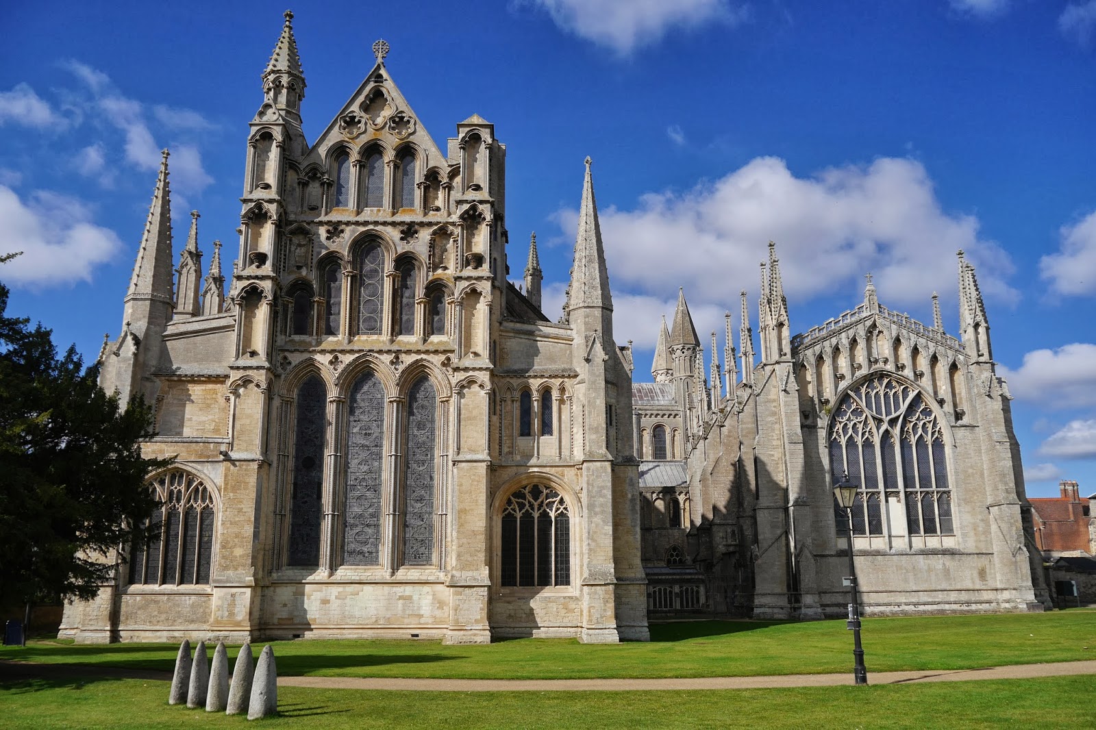
We went outside and round to the east end, where the scale of the Lady Chapel relative to the rest of the Cathedral. I can't discover the significance of the five mysterious pointed stones in the foreground.
We headed south past an assortment of former monastic buildings, which seem now to be part of the Cathedral School, to reach Ely Porta. This great gatehouse was begun in 1397. One interesting feature is that is has two archways on the outside (one for carriages and one for pedestrians), but only one on the inside.

We followed a tarmac path away from the Porta and instantly had this rural view of the Cathedral with horses grazing. The octagonal crossing tower can now be clearly seen.

This path crossed Broad St and led down through the Jubilee Gardens to the waterfront of the Great Ouse. We headed east along the busy river bank, opposite the marina and soon reach the Maltings.

It dates from 1868 and was built by a local brewer to malt barley for brewing ale, reasonably enough. It is now a venue for weddings and meetings. We just loved the brick detailing.
Now we followed the riverbank for a while along a gravel track.

We moved away from the river to pass the Roswell Pits nature reserve (flooded former clay pits) and crossed the river by an extremely functional bridge to arrive at Queen Adelaide Way. We walked on a grassy bank beside the road now parallel to the river and going back towards the city. As we walked, there was a typical fenland agricultural landscape to our left, but to the right there were intermittent glimpses of the Cathedral from slightly different angles. This one made perhaps the best photo.

At a road junction, a right turn brought us across the river again and back to where we had first met it. To complete the walk we returned to St Mary's St, via Fore Hill and High St. In the latter, we admired another entrance to the Cathedral precinct, the Sacristan's Gate.

Walking up Fore Hill, we finally appreciated what we had read about Ely being an island before the surrounding Fens were drained.
Conditions: some cloud, but surprisingly hot.
Distance: about 4.5 miles.
Rating: four and half stars, although walking along the road palled after a while.
No comments:
Post a Comment