Fletcher Bay
We have now relocated to Coromandel Town, the main settlement in the Coromandel Peninsula on the North Island's east coast. We had read about the Coromandel Walkway, a coastal walk at the tip of the peninsular and promptly booked to go on it the next day. It some ways it seemed odd to have to book a tour: it doesn't look to be too far north of Coromandel Town and surely there would be some way to get back to the car if we did it under our own steam?
In fact the drive from Coromandel to Fletcher Bay where the walk begins takes near enough two hours, most of which is over a twisty gravel (or "unsealed" as it is known in NZ) track. But more important, there is nothing at either the start or the finish apart from very basic campsites. So we booked with Coromandel Discovery. Barbara, the owner, told us that it would take her a further two hours to get from Fletcher Bay to the end point at Stony Bay. The main reason being the almost complete absence of roads and the presence of Mount Moehau (892m) in the way.
We arrived at Fletcher Bay in late morning with the weather cloudy and drizzling, having had an interesting journey up, enlivened by Barbara's informative commentary and a nice chat with the Swedish/Dutch couple and their baby who we shared the minibus with.
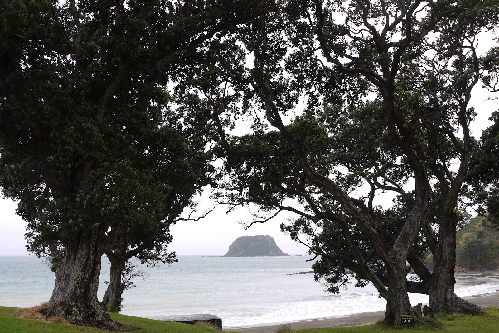
You cross the back of the bay and climb a clear grassy track behind a small headland. Soon there is a fine view back over the bay.

You continue along behind the next, rather rocky, bay, with a much more substantial headland ahead - in fact it is a rocky promontory jutting out to sea - the Sugar Loaf (220m).

We imagined we would climb it, in the manner of the South West Coast Path we have been walking at home - Swyre Head is only 20m lower - but the path headed inland to pass behind it. Further inland we were struck by the folds in the hills, and this seemed very characteristic of the whole area.

After a remarkably muddy area (very heavy red clay), we continued on a grassy track and could now see the Sugar Loaf from the eastern side and the Sugar Loaf Rock that lies beyond it.

Now we began a long descent through resplendent Nikau palms ...
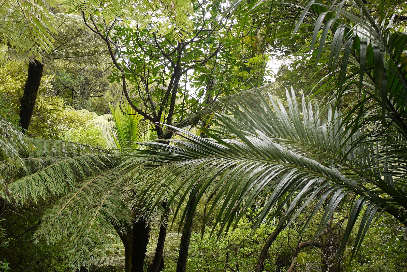
... and tree ferns ...

... to reach sea level at Poley Bay. We took a break from the walk to explore this rocky cove, with its black sand and layered black volcanic rock. The sea was pretty rough and I succeeded in being overrun by a wave as I took my artistic low vantage point photos. I completed the walk with wet feet.

As on any coastal walk, the consequence of this descent was a steady climb, to then walk along a horizontal path along the side of the mountain. We paused at a a strategically placed bench and enjoyed the dramatic view back along the coast.

A bit further on a steep side track led to a lookout (NZ for a viewpoint). It turned out to be just a bare mound of hard earth, but there were great views back and forwards along the coast. Our destination, Stony Bay, was around the first headland.

There now followed a long, gentle descent through native bush. Many of the trees were marked with coloured plastic triangles and we had been told that theses were not some arcane system of way-marking, but rather part of a campaign to trap and kill possums. There are apparently some incredible number of possums - 70m comes to mind - which were originally introduced to tackle other pests and now prey on native species such as the Kiwi.
The last section seemed to go on for ever, and was indeed about an hour and half of steady walking, but eventually Stony Bay could be clearly seen and the walk was complete.

Conditions: dully, some drizzle, but quite warm.
Distance: we read various distances, but 10-11km seems right. It took us four hours with breaks.
Rating: four stars. Not entirely unlike the SWCP, but with more rugged and exotic scenery. Perhaps the only disappointment was a general lack of wildlife.
Reflections
We are starting to realise that walks in New Zealand are not so easily found as they are at home. This path was originally constructed as a bridleway between two farms in the late C19. In general, paths must have begun because people wanted to get from A to B. Up here, there are no settlements, so there are no paths, and the difficult terrain means that paths have to be specifically made, rather than evolving as a consequence of people's desire to get from one place to another. Maori presumably mainly travelled by water.
No comments:
Post a Comment