Thursday, 17 March 2016

Spencers Wood, Three Mile Cross & Shinfield

A new housing development in Spencers Wood

The village where I live (Spencers Wood) is undergoing substantial development and it occurred to me that it might be worthwhile to capture what it is like now before it is changed out of recognition. The village had a population of just over 4,000 in the 2011 and the strategy of Wokingham Council is to build about 2,500 additional houses in the area just south of Junction 11 of the M4 (which also includes Three Mile Cross and Shinfield). Attention has focused on this figure and nobody seems to  have asked how many houses there are currently. I don't know either, but a reasonable guess might be 1600-2000, so a significant expansion is projected.

I walked down the hill towards Three Mile Cross, passing the new Crest development off the Basingstoke Road. Access is new road between existing houses and 100 houses are to be packed into the field behind them. 

At Three Mile Cross a small plot of land which surrounded a disused chapel has just been redeveloped with six detached houses miraculously packed in. The chapel itself has been ingeniously altered to provide two storey accommodation.


Turning right into Church Lane, after a few houses there are fields on both sides of the road, although the hedgerow on the left has been cut down in preparation for development. This pretty thatched cottage, one of very few in the area, will soon be surrounded by a modern estate.


Turning right into Hyde End Lane, an area on the right has been set aside for a public green space. With all the wooden fences and no other features at present it looks a bit over-engineered.


Further along the road, past a farm and a school there is Ryeish Lane on the right, a quiet narrow, winding lane I have often strolled along on an afternoon or evening. Sadly, there are going to be houses on both sides in due course.


Opposite is the field path to Shinfield where trees have already been planted to help create some small sense of separation as the two villages expand towards each other.


I walked across the open space to the edge of Shinfield. It looks more barren than hitherto, with next to no wild flowers - it was never very exciting visually, but at least you could expect to see some colour and a few common butterflies at the right time of year.

On the far side, the narrow hedged path into Shinfield was temporarily closed and part of the hedge had been torn down.


I turned left towards Shinfield church, it dates from the 14th century, although the tower was rebuilt in 1644 and there were alterations by Sir George Gilbert Scott in the 19th century. Opposite the church is the brick and half-timbered Farm Farm of 15th century origin, rebuilt in the 16th century.


Just off to the left is the former rectory, a rather splendid construction of 1847, now L'Ortolan restaurant.

This little group present an oasis of traditional building in the desert of new houses than surrounds it. From here I walked down to the School Green and the pleasant red brick primary school founded in 1707 and extended in 1860 and 1889.


Walking down Millworth Lane and turning right brought me to another new public open space. Langley Mead, again rather bare and over-engineered, but already attracting some dog walkers.


I merged onto Hyde End Road and headed back into Spencers Wood, turning right just before another large new development, Croft Gardens, on what, last year were grassy meadows.


Conditions: a lovely sunny day.

Distance: about five miles.

It was good to be reminded of some nice local buildings, but obviously it was far too late to do what I set out to do - development has already had a massive impact and the shape of things to come is all too clear. It was however a worthwhile, but rather depressing, thing to do.

Tuesday, 15 March 2016

Aldeburgh and Thorpeness


The Moot Hall, Aldeburgh

We started this lovely walk along the Suffolk coast at Aldeburgh's Moot Hall, strangely located just behind the sea front. It dates from 1520-40 and the ground floor was originally an open market. The term "Moot Hall" dates only from the nineteenth century as part of the Victorian restoration - building is referred to in earlier documents as the "Town Hall".

We walked along the path at the back of the beach past the profusion of fish shops and headed north. It was so misty that we could scarcely see the sea. Soon we reached the wonderful Scallop - a four-metre high steel sculpture conceived by Suffolk-born artist Maggi Hambling, and made by Aldeburgh craftsmen Sam and Dennis Pegg. This photo comes of course from an earlier visit. The Scallop was intended as a memorial to the composer Benjamin Britten, who spent much of his life in Aldeburgh and nearby Snape. When it was first unveiled in 2003 a 500 signature petition was gathered to support its removal, but it seems to now be accepted as a fine piece of public art.


As we neared Thorpeness a straggle of houses appeared at the back of the shingle beach in a whole miscellany of styles. We rather liked this glass and wood one with its oddly shaped roof. We were momentarily concerned when someone came out seconds after I took this photo - was he coming to complain about invasion of privacy? Happily not, he greeted us cheerily and proceeded to fly a kite.


A bit further on, having still not seen the sea, we turned inland along a wooden path into Thorpeness. This has a remarkable history and is one of only two planned seaside resorts in the UK (Portmeirion in North Wales is the other) developed by Glencairn Stuart Ogilvie from 1910 onwards. The first building you see, The Boathouse, was one of the first to be completed, in 1912


Behind The Boathouse is the Meare. This was once a muddy marsh fed by the Hundred River. Ogilgy stopped the river and had the Meare created as a man-made lake by hand-digging to a depth of 2.5 feet. It is still used for boating.


We headed onto into the village and were transfixed by the huge Westbar in Westgate. The top section conceals a water tower. The other houses in the street are in a sort of mock-Tudor / arts and crafts style.


We went through Westbar and turned left and left again the reach the Margaret Ogilvie Almshouses of 1928, built originally as accommodation for workers. The central section jars rather with the half-timbered wings.


Almost opposite is the Workmen's Club, which makes sense given the original function of the almshouses. A sign revealed that it has recently been converted into five separate dwellings under the collective name of Thorpeness Hall.


We returned to the lake along The Whinlands and turned right into Lakeside Avenue which led indirectly to the amazing House in the Clouds (1923). Like the Westbar, this too once concealed  a water tower, but after mains water arrived, it was converted in 1977 into a wonderful dwelling, which can now be rented as holiday accommodation.


Nearby is an old post windmill, moved here from Aldringham in 1923 and converted to pump water, which it continued to do until the advent of mains water.


We headed now towards rather strange gold club building ...


... and walked along a path parallel to the coast back towards Aldeburgh. There were woods to our right and marshland to our left. On reaching Aldeburgh we passed a holiday home site and headed towards the town centre passing All Saints church. The base of the tower, the south aisle and the unusual porch all date from about 1300.


At the bottom of the hill we turned right into the long High St: charming and full of character, although no single building is especially distinguished. At the end on the right, we enjoyed this charming and fairly typical group, although the steps up to the door of the former Customs House were rather unusual.


We carried on to the edge of Aldeburgh, in sight of the Martello tower at Slaughden and concluded by retracing our steps to the Moot Hall.

Conditions: grey and misty.

Distance: 5 miles.

From: a new site for me, Go for walkies (though it lacked a map).

Rating: five stars.


Chelmsford

 Shire Hall

On the way back from a trip to Suffolk, there was just time for a short walk around Chelmsford, a city only since 2012, when it was awarded the status on the occasion of the Queen's Jubilee. I started at Shire Hall in Tindal Square at the top of the High St. It dates from 1790-2 and was designed by John Johnson. It is, said Pevsner, "a thoroughly civilised public building". The facade is very harmonious and well-composed.

Just behind Shire Hall lies Chelmsford's other main architectural treasure, the Cathedral of St Mary.


It is all too obvious that this is a parish church later elevated to cathedral status, in this case in 1913. The tower is the oldest part, dating from the 15th century, and there were significant additions and alterations in late Victorian times and in 1923.

Inside the cathedral is light and surprisingly colourful, with a wonderful Tudor style ceiling in the nave dating from 1899. The late 15th century piers were rebuilt by John Johnson, mentioned above, in 1801-3.


The church is surrounded by an irregularly sized church yard, with Victorian or late-Georgian houses on the New St side.


I headed up New St and crossed the inner ring road to reach the offices of the former Marconi works of 1912, once one of Chelmsford's principal employers. The whole site is now being redeveloped as apartments, having I think been empty for some long while.


I turned back towards the centre and then right into Victoria Road and on into Victoria Road South, where I found this imposing 1908 building, also recently done up. It was apparently the Law Building of the former Anglia Ruskin University central campus.


Back up Victoria Road South and into Duke St, to find the red brick County Hall of 1909. Clearly the years before the First World War were an important time for Chelmsford. Surprisingly it is not even mentioned in Pevsner.


It is in any event dwarfed by the newer stone County Hall next door, dating from 1935. It seems the earlier effort was soon found to be inadequate. This is in Pevsner, and he is scathing about it: "a sad anticlimax ... classical motifs handled loosely and without distinction ... it might be a bank in any city bigger than Chelmsford".


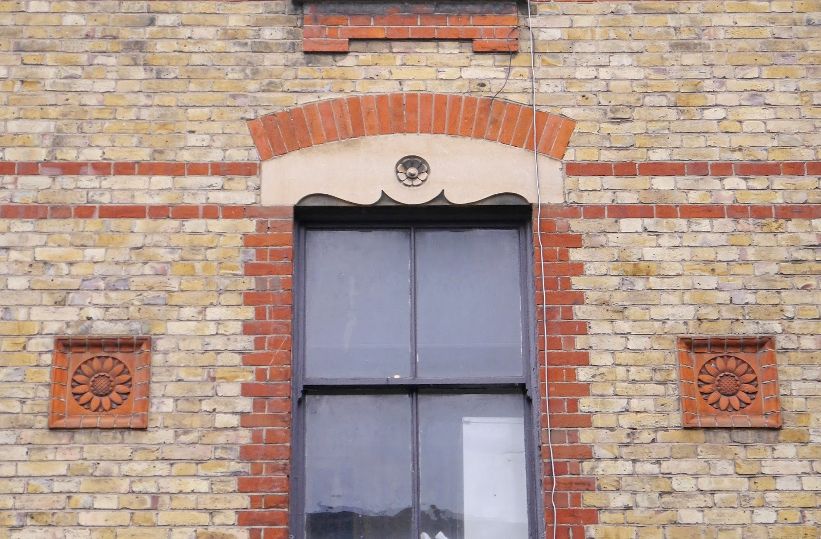
It is indeed curiously unimposing, but a closer look reveals that quite a lot of effort has gone in to the decoration of the facade.


Further along the street I enjoyed these nice sunflower panels on the first floor of a Victorian shop.


Duke Street leads back into Tindal Square where the 18th century Saracen's Head stands, surely a one-time coaching inn.


Conditions: grey.

Distance: about a mile and half.

Rating: three stars. My researches hasn't led me to expect much, and I wasn't wrong. I may have missed some other worthwhile buildings, but most in the central area are modern. In truth it doesn't really feel like a city and interestingly the road signs in from the A12 still refer to "town centre".

Monday, 7 March 2016

Old Basing

Oliver's Battery

This week's one sunny day - so out for a quick local walk in Old Basing, starting at the recreation ground. Off to the left is Oliver's Battery, where siege guns were set up during the Parliamentarian assault on Basing House, of which more below. Originally, it was the site of a Norman motte-and-bailey castle.

Turning left along The Street you soon reach the 15th century brick-built St Mary's church, with an nave and two aisles of seemingly identical proportions.


Inside, I very much admired the dramatic Angel of Peace by John Hayward, 1971.


Not far away is the entrance to the ruins of Basing House. It was built on the site of another Norman castle by Sir William Paulet, later the 1st Marquess of Winchester. Paulet was appointed Lord Treasurer in 1550 and his house was said to be as large and magnificent as Hampton Court Palace. As there is next to nothing left of Basing House, here is a picture of Hampton Court, to give an idea.


Basing House was a Royalist stronghold during the Civil War and was under siege from the Parliamentarians from 1643 until its fall in 1645. It was afterwards ravaged by fire and looted and it seems that bricks were taken to be reused in other buildings in the neighbourhood..

You enter through the 16th century Garrison Gate ...


... and very soon cross a bridge. Looking down, you might think this was a moat, but in fact it was a section of the 18th Basingstoke Canal, which by chance I walked along recently near Dogmersfield.


Over to the right is the large Walled Garden, seemingly an 18th century recreation of a 16th century garden.


The site of the house is a circular mound with a ditch round it and a viewing platform at the back. This is the view and it gives some sense of a number of buildings tightly packed inside a high brick wall.


I did a full circumnavigation and then left by the Garrison gate, continuing along the road to the Great Barn, one of whose adjoining buildings now houses the Visitor Centre and ticket office for Basing House.


This is the second fine barn I have seen in Recent weeks, and although it is not as impressive as Great Coxwell, it is still an imposing structure.


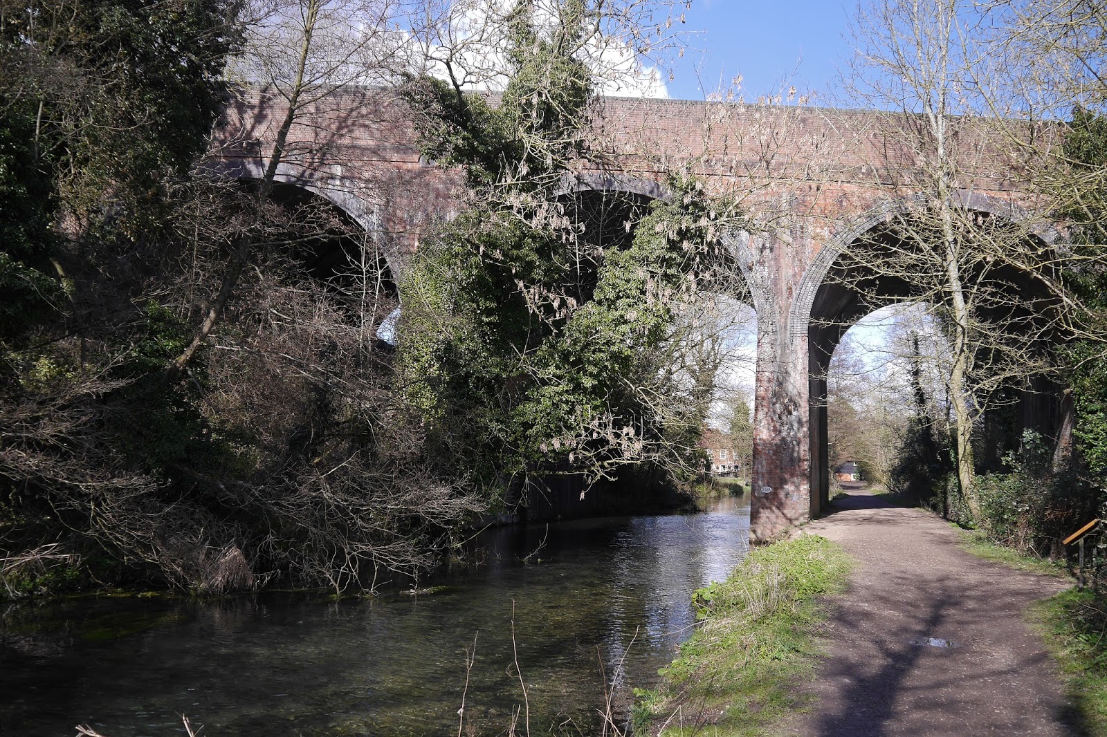
The route now goes along the bank of the infant River Loddon, which rises somewhere nearby, and under an imposing railway viaduct. 


After the Millstone pub, the route continues across an area of common to reach The Street and the start of the walk.

Conditions: a lovely sunny day, quite fresh.

Distance: 3 miles plus the exploration of Basing House.

From: Walks into History: Hampshire by Robert Wood (Countryside Books)

Map: Explorer 144 (Basingstoke, Alton and Whitchurch)

Rating: four stars. Full of interest.

Friday, 4 March 2016

Avebury to Morgans Hill (Wessex Ridgeway Wiltshire 2)


Avebury from the West

We started the Wessex Ridgeway back in October 2015, but an injury to my ankle and indifferent winter weather have meant that only today are we doing the second leg. We set off from Avenbury, the west of the stone circle and walk through the small village. On the right is St James church, Norman with a pair of Saxon windows and the usual Victorian alterations.


We head west, passing through Avebury Trusloe. To the north there are a few more stones.


This track brings us to the A4 and I confess that here I misread the map and sent us south towards the busy A361, when we should have gone along the A4 before heading south. A small compensation was this lovely riding school.


We plodded along a rough grass verge for half a mile and then headed left along the route of an old Roman Road gradually climbing the rutted path. After a while the track leveled out and over to the right we could see the Cherhill Monument (on the slope of the hill beyond it is the Cherhill White Horse dating from 1780). The monument, described by Pevsner as the Lansdowne Obelisk, was erected in about 1845 by the third Marquess to commemorate his ancestor Sir Willliam Petty, the 17th century economist.


We passed to the back of Morgans Hill, still enjoying the view to the north ...


.. and soon after being struck by the terracettes on this round hill.


We ended the leg at Smallgrain picnic area, just off the Wessex Ridgeway.

Conditions: cold and reasonably bright, with just a small hailstorm at the end.

Distance: just under 6 miles.

Map: Explorer 157 (Marlborough & Savernake Forest)

Rating: three and a half stars.