Pages

Friday, 29 May 2020

St Mary Bourne

One of the thatched cottages in the village (complete with dovecote and doves)

A nice circular walk from the pretty village of St Mary Bourne. The first stage follows the Test Way, which we did in 2017-18. Happily, however, we will be doing the Test Way section in the reverse direction.

We start by the village shop and turn left into the main street and are immediately confronted by a set of Almshouses, named for Robert Holdway and opened in 1862 (and modernised in 1982).


We headed along the main street and turned left then right to join the Test Way heading north west along a series of field edge paths. There was a nice view to the north east after a while.


The fields were all arable, with the exception of this lovely field of buttercups and a lone horse.


We turned left through woodland to then cross some very large fields belonging to the Trinley Estate (the largest was 250 acres).

Three further paths brought us back to the Test Way on the south east side of St Mary Bourne and we descended to reach the edge of the village and cross the narrow Bourne Rivulet.


The Rivulet follows the line of the road from Hurstboure Tarrant to St Mary Bourne and is everywhere narrow but fast flowing. At St Mary Bourne it flows into a quite large lake. (Looking at my previous blog of Hurstbourne Tarrant to Longparish) I photographed the lake but didn't realise its connection with the stream.)


Soon after this we reached the High St passing the 12th century church of St Peter. We weren't of course able to see its 12th century font.


We did admire some extravagant tombstones in the churchyard on our way back to the start of the walk.


Conditions: warm and sunny.

From: Walking in the North Wessex Downs (Cicerone)

Map: Explorer 131 (Romsey, Andover & Test Valley)

Distance: 4.75 miles.

Rating: 3 stars.

Thursday, 28 May 2020

Kingsclere and Watership Down

St Mary's church, KIngsclere

This is a walk we have done before, albeit in the reverse direction: Watership Down and Cottington Hill. We set out from the car park near the Norman church of St Mary and climbed Anchor Road to reach the playing field. We headed along the right side of the field towards the Hannington radio mast on Cottington Hill, first walking along the right hand side of the gallops of Park House Stables owned by the Balding family.


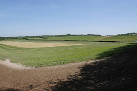
At the far side of the gallops, just as we entered the wood, we had a nice view back towards Kingsclere, enlivened by some horses out for a gallop.


As we climbed we were intrigued by this tree which had split into two and then somehow created a branch which linked the twin trunks.


At the top of the climb we headed right (west) passing the radio mast and continuing along the same line to reach the car park at White Hill, where the path crosses a road. This was the view ahead towards Watership Down.


And this is a more comprehensive look at White Hill.


We walked along the ridge, soon with gallops on our right and after a mile or so doubled back across the gallops (there is a gate) and headed back along the other side. Then down through a little bit of woodland and along farm tracks to reach the road back to Kingsclere.

Entering the village we crossed the shallow stream ...


... and walked along the main street back to the car park.


New flowers of the day

Rough Hawk Bit?

Bugle


Reflections

In the past when I have done versions of this walk I have always been struck by the ferocious yellow of large fields of oil-seed rape. Today there was no sign of any rapeseed. A quick Google suggests that there is indeed less demand for it. It certainly would enable the countryside to revert to a more natural-looking colour palette.


Conditions: warm and sunny.

Distance: 5.75 miles.

From: Walking in the North Wessex Downs (Cicerone).

Maps: Explorer 144 (Basingstoke, Alton & Whitchurch.

Rating: four stars.

Tuesday, 26 May 2020

Milton Lilbourne and Easton Royal

St Peter's church

We have ventured further afield today to explore Pusey Hill in Wiltshire starting from the village of Milton Lilbourne. We parked near the church (14th century with Victorian restoration) and headed south, soon taking a right turn into Clay Lane. This turned out, to our surprise, to be an absolute quagmire, although there was a desire path on the right hand side of the main track.


We continued along a field edge and turned left towards the hill. As we got closer we were struck by the poppies and cornflowers in the nearby field.


This was our first view of the hill.


We wound our way up a sunken path - this is the view looking back.


To our delight, the chalk hillside was home to loads of Adonis Blue butterflies and even a Marsh Fritillary (despite the name they are often found on chalk hills). There were also lots of six spot Burnet Moths, including this mating pair.


We continued along the ridge to see this lovely valley off to the south with its strip lynchets.


We did go slightly wrong after this, taking a left turn earlier than we should have and missing the Giants' Grave, a stone age long barrow. However, we found our way down to Easton Royal by following a parallel track to the one we were intended to follow, so our error wasn't too disastrous. The village is very welcoming, with a lovely group of thatched cottages being the first thing you see.


Just beyond the cottages is the church which dates from 1591, with Victorian alterations and additions.


We headed west towards Milton Lilbourne and, as we got closer, headed along this lovely avenue of chestnut trees.


At the end, after farm buildings and paddocks, we passed King Hall, a grand Victorian house.


To complete our visit, we headed along the main street to see the Manor House, a fine early Georgian house (Pevsner).


New flowers of the day

Fox and cubs


Field Scabious

Conditions: warm and sunny.

Distance: 6.25 miles

From: 100 walks in Wiltshire

Maps: Explorer 157 (Marlborough & Savernake Forest) and Explorer 130 (Salisbury & Stonehenge).

Rating: five stars.
Friday, 22 May 2020

Ashampstead and Yattendon

Ashampstead

We started our walk at the small village of Ashampstead and were immediately drawn to this curious grouping of buildings on the corner of the crossroads. It looks like the middle section was shoe-horned in at some point.

On the way bay we noticed this interesting structure at the back of the house on the right. I learn from Pevsner that it is a19th century Coach House.


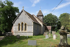
We turn left at the crossroads and walk down the lane to the 13th century church of St Clement. It is currently closed, of course, which is frustrating as it has the most complete set of medieval wall paintings in Berkshire.


We cross two fields to reach a concrete road which leads to a farm shop. It is amazingly busy and clearly doing great business. We then walk along a track and emerge into a large field which we cross, then through a bit of woodland to an even larger field.


We continue along field-edge paths towards Yattendon, crossing another large field on a nicely marked path.


We have been through Yattendon many times on the way to our dentist in Pangbourne, but it was good to walk through it and see things more clearly. This is the Pump House (now a bus shelter) which was the work of the great Victorian architect, Alfred Waterhouse. Waterhouse bought the manor house in Yattendon and lived there as a country squire. Waterhouse's long list of buildings include Manchester City Hall, the Prudential building in Holborn and Reading Town council chamber and offices.


Nearby is the church of St Peter and St Paul which dates from about 1450. Waterhouse did some internal and external work on the church, including adding the porch.


We followed a path to the left of the church and emerged into woodland. This soon gave way to a series of massive fields where we walked along the field edge: I have never seen fields so large as on this walk.

After the final field we followed a track into Ashampstead which became Church Lane and led us back to the crossroads.


New flowers of the day

Rough Hawk Bit

Slender Speedwell

The Slender Speedwell was harder to identify, but when I looked in my Collins Flower book and read that it was found in churchyards I felt more confident, as that was where we saw it.

Reflections

I was left with the strong sense of a very well managed farming operation on a grand scale. The price of this was all to obvious: we saw a grand total of two butterflies during the walk and there was a noticeable lack of wild flowers in the hedgerows, which were anyway few in number because of the massive fields. There was just one set-aside in the corner of a field, but this had few flowers and was isolated from everything around it. There were various notices on display about facilitating wildlife, but little evidence of anything much being done to make it a reality.

Conditions: bright, but cool.

From: Walking in the North Wessex Downs (Cicerone).

Map: Explorer 158 (Newbury & Hungerford)

Distance: 4.25 miles

Rating: three stars.

Thursday, 21 May 2020

Aldworth & The Ridgeway

St Mary's church, Aldworth

For today's walk we headed to Aldworth, starting the walk at St Mary's church. It dates from the 14th century, with 19th century alterations. Its claim to fame is that houses nine stone effigies of members the de Beche family known as the "Aldworth Giants". Sadly, the church, like all others, is closed.

We headed up the track to the left of the church and were hailed by a cheery fellow heading towards us who gave us a mini lecture on the area.  We briefly joined a lane and then left it for a track heading towards the Ridgeway. Soon there was a wonderful view over a valley to the east.


A bit further on, it became clear that there were two parallel valleys separated by a hill and then coming together. They are shown on the map as Streatly Warren.


At the end of the track we turned right onto the Ridgeway. 


We walked the entire Ridgeway with our friends Merv and Pud between October 2013 and July 2015 and passed this way traveling east to west when we did the 8 mile stretch from Streatley to Bury Down.

We followed the track, heading downhill, and enjoying being on the Ridgeway again after such a long gap. As the path leveled out, a picturesque farm and some houses could be seen off to the right


After half a mile we turned right at a house called "Wynders". Strange name, but the house did have a lot of windows ... We headed south through fields passing the isolated Kiddington Cottage to climb up through woodland to reach the B4009. Here we turned right passing, but not really noticing, a pair of semi-detached house by Lutyens. (Only discovered when I looked in Pevsner to find out about the church.)

Then left across two fields to reach Aldworth and the celebrated Bell Inn. It is closed of course, but was formerly a celebrated real ale pub, and hopefully will be again.


Opposite is the old well, thought to be 372 feet deep.


A short walk along the road brought us back to the church.

New flowers of the day

We have been increasingly aware of the wildflowers we pass (partly because of the lack of butterflies) and while we can identify quite a lot we thought we would try to spot a few new ones on each walk. This lovely yellow one is Common Rock Rose


... and this is Common Mallow.


Conditions: hot and sunny.

From: Pub walks in Berkshire & Oxfordshire

Distance: 4.75 miles.

Map: Explorer 158 (Newbury & Hungerford) and 170 (Abingdon, Wantage and Vale of White Horse)

Rating: 4 stars.
Monday, 18 May 2020

Bishopstone and Hinton Parva

Bishopstone Pond

We went a bit further for a our walk today: to Bishopstone just east of Swindon. The route was rather simple: due south as far as a bridge over the M4, then north east up to Hinton Parva, then east back to Bishopstone.

We parked near the Royal Oak pub and followed signs to The Ridgeway, emerging into the head of of delightful valley, marked on the map as Bishopstone Folly.


We had no option but to turn left at the top and this brought us into a second valley, wider and with a sharp bend to the right. We saw some Common Blue butterflies here: the first of the year.


We emerged to go straight ahead, crossing the Ridgeway and continuing south through farmland. After a while I noticed a tall building to our left which I thought must be the Dutch style, 17th century Ashdown House, just over the border in Berkshire. I have been past it before but never been in. I have made a note to research a circular walk in the area.


As we approached the end of this section, now on a farm road, we passed by some cows and could now see and hear the Motorway.


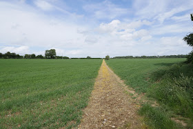
We reached the motorway bridge and turned half right to walk along a path between fields. The green landscape was broken up by the colours of this field off to the right.


As we approached the return crossing of the Ridgeway, the distinctive Charlbury Hill could be seen ahead to the right.


We passed through the grounds of Hill Manor, a horse racing stable. We were interested to see the training gallops consisting of bits of carpet and underlay.


Leaving the Manor, we found ourselves in the wonderful winding valley known as The Combes. This is the view looking back.


To complete the walk we went through the village of Hinton Pava, across a field and then along the road for over half a mile back to Bishopstone. Not the ideal way to finish a quite long walk, although we did see our first Swallows of the year as we entered the village.

Conditions: mild and bright.

Distance: 6.5 miles.

From:  100 walks in Wiltshire.

Map: Explorer 170 (Abingdon, Wantage & Vale of White Horse).

Rating: four stars.