Pages

Sunday, 25 November 2007

Axbridge and Cheddar Reservoir (again)

Looking across Cheddar Reservoir to Crook Peak

We had hoped to go out for a walk yesterday, but it was cold and wet. Today however dawned bright and dry. This walk starts in the centre of Axbridge [see photos from the last time we did it], touches the edge of Cheddar Reservoir and then follows the route of the former Cheddar Valley railway, the Strawberry Line, for a while. It then completes a wider circle through lanes and along the waterways of the Somerset levels. All along there are lovely views of the Mendips, especially Crook Peak, which we walked a couple of weeks earlier. 5 miles in all.

The former Strawberry Valley line

Rating: three and half stars.

From: Pathfinder Guides No 21 – Somerset, Wiltshire and the Mendips (Jarrold).

 
Sightings

The highlight was a grey heron standing by the edge of a rhine (waterway). We also enjoyed a willow with a distinctly Mohican look (the ubiquitous Crook Peak is again in the background).


Sunday, 18 November 2007

Swallowfield

Path by Chill Hill

About the walk
Walking and pubs are inextricably linked in many people’s minds. We have decided to join the majority and combine some of our Sunday walks with a pub lunch. Following my usual practice, I have bought a book …
This walk starts from the excellent George and Dragon at Swallowfield, a pub we already know as it is not far from home. The route follows some pleasant tracks to reach the Blackwater river near its confluence with the Whitewater. The 5 mile version which we took (there is a longer 6¼ mile option) then follows part of the old roman road known as the Devil’s Highway, and finally swings back to re-find the pub. Part of the walk goes around the base of Chill Hill which I walked in the summer.
Rating: 3 and half stars
From: Les Maple - Pub walks for motorists: Berkshire and Oxfordshire (Countryside books).
Map: Explorer 159 (Reading, Wokingham & Pangbourne).
Reflections
This walk combined elements of other local walks and added some new paths which I have not previously walked. I do like this sense of “joining up” bits of hitherto isolated geographical understanding. Also I always enjoy seeing a landmark from a different angle. I know most of the roads around here, but it is very welcome to begin to know the paths and how they are linked. I can see the beginning of more ambitious self-designed walks.
Sightings
A cold wet day, so not much going on – or perhaps we were not in the mood to notice. The highlight was a rabbit absolutely speeding across an open field, then stopping dead to presumably reassure itself that it was safe to continue, then another rapid sprint to complete the job. And on the last part of the walk we crossed a field of mint, to be assailed by its smell. A first.

Saturday, 10 November 2007

Crook Peak

Crook Peak

In Somerset for the day, we wanted a good, reasonably quick walk near to our destination. We thought of doing the book version of this wonderful walk. [Sue Gearing – More Mendip Walks (Cromwell Press)] That is a classic circular walk: you park underneath Crook Peak, make a steep climb to the ridge which leads to it, walk along the ridge to the Peak, then along the main ridge of the Mendips to Wavering Down. This walk then swings right to descend through woodlands and returns to the start along the road and then by a stream. In essence, the climb, ridge walk and woods are lovely, but the final couple of miles is fairly boring.
After some reflection we decided to start the walk from the National Trust car park on the edge of Winscombe and walk up through Kings Wood to the other end of the ridge.
Path through Kings Wood

We then walked along Wavering Down descended and then climbed again to reach Crook Peak.

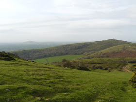
Wavering Down leading to Crook Peak

Crook Peak - closer now


Unusually, we then simply turned round and came back. However, the joy of this walk is the wonderful views in all directions, so this was not much of a hardship. One highlight was a lovely view over Cheddar Reservoir.

Cheddar Reservoir from Wavering Down

Five miles overall.

Rating: four stars.

Maps: Explorer 141 (Cheddar Gorge and Mendip Hills West) for the start of this walk; Explorer 153 (Weston-Super-Mare) for Crook Peak itself.

Crook peak

Crook Peak is a landmark for miles around, and was apparently used as such by ships negotiating the Bristol Channel. It was also the location of one of the beacons which signaled the arrival of the Spanish Armada.

Sunday, 4 November 2007

Burnham Beeches

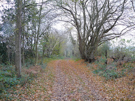
Egypt Woods

A lovely autumn day, dry and sunny - what could be nicer than a walk in Burnham Beeches? Starting to the north of the main part of the Beeches (where it was predictably very crowded with other people who had the same idea) this walk goes first away from the woods to the village of Hedgerley then through Egypt Woods, named after a gypsy encampment.

From: Pathfinder Guide No 25 Chilterns and Thames Valley (Jarrold).

Rating: three and half stars.

Map: Explorer 172 (Chiltern Hills East).


Reflections

What was really striking, apart from the lovely autumn colours of course, was that in the woods you could actually hear the leaves falling. It felt as though autumn was really coming urgently this year.

Sightings

The early part of the walk passed between open fields and it was surprising to see a flock of buzzards wheeling overhead. We couldn't see - or guess - what might be attracting their interest.