Pages

Sunday, 29 August 2021

Swanage and Durlston Country Park


We are making a flying visit to Poole and decided to take a local walk starting from Swanage. We first did this walk in February 2011 when it formed the third stage of the South West Coast Path. We parked in the long stay car park overlooking the pier and the first thing of notice was the pair of Ionic columns, which mark the entrance to Prince Albert Gardens. They date from the early 19th century and were brought to Swanage by John Mowlem.

The gates were quickly followed by an obelisque. 


This turned out to be one that was erected to commemorate the life of Prince Albert and is believed to be the first in the country to be built after his untimely death at the age of 42 in 1861. It was located in the High Street, next to where the British Legion is now, but was taken down in 1971 to make way for a new row of houses. Permission has been given permission to be rebuilt in Prince Albert Gardens, although the work is not yet complete. It overlooks Swanage Bay, close to Peveril Point where the prince is said to have disembarked from the royal yacht in the 1850’s.

 Next there was a nice view of the Pier with Ballard Down behind.


Now we passed a rather beautiful tower, which we had looked at from afar in 2011. 


The Wellington clock tower was originally built in 1854 in honour of the Duke of Wellington near London Bridge, but was soon found to be impeding the traffic and taken down. George Burt, a nephew and business partner of John Mowlem,  removed the stones to Swanage and rebuilt the tower in its present location. The clock never followed, and a spire was removed in 1904 as it had become unsafe. 

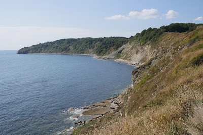
 We headed towards Peveril Point and then enjoyed a nice view along the Coast Path toward Durlston Castle.


As we got closer to Durlston we could see that a lot of improvements have taken place since we were last here: the fairly basic path is now chanelled by low stone walls on either side, with occasional places to sit and admire the view. Well done to Durlston Country Park!

We paused for some ice cream and to admire Durlston Castle. 


The Castle's website explains that it was built as a restaurant by George Burt (who we have heard of before) and was part of his grand plan to create an exclusive housing estate on his land as part of his dream of transforming Swanage into a fashionable resort. On this occasion we didn't visit the wonderful stone Globe, also installed by the indefatigable Gorge Burt.

We now headed along the Coast Path towards the Lighthouse at Anvil Point.


Looking back there was a great view of Tilly Whim Caves.


We passed the Lighthouse and headed inland to locate a pleasant country path which was parallel with Durlston bay and which led us all the way back into Swanage. We loved this gargoyle (one of several) as we passed by ...

At the end we turned into the High Street towards to the town centre and admired several of the buildings: the Congregational Chapel, now United Reformed Church  ...

... the imposing Purbeck House Hotel ...

... and the Town Hall. This is essentially an unremarkable building to which has been added a superb facade by Sir Christopher Wren no less. Inevitably it was George Burt who rescued it from the Mercers' Hall in London's Cheapside.


After this we quite soon returned to our starting point.

Map: Explorer OL15 (Purbeck and South Dorset).

Book: 50 walks in Dorset (which we also used in 2011).

Rating: four stars.

Sunday, 22 August 2021

Tollard Royal and Ashcombe House

 St. Peter ad Vincula

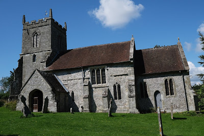
We are on our way back home from a visit to Poole and it seemed like a good idea to do a walk on the way. This 4.5 mile walk from Tollard Royal, just in Wiltshire, seemed the perfect choice. We parked by the interesting church of St. Peter ad Vincula (St Peter in Chains") which dates from 1469, with later alterations. It is one of only 15 churches in England with this dedication, which is taken from the Basilica of San Pietro in Vincoli in Rome.

Nearby is King John's House. It has nothing to do with King John and is instead a former manor house which was later a farmhouse, and has at its core a 13th-century hall house. Remodelling in the 16th and 17th centuries added wings, in part timber-framed. Augustus Pitt Rivers restored and extended the house, and opened it to the public around 1890 as a museum, but by 1907 it was again a residence. (Information from Wikipedia.) You can get a glimpse of half timbering, but nothing more.

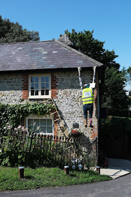
The village is charming and a delightfully whimsical programme is clearly underway to enhance it. The first house we passed had this delightful workman suffering a slight mishap. 

Across the main road is the village pond and here a gnome seems to be fighting off a large snake. There were several other examples.

Now we started the walk proper and walked up path to the left of the pond and then forked left to follow a delightful track at the bottom of a sloping hillside.

There were innumerable Meadow Brown, White and Common Blue butterflies.

Further along we began to diverge from the hillside and some very attractive open country lay before us.

Soon we encountered a series of path junctions and after some deliberation managed to work out the right route heading north along a ridge. We walked through the wide-open spaces to reach a decision point. "Cross a stile and turn right along the byway" said the walk book, but we could not locate these vague descriptions. We spotted a trig point which gave us confidence to head off to the right and we followed a path which had other people heading towards us, though not close enough to intercept.

This route led us skirt the edge of Ashcombe House, of which we could see nothing at all. There have been several buildings on the site and according to Wikipedia, the current Ashcombe House was originally part of the much larger mid-eighteenth century structure, and is an L-shaped three-bay survival of the eastern wing.

Once we emerged from the wooded grounds we found difficulty in finding the route back to Tollard Royal. We followed a tarmac road which meandered through the countryside confident that we were on the right route.

Near the end of the road we realised that we had somehow missed a turning as we were back at the "delightful track at the bottom of a sloping hillside" as described earlier. Chastened, we followed the track back to the village pond.

Conditions: very pleasant.

Distance: 4.5 miles.

Map: Explorer 118: Shaftesbury & Cranborne Chase.

Rating: four stars.

Source: 100 walks in Wiltshire (The Crowood Press). The walks in this book are very inviting, and we have done several of them, but the walk descriptions seem always to be lacking in precise detail. We have several times got lost.

Thursday, 19 August 2021

Dunster Castle and town

The Gatehouse

On our way home from Lynton we decided to stop off at Dunster Castle, near Minehead. We had passed by the entrance several times in the past as we returned home from visits to North Devon, but there never seemed to be the right moment to stop.

The first castle on the site was built - of wood - just after the Norman Conquest by the De Mohun family. According to the Dunster website,  the De Mohuns sold the castle to the Luttrell family in 1376 and they were responsible for most of what we see at Dunster today. They built the gatehouse in 1420, created a Jacobean mansion in 1617, defended and saved the castle during the English Civil War and updated the castle in the Victorian era. The Luttrells lived there for 600 years until 1976 when the property was gifted to the National Trust.

Nowadays visitors go through the massive Gatehouse and then reach the 13th century lower level gateway with its massive iron-bound oak doors.


You emerge at the top into a large grassy area with the facade of the house before you. George Luttrell commissioned Anthony Salvin to remodel Dunster Castle in 1868-72. Luttrell employed the prolific architect Anthony Salvin, to redesign the castle and create a comfortable Victorian family home. Salvin had worked on many other castles and country houses including Alnwick, Caernarfon and Windsor Castle. At Dunster he altered the building’s exterior, demolishing the chapel on the south front, building two new towers and adding battlements emphasising its medieval origins.

We went inside to have a look. The rooms were very Victorian and perhaps you could say were quite cosy. The most striking room by far housed a set of 17th century leather wall hangings of Antony and Cleopatra. They are believed to be the largest and most complete of their type in the world. We were certainly impressed.


Emerging into the area in front of the castle we were very taken by this delightful structure, Tenants Hall. It was built on the upper storeys of the Gatehouse in 1764.

We decided - perhaps wrongly - to give the celebrated 18th century watermill a miss and instead have a brief look at the village of Dunster. We started by walking down to the very attractive West St, with its pastel-painted houses.

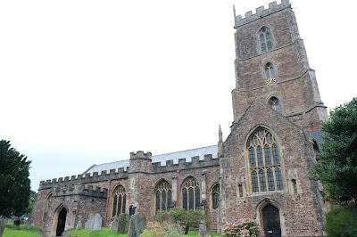
From there we walked back to the imposing Priory church which mainly dates from the 15th century.


A little further on, on the left, was the Dunster Village (or Secret) Garden, a delightful walled area managed by local residents.  Above the garden looms the Conygar Tower. It was commissioned by Henry Luttrell and designed by Richard Phelps. It was built in 1775 and was designed to be about 18m high so that it can be seen from Dunster Castle on the hill opposite. It was just a folly: there is no evidence that it ever had floors or a roof.

A little further on we came to this unusual and interesting building. It looks to be half-timbered with a slate-hung facade. There seems to be no evidence that it was ever used by nuns.

Turning into the High Street we headed to the top to see the splendid Yarn Market which was built for the wool trade in the 12th century,


Conditions: greyish and a bit wet.

Rating: four stars. A very interesting and enjoyable stop off. We doubtless have spent more time exploring the the castle, the village and its environs.

Wednesday, 18 August 2021

Lynmouth and Watersmeet

The East Lyn River

Today Jim and Em are taking us on a walk to see Watersmeet. We walked down from Lynton to reach Lynmouth and our first sight on this trip of the East Lyn River. This was famously the location of the devastating 1952 flood which resulted in 32 lives lost. A substantial programme of remedial works  successfully prevented a repeat.

We passed the harbour with its delightful Rhenish tower (c 1860 by one General Rawdon), rebuilt after the 1952 flood. It is a pity the tide was out.

We continued along the right bank of the river and then cross to the left where we had a nice view of the church of St John the Baptist (1869, with later additions in 1908 and 1921).

 
Soon we saw this delightful creature climbing up the right bank ...
 

... while on the left we spotted a new horror: artificial hedge! It looked truly awful. I couldn't bring myself to take a picture.

Soon we left Lynton behind and crossed the rather lovely bridge to enter the woodland.
 
 
We followed a climbing path through the woods with the pretty river on our left. Quite soon we started to spot Grey Wagtails with their characteristic nodding (or perhaps I should say wagging) behaviour.
 

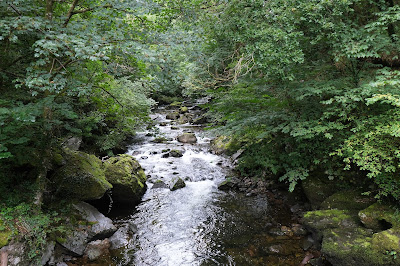
 As we got nearer to Watersmeet the river became more rock-strewn.
 

Watersmeet marks the joining of the East Lyn and Hoar Oak rivers. The house usually provides a cafe and loo, but sadly not today.
 
 
We headed back along the opposite - and rather quieter - bank, admiring another shapely bridge.
 
 
Further along, these trees stood out along the hillside ...
 

... and a little further on this fallen tree had been embellished by banging coins into the wood. I would love to know whose idea it was and what was its purpose.


We carried on back to the start. My arthritic knee was beginning to play up so we thought about taking the the funicular up to Lynton. When we got to the entry point we quickly realised that this wasn't a viable option as there was a long queue ahead of us. I gritted my teeth and plodded slowly up the hill.

Conditions: grey, but mild.

Map: OL9 (Exmoor).

Distance: about six miles in all, including the descent from and climb to our base in Lynton.

Rating: four stars. Delightful.

Tuesday, 17 August 2021

Lynton


After our excellent walk around the Valley of Rocks, I decided to make a short blog of what we saw as we approached and then walked through Lynton. The first interesting feature was the Funicular Railyway which connects Lynton (high above the sea) with Lynmouth (at sea level). The funicular is interesting for being the only water-powered one in the world. The left hand picture shows one carriage coming down from Lynton, while the right hand picture shows the specific point where the two carriages cross.

We continued along the path and enjoyed this lovely view down to Lynmouth. It does illustrate however Lynmouth's main weakness: the lack of a sandy beach.

We emerged opposite the Church of St Mary. The nave south wall dates from 1741, but everything else is 19th century.

A right turn led us past the imposing main entrance to the Valley of Rocks Hotel. The rest was less interesting.

We walked along Lee Road to soon reach the rather splendid Town Hall of 1898-1900. Pevsner is not so positive: "Small, but certainly an attempt at municipal architecture in a holiday spirit ... Utterly un-Devonian." I think that is rather harsh.

Further along was the interesting United Reformed Church in a rather similar style.

At the end of Lee Road was the Holy Saviour: a Roman Catholic church attached to a convent of the order of Poor Clares. It a rather austere building dating initially from 1910, but not completed until 1931. Pevsner describes it as "decently and honestly utilitarian", and I can't disagree.

While we were in Lynton we learned of a local controversy concerning the convent: much of the greenery on the hillside behind the convent had been cut down and just left. This was felt to be a poor job.

Conditions: grey

Distance: a mile.

Rating: three stars, but most enjoyable.

Lynton: The Valley of Rocks


                                                     The eastern end of the Valley of Rocks

We are in Lynton in North Devon visiting Ange's brother and family and no sooner have we had lunch than we are off to see the Valley of Rocks (not the Rocks).  We have been here before, in 2017, when we were walking the South West Coast Path from Hunter's Inn to Lynton.

We were surprised by how quickly we left the town and are now following a high rocky path which looks down on the western end of the Valley. Unexpectedly, the valley is home to a cricket ground. There is also a car park.


We continued along the high path and soon passed above Lee Abbey. The site was originally owned by the Cistercians at Forde Abbey and the Gothic Revival buildings were rebuilt or extended in Victorian times. In the 1920s it became a hotel, at which time the main extensions were built. During the Second World War it became a boys' school, and in 1945 was acquired by the Christian Fellowship. The site now offers retreats, group weekends and Christian family holidays


We gradually descended from the high path and reached the road that leads up to Lee Abbey. There was a fine view of the buildings, which look unchanged since our previous visit.

One we had passed the Abbey we entered the Valley of Rocks at ground level.

The official South West Coast Path is the path coming in from the left, but we took the narrow road instead which comes in from the right. Why?

Well it turns out that if you stand in the right place along the road and look in the right place in the high rocks opposite, you get an interesting view. It is the White Witch. You may want to click on the image to get a full-size version.

Look at the large square rock on the left. On its right side is a slanting rock. If you look at the gap between the two rocks a silhouette of a woman comes into view. So long as you are in the right place!

It remained only to continue along the Coastal Path to reach Lynton and then head through the town to where we are staying. This was surprisingly interesting and will shortly be the subject of a separate post.

Conditions: Warm and sunny.
 
Distance: about 4.5 miles.
 
Map: Explorer OL 9 (Exmoor).
 
Grading:  Easy.
 
Rating: four stars.